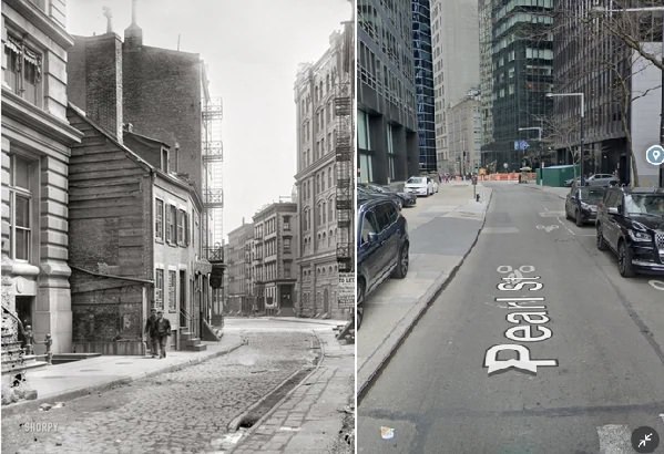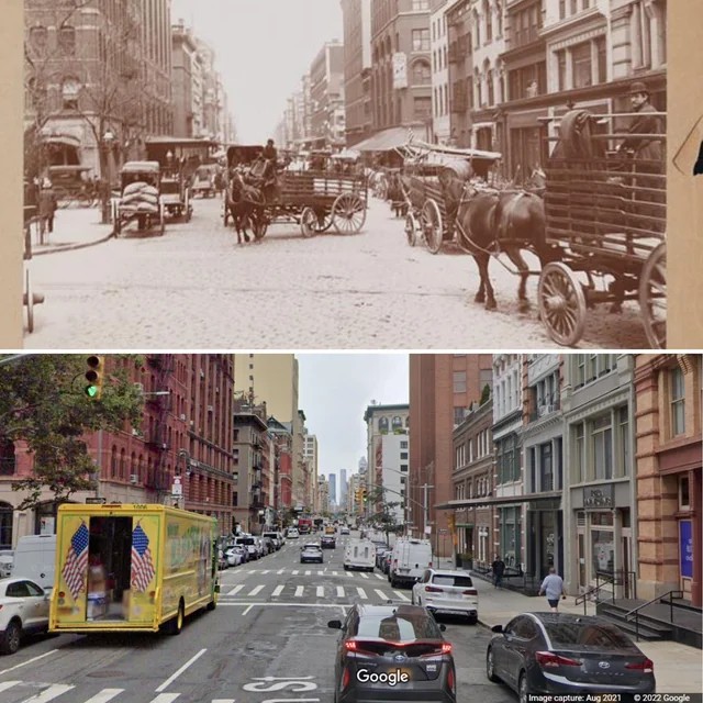

in

New York City Then and Now: A Visual Journey Through Changing Streets and Skylines

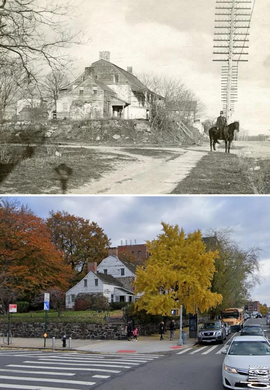
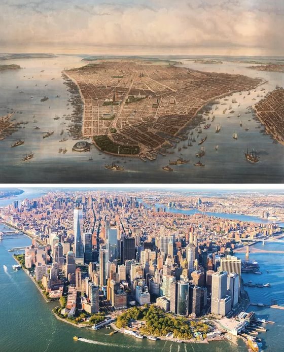
New York City grew from a small colonial port into the largest city in the United States. In the 1600s, Dutch settlers built trading posts and simple wooden homes in what is now Lower Manhattan. Narrow streets followed old paths instead of a planned grid.

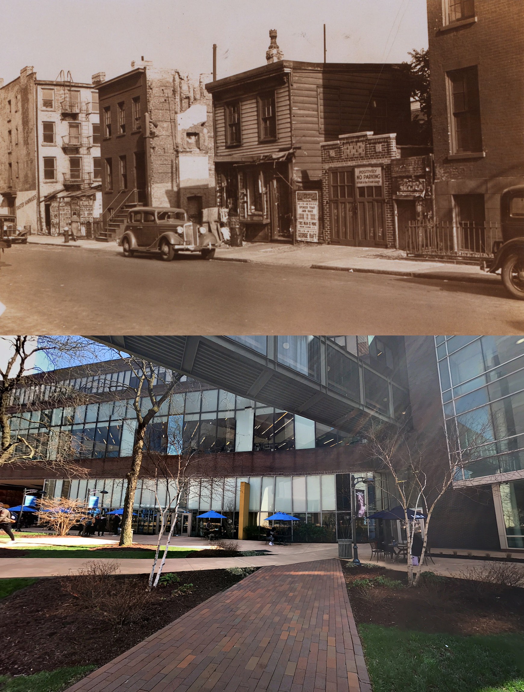
By the 1800s, the city expanded northward. Brick rowhouses replaced many early structures. Immigration increased the population, and new housing blocks filled quickly.

Today, New York City shows layers of development across its five boroughs. Historic brownstones, early skyscrapers, and modern glass towers all stand within the same city blocks.

The five boroughs and their early growth

New York City consists of Manhattan, Brooklyn, Queens, The Bronx, and Staten Island. Each borough developed at a different pace.

Manhattan became the main business center early in the city’s history. Brooklyn developed strong residential neighborhoods and industrial waterfronts. Queens grew through suburban-style housing and airport construction. The Bronx filled with early apartment districts and civic buildings. Staten Island kept a more suburban pattern with detached homes and smaller commercial centers.

Together, these boroughs show a wide range of building types and planning styles.

Read more

Rowhouses and early apartment buildings

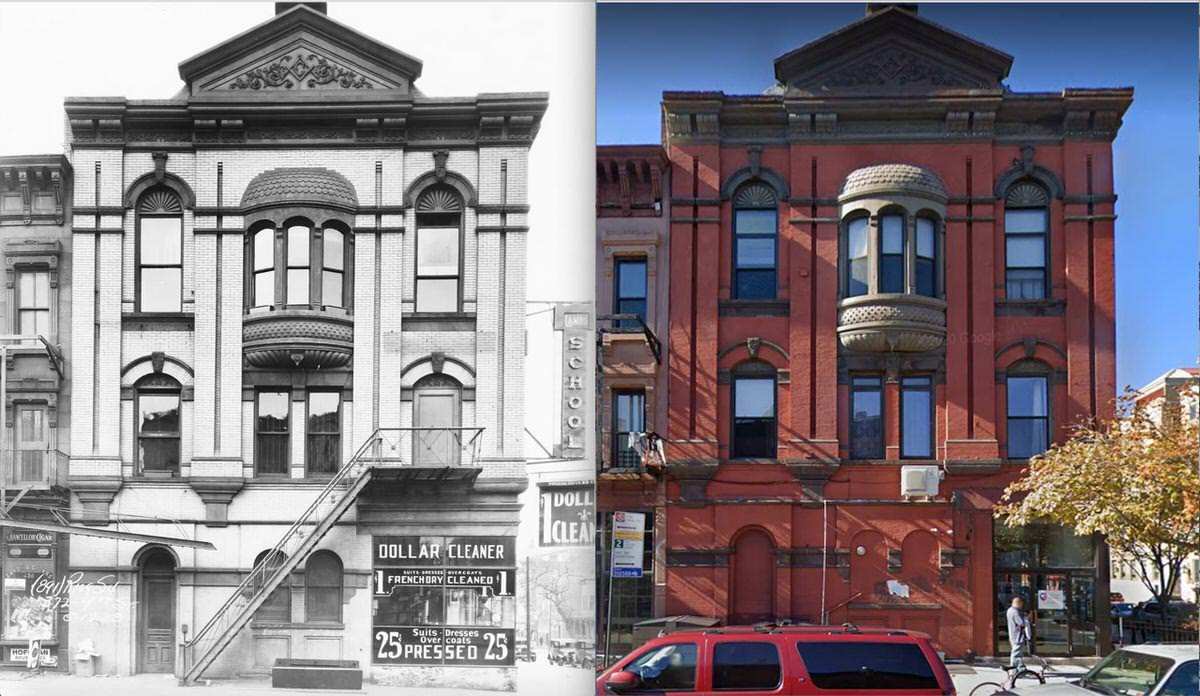
During the late 1800s and early 1900s, rowhouses became common across Manhattan and Brooklyn. Builders used brick and brownstone fronts. Many included stoops, decorative lintels, and iron railings.

As population density increased, apartment buildings replaced many single-family homes. Early apartments often stood five or six stories tall. These buildings used courtyards to bring light and air into interior rooms.

Some neighborhoods still show full blocks of these early designs. Their exterior appearance remains mostly intact even when interiors have been modernized.

The rise of skyscrapers

New York City led the early development of skyscrapers. Steel frames allowed buildings to rise much higher than masonry structures. Elevators made upper floors useful for offices and apartments.

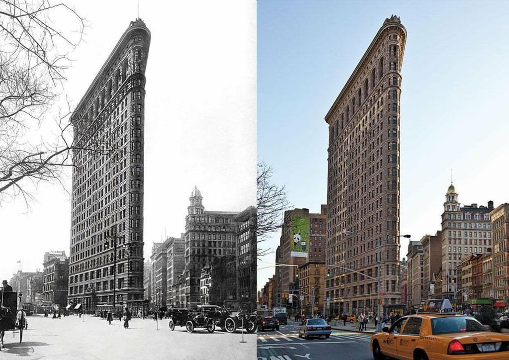
Buildings such as the Empire State Building and the Chrysler Building became global symbols of the city. Their Art Deco designs showed the style of the early 20th century.

Later office towers introduced glass curtain walls. Midtown Manhattan gained many modern corporate buildings after World War II.

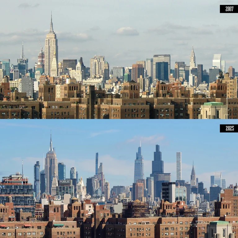
Recent construction added supertall residential towers. These structures use advanced engineering to reach extreme heights while occupying small land areas.

Bridges and transportation structures

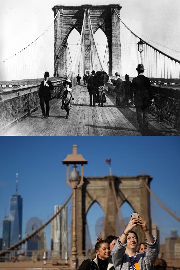
Major bridges helped unite the city. The Brooklyn Bridge connected Manhattan and Brooklyn in 1883. This structure allowed daily commuting between the boroughs.

The Queensboro Bridge and other East River crossings supported further growth. Subway expansion also allowed residents to live farther from their workplaces.

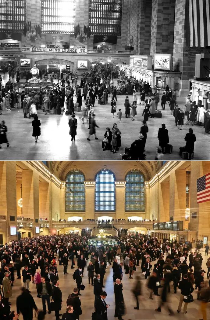
Grand train terminals shaped surrounding districts. Grand Central Terminal remains one of the best known examples of early 20th-century transportation design.

Air travel later shaped the outer boroughs. John F. Kennedy International Airport and LaGuardia Airport brought large transportation complexes into Queens.

Industrial areas and waterfront change

New York City once depended heavily on shipping. Piers along Manhattan, Brooklyn, and the Bronx handled cargo from around the world. Warehouses and factories stood close to the waterfront.

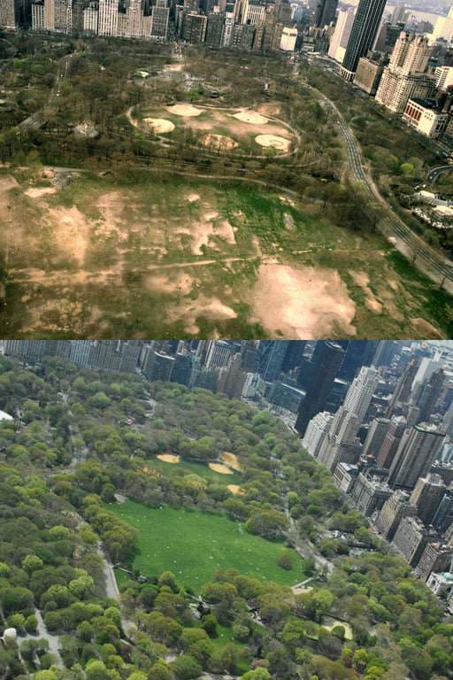
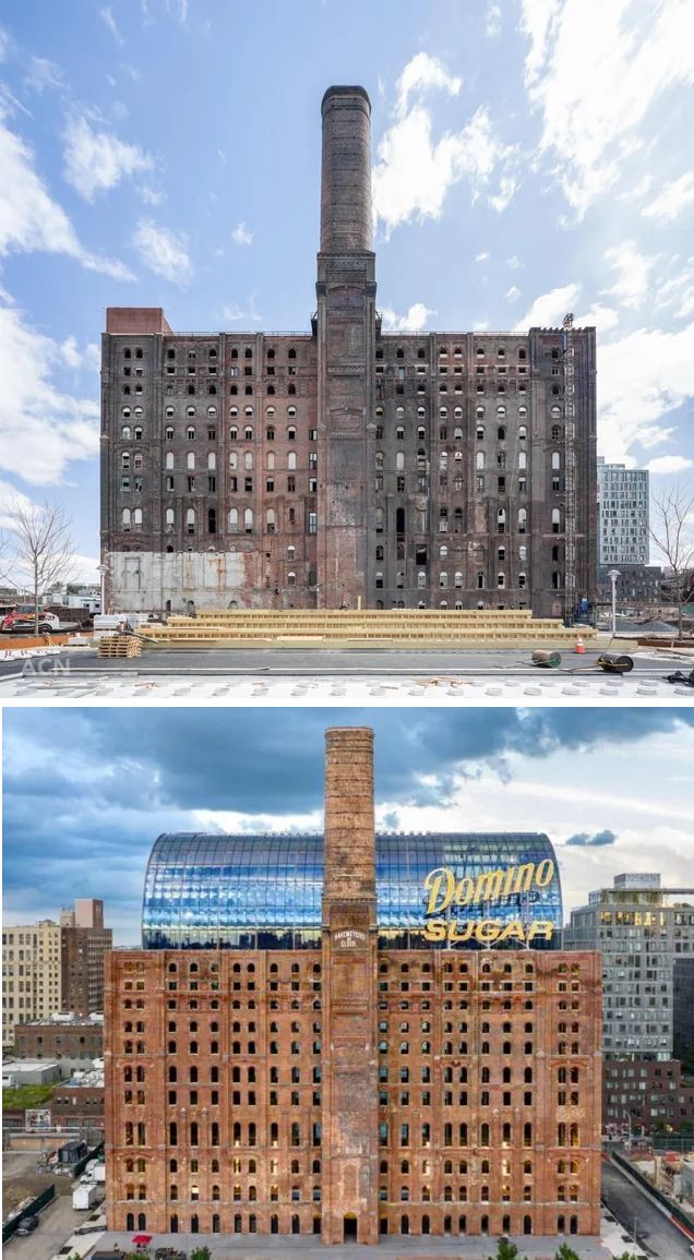
As shipping methods changed, many of these facilities closed or moved. Cities replaced some industrial areas with parks, housing, and office space.

The High Line shows this shift. This former freight rail structure now operates as a public park. Nearby warehouses became residential buildings and offices.

Brooklyn waterfront districts also saw warehouse conversions into apartments and technology offices.

Public housing and large developments

During the mid-1900s, large public housing developments appeared across the city. The New York City Housing Authority built residential towers surrounded by open grounds.

These buildings followed modern planning ideas of the time. Wide open spaces replaced the tighter street patterns of older neighborhoods.

Private development also created large apartment complexes. These often included parking areas and shared green space.

Cultural landmarks and civic structures

New York City contains major cultural buildings from many eras. Carnegie Hall shows late 1800s construction methods. Lincoln Center reflects mid-1900s civic design.

Libraries, museums, and courthouses also show changing architectural styles. Early civic buildings often used classical stone designs. Newer buildings often use glass and steel with open interiors.

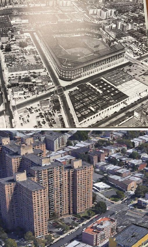
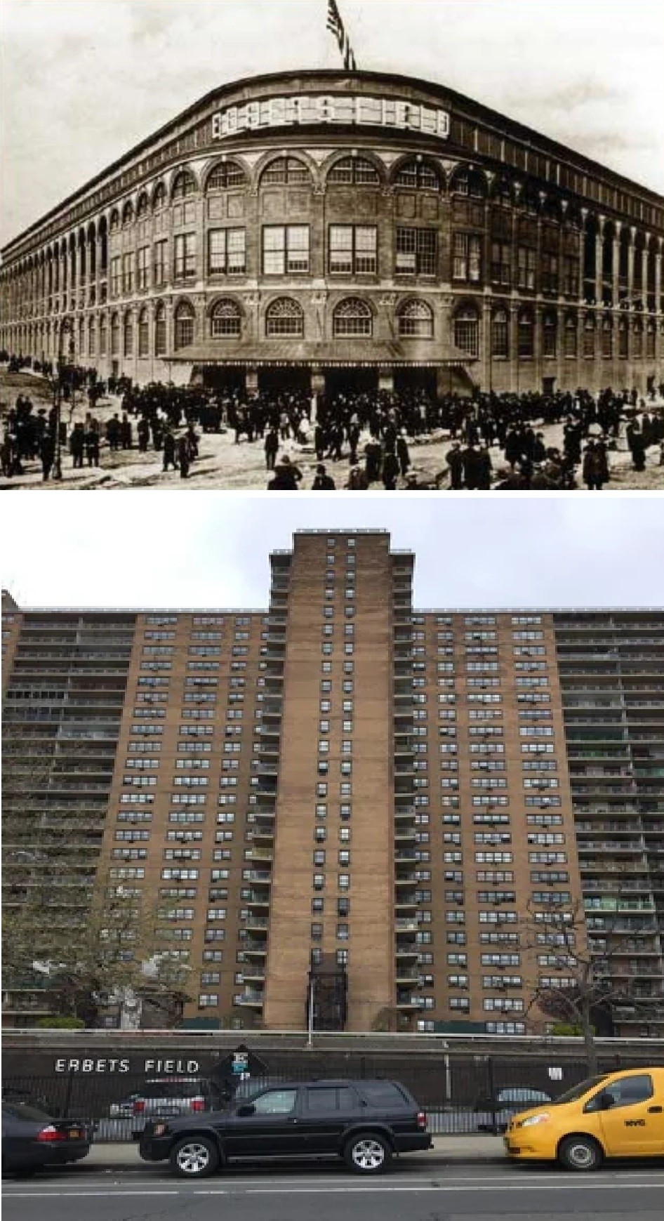
Sports venues also reflect change. Modern stadiums include updated seating, lighting systems, and expanded public areas compared to earlier ballparks.
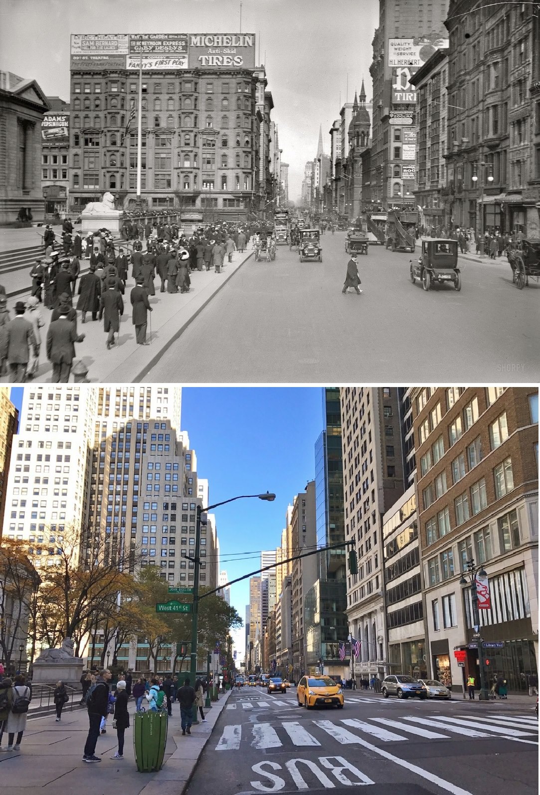
#3 Fifth avenue with the New York Public Library on the left in 1913 and 2016.

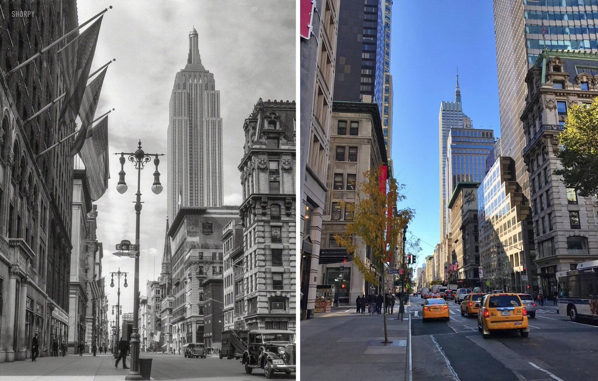
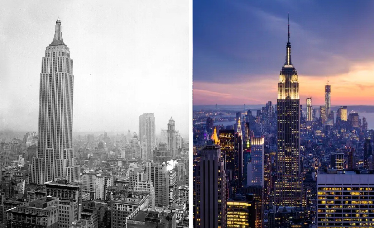
#5 Empire State Building from 41st and 5th in 1933 and 2016.

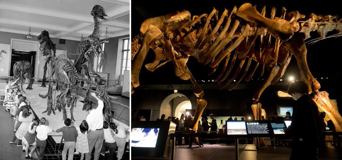
#18 The American Museum of Natural History. 1956 vs 2016

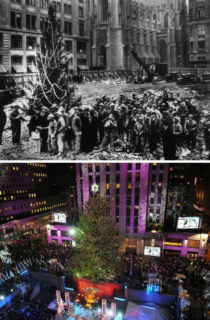
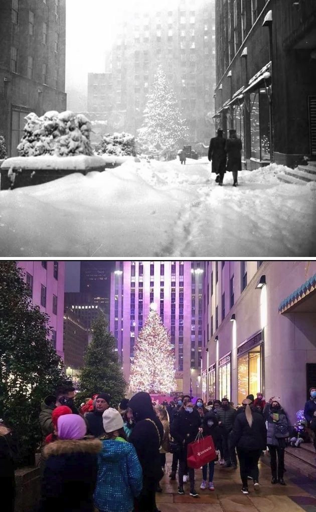
#19 Center Christmas tree at Rockefeller. 1931 vs 2021

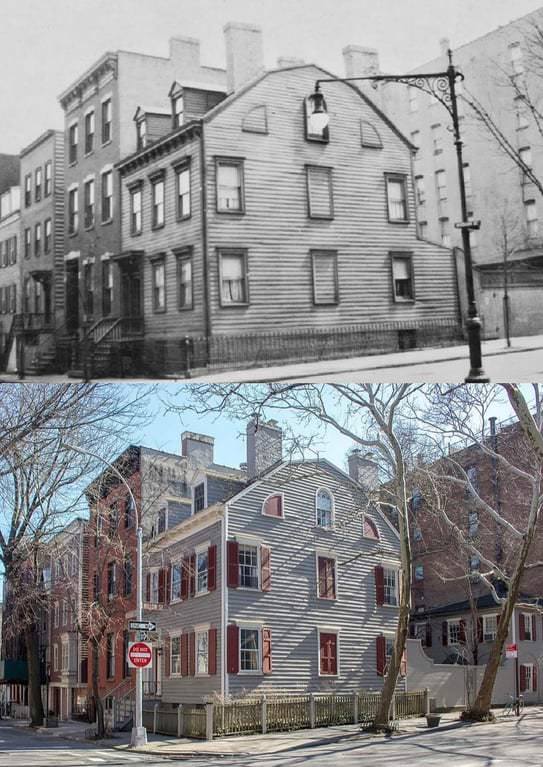
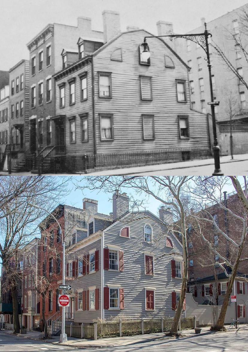
#22 24 Middagh Street, Brooklyn Heights. 1925 vs 2023
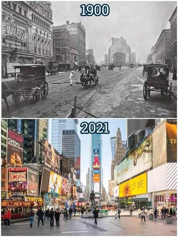
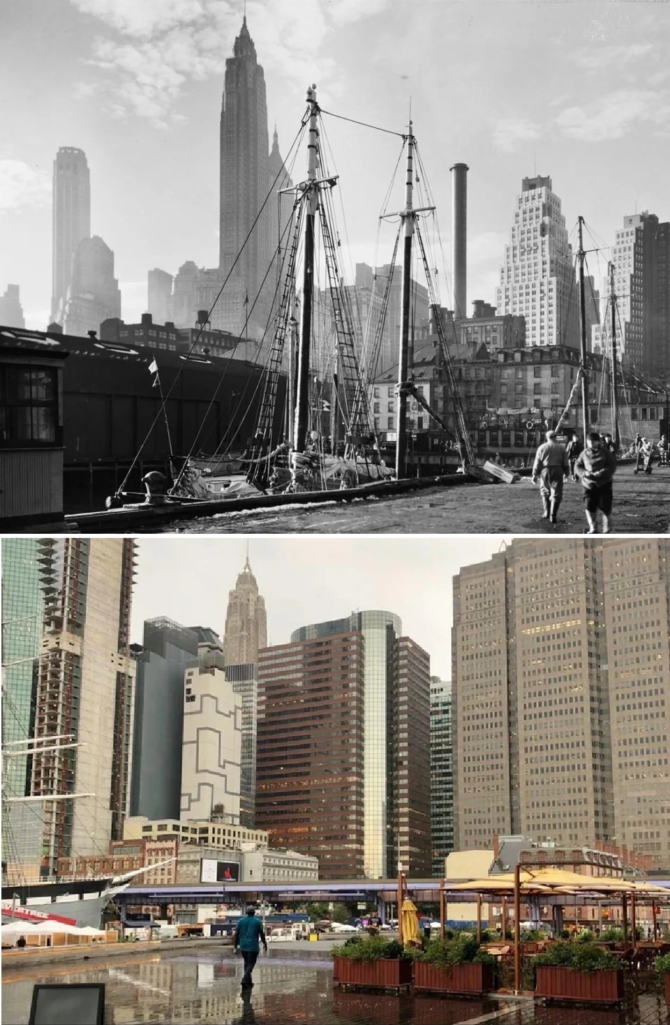
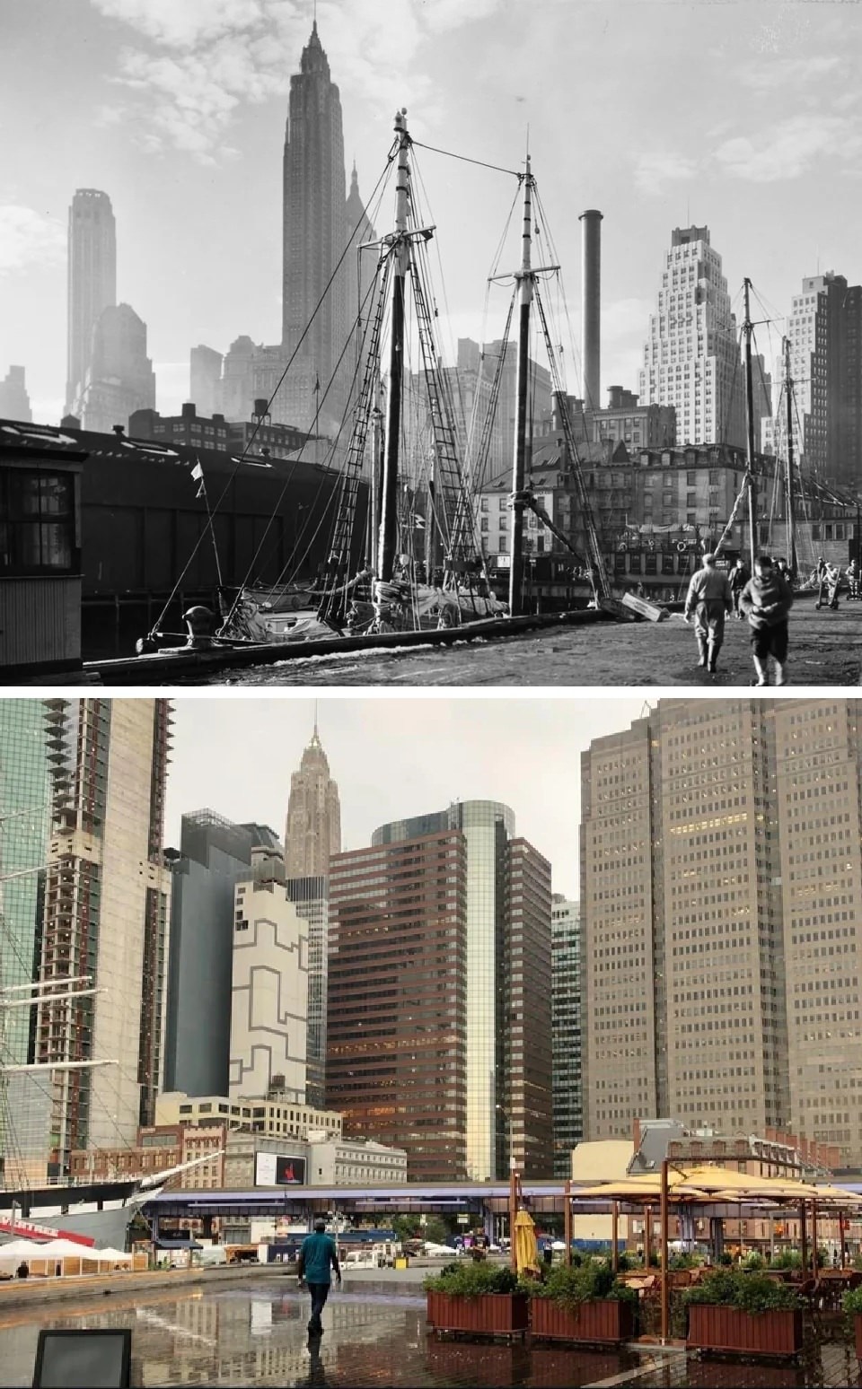
#26 Pier 17, South Street Seaport, Manhattan. 1935 vs 2020
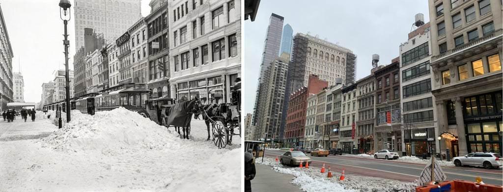
#28 27 W 23rd Street, New York City – 1905 snowstorm VS outside a COVID testing center December 2020

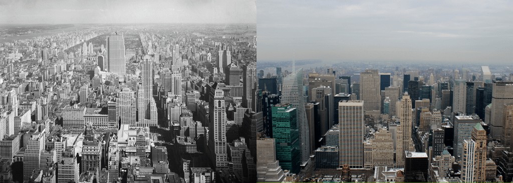
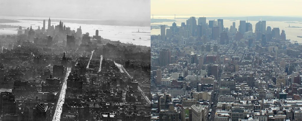
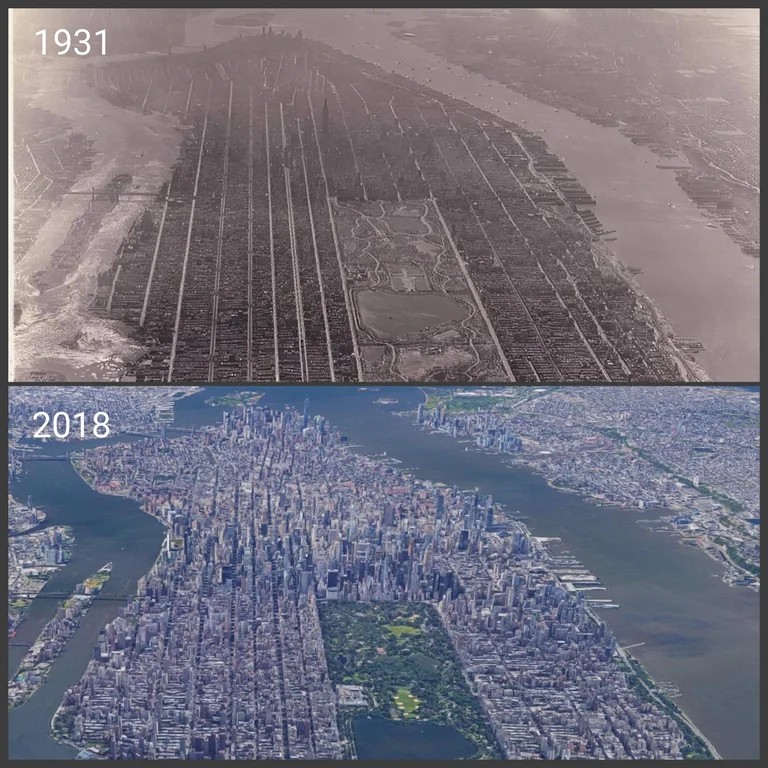
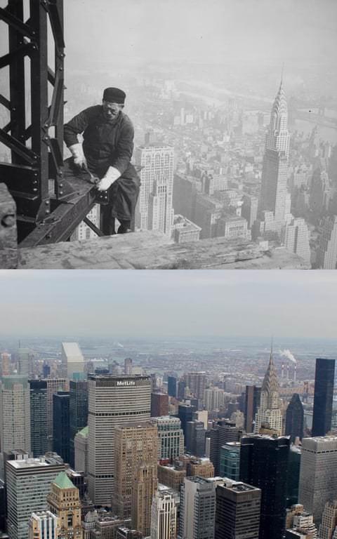
#29 Looking North From the Empire State Building – Manhattan. (1931-2011)

#30 Looking North From the Empire State Building – Manhattan. (1931-2011)

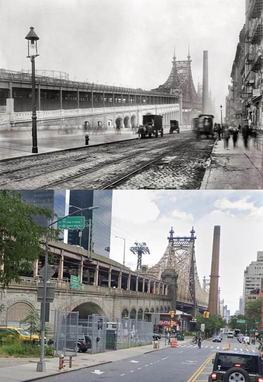
#35 59th Street Queensboro Bridge shortly after completion, 1909–2020.

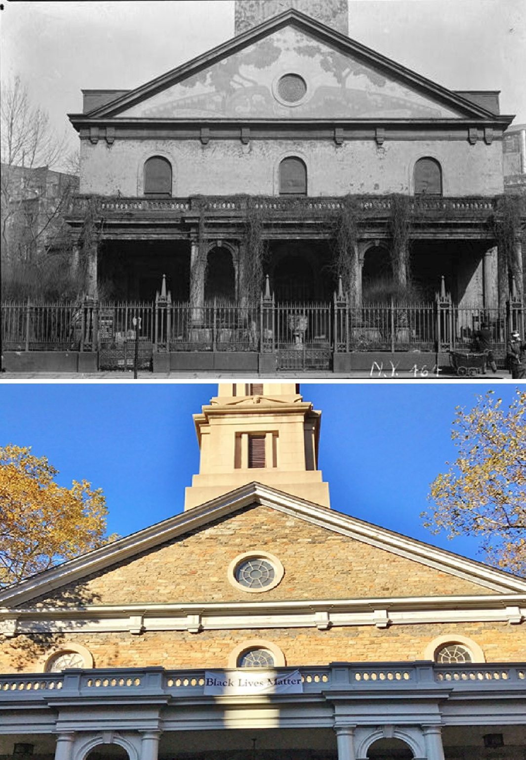
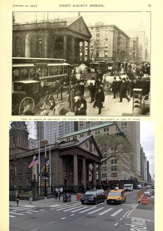
#36 St. Paul’s Chapel on Broadway, New York, 1903–2020.

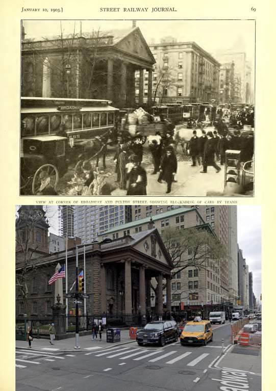
#37 St. Paul’s Chapel on Broadway, New York, 1903–2020.

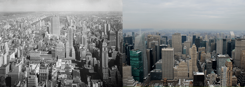
#40 View from the Empire State Building, 1931–2011.

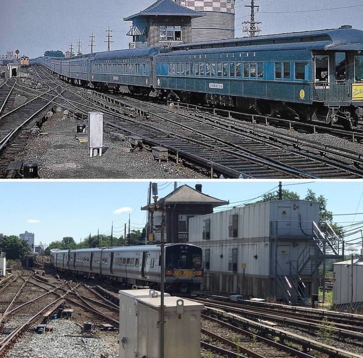
#42 Long Island Rail Road Jamaica Station, 1950s–2020.

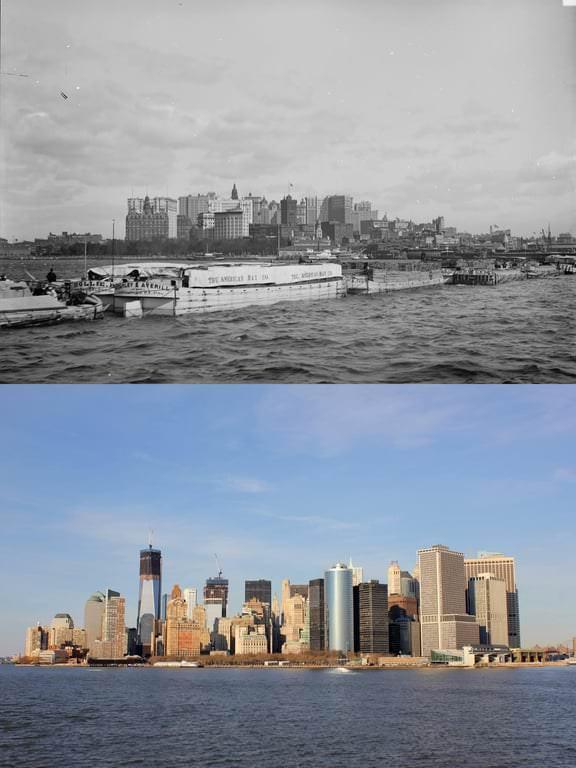
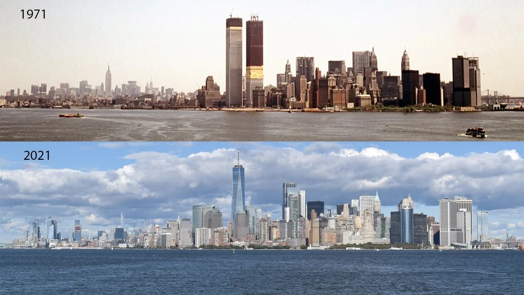
#44 Manhattan skyline from New York Harbor, 1900s–2012.

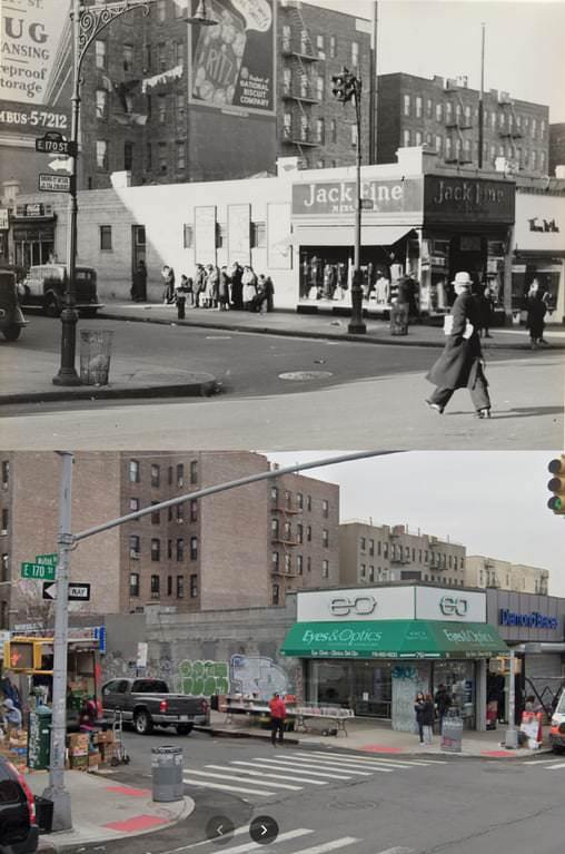
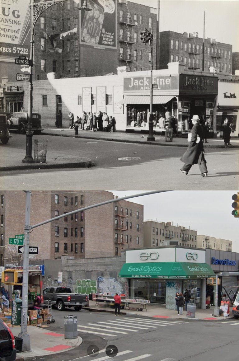
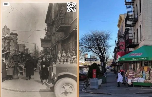
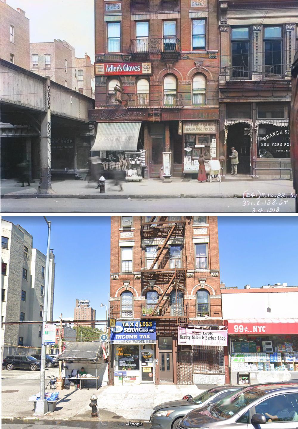
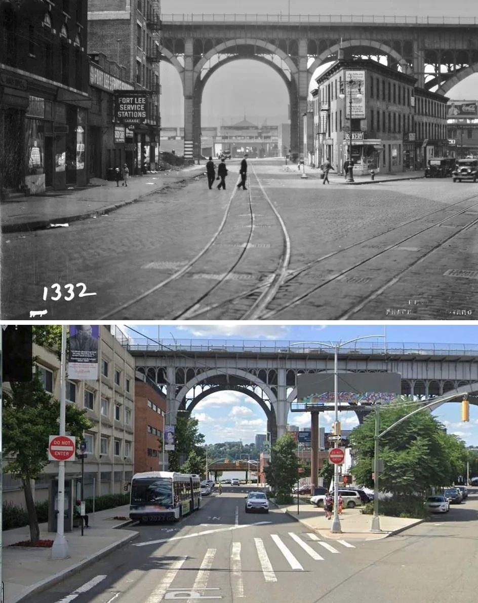
#45 East 170th Street and Walton Avenue, The Bronx, 1937–2021.

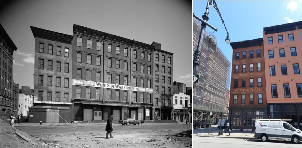
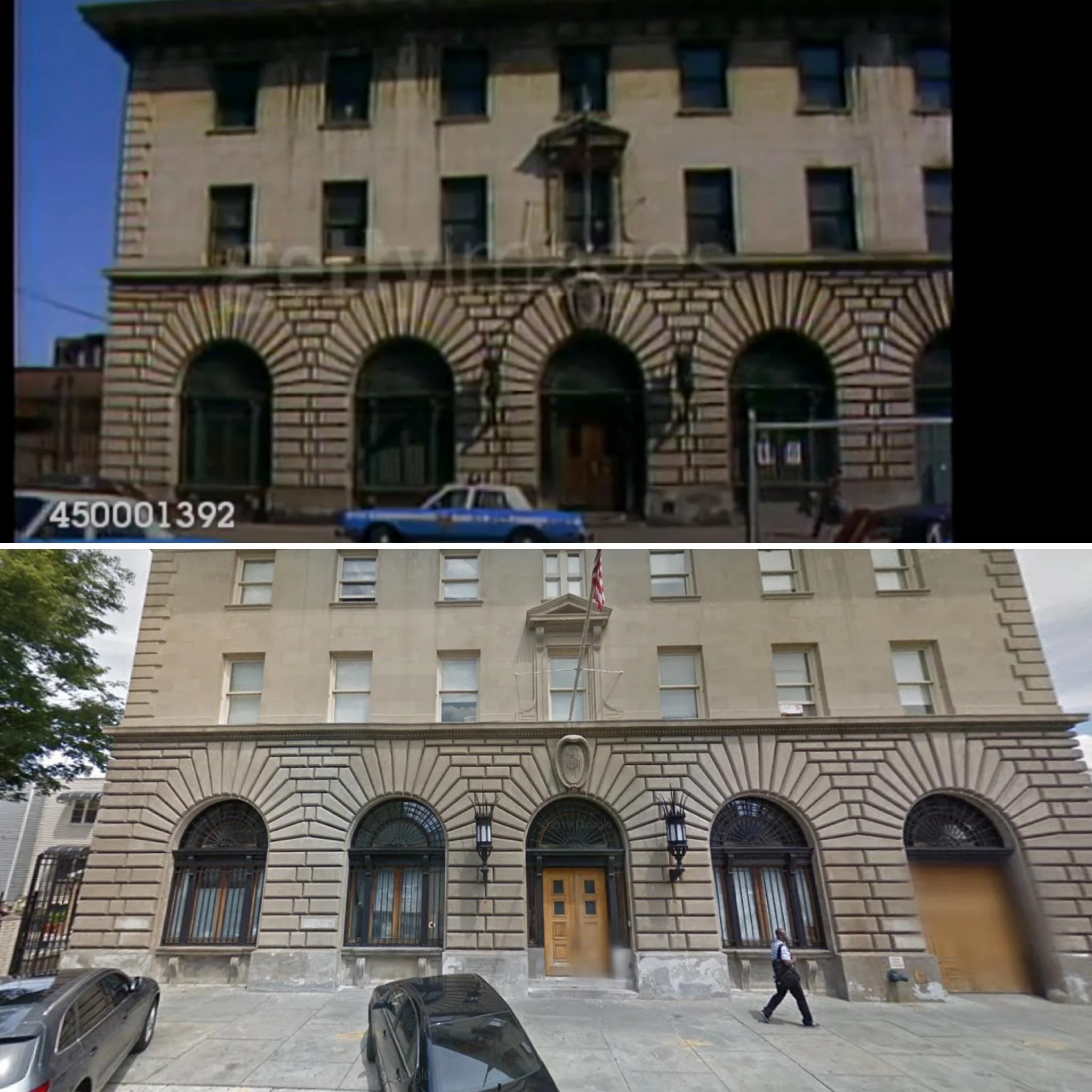
#51 413 Greenwich Street, the Morrison and Boinest Co. Building, New York, 1980–2023.

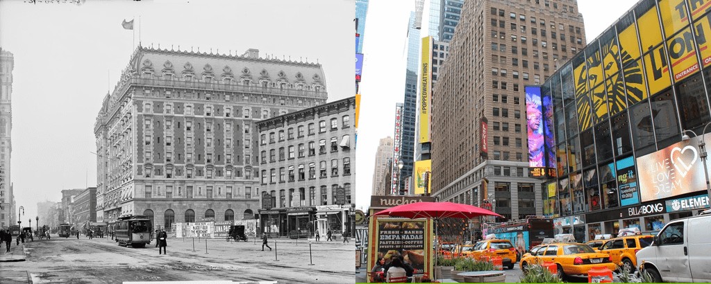
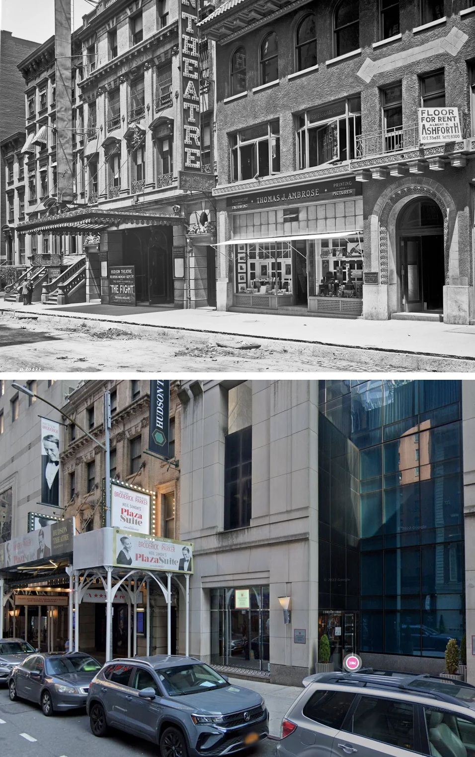
#55 Hudson Theatre and the Quality Shop, 1913–2022.

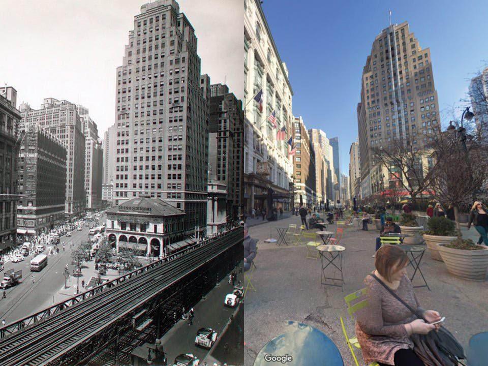
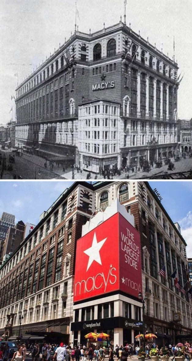
#56 Macy’s Flagship Store at 34th Street and Herald Square, 1906–2021.

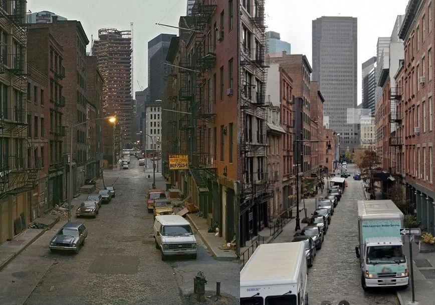
#63 Water Street seen from the Brooklyn Bridge on-ramp, 1984–2022.

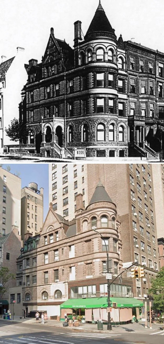
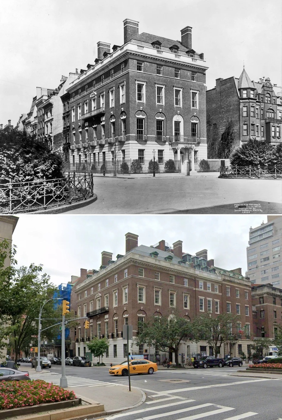
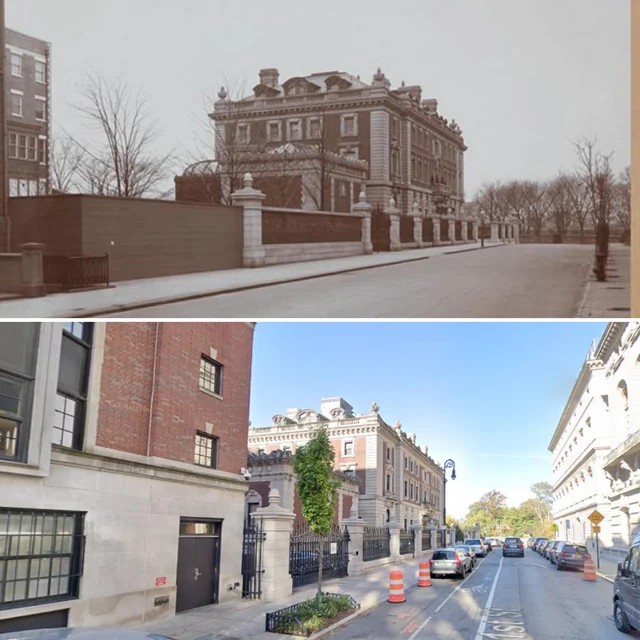
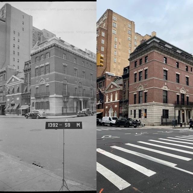
#65 Carnegie residence at 5th Avenue and 90th Street, 1900s–2021.

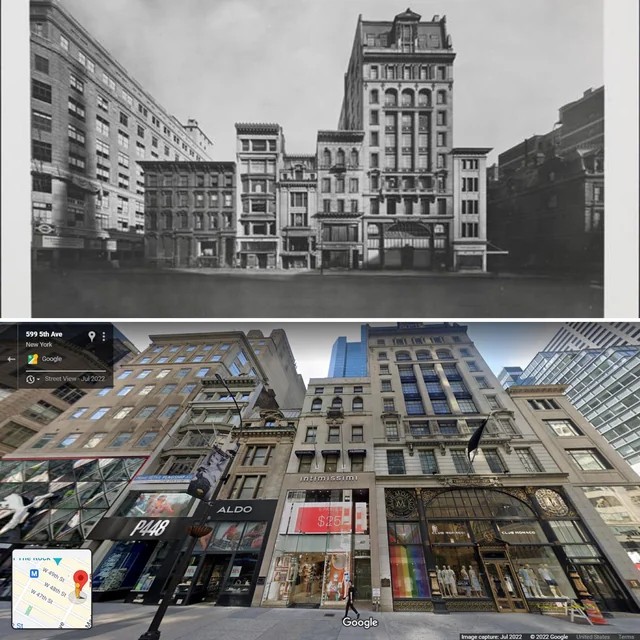
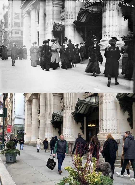
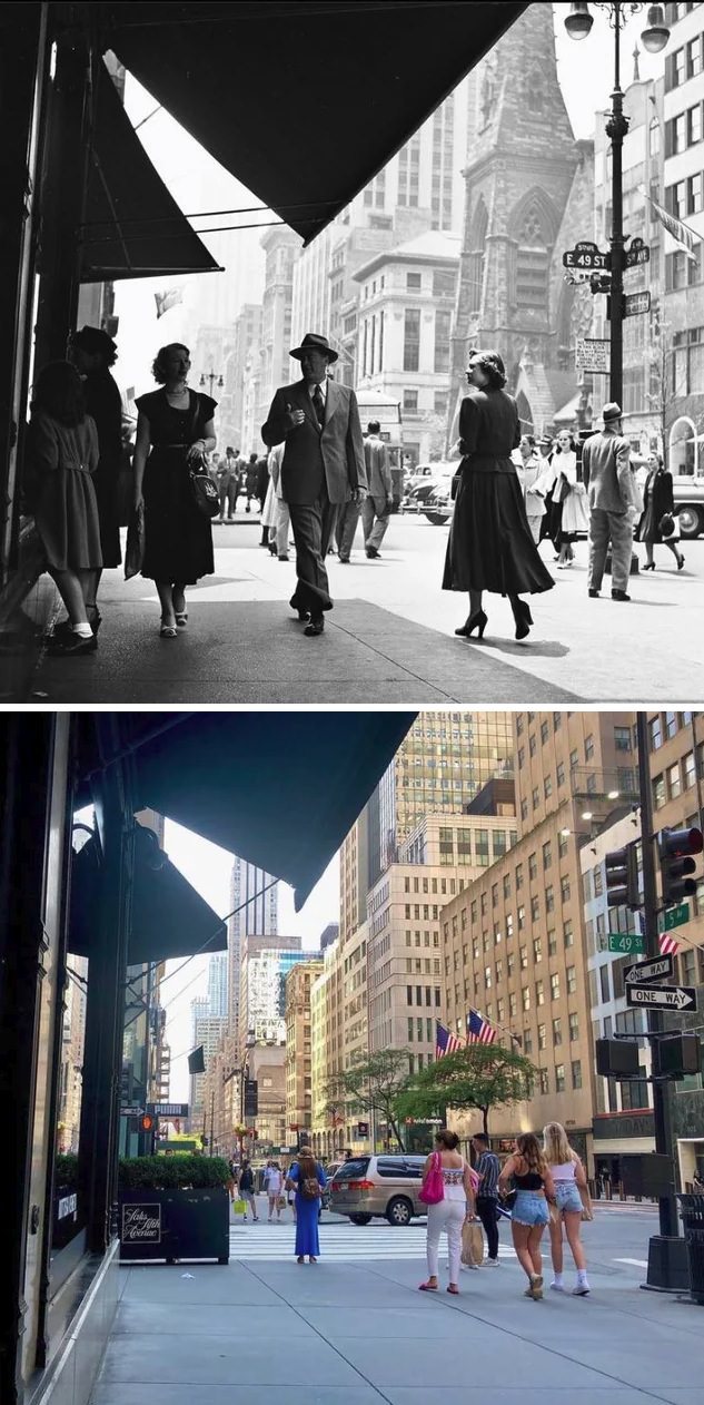
#67 5th Avenue between 48th and 49th Streets, 1923–2022.

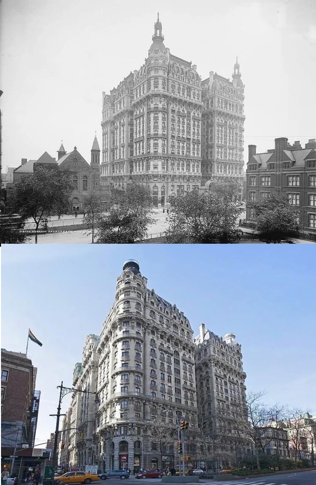
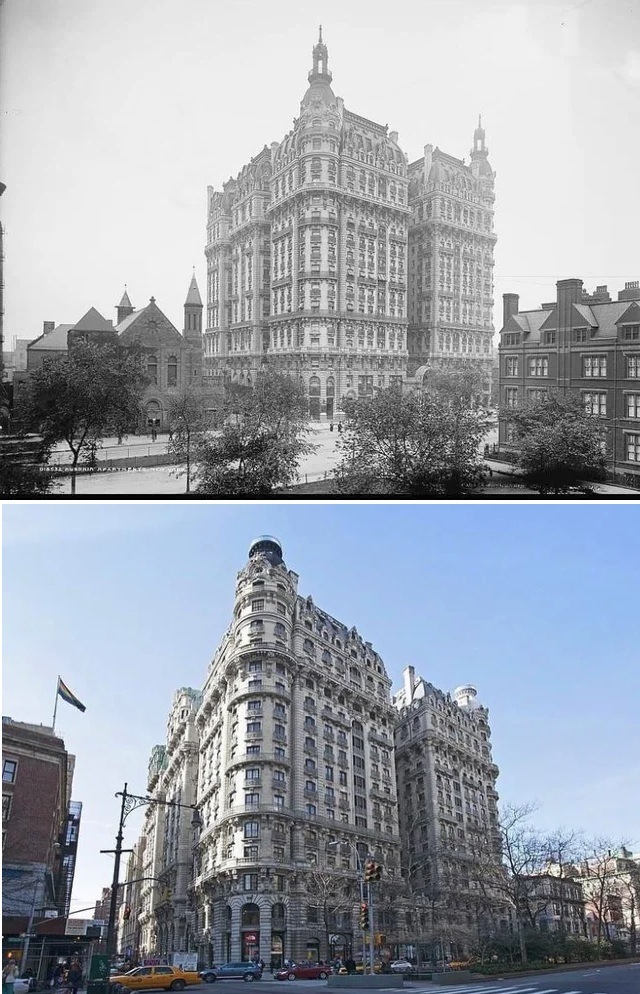
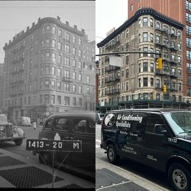
#69 The Ansonia Apartments at Broadway and 73rd Street, 1904–2014.

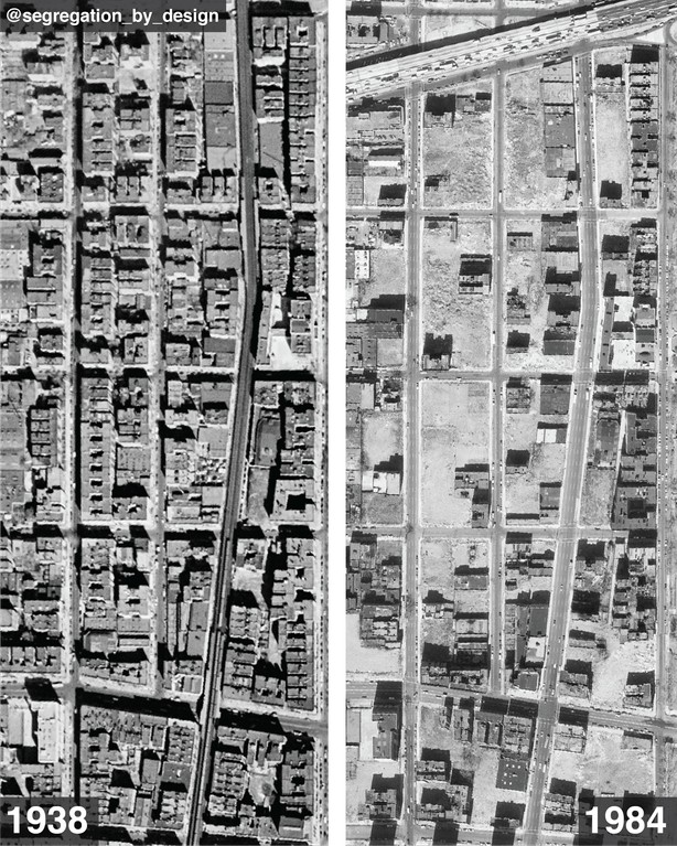
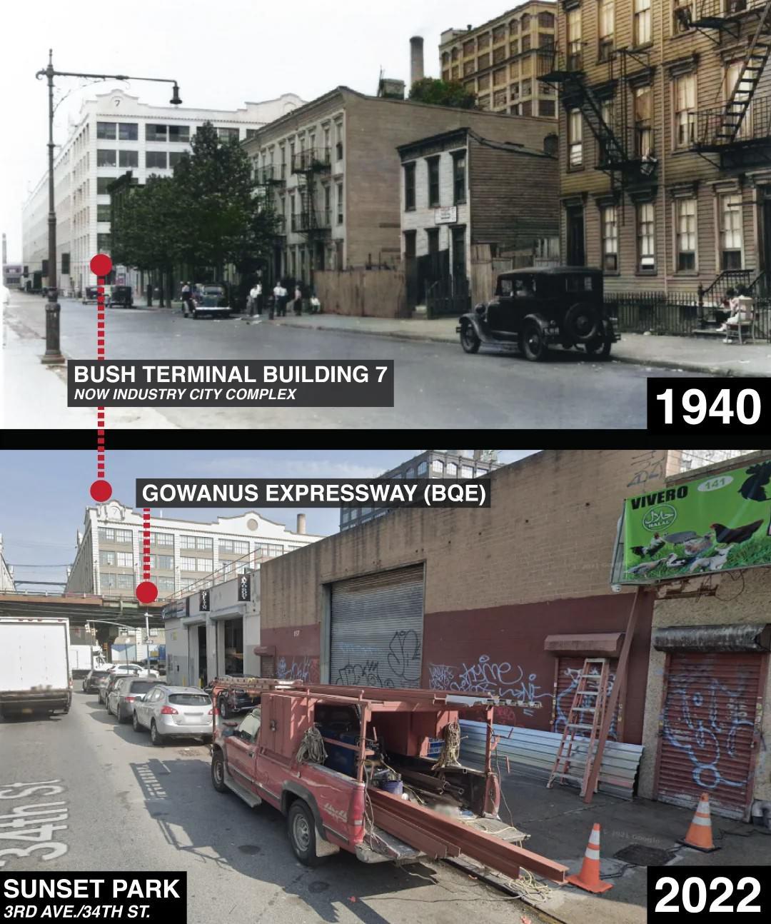
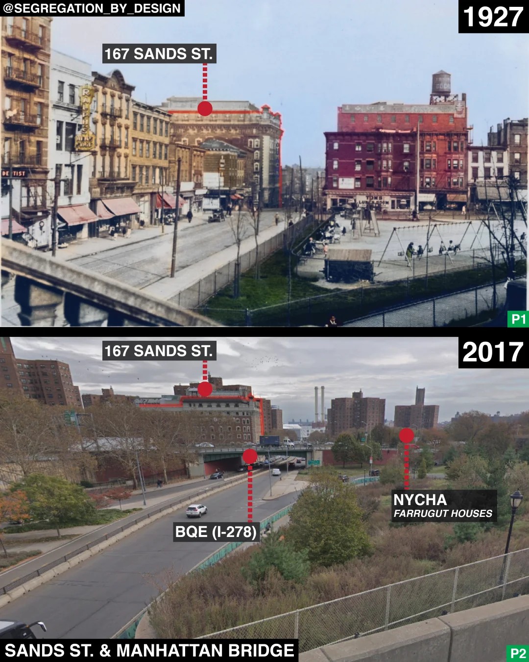
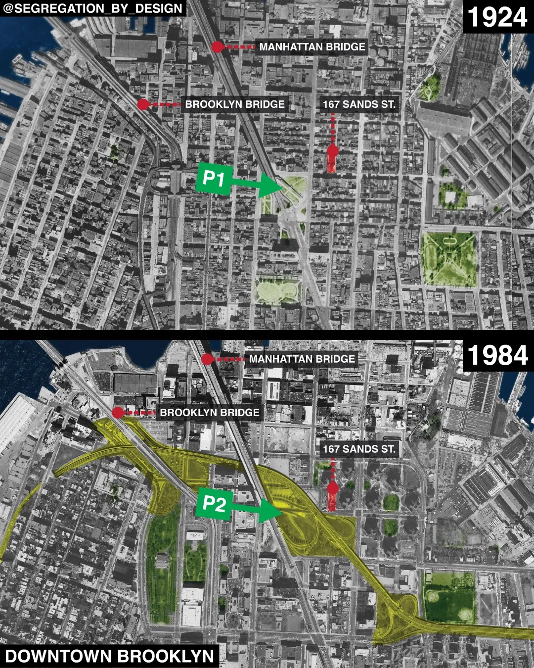
#71 Sunset Park before and after the construction of the Brooklyn-Queens Expressway, Brooklyn, 1940–2022.

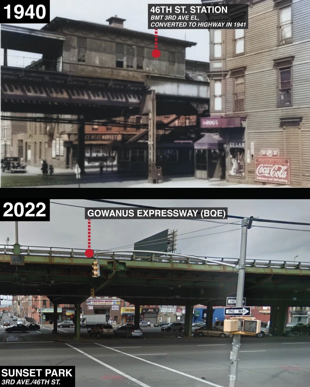
#72 Sunset Park before and after the construction of the Brooklyn-Queens Expressway, Brooklyn, 1940–2022.

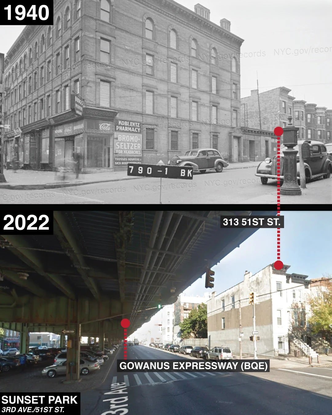
#73 Sunset Park before and after the construction of the Brooklyn-Queens Expressway, Brooklyn, 1940–2022.

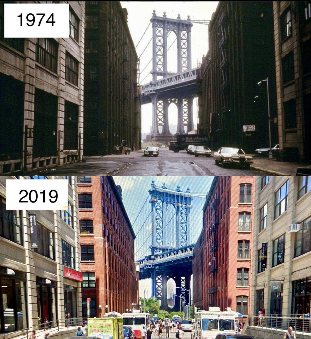
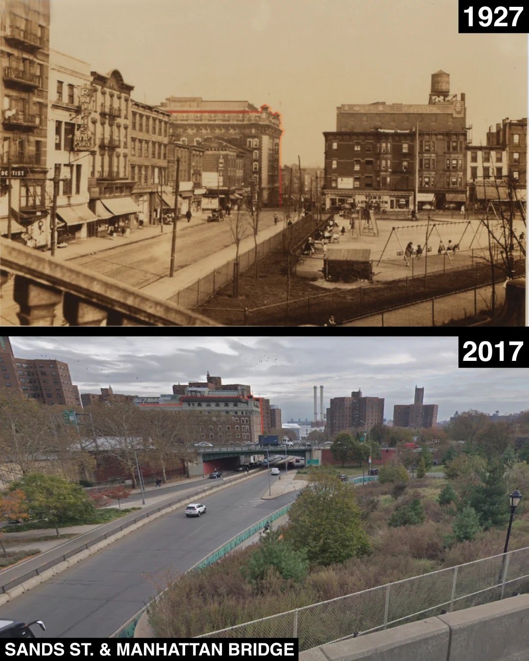
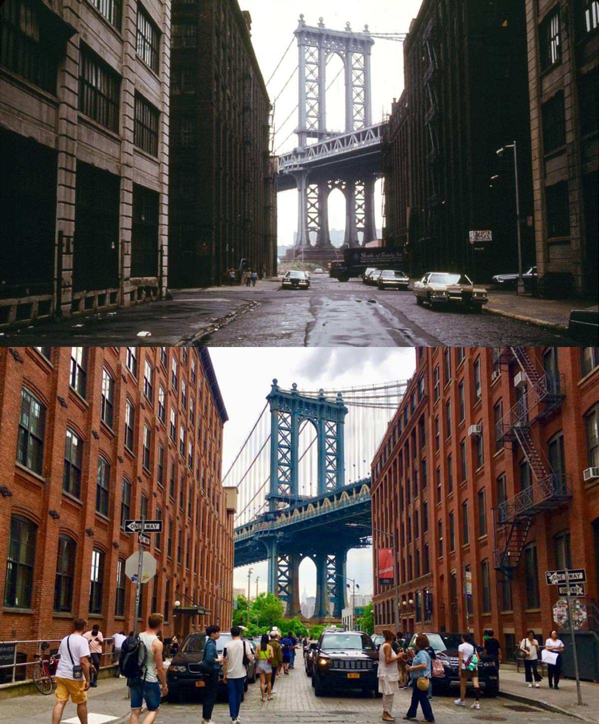
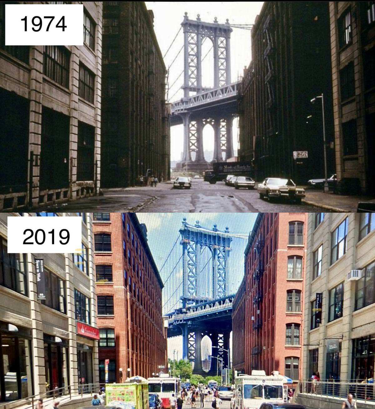
#74 Washington Street and the Manhattan Bridge, Brooklyn.

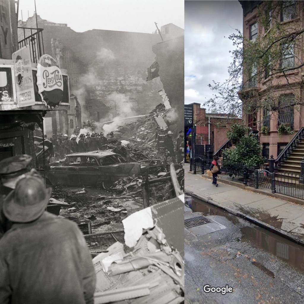
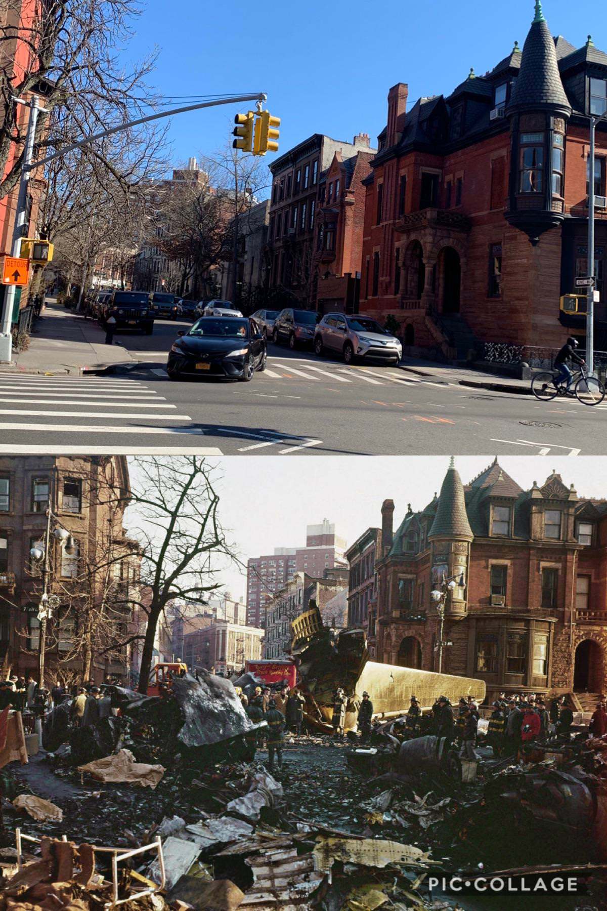
#75 Plane debris in Park Slope after a mid-air collision, Brooklyn, 1960–2020s.
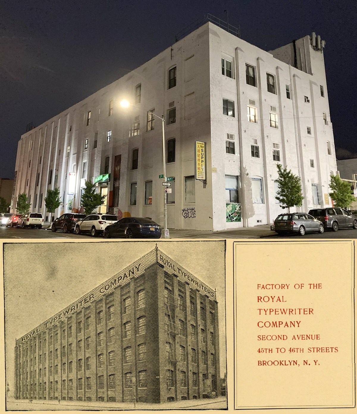
#79 Royal Typewriter factory, Brooklyn, 1904–2020s.
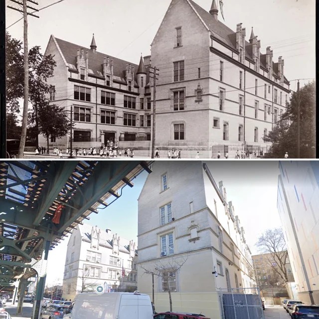
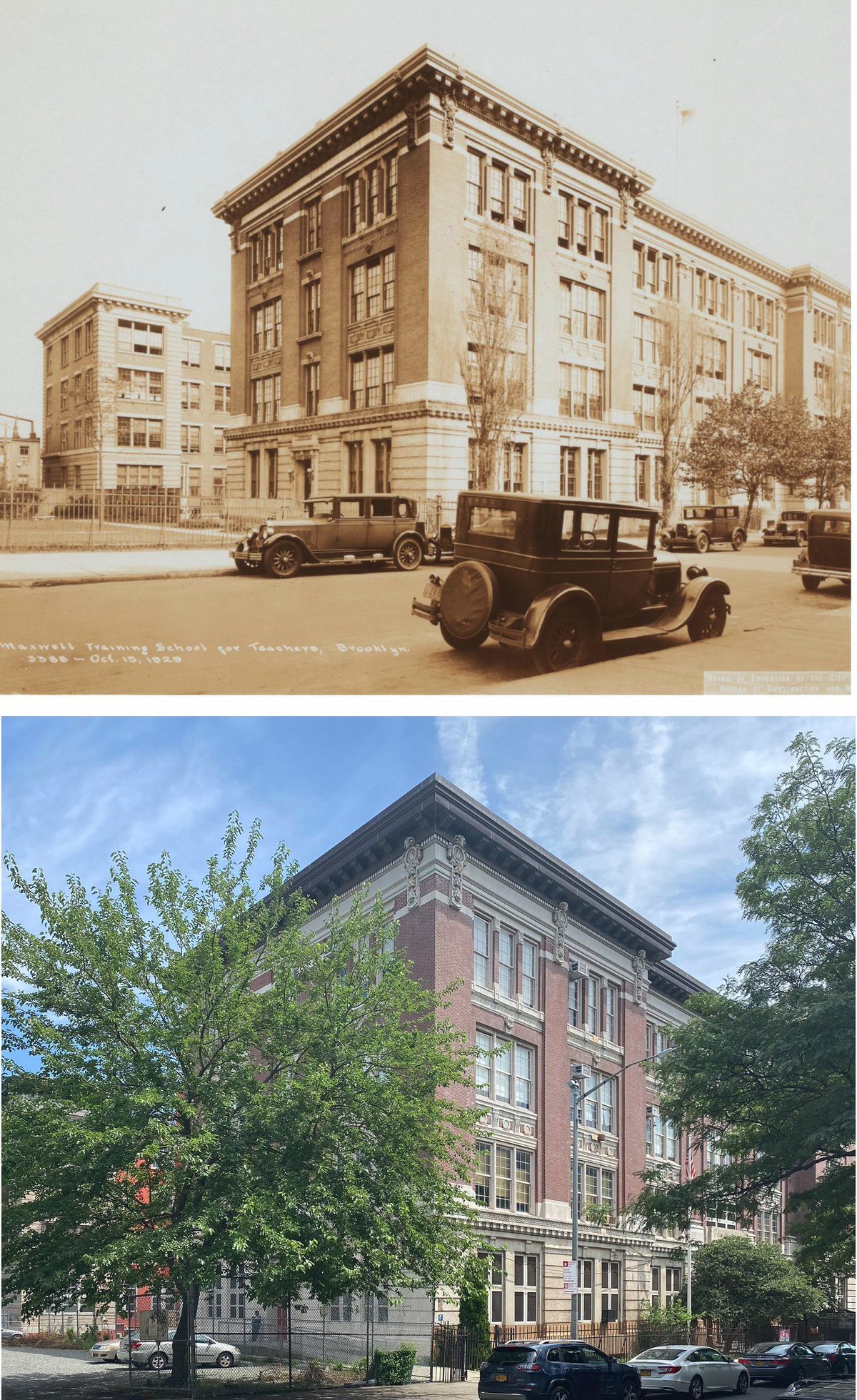
#82 Maxwell Training School for Teachers in Crown Heights, Brooklyn, 1929–2020.

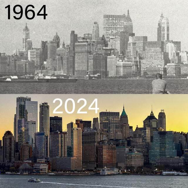
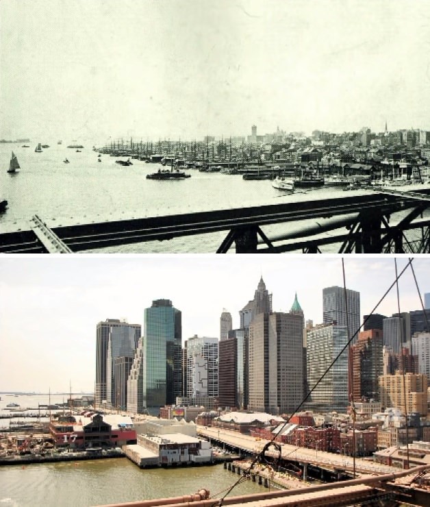
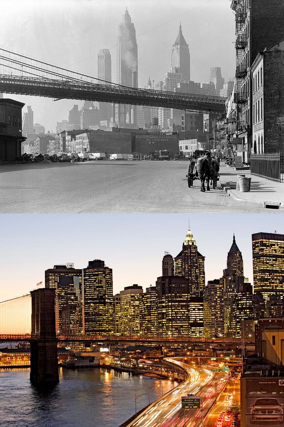
#83 Skyline of Lower Manhattan from the Brooklyn Bridge, 1886–2014.

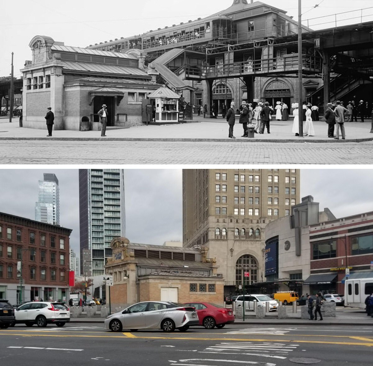
#84 Corner of Atlantic and Flatbush Avenues, Brooklyn, 1910–2020.

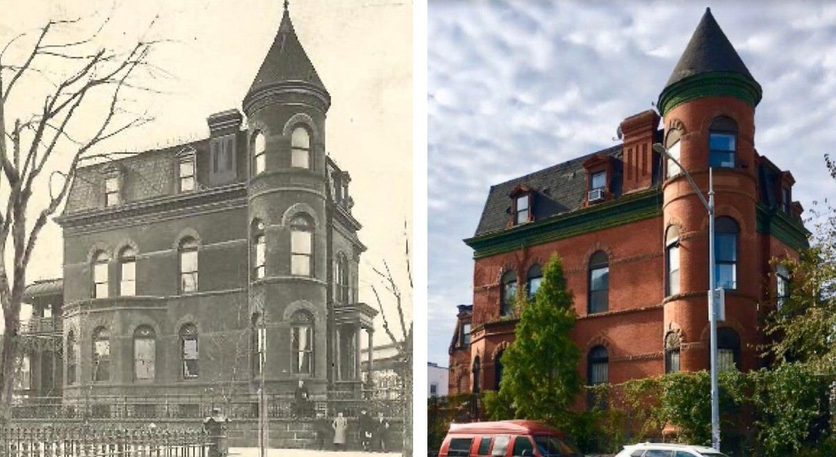
#87 Frederick Cook Home in Bushwick, Brooklyn, 1909–2020.

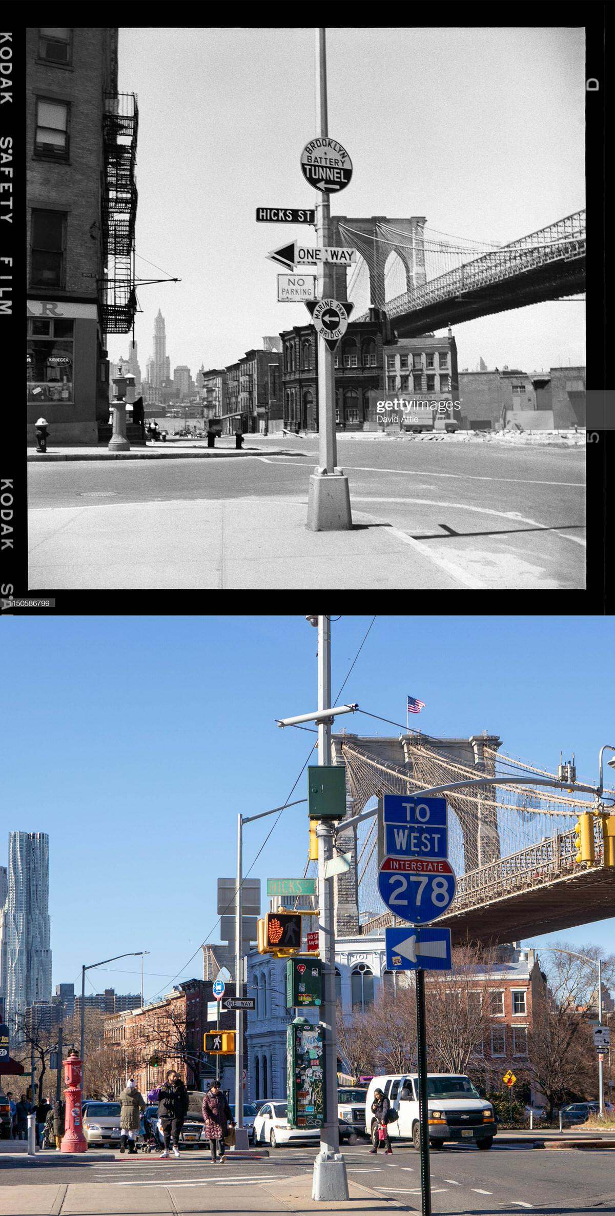
#88 Hicks Street and Old Fulton Street in Brooklyn Heights with a view of the Brooklyn Bridge, 1958–2021.

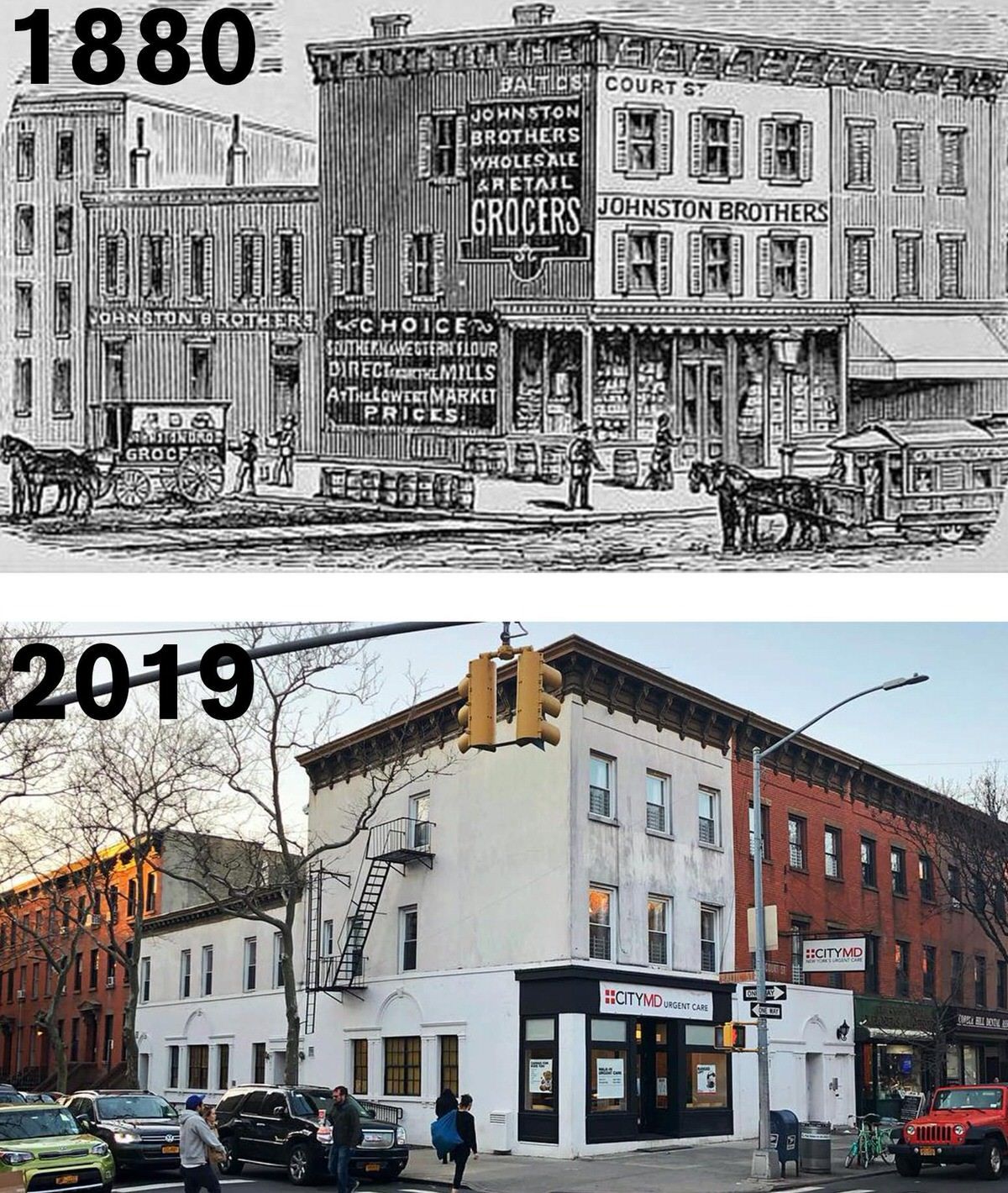
#89 Corner of Court and Baltic Streets, Brooklyn, 1880–2019.

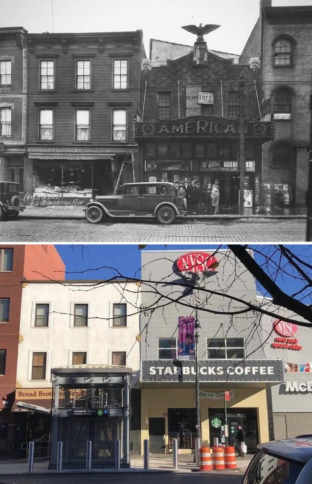
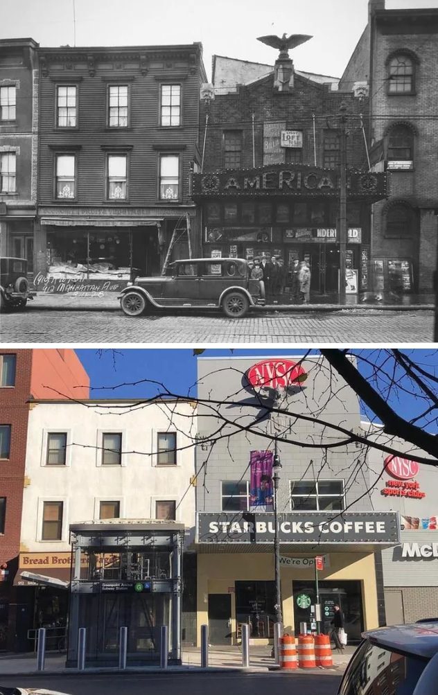
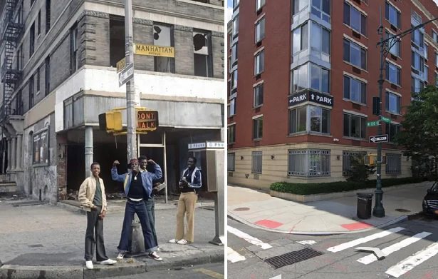
#91 Manhattan Avenue between Kent Street and Greenpoint Avenue, Greenpoint, 1928–2021.

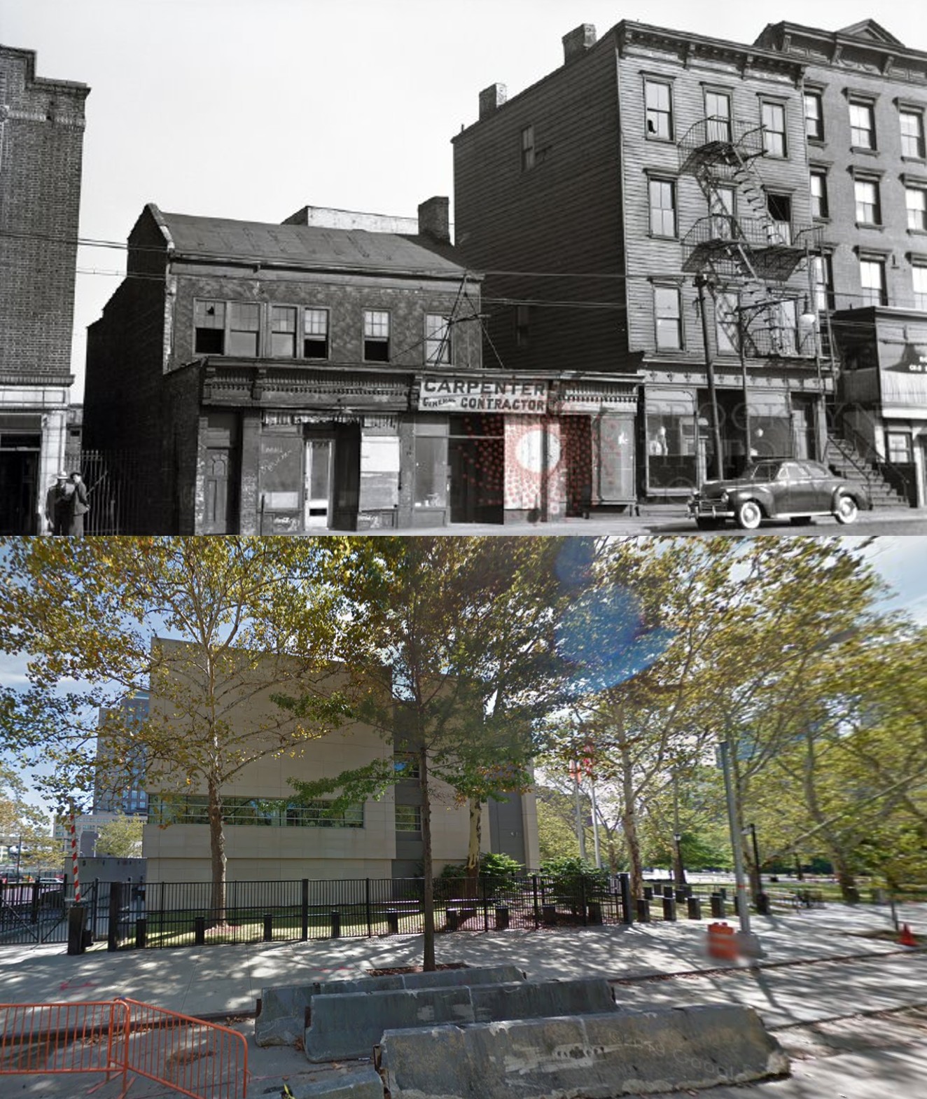
#92 Washington Street, Downtown Brooklyn, 1939–2014.

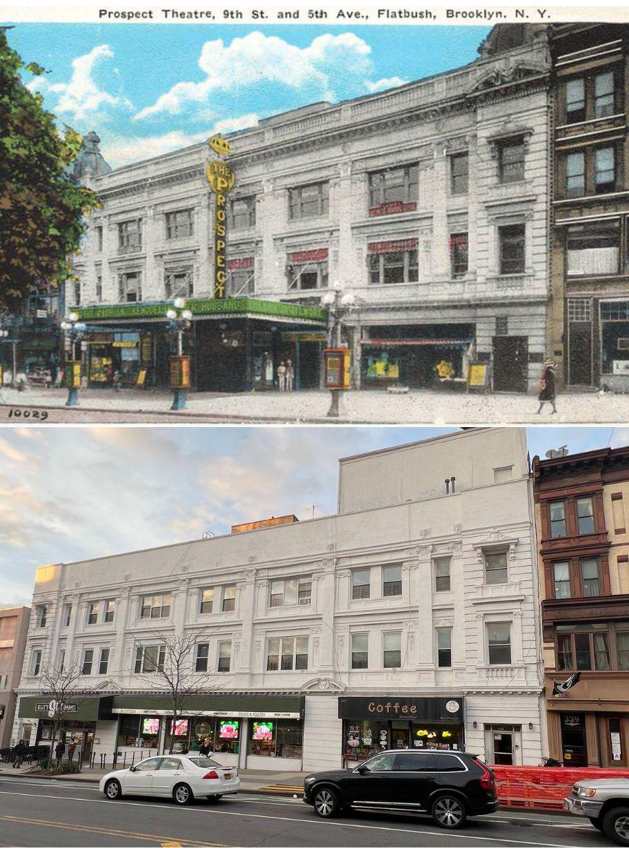
#94 Prospect Theatre in Park Slope, Brooklyn, 1920s–2020s.

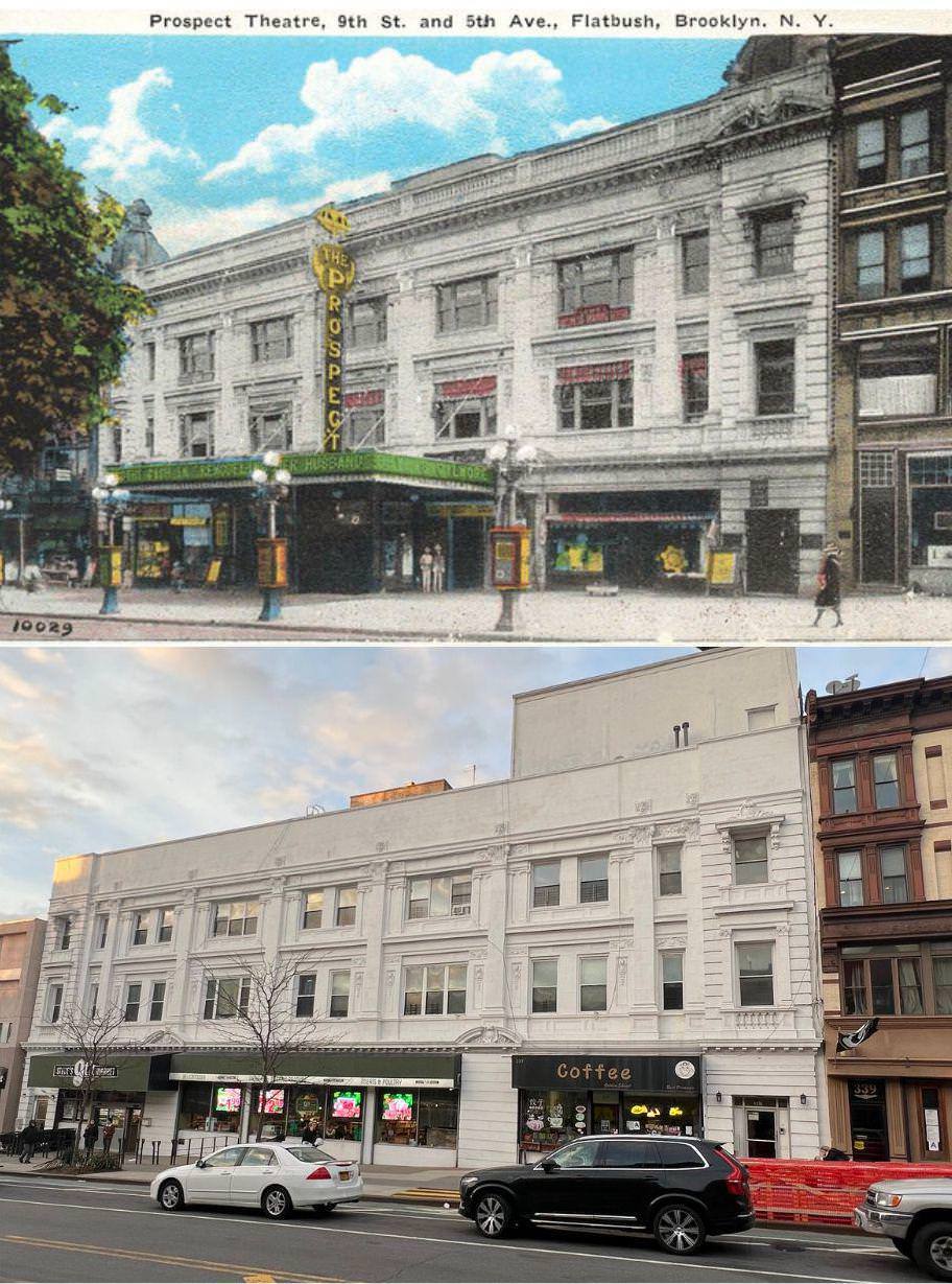
#95 Prospect Theatre in Park Slope, Brooklyn, 1920s–2020s.

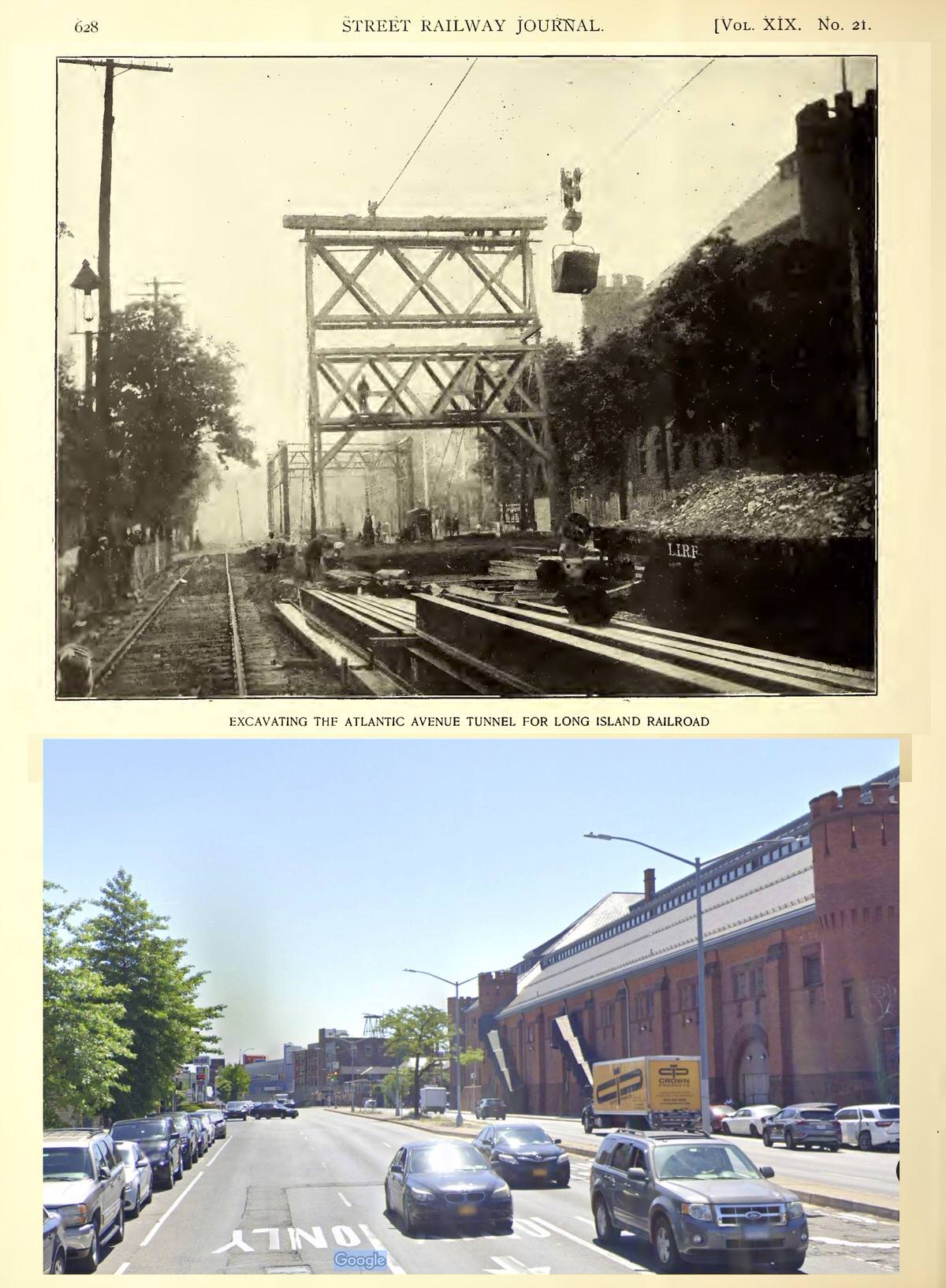
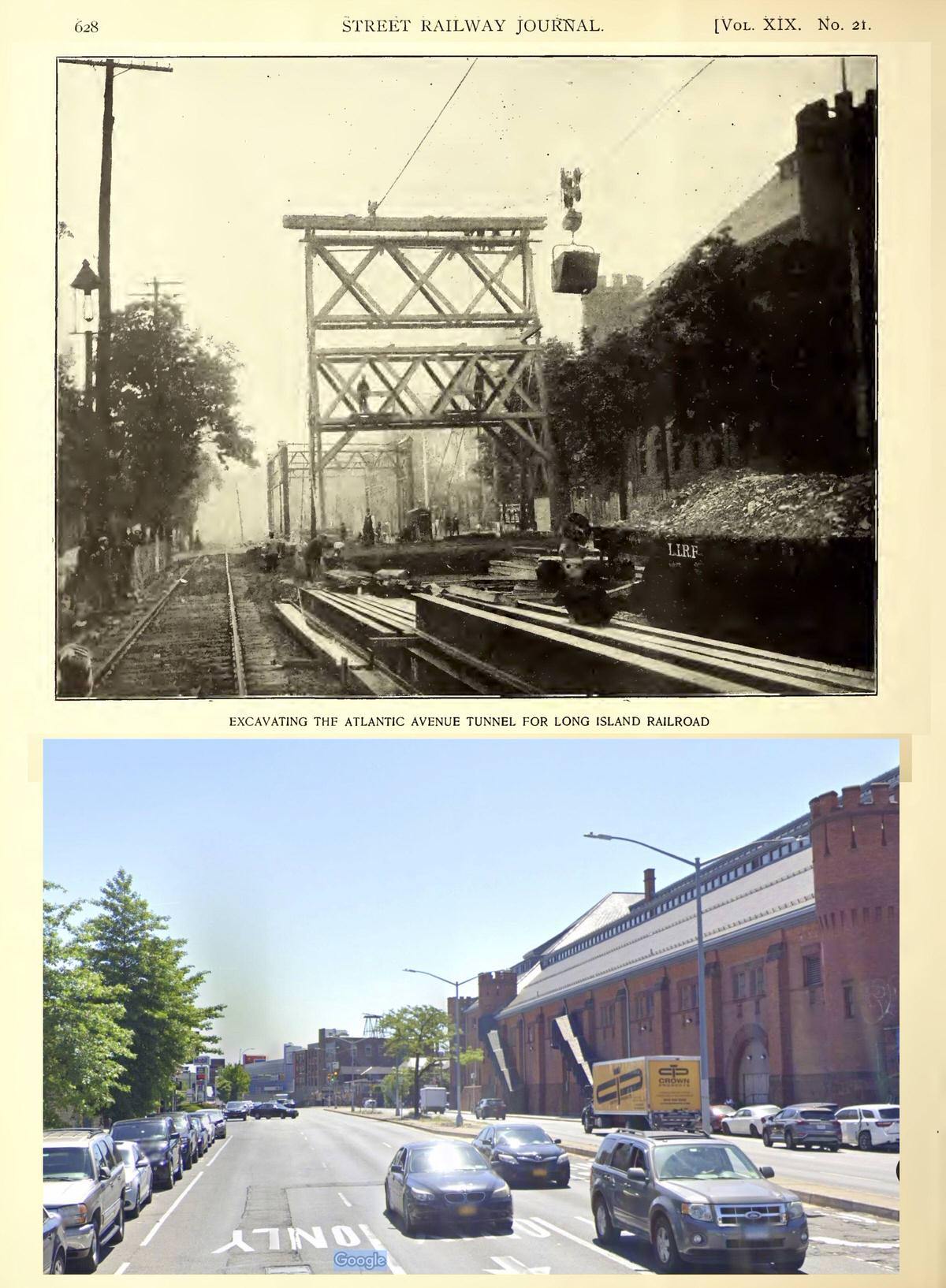
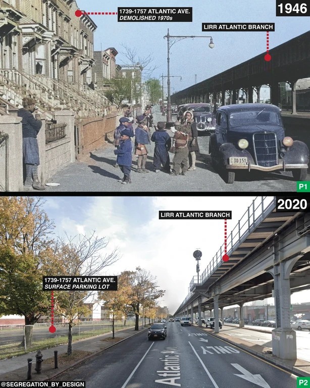
#99 Atlantic Avenue in Bedford-Stuyvesant, Brooklyn, 1946–2020.

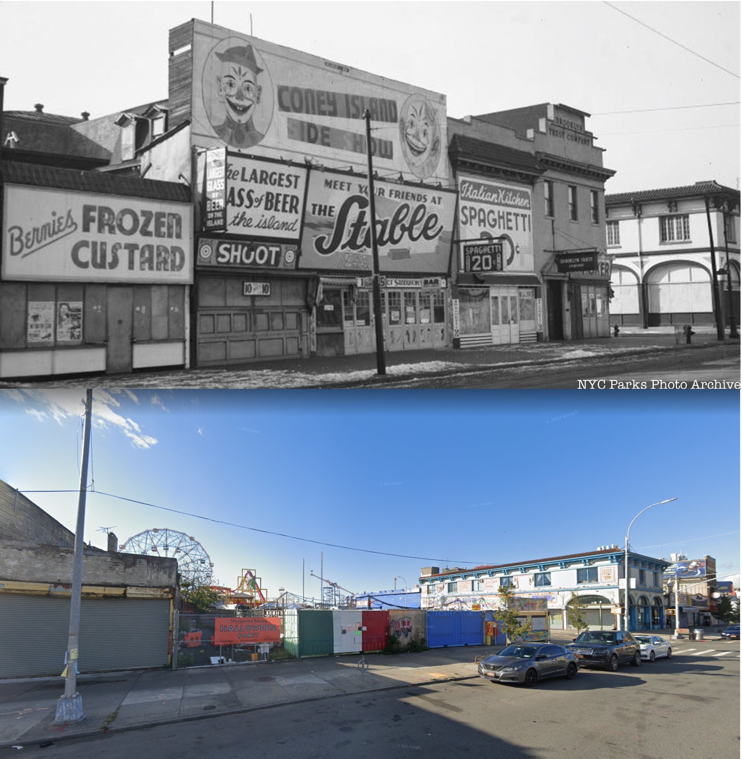
#100 Corner of Surf Avenue and West 12th Street, Coney Island, 1940–2020.

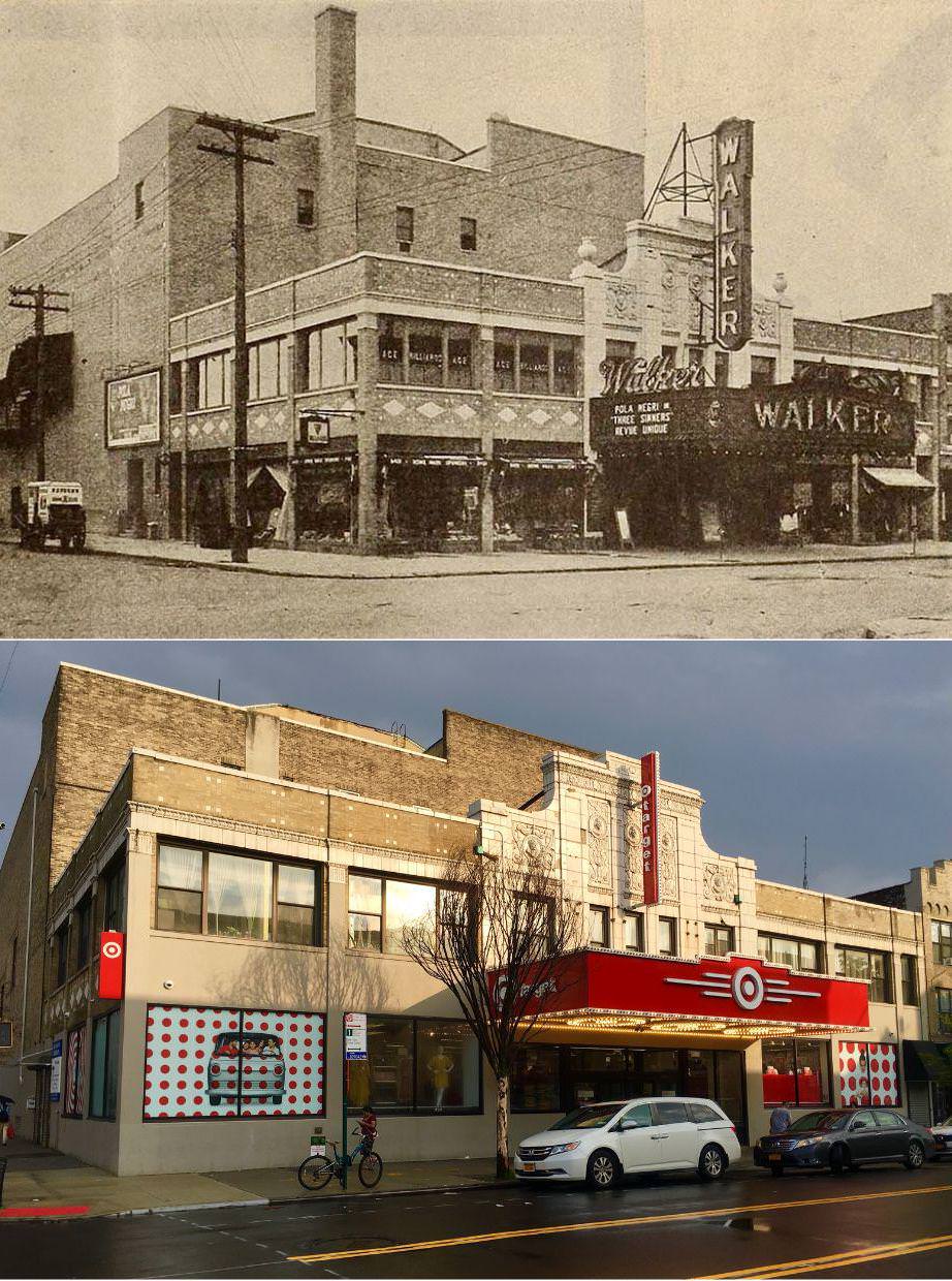
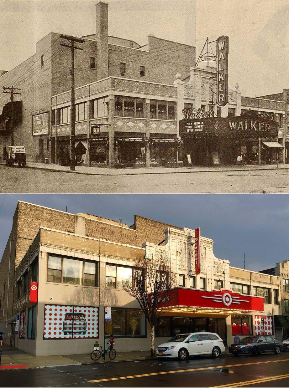
#103 The former Walker Theater in Bensonhurst, Brooklyn, 1928–2023.

#104 The former Walker Theater in Bensonhurst, Brooklyn, 1928–2023.

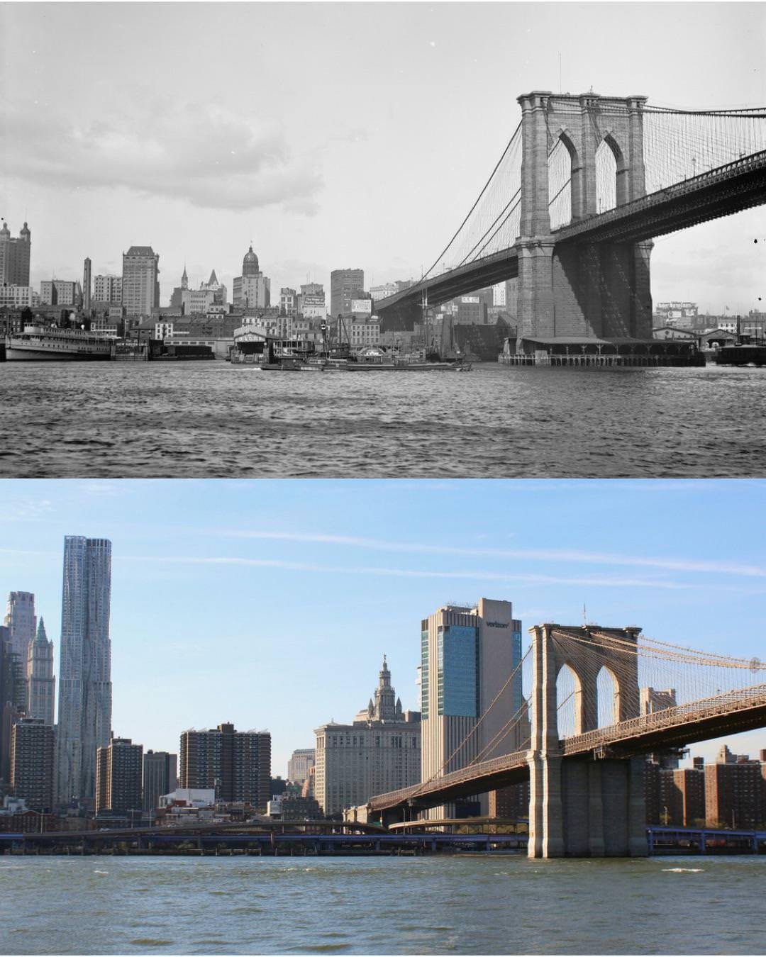
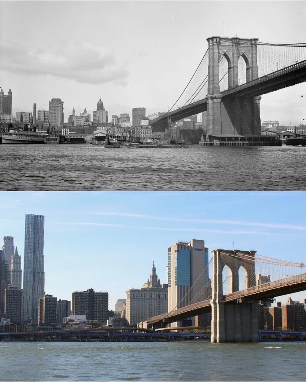
#106 The Brooklyn Bridge and the Manhattan skyline, 1900s–2023.

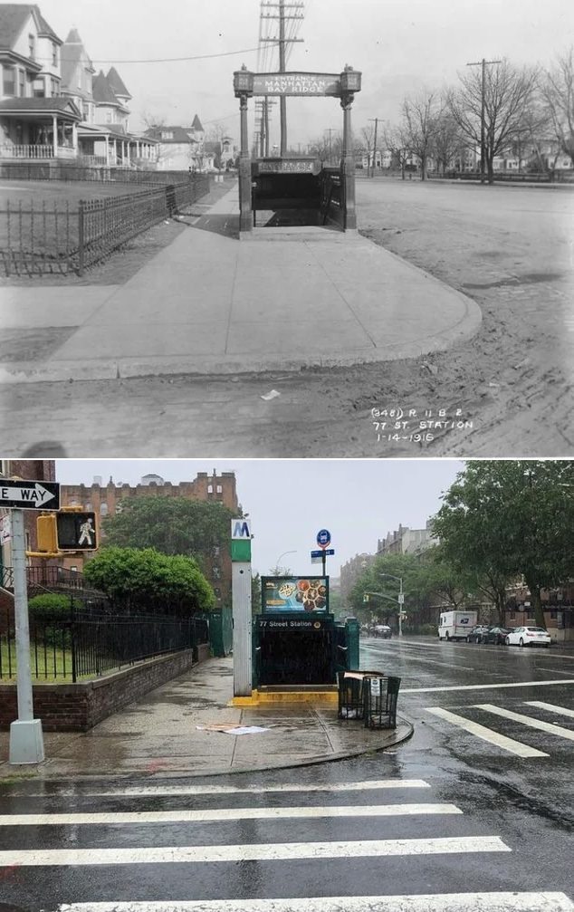
#109 4th Avenue and 77th Street, Bay Ridge, 1916–2023.

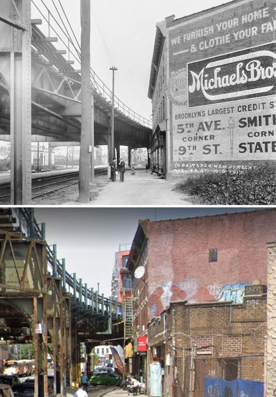
#110 New Utrecht Avenue off 42nd Street, 1917–2019.

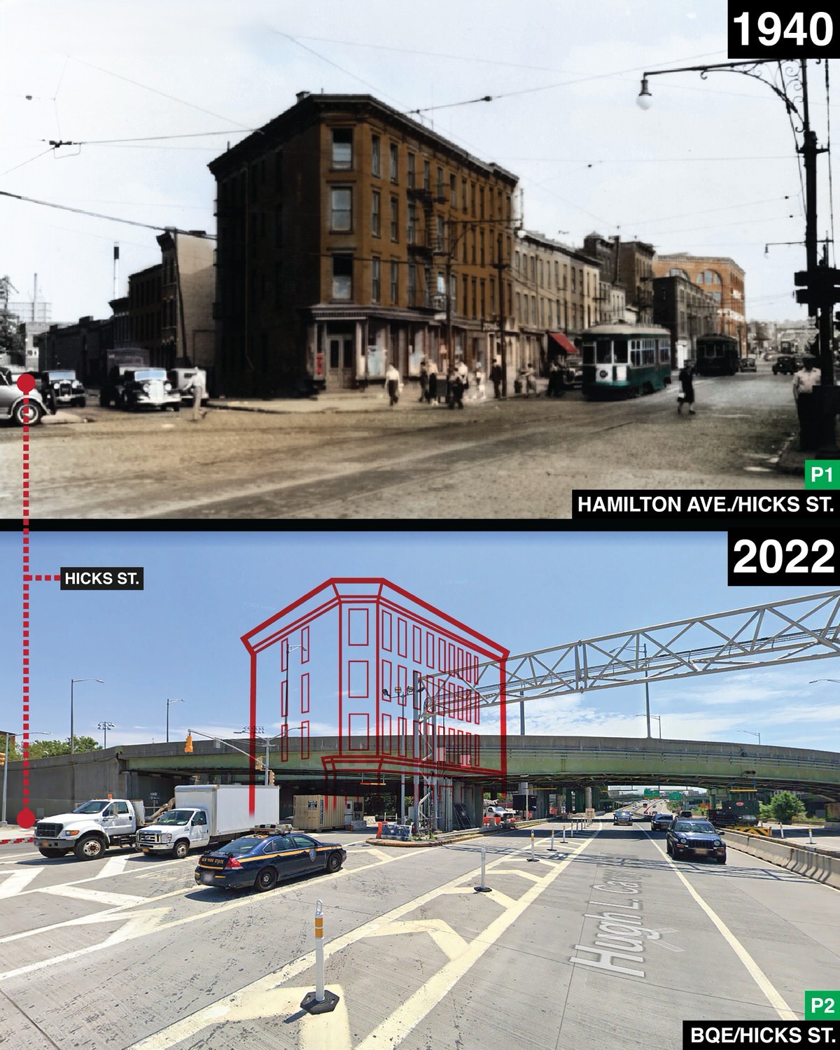
#111 Hamilton Avenue in Red Hook, Brooklyn, 1940–2022.

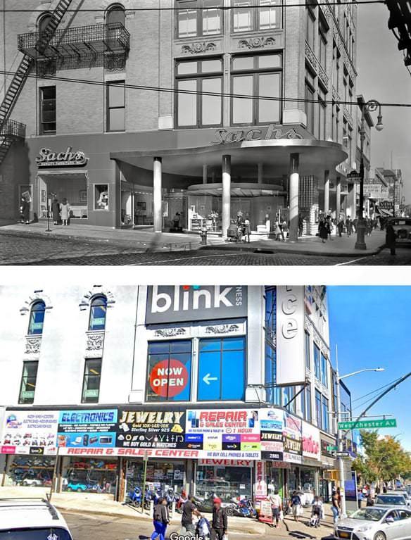
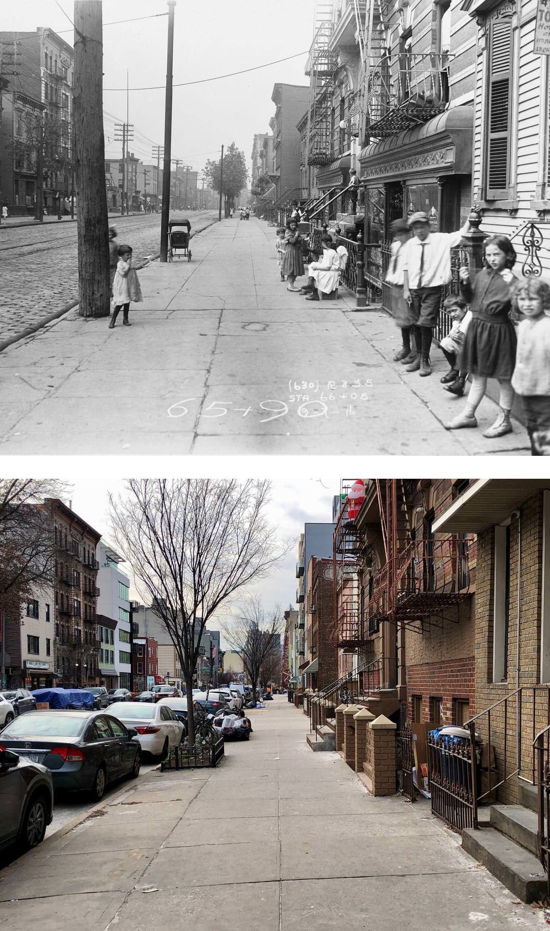
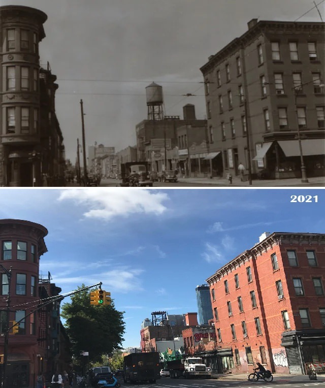
#113 Metropolitan Avenue from Manhattan Avenue, Williamsburg, 1916–2020.

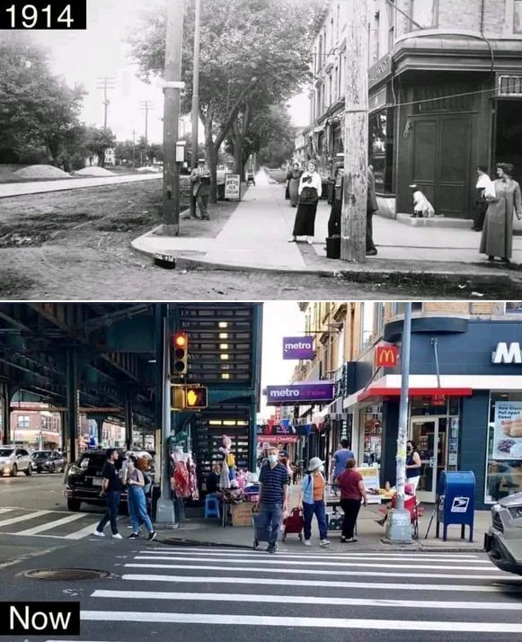
#114 86th Street and 20th Avenue, Brooklyn, 1914–2023.

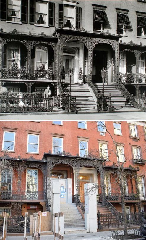
#115 24 Middagh Street, Brooklyn Heights, 1925–2022.

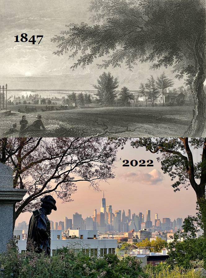
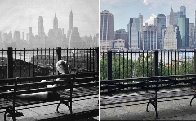
#116 Skyline and the East River from Brooklyn Heights, 1957–2021.

#117 Down Under the Manhattan Bridge Overpass, 1974–2020.

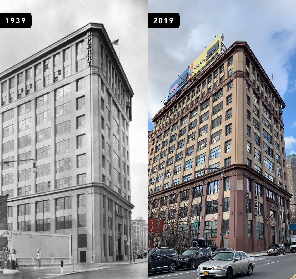
#120 Sperry Gyroscope Company, Brooklyn, 1939–2019.

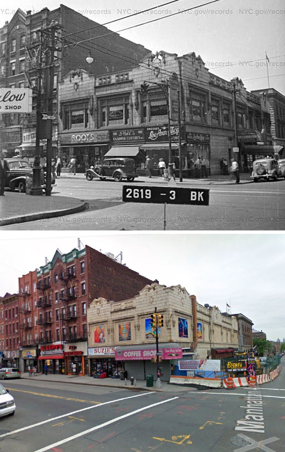
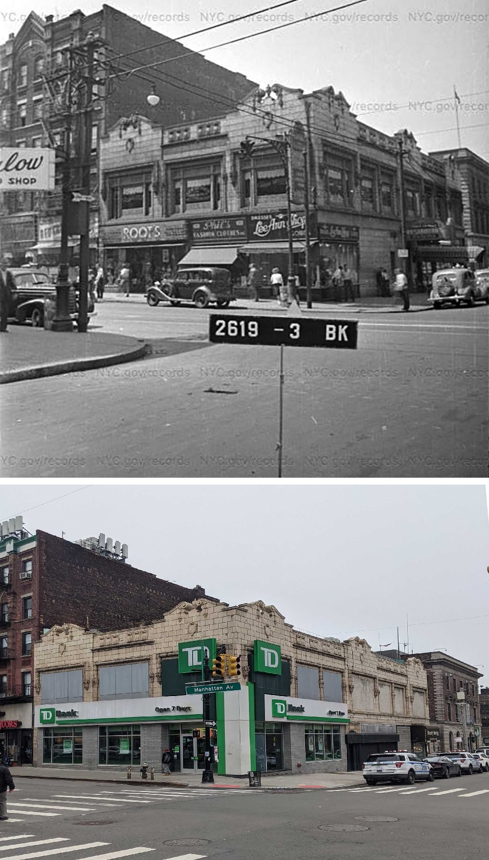
#122 Meserole Avenue and Manhattan Avenue, Greenpoint, 1940s–2009.

#123 Meserole Avenue and Manhattan Avenue, Greenpoint, 1940s–2021.

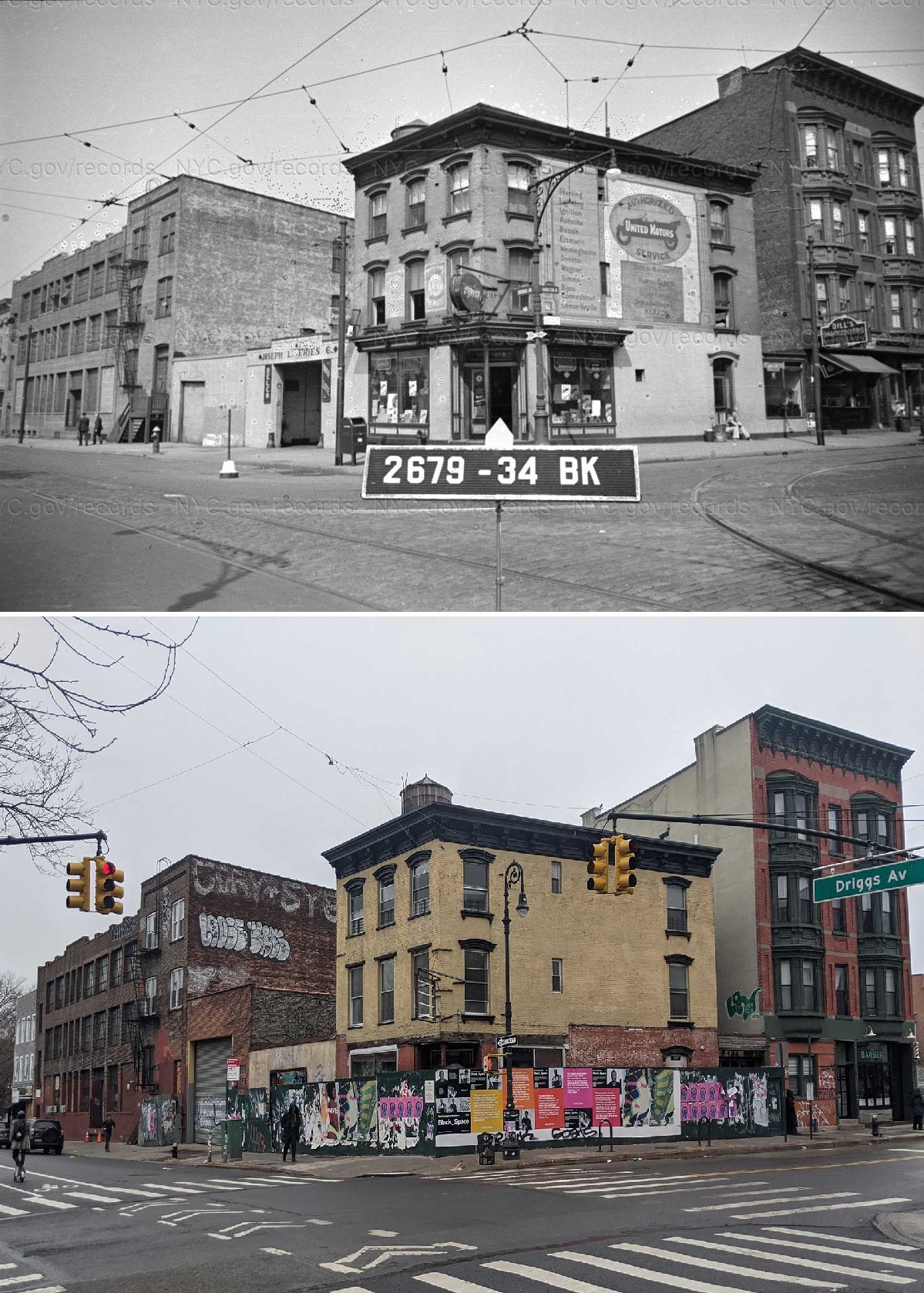
#124 Manhattan Avenue and Driggs Avenue, 1940s–2021.

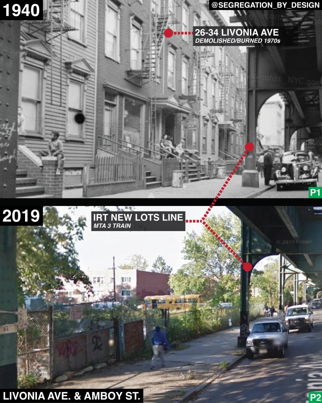
#126 Livonia Avenue in Brownsville, Brooklyn, 1940–2019.

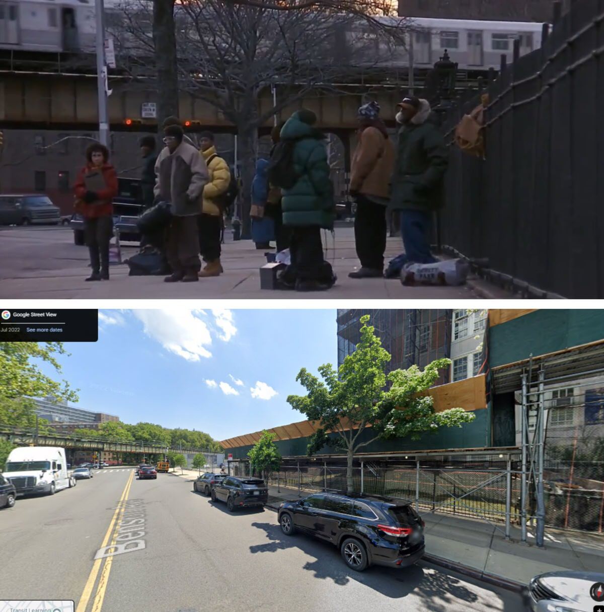
#127 The former Motion Lounge social club, Donnie Brasco, 1981–2024.

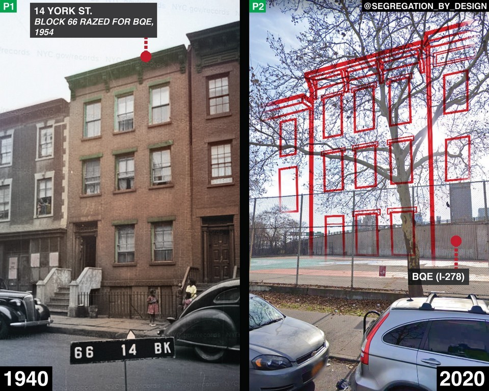
#128 York Street in Downtown Brooklyn before and after the construction of the Brooklyn-Queens Expressway, 1940–2020.

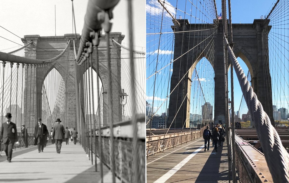
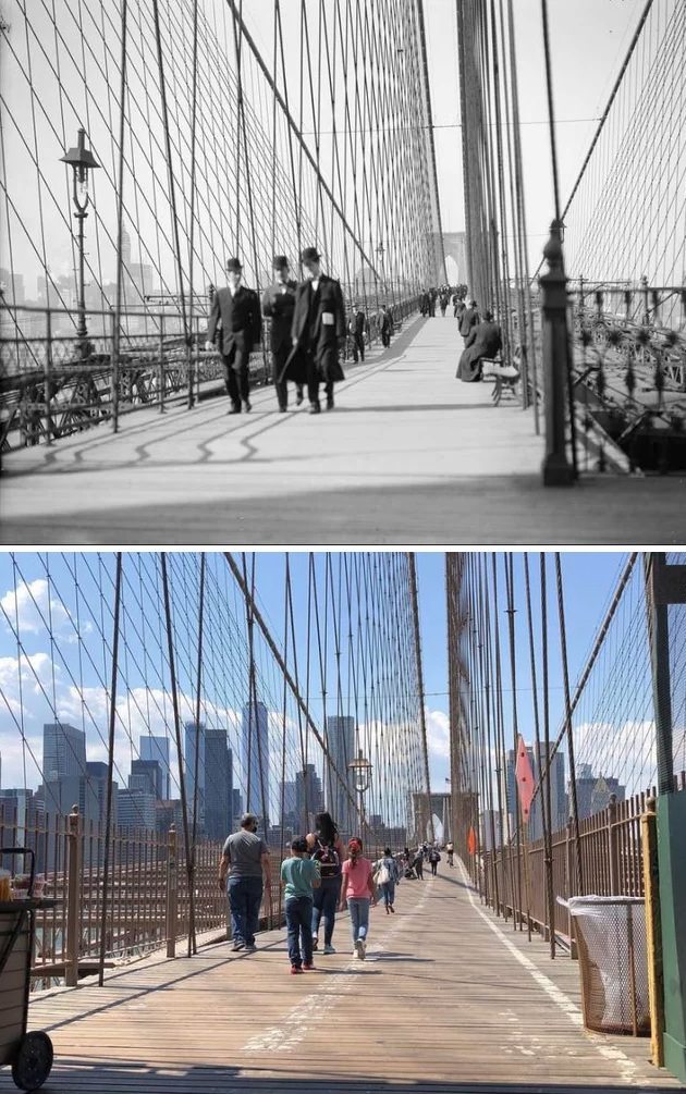
#129 The Brooklyn Bridge pedestrian walkway looking west toward Manhattan, 1905–2021.

#134 Bergen Street and Vanderbilt Avenue, 1941–2021.

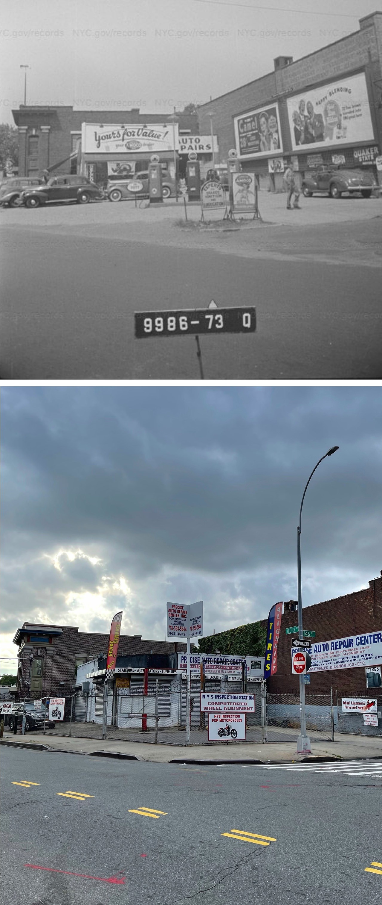
#135 Archer Ave & 146th St in Jamaica, Queens, 1940 vs 2020

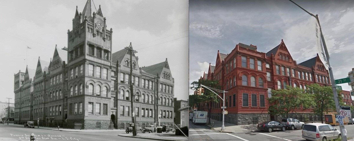
#136 PS1 21st Street and 46th Road, Long Island City, Queens, NY (1935 and 2018)

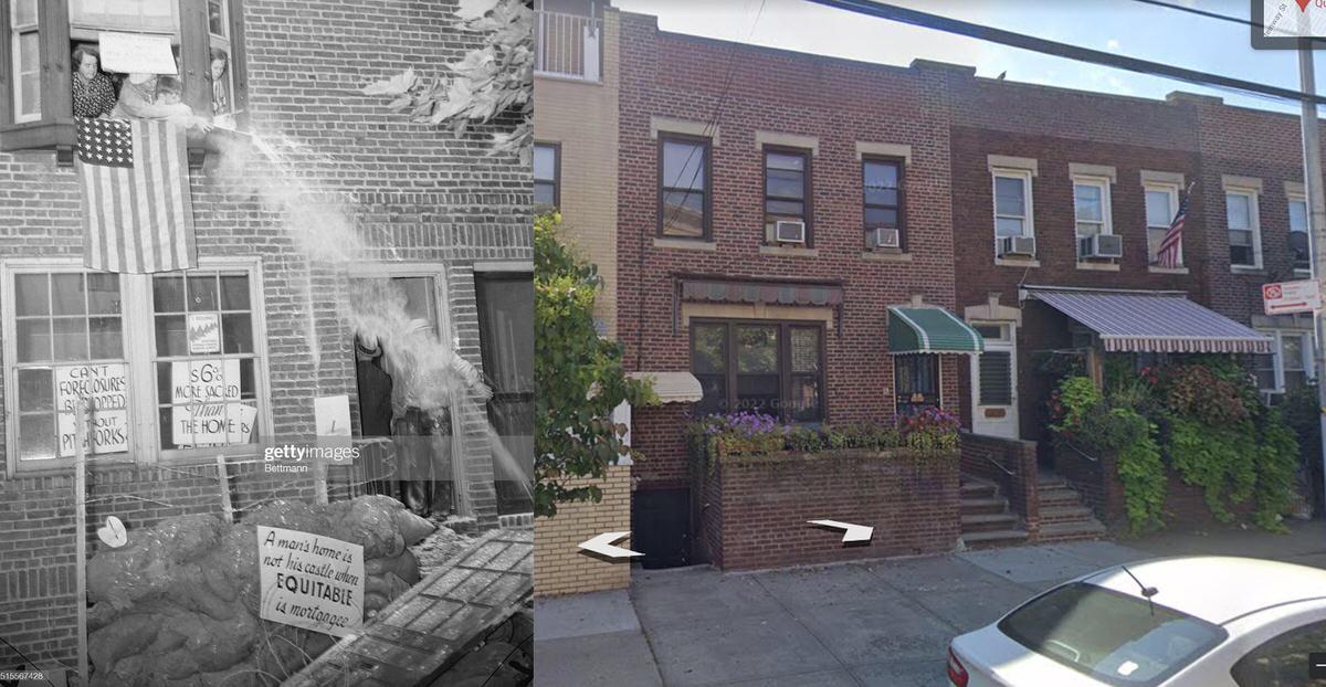
#137 “Bombs” meet Evictors, Sunnyside Queens 1936 vs 2020

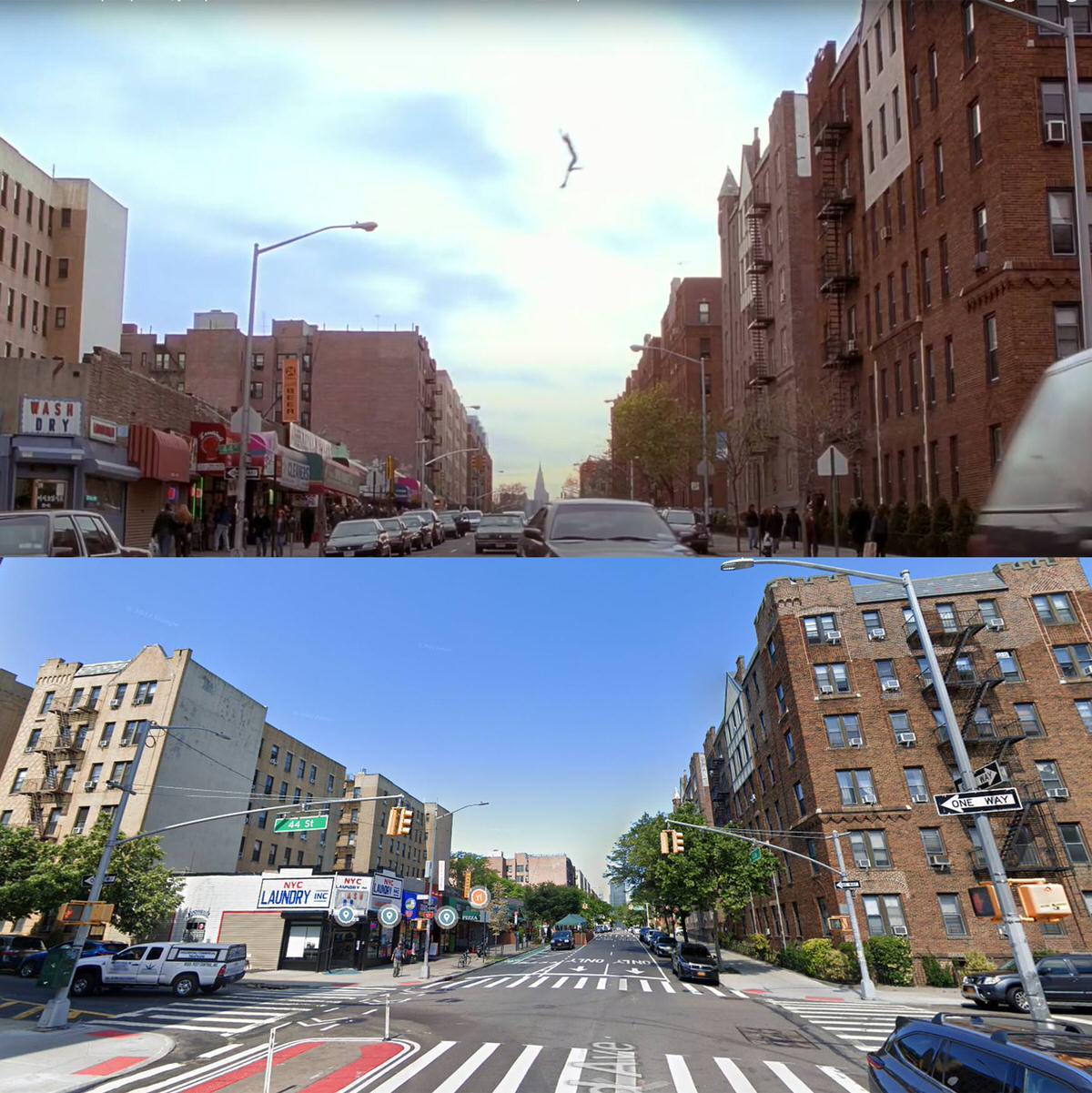
#138 Spider-Man 2002 vs 2023 at the corner of 44th street and 43rd Ave Sunnyside Queens NYC

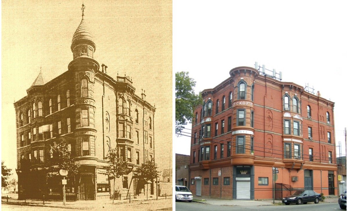
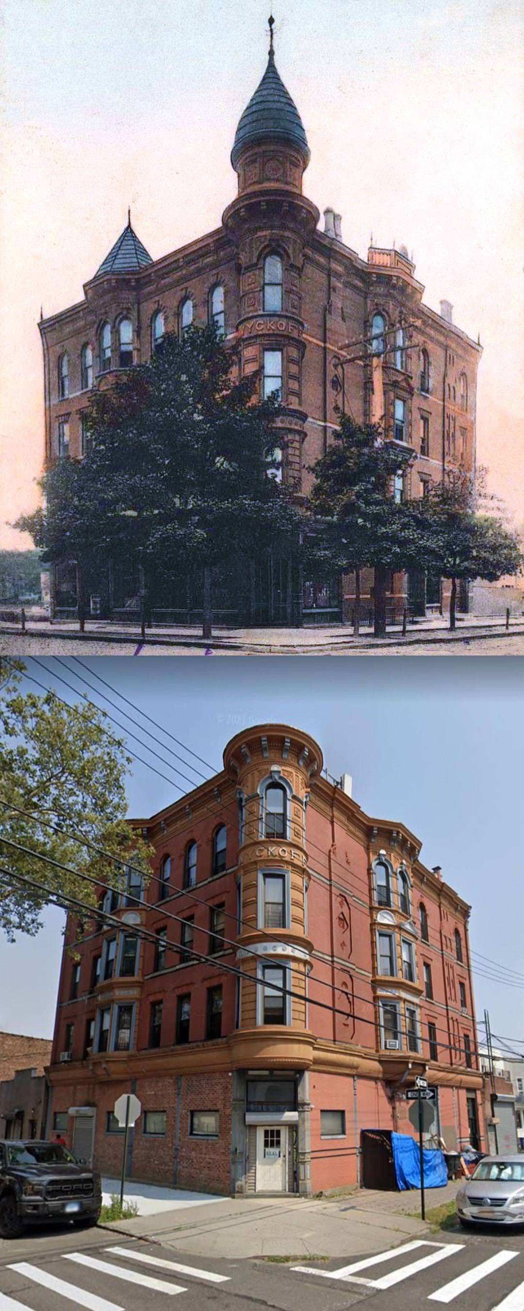
#139 The Wycoff Building in Woodhaven, Queens, 1890 vs 2020

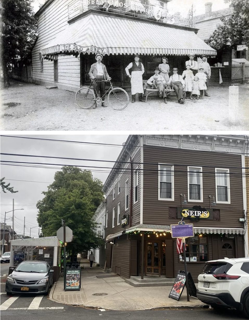
#140 Neir’s Tavern in Woodhaven Queens, NY in 1898 and 2022

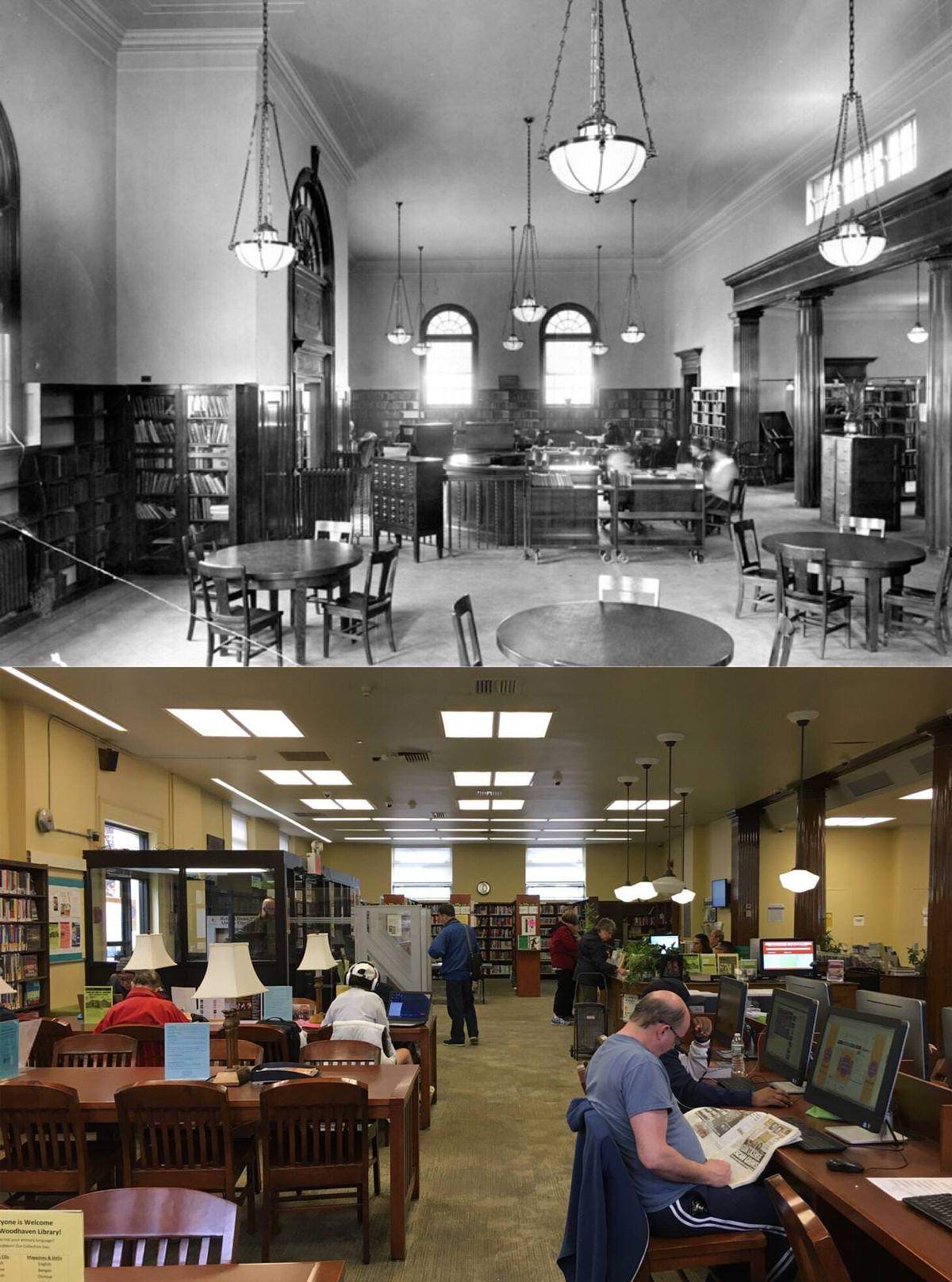
#141 Woodhaven Branch of the Queens Borough Public Library in 1935 and 2020

#142 Former Woodhaven Bank at 93-02 95th Avenue in Ozone Park, Queens. 1910s vs 2022

#143 Looking east on Broadway from 73rd Street in Jackson Heights, Queens. 1929 vs 2021

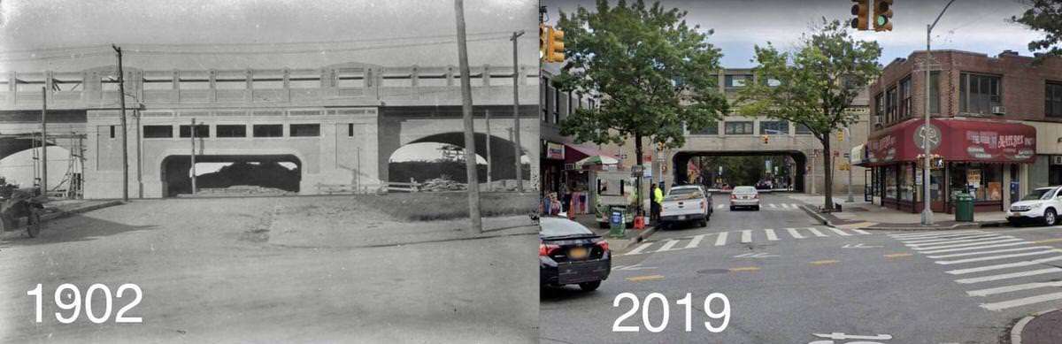
#145 Greenpoint Ave and Queens Blvd, Sunnyside, Queens. 1902 vs 2019

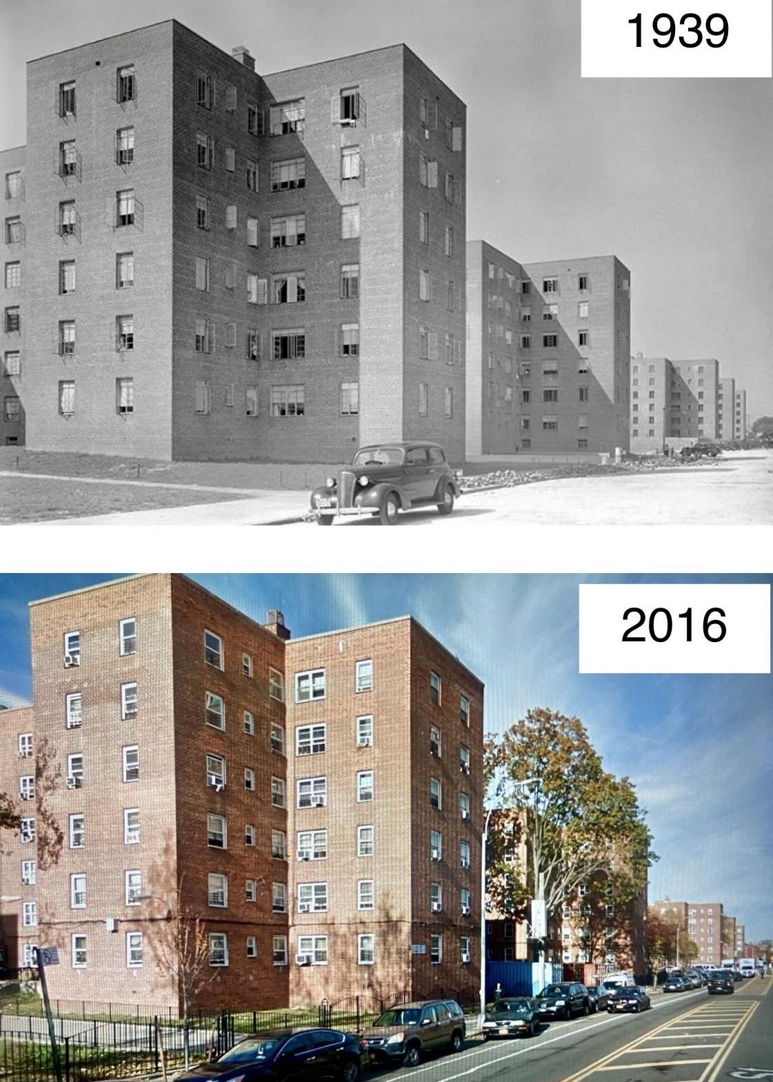
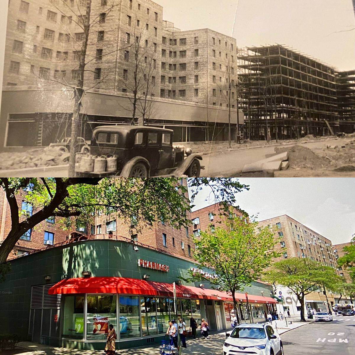
#149 Parkchester, Bronx, NY 1939 (under construction) and 2020

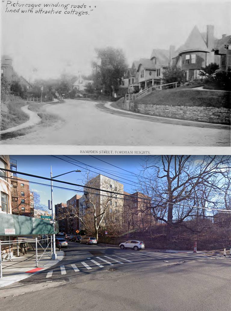
#151 Hampden Street in Fordham Heights Bronx, New York (1898 vs. 2022) Hampden is now West 183rd Street. View is looking east from Sedgwick Avenue towards Loring Place along 183rd.

#152 East 170th Street and Walton Avenue in The Bronx (1937 vs. 2021)

#157 Thomas Edison’s Bronx Movie Studio 1908 & 2020

#159 Stone parsonage in Highbridge the Bronx, 1940s vs 2025

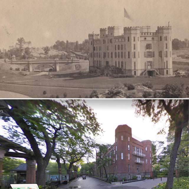
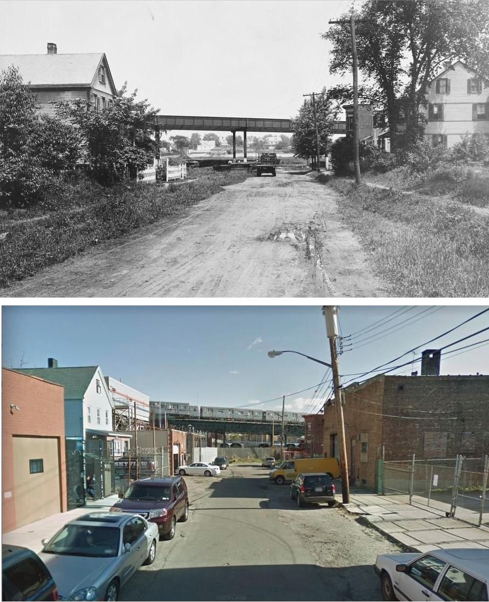
#164 239th Street and Byron Ave, Bronx, NY (1922-2019). Tracks in the background are to the MTA Storage Yard off the 2 Train Line.

#166 Morris Ave and Grand Concourse, Bronx, NY (1929-2018).

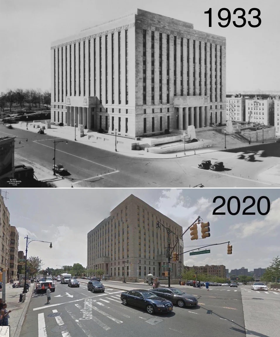
#167 Bronx County Court House: 161st Street and Grand Concourse, Bronx. 1933 Vs 2020

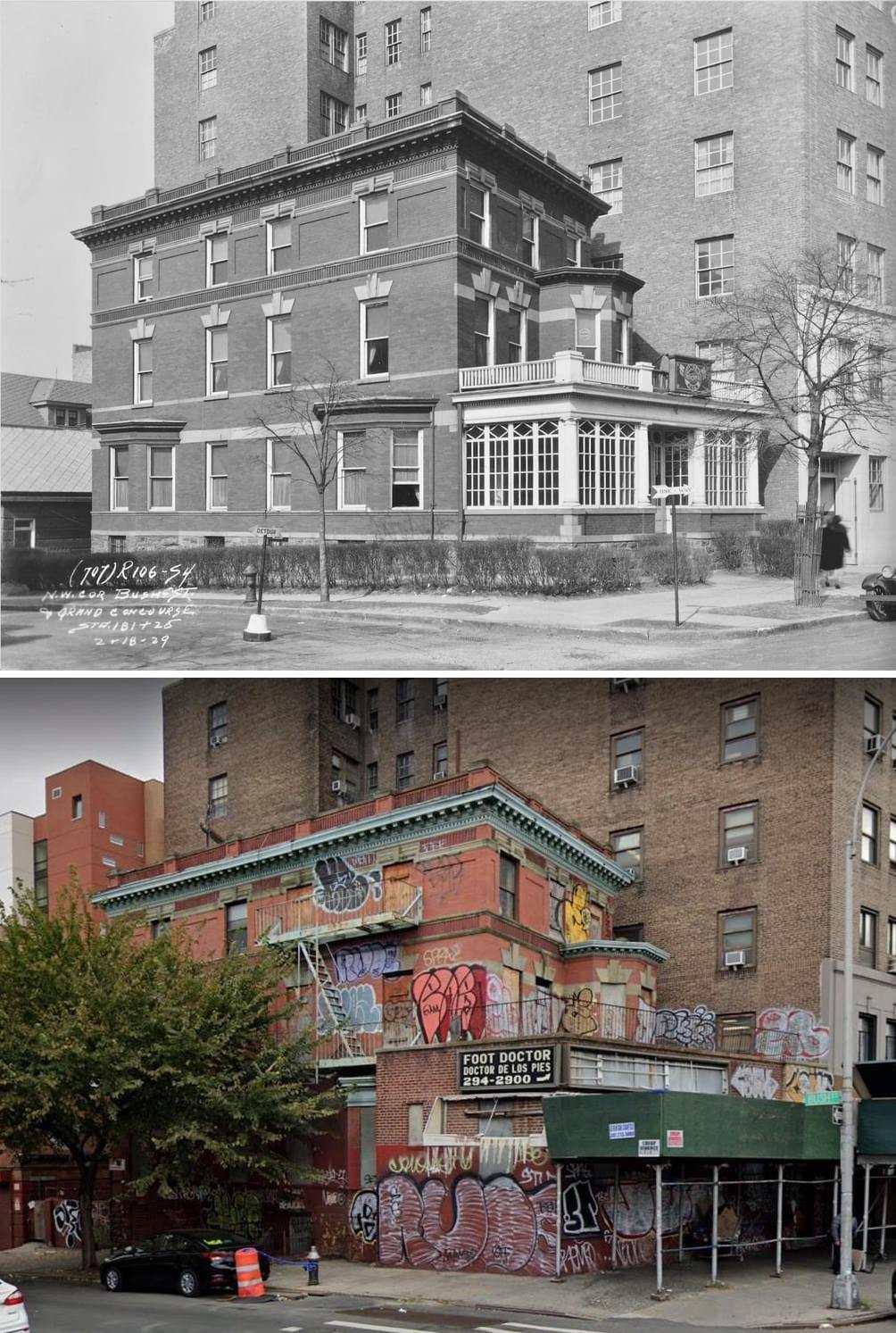
#168 Grand Concourse & Bush Street, Bronx NY (1929-2019).

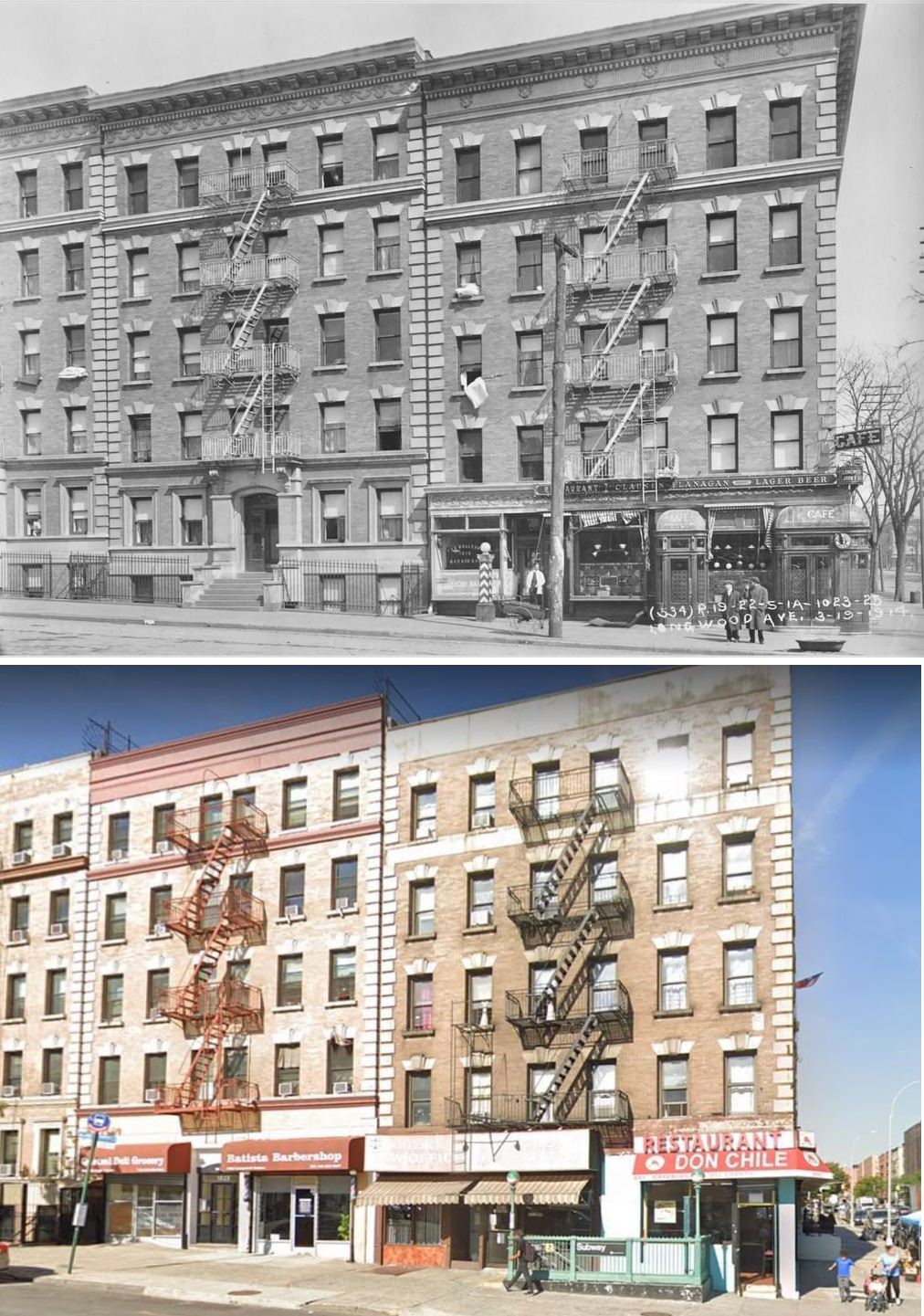
#169 Longwood Avenue & Southern Boulevard, Bronx. 1914 vs 2020

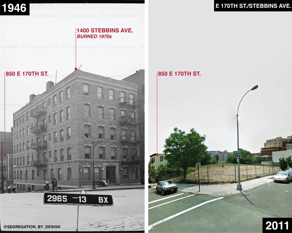
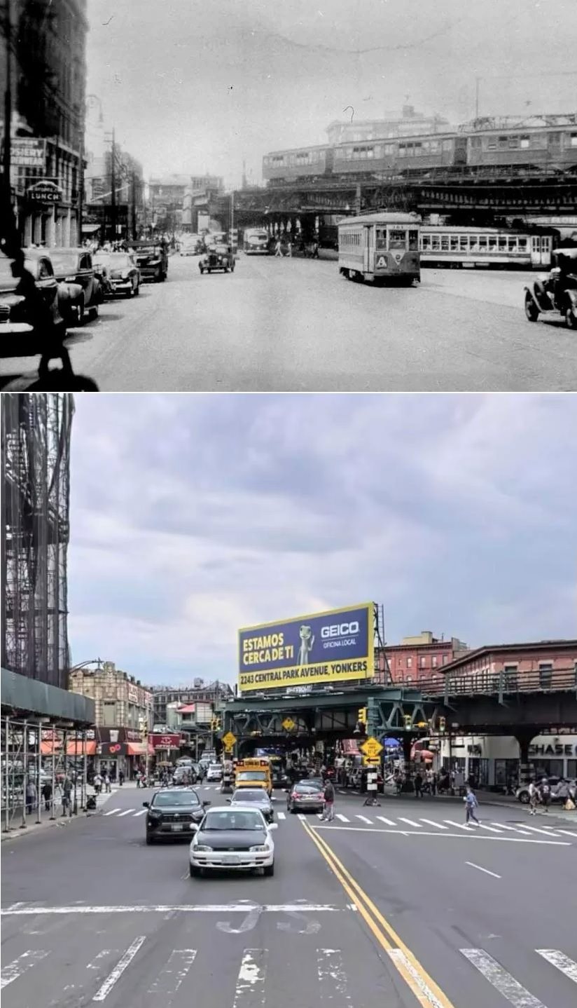
#173 Southern Blvd and Westchester Ave, Bronx. 1946 vs 2022

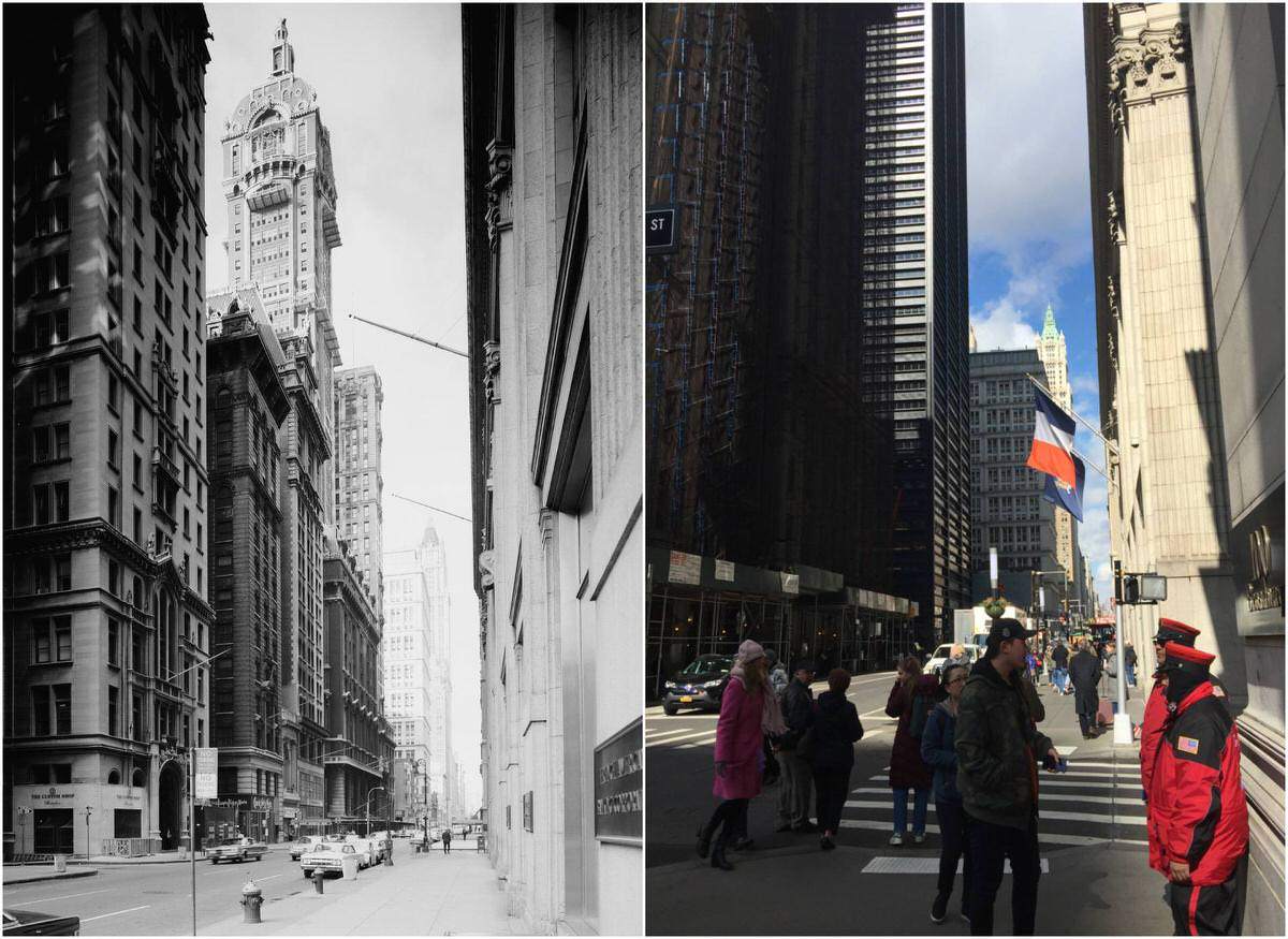
#174 Singer Building on Broadway, Lower Manhattan, 1960s–2018.

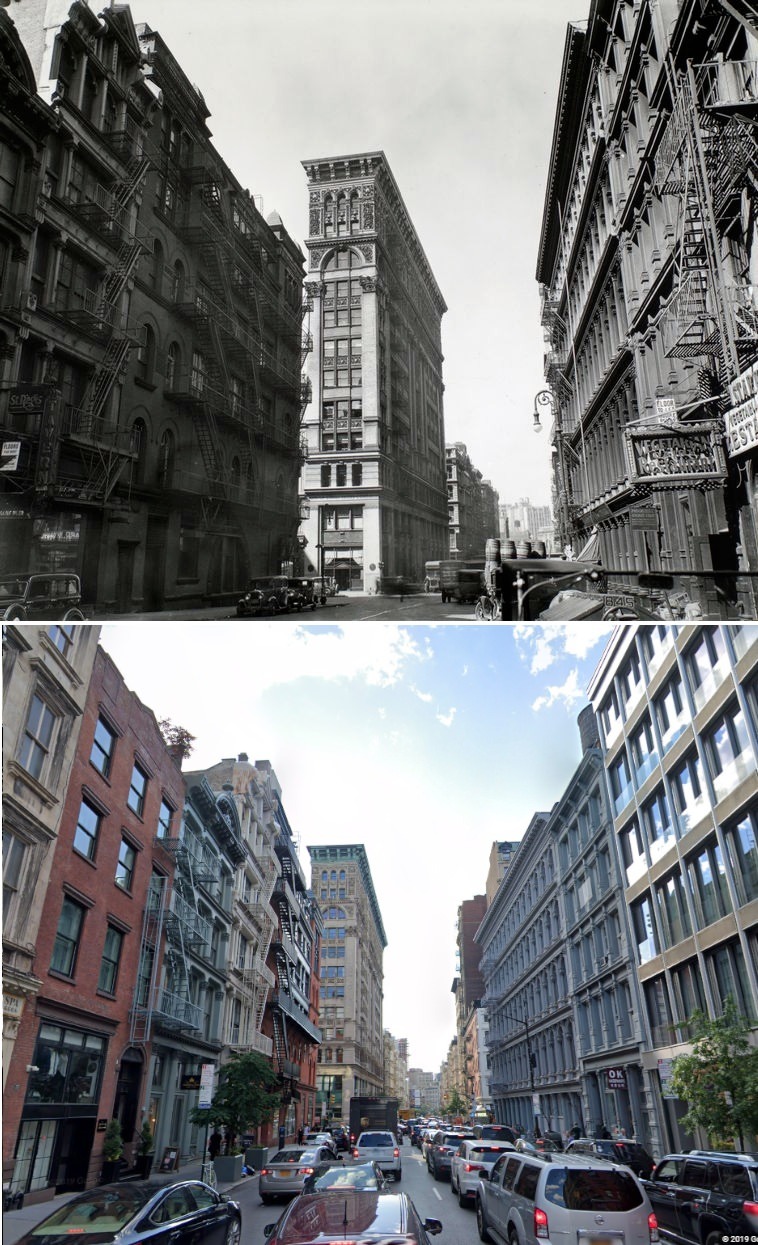
#175 Looking northwest up Broome Street toward Broadway, Manhattan, 1935–2019.

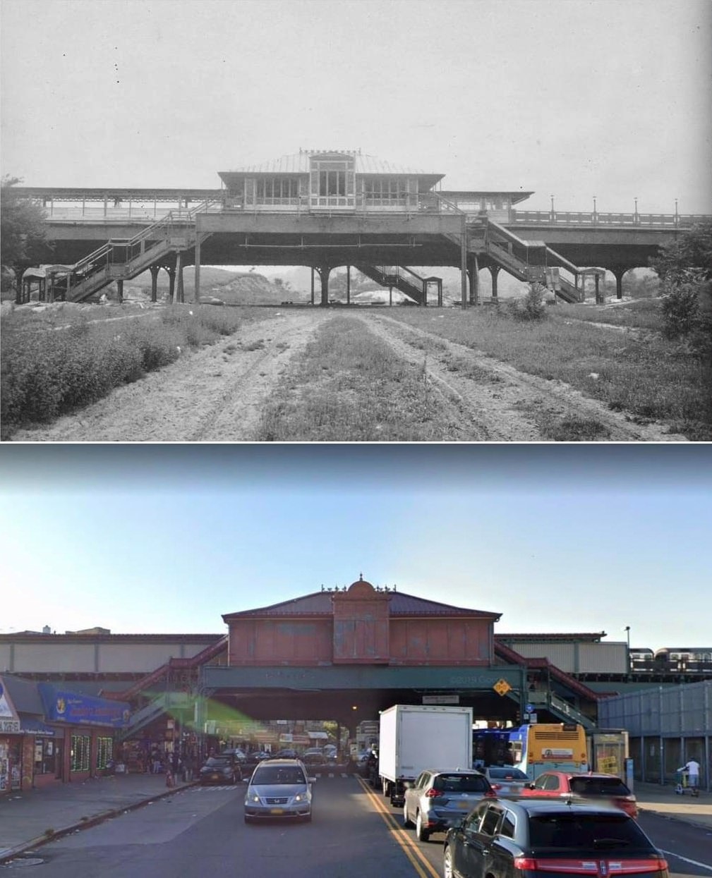
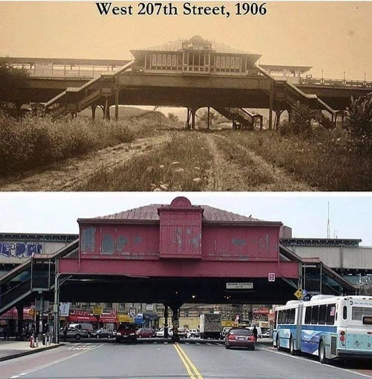
#176 207th Street Station at 10th Avenue, Manhattan, 1906–2019.

#181 5th Avenue looking uptown from 46th Street, Manhattan, 1920–2018.

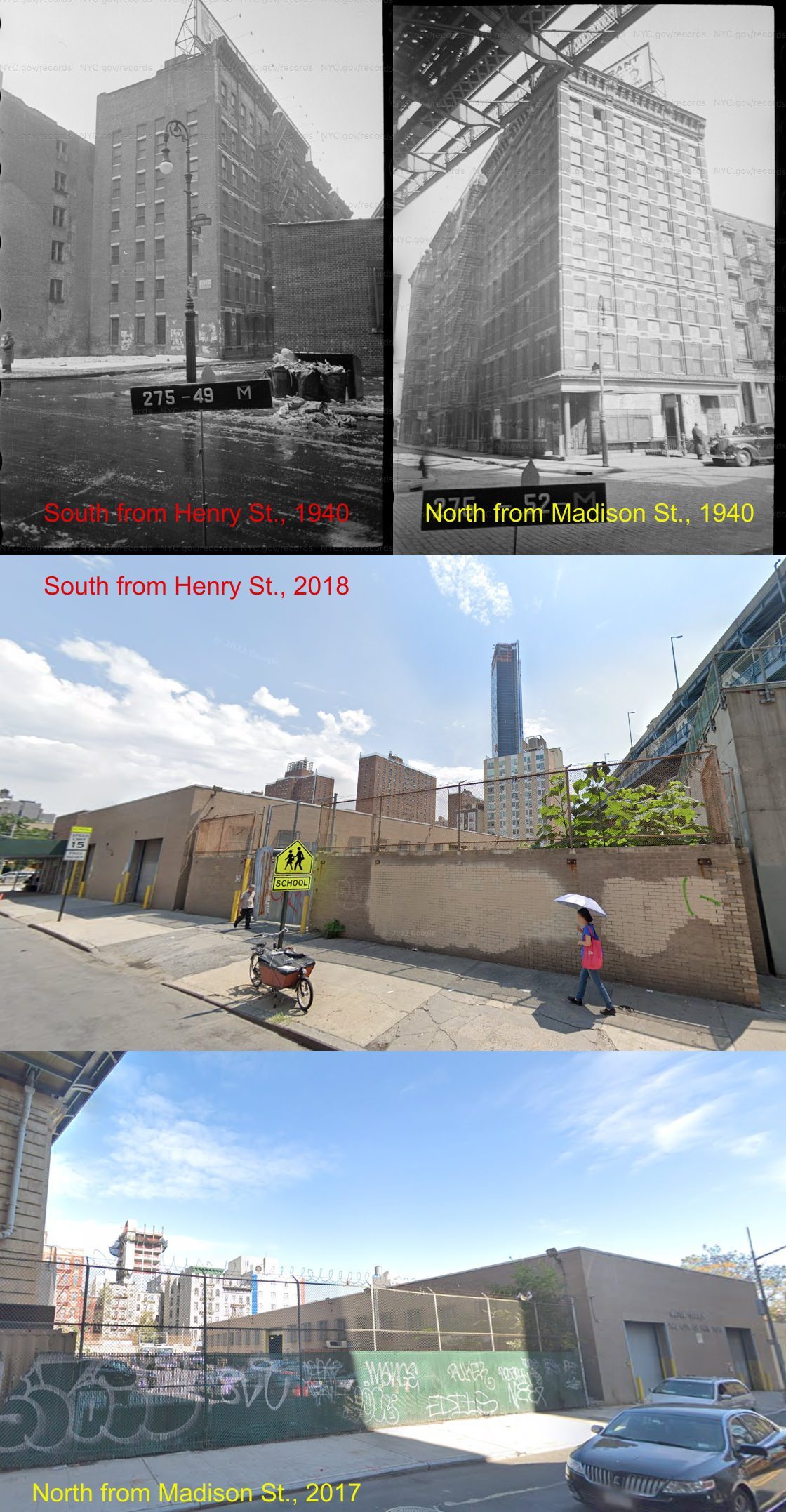
#182 Birmingham Street, Manhattan, 1940–2018. Eliminated by the early 1960s, this street has been replaced by a NYC Department of Environmental Protection garage and the adjoining yard.

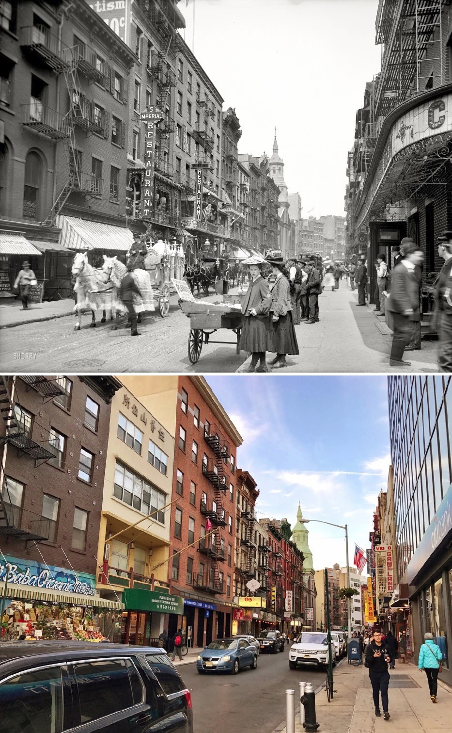
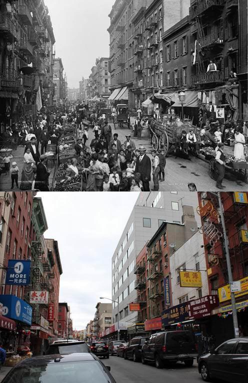
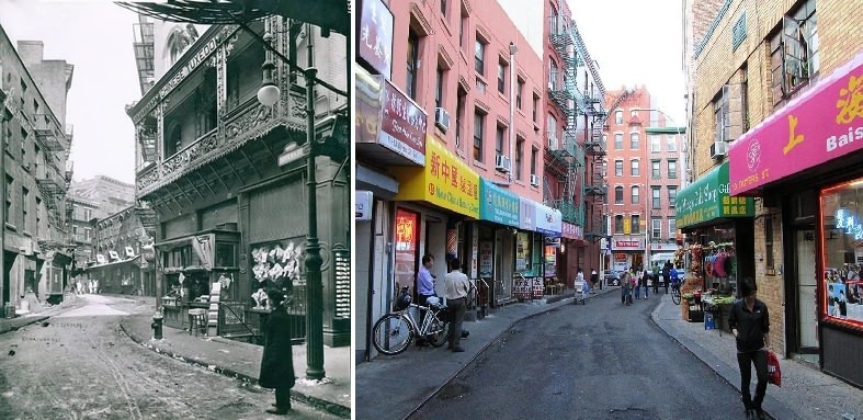
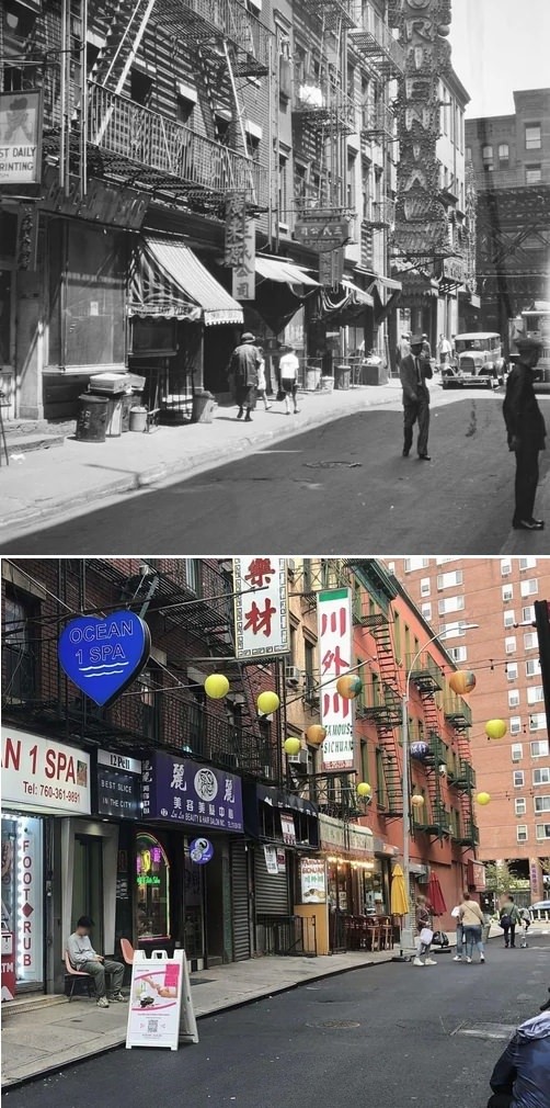
#185 Looking east on Pell Street from Doyers Street in Chinatown, Manhattan, 1930–2022.

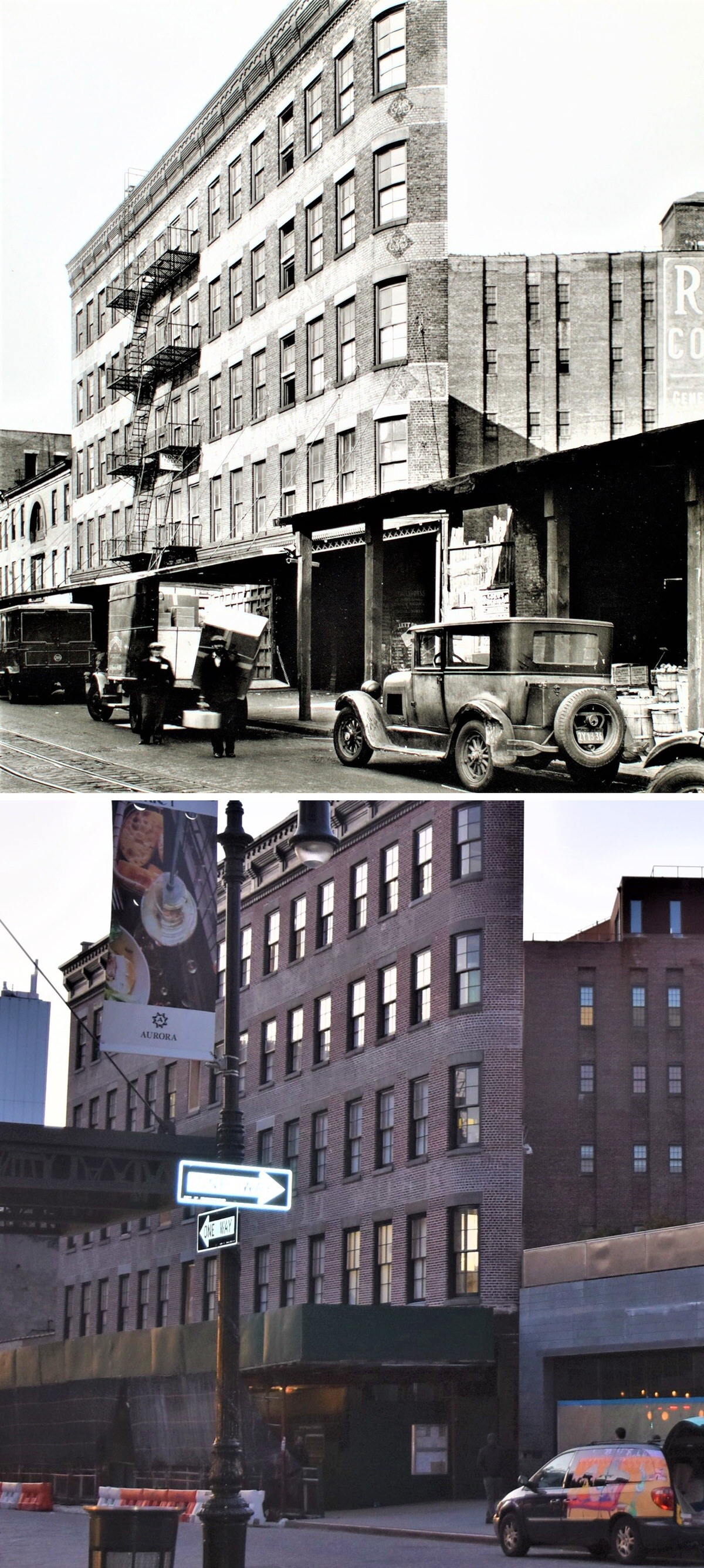
#186 53 Gansevoort Street, Meatpacking District, Manhattan, 1936–2020.

#187 The Ansonia Apartments at Broadway and 73rd Street, Manhattan, 1904–2014.

#188 Broadway and 60th Street, Woodside, Queens, 1926–2016.

#189 Washington Street and the Manhattan Bridge, Brooklyn, 1974–2019.

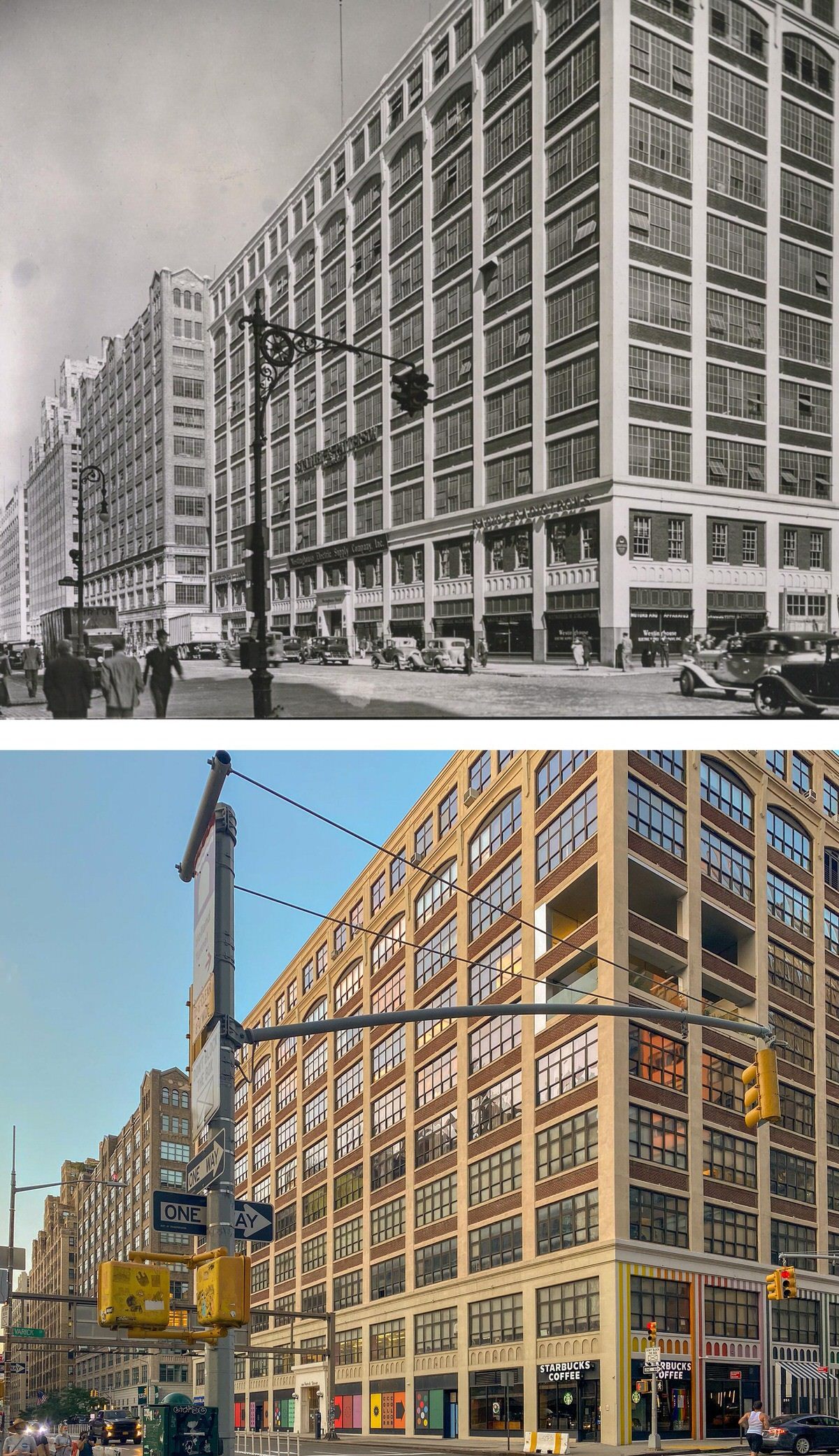
#190 Spring and Varick Streets, Manhattan, 1935–2020.

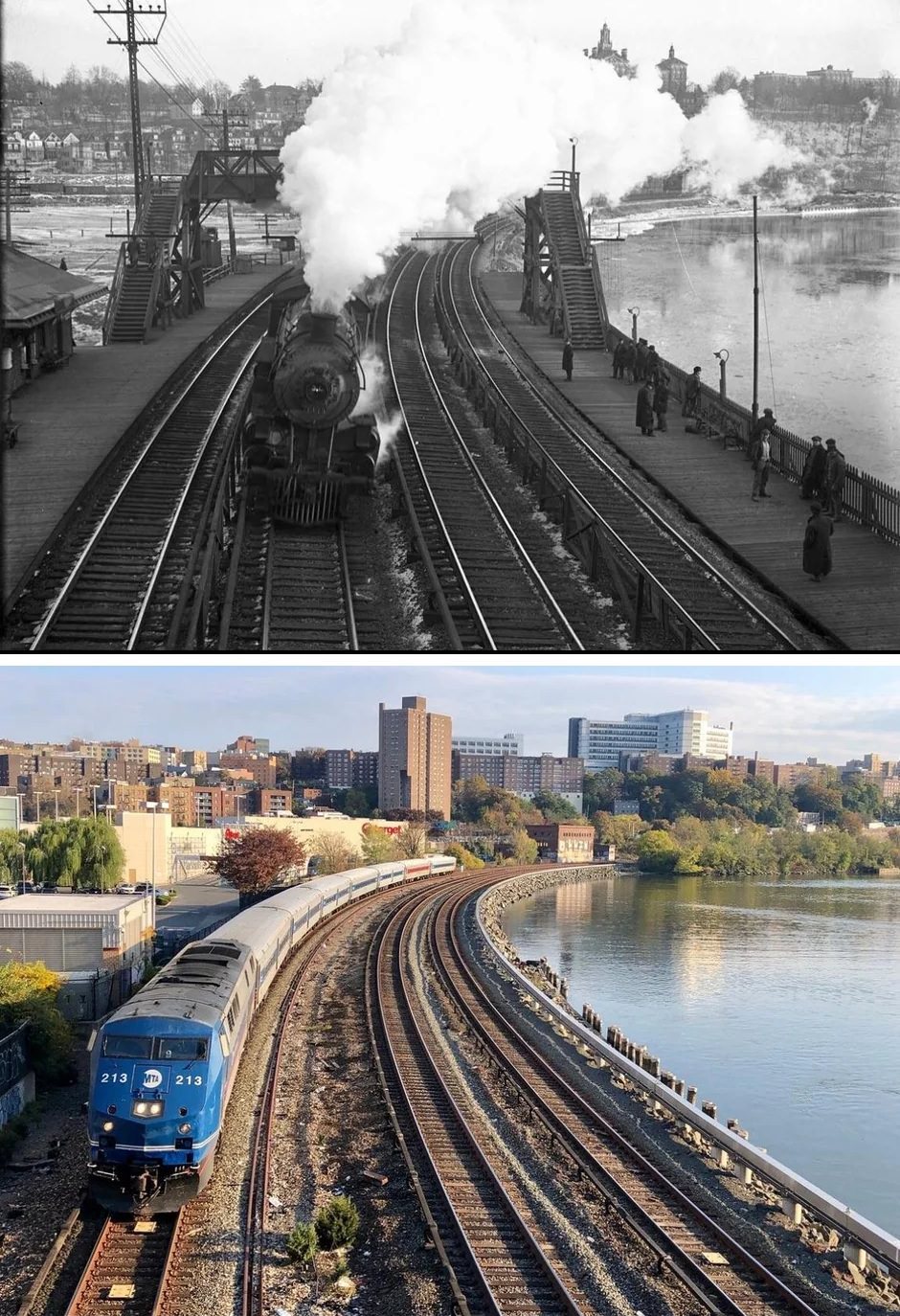
#193 Marble Hill Train Station, Manhattan, 1910–2023.

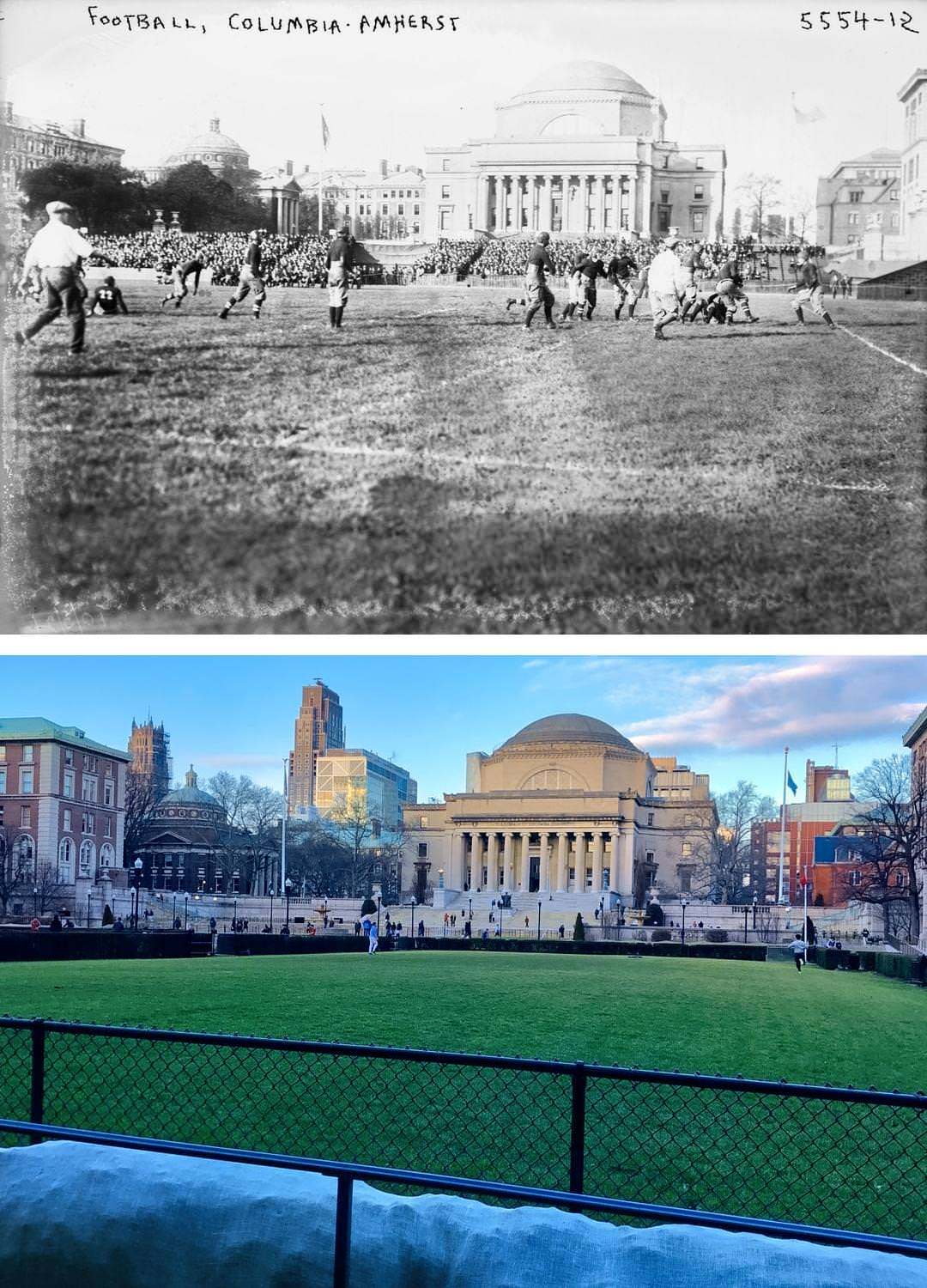
#194 Looking north toward Columbia University’s Low Memorial Library in Morningside Heights, Manhattan, 1920–2022.

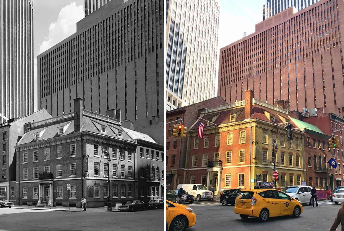
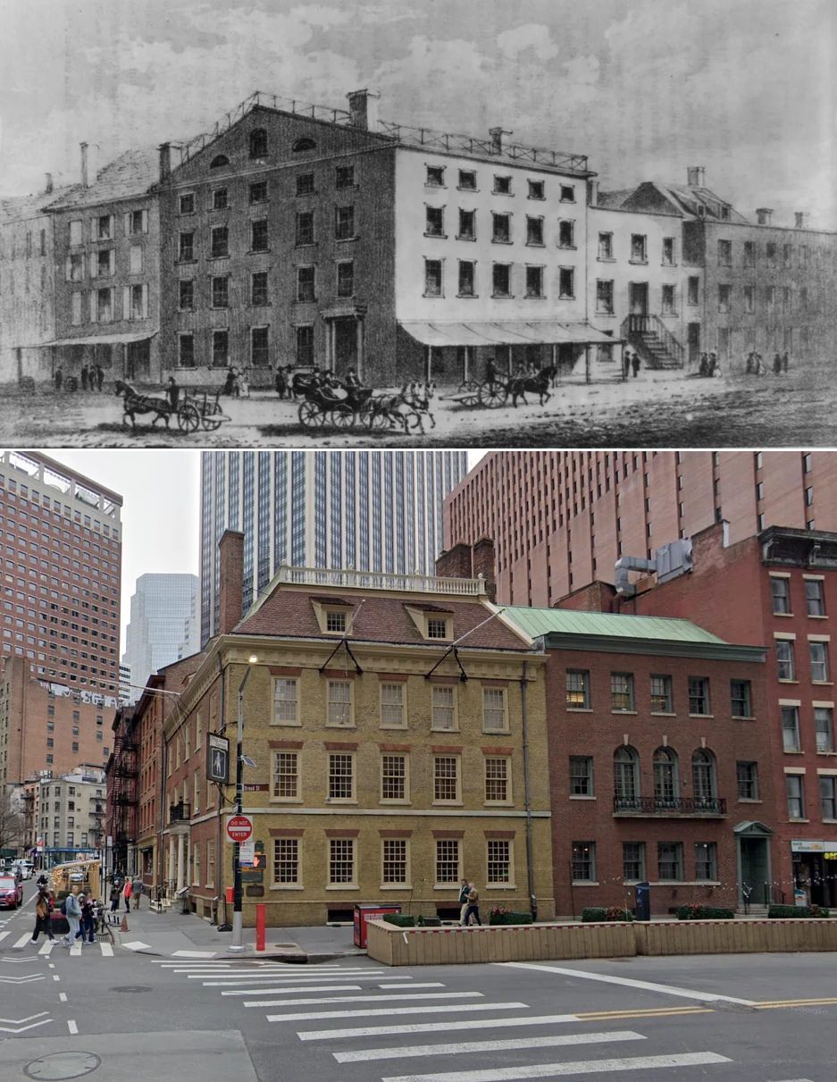
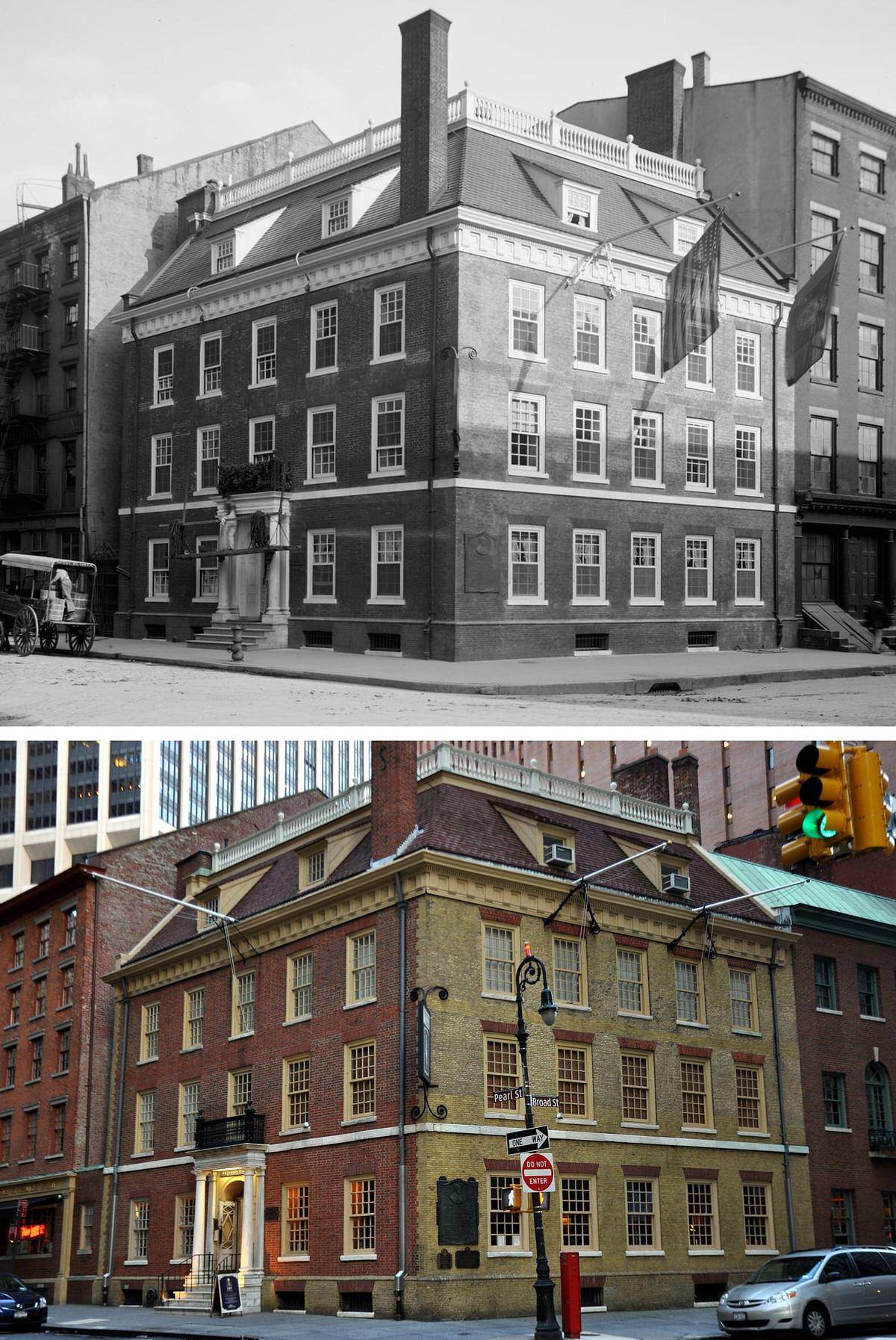
#199 Fraunces Tavern, the oldest structure in Manhattan, 1907–2020.

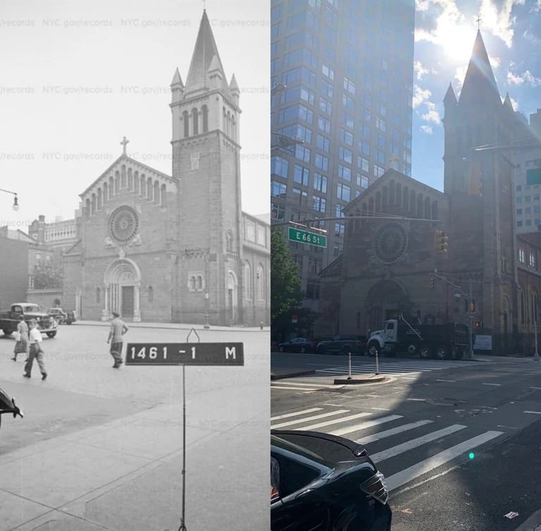
#200 East 66th Street and 1st Avenue, Manhattan, 1940–2021.

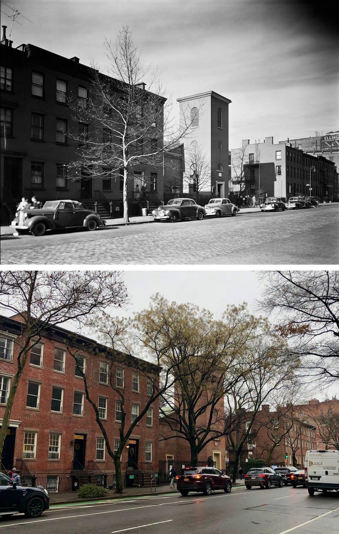
#201 Looking northwest along Hudson Street from Barrow Street in the West Village, Manhattan, 1936–2021.

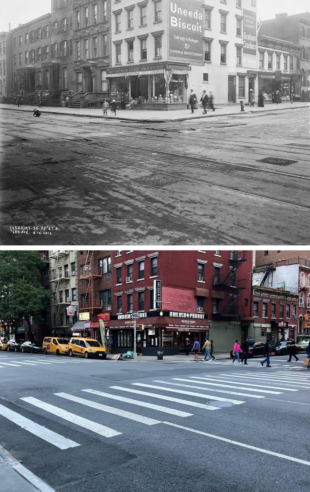
#202 Lexington Avenue and East 27th Street in Rose Hill, Manhattan, 1912–2023.

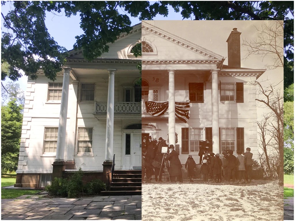
#205 The Morris-Jumel Mansion, Manhattan, 1906–2019.

#206 Manhattan Avenue between Kent Street and Greenpoint Avenue, 1928–2021.

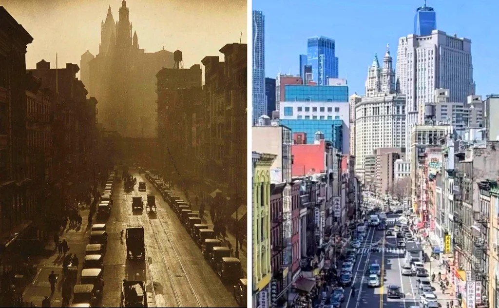
#208 East Broadway from the Manhattan Bridge, 1924–2020.

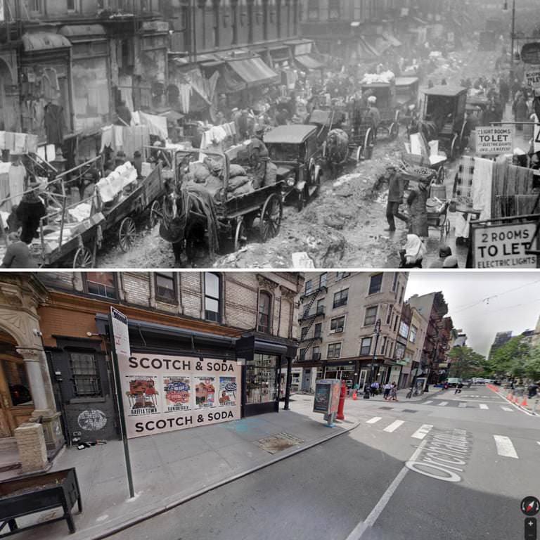
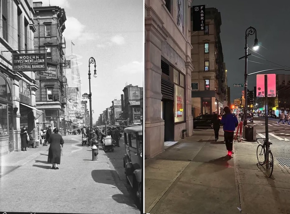
#209 Orchard and Grand Streets, Manhattan, 1934–2023.

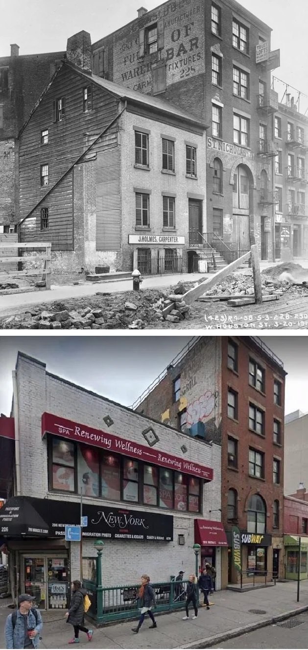
#210 228-230 West Houston Street, Manhattan, 1914–2020.

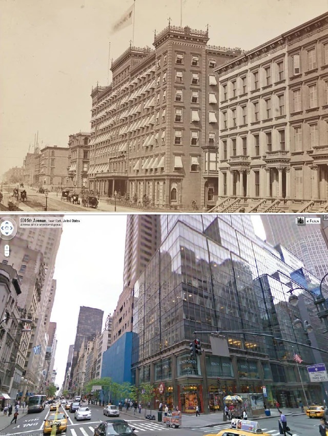
#212 Windsor Hotel at 575 Fifth Avenue, Manhattan, 1880–2023.

#216 Saint Clair Place and West 125th Street, 1929–2024.

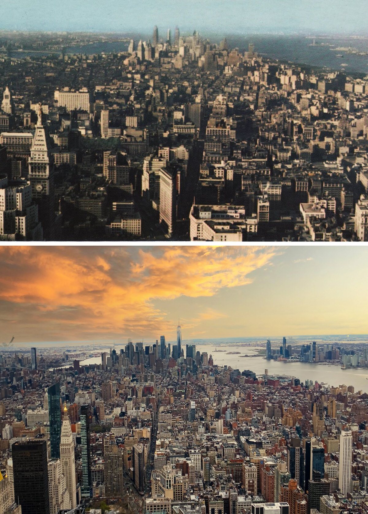
#218 Looking south from the Empire State Building, Manhattan, 1931–2011.

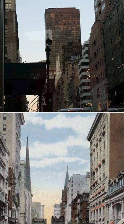
#219 Looking south on Fifth Avenue from West 28th Street, Manhattan, 1915–2021.

#220 Henry Street and Market Street looking southwest, Manhattan, 1979–2021.

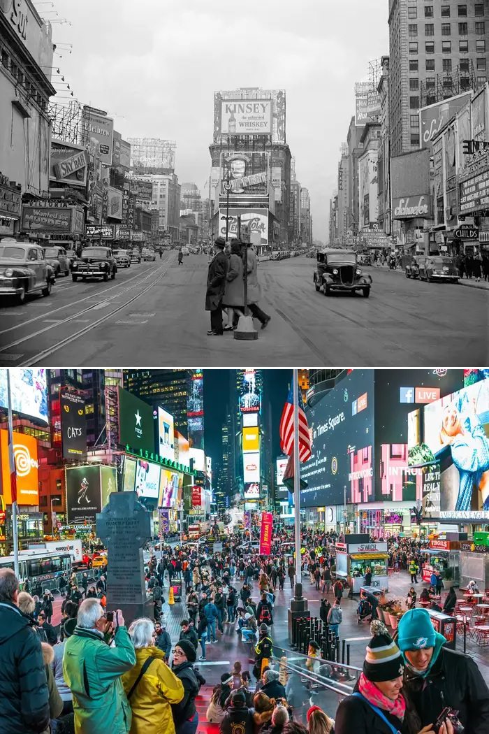
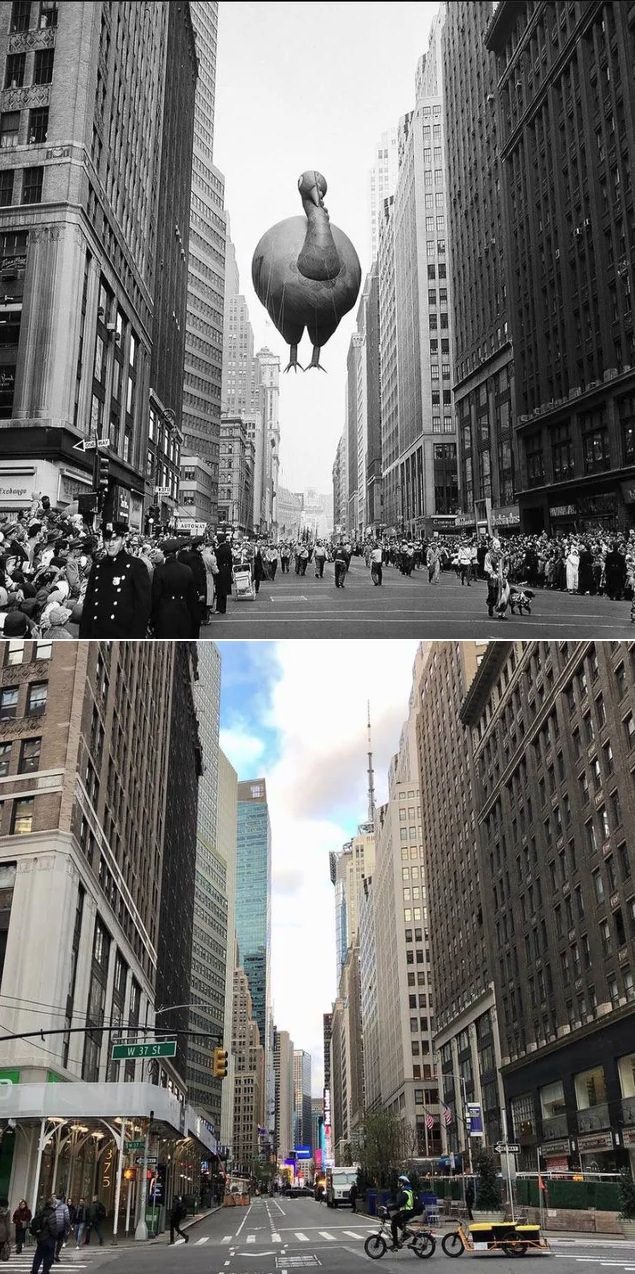
#221 Broadway and West 37th Street, Manhattan, 1955–2021.

#222 The Brooklyn Bridge and the Manhattan skyline, 1900s–2023.

#223 Pier 17, South Street Seaport, Manhattan, 1935–2023.

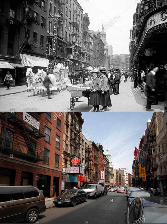
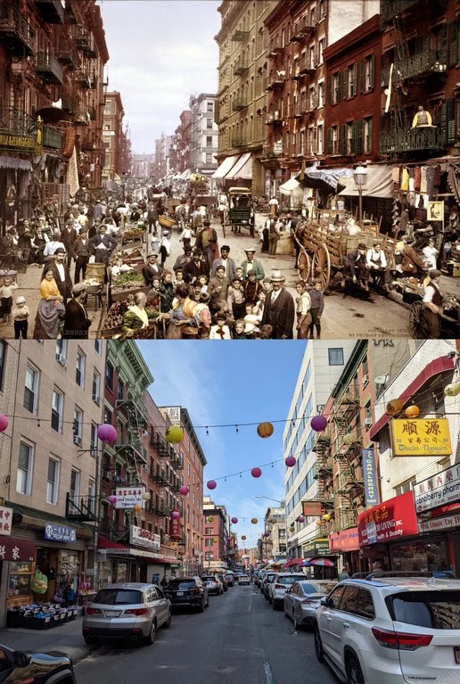
#224 Mulberry Street, Little Italy, Manhattan, 1900–2022.

#226 Looking north on the east side of 5th Avenue from East 34th Street, Midtown Manhattan, 1910s–2022.

#227 West 207th Subway Station, Manhattan, 1906–2021.

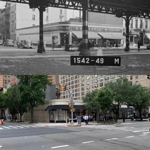
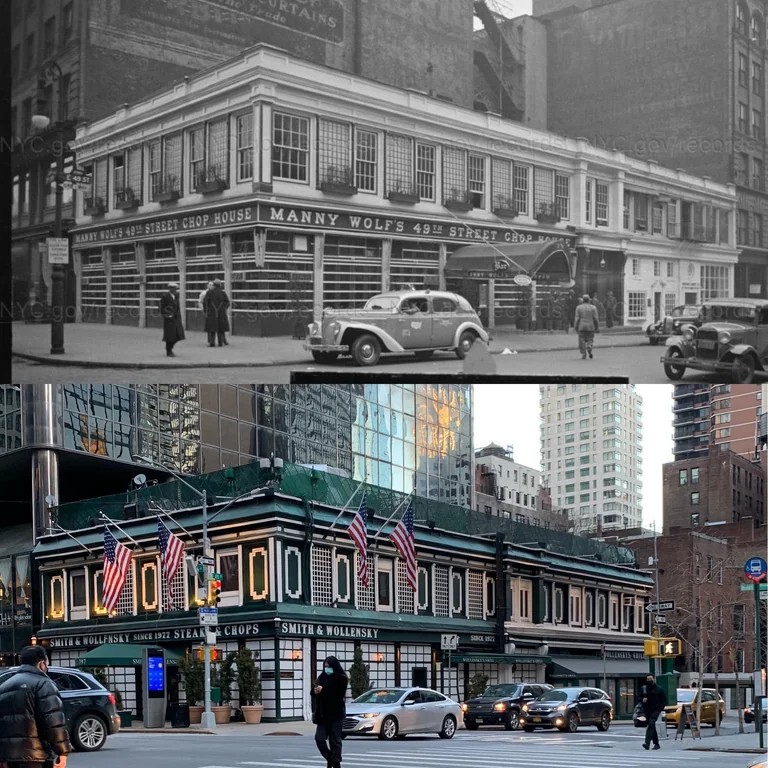
#228 Corner of 49th Street and 3rd Avenue, Manhattan, 1940–2021.

#229 East 49th Street and 5th Avenue, Manhattan, 1940–2021.

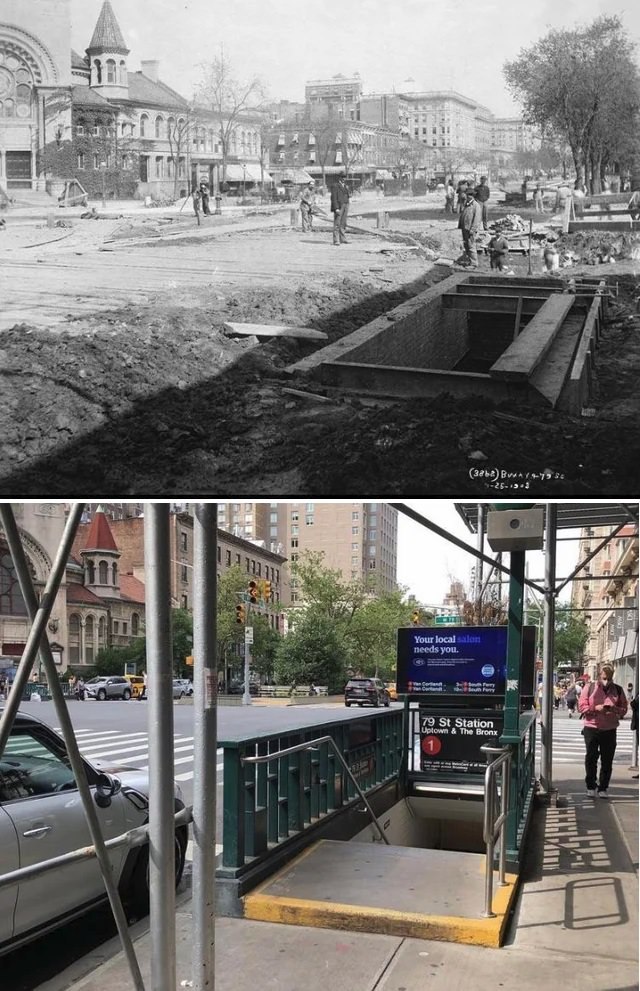
#230 Broadway at 79th Street, Upper West Side, Manhattan, 1903–2020.

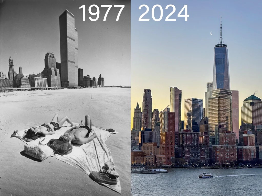
#232 Battery Park City in Lower Manhattan, 1977–2024.

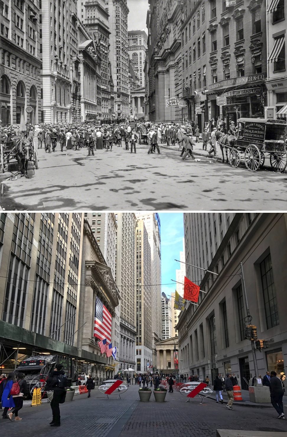
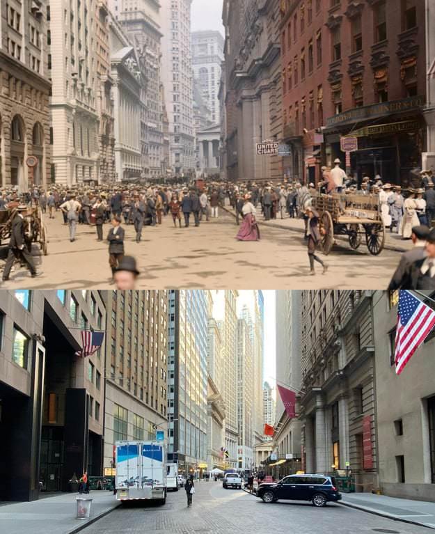
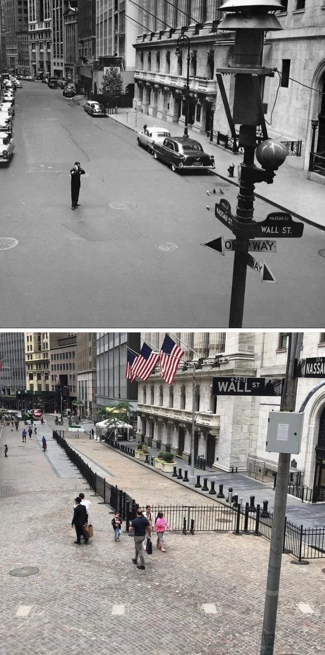
#234 Looking south to Broad Street at Wall and Nassau Streets, Financial District, Manhattan, 1956–2021.

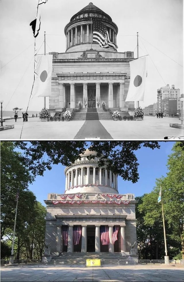
#235 Grant’s Tomb in Riverside Park, Morningside Heights, Manhattan, 1917–2021.

Written by Wendy Robert

Brand journalist, Ghostwriter and Proud New Yorker. New York is not a city – it’s a world.

Leave a Reply

Comment using name and email. Or Register an account

GIPHY App Key not set. Please check settings