

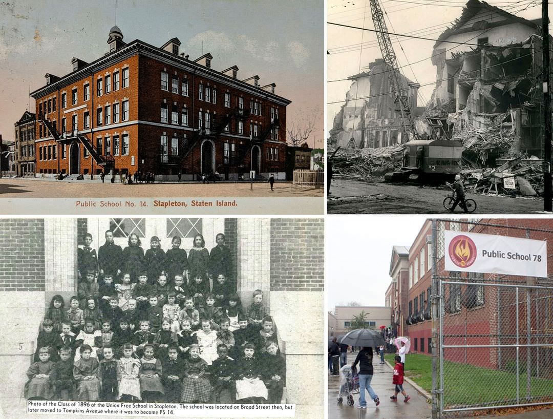
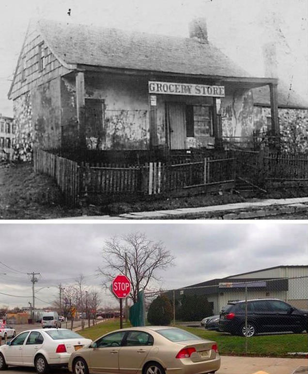
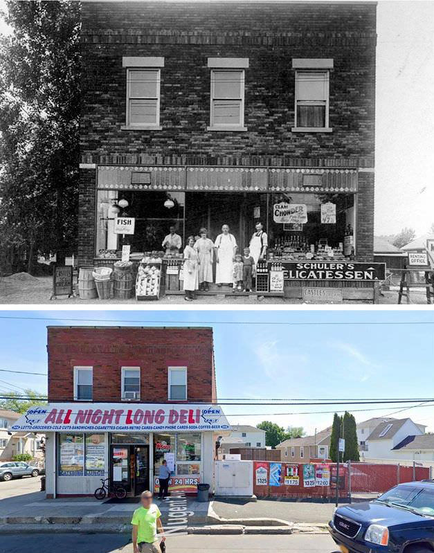
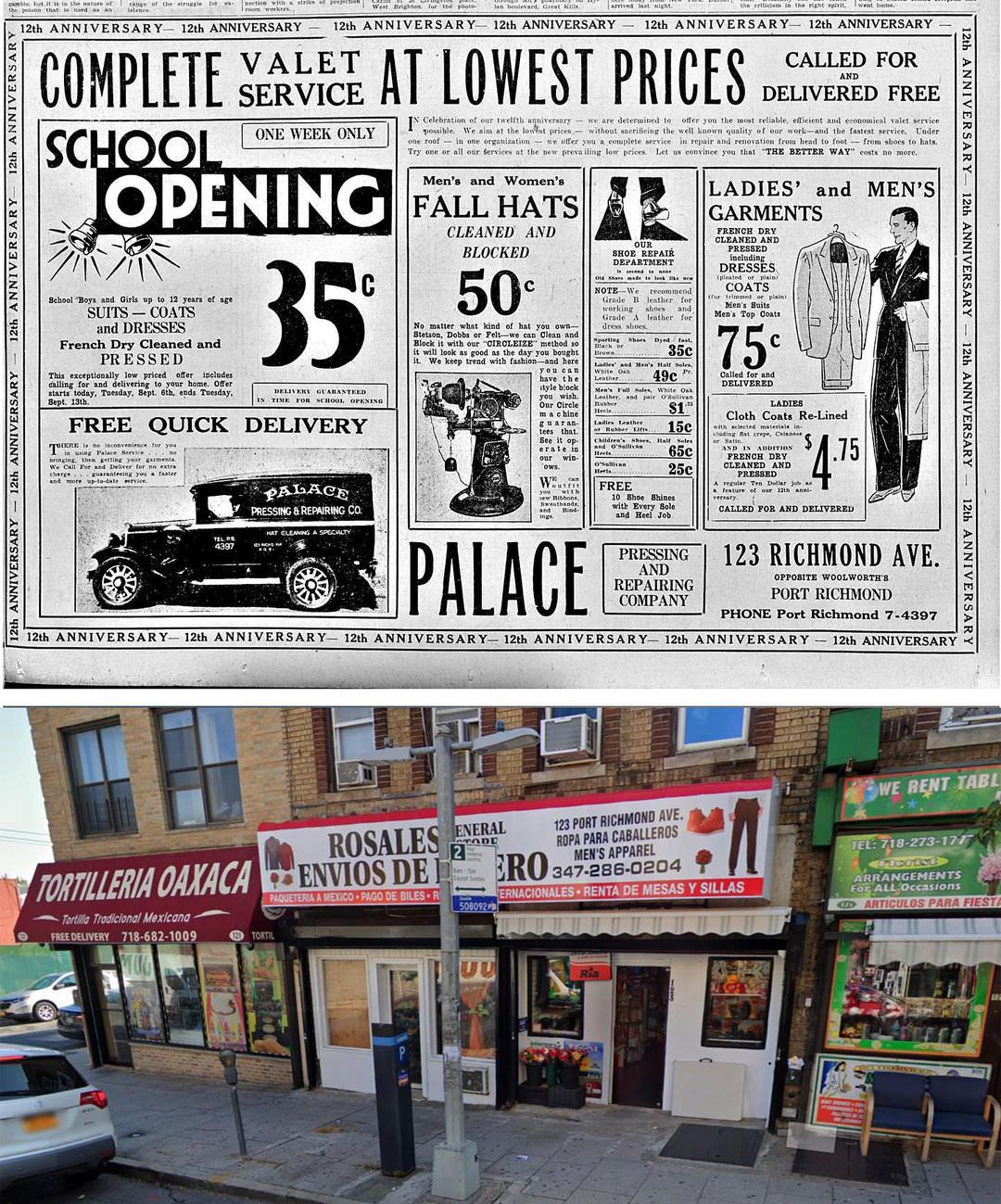
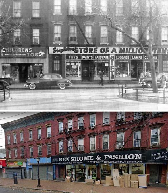
The essence of a place is not only defined by its current panorama but also by its storied past. As we traverse through decades of images, “Then and Now” photos of Staten Island offer a unique portal through which we can experience the island’s evolution. These paired images, some a century apart, capture the changing face of Staten Island while celebrating the enduring spirit of its community.
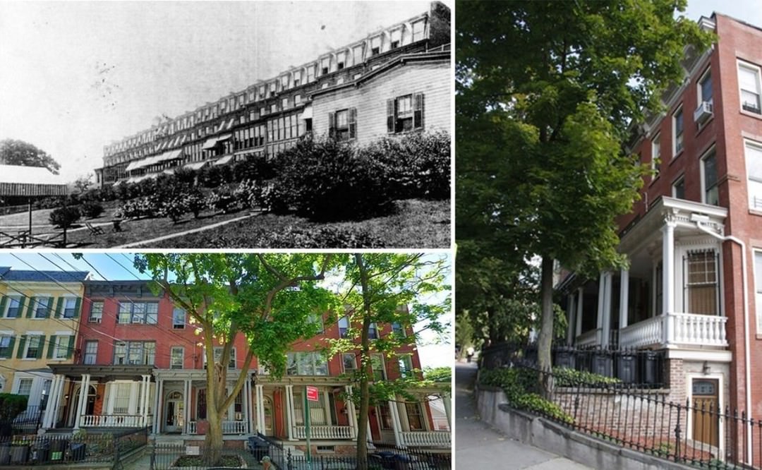
Peering into the paired photographs, certain streets, once bustling with vintage vehicles and pedestrians in period attire, are now lined with contemporary cars and city dwellers donning modern fashion. Yet, the foundational architecture, the heart of the street, remains, echoing tales of yesteryears and whispering secrets of today.
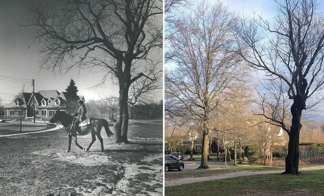
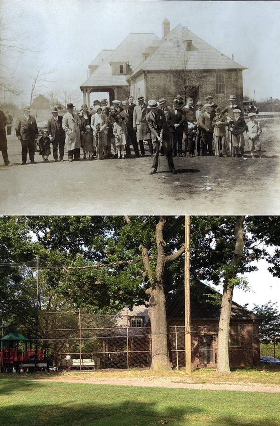
The island’s green spaces, some of which have flourished for over a century, have their own stories to tell. In some spots, dense groves from decades ago have made way for urban expansion. In contrast, other areas depict nature’s tenacity, with the same trees standing tall, only now surrounded by newer benches or playground equipment.
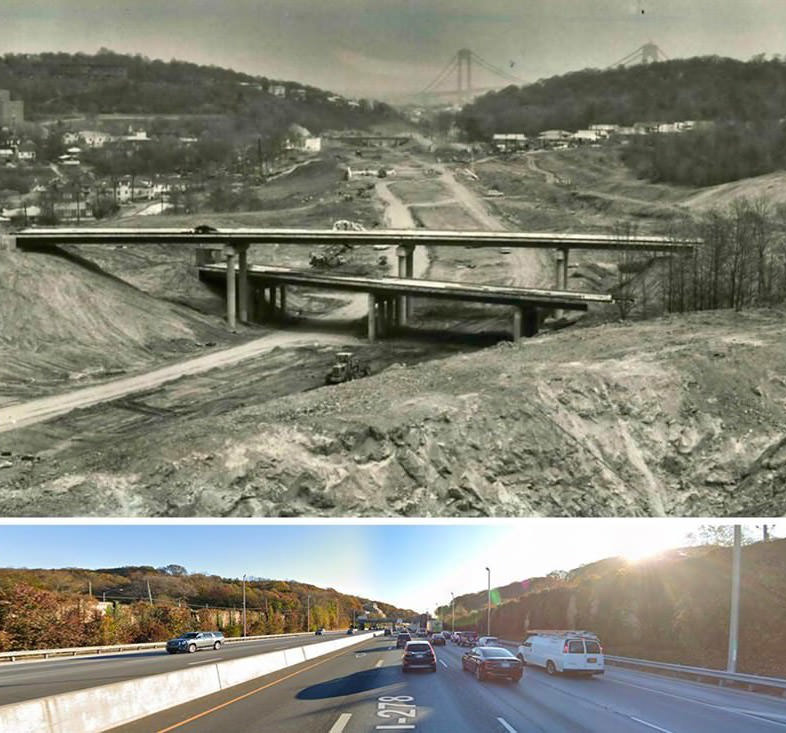
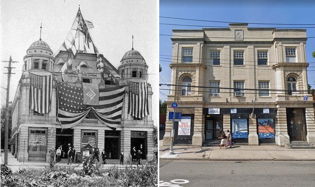
Certain landmarks, like bridges, have become symbols of Staten Island’s identity. The paired images reveal their enduring majesty, even as the surroundings have transformed. Similarly, waterfronts, once hubs for trade and transport, now serve as recreational spots, with the essence of water acting as a continual, soothing presence.
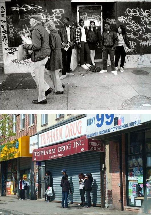
Perhaps the most touching pairs are those capturing everyday life. Children playing, vendors selling, and families gathering—some scenes remain touchingly similar despite the decade’s gap. The setting might have changed, but the spirit, the joy, the camaraderie, resonates across time.
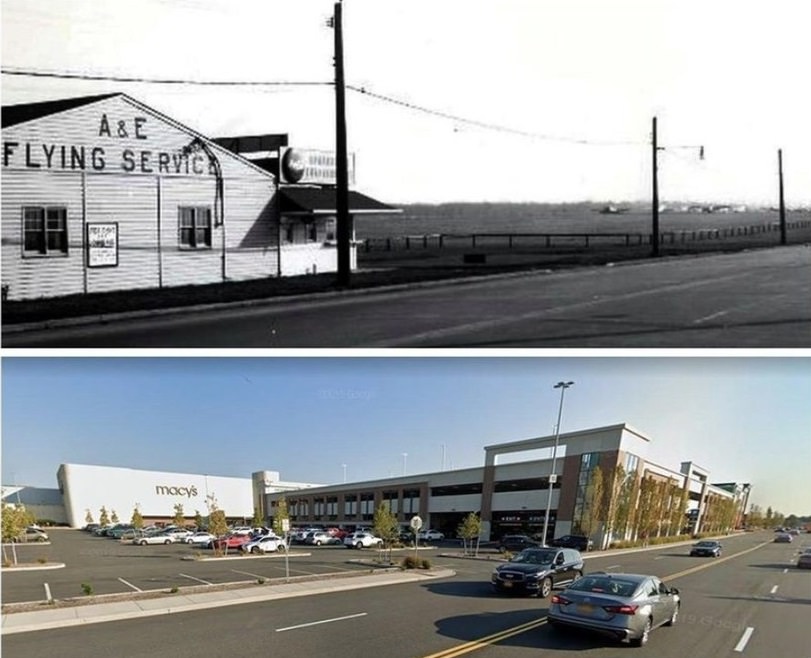
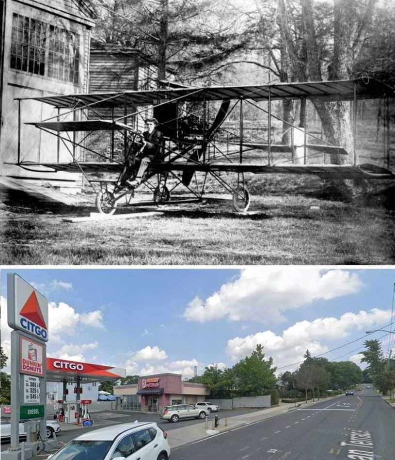
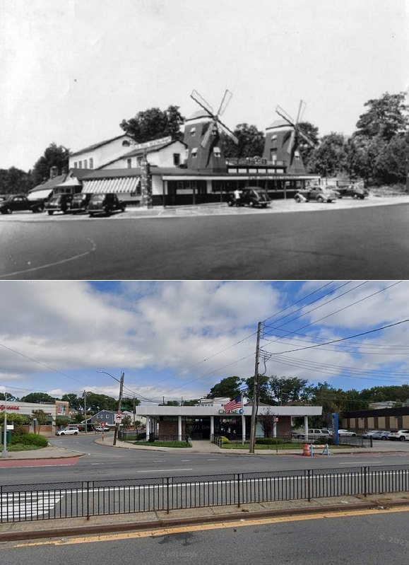
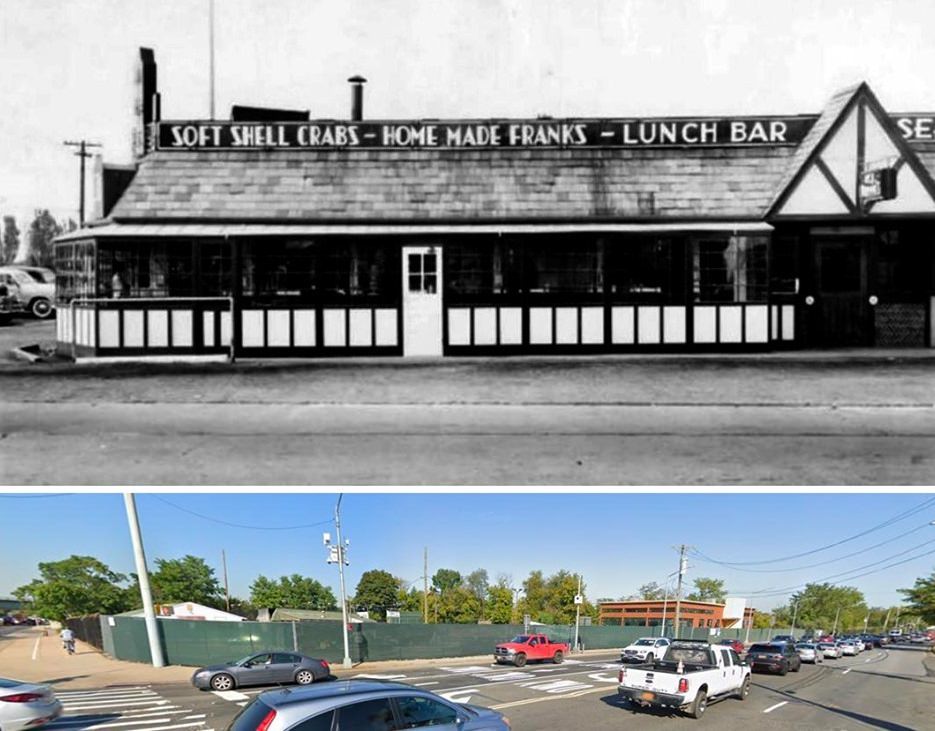
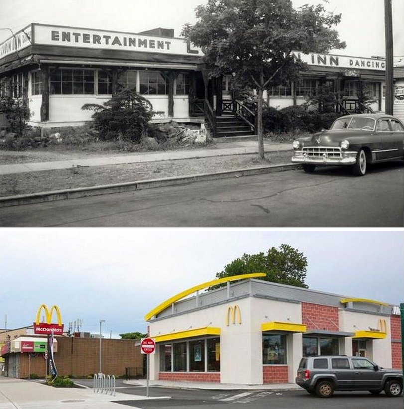
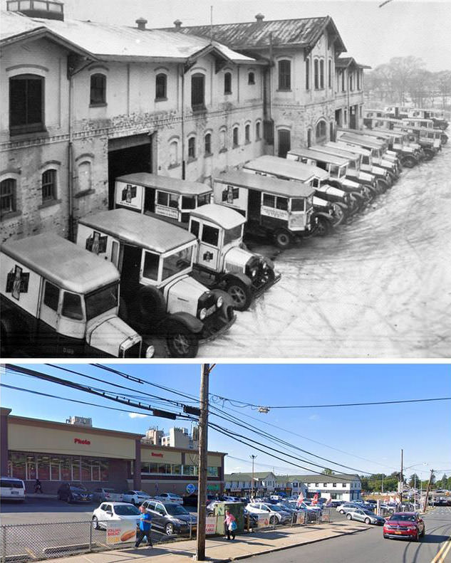
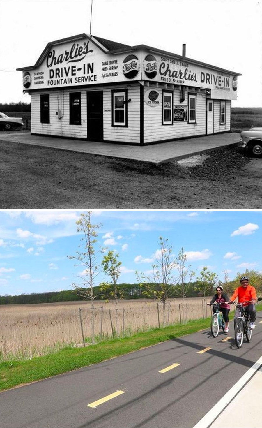
#1 A & E flying service in 1960s and the same place in 2017
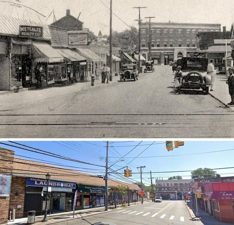
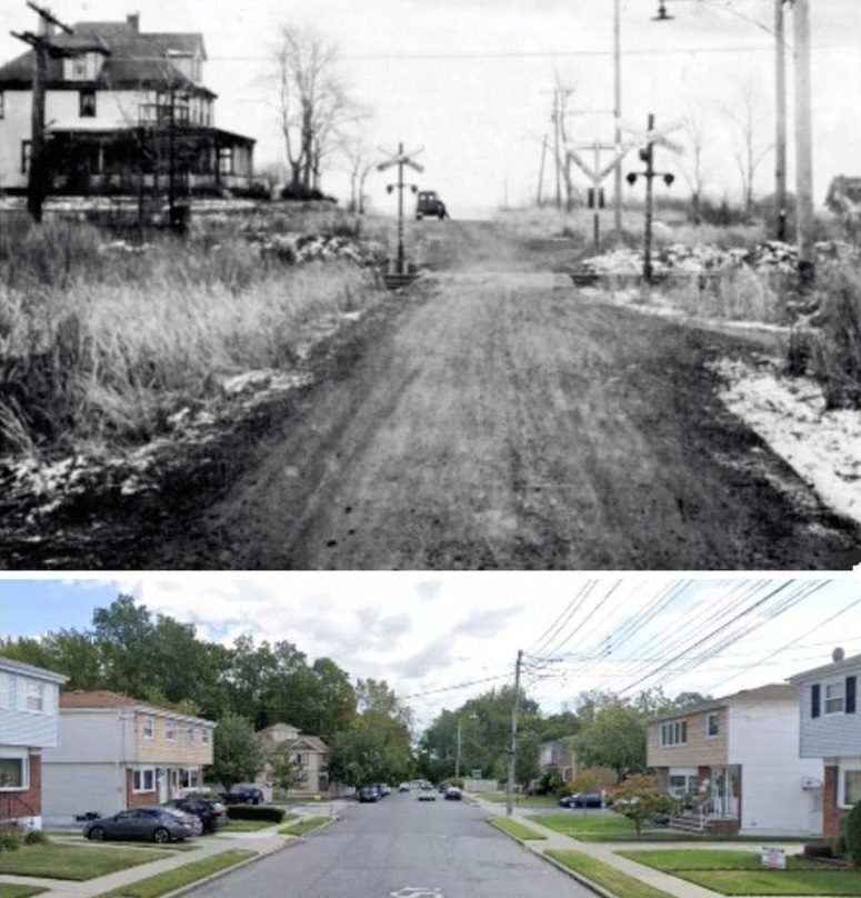
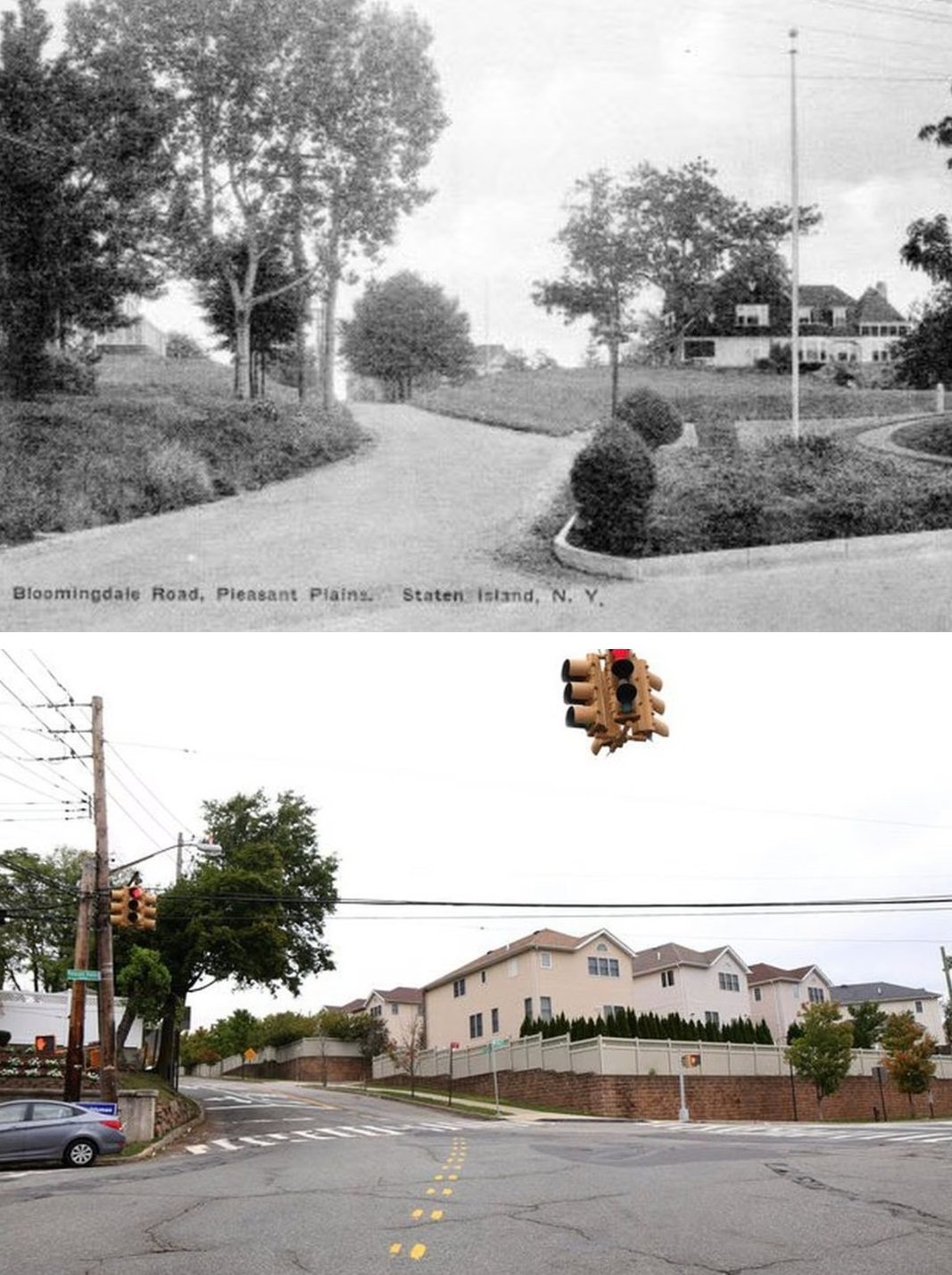
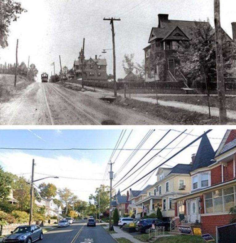
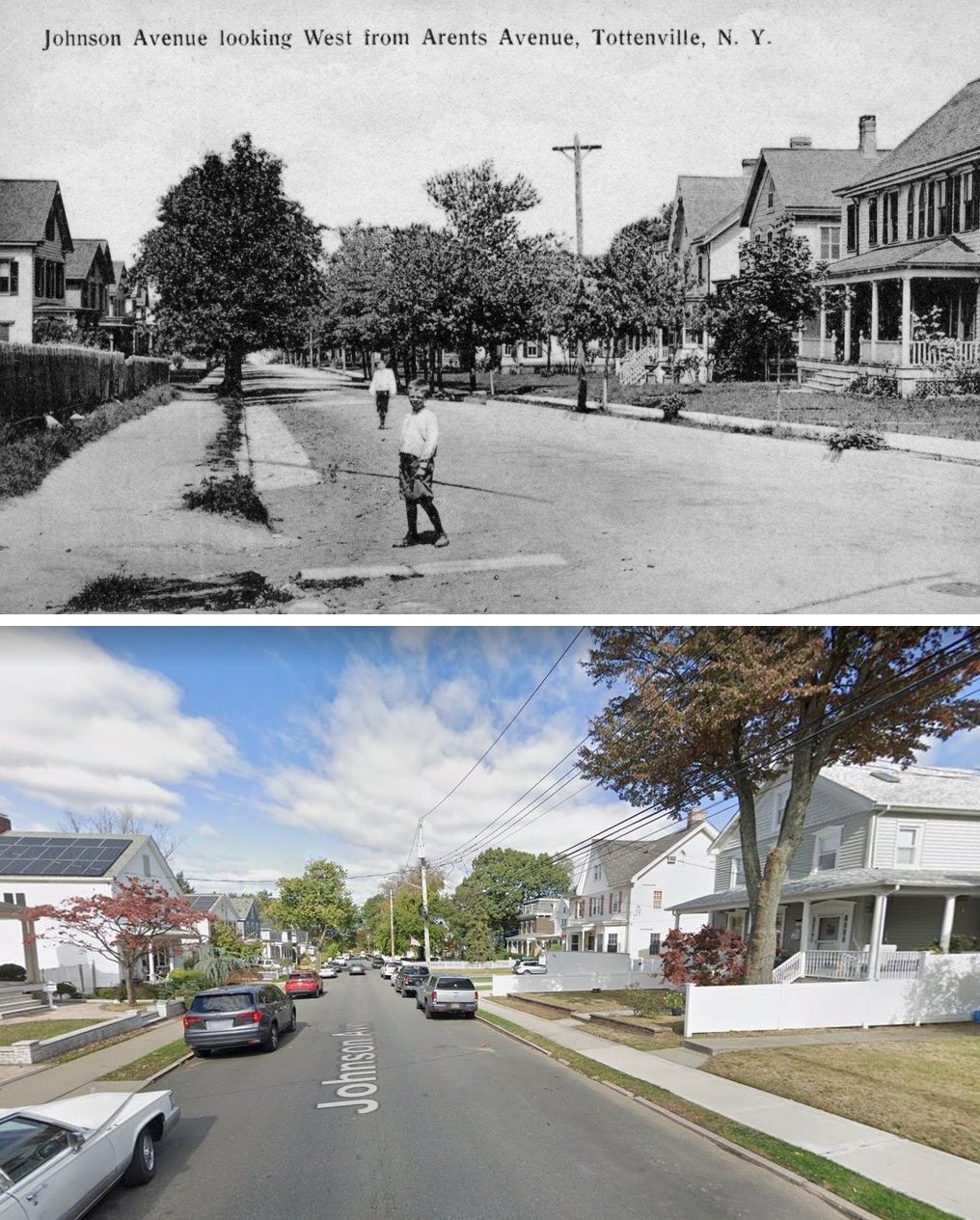
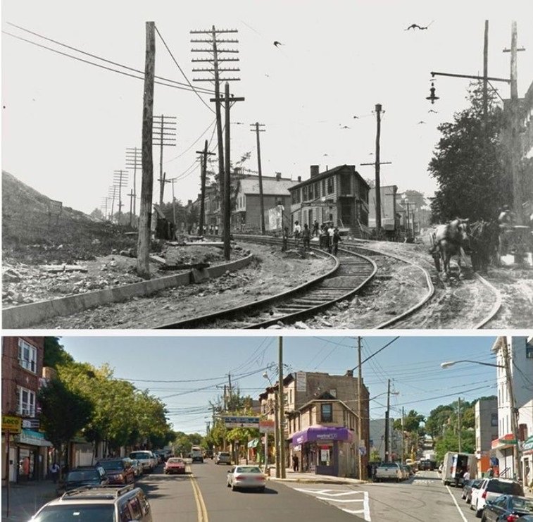
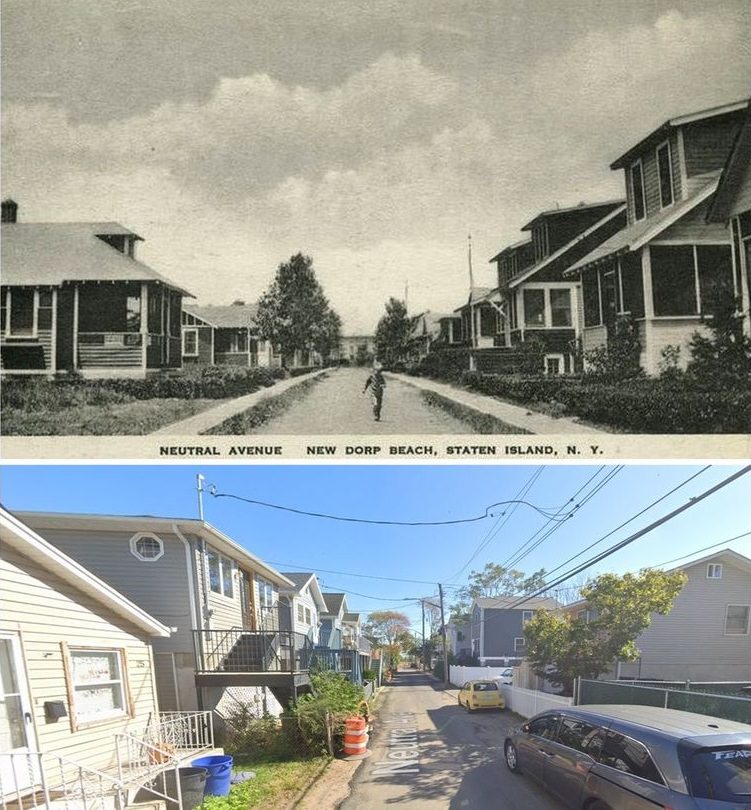
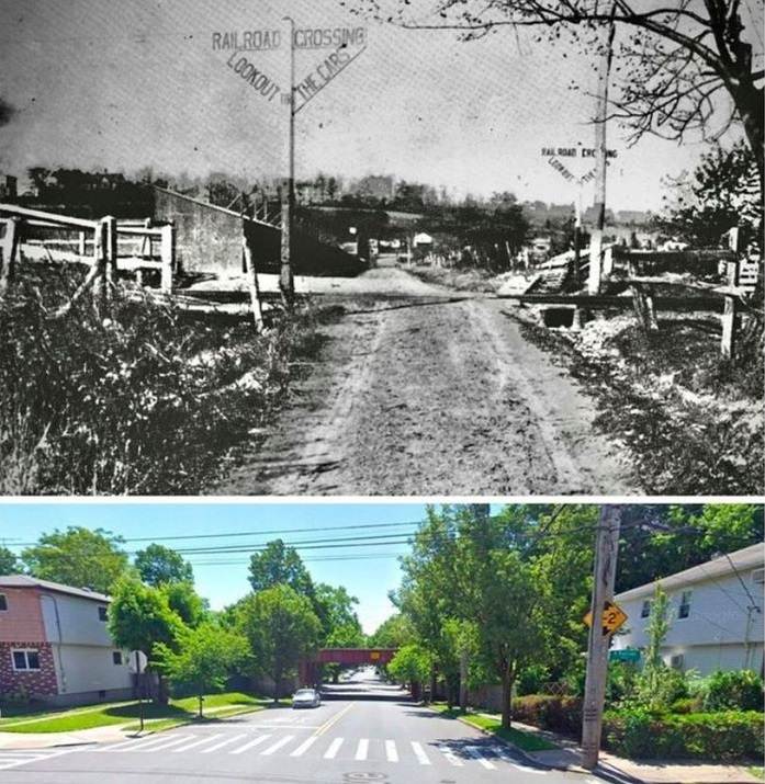
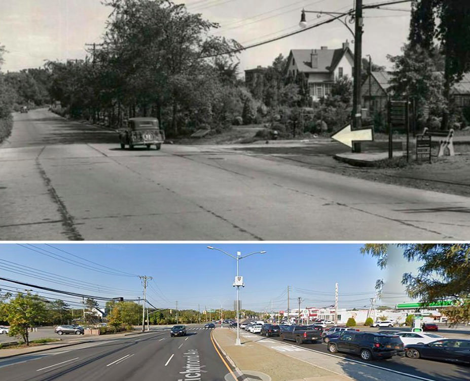
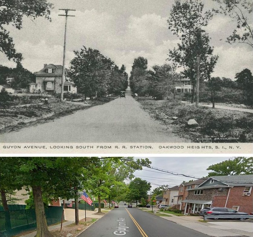
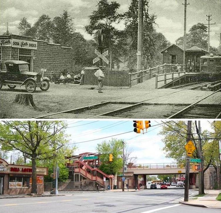
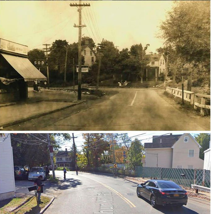
#2 Giffords Lane, early 1900s and 2010s
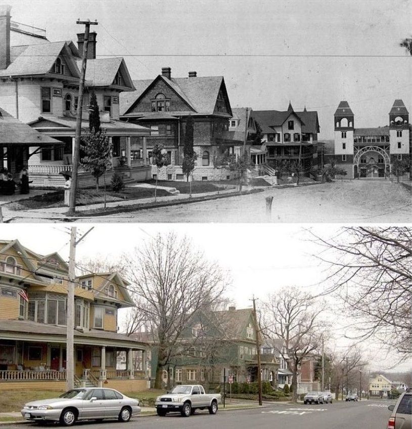
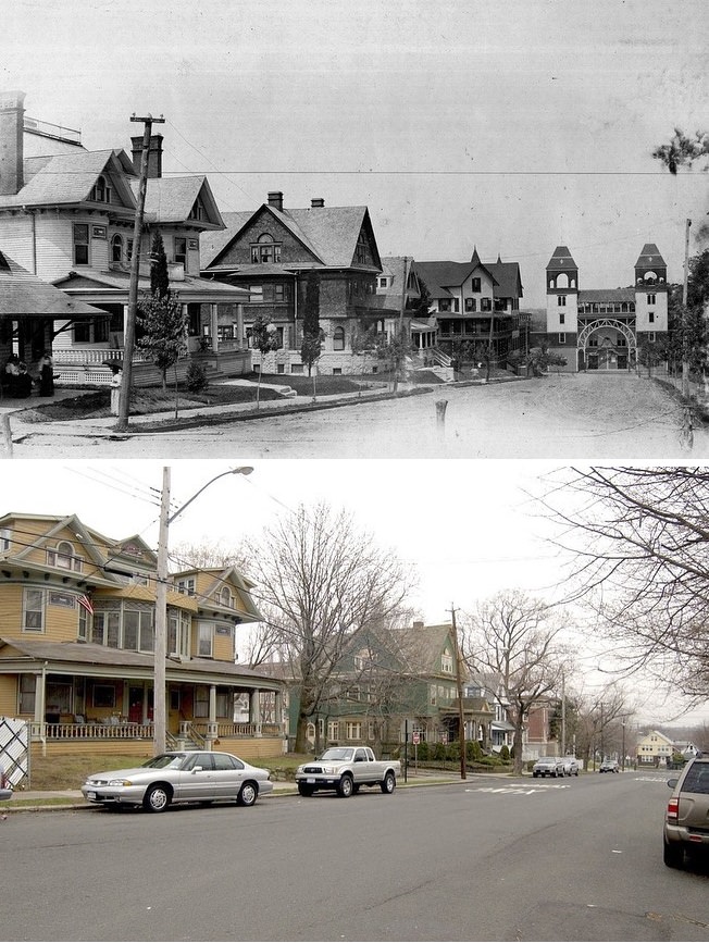
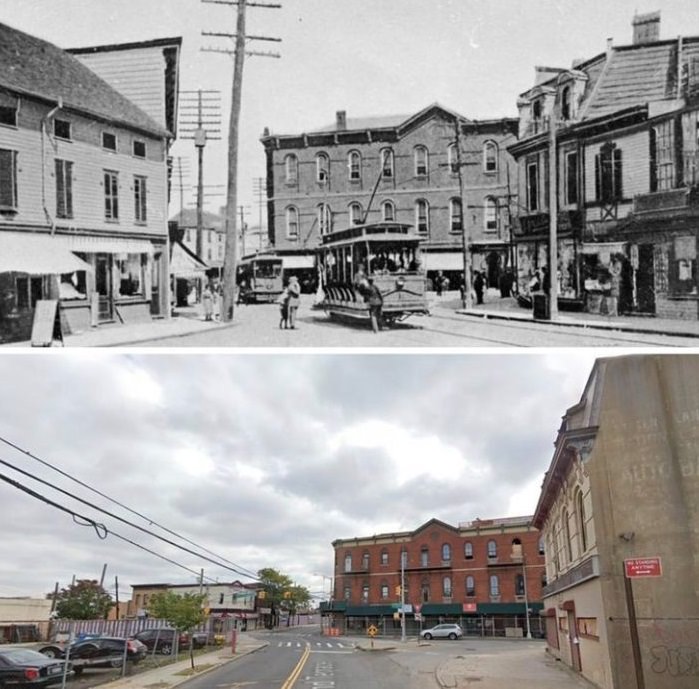
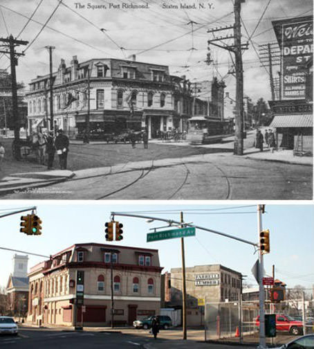
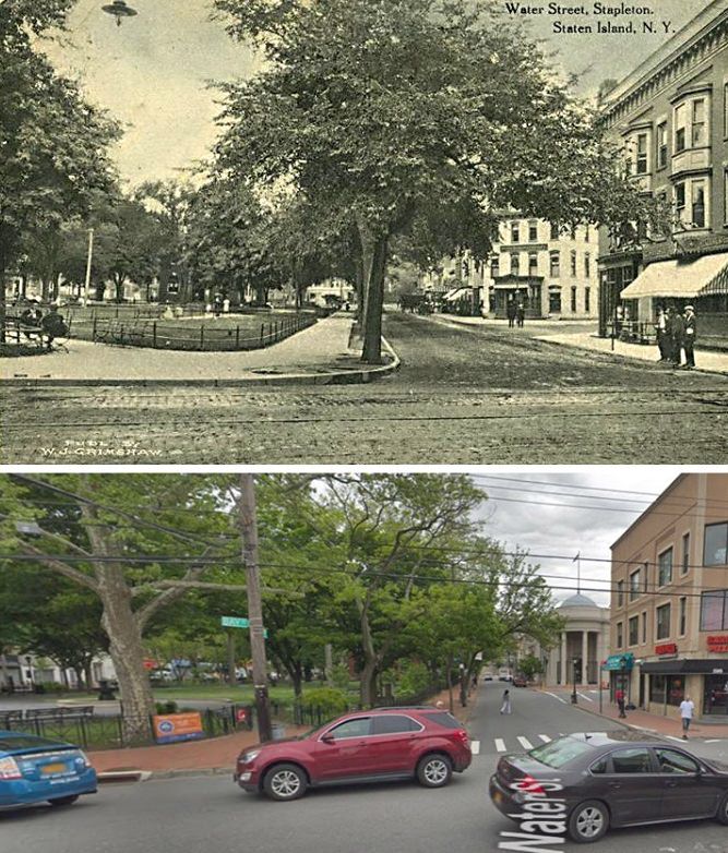
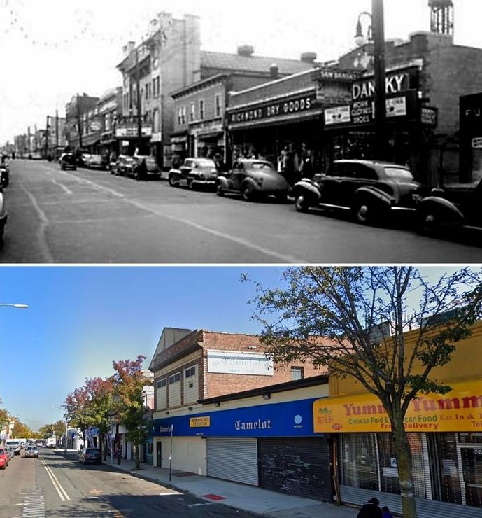
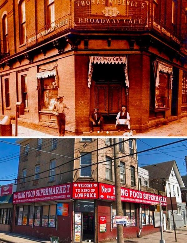
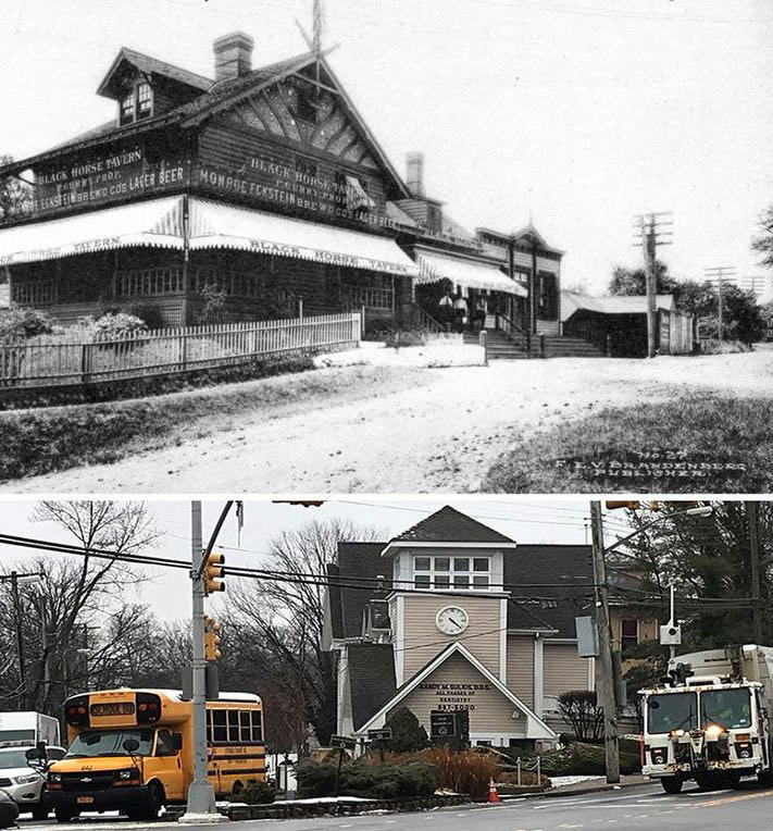
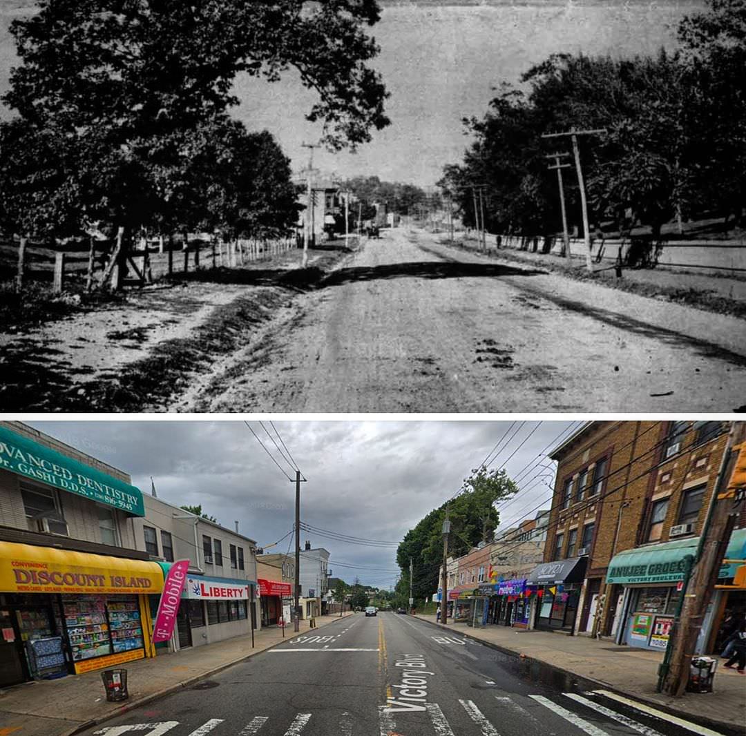
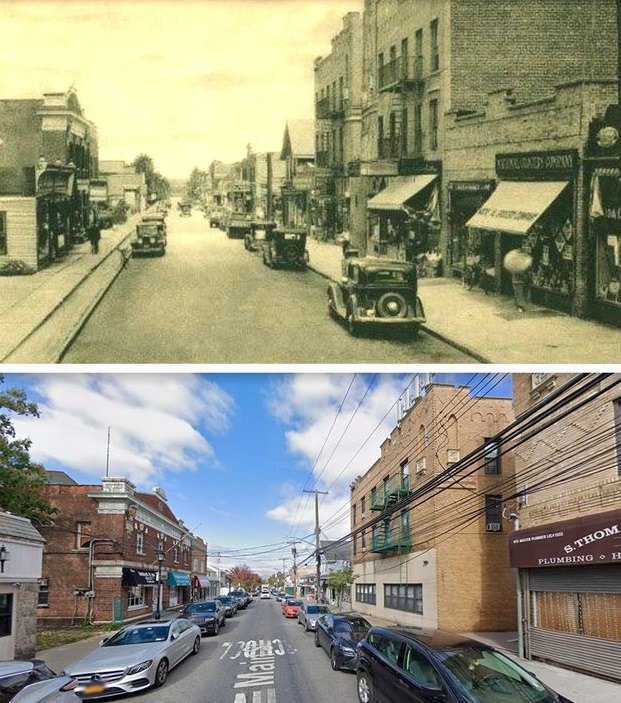
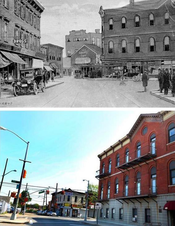
#3 The Boulevard in 1899. Notable for its University Temple, a large auditorium.
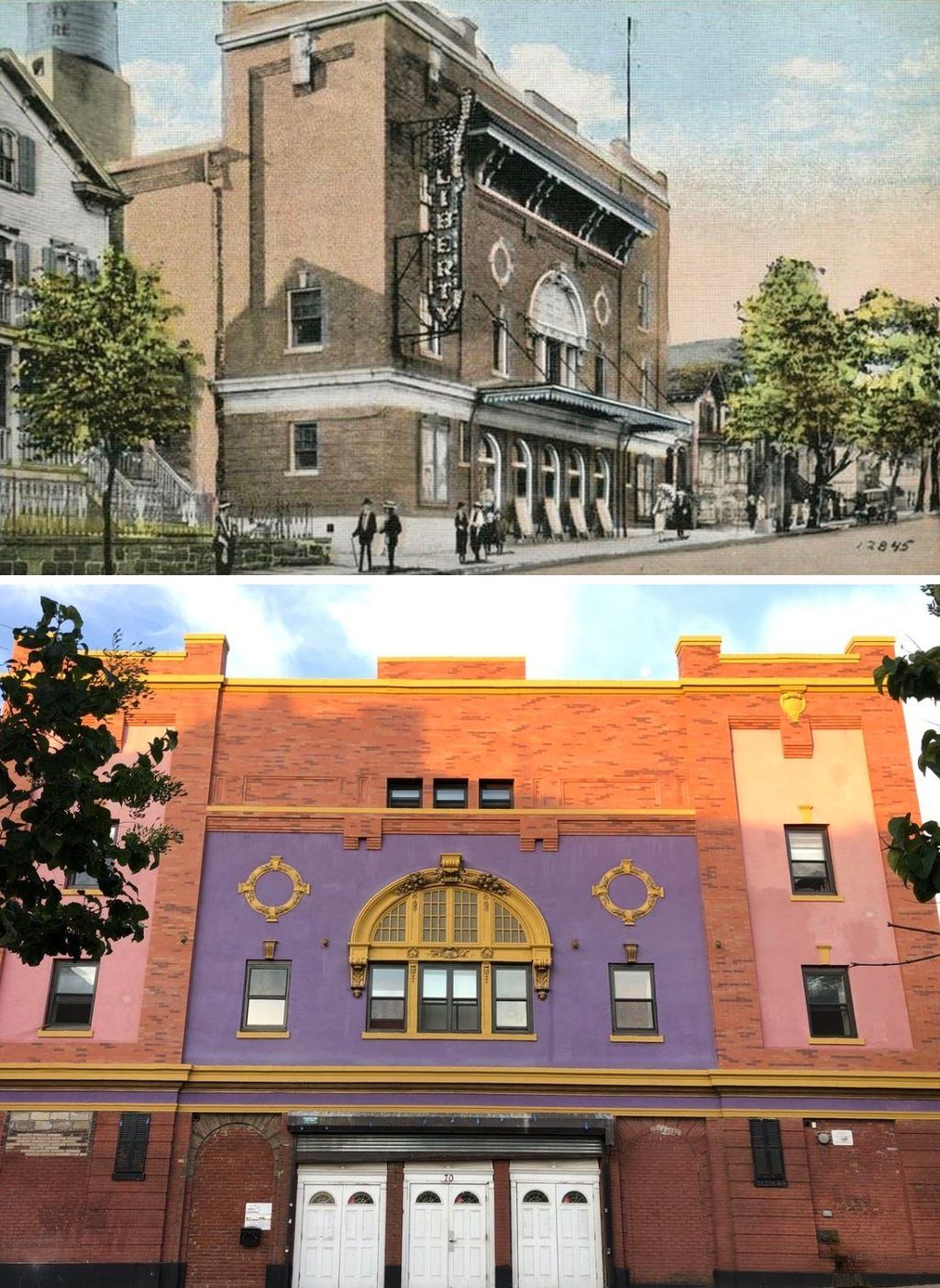
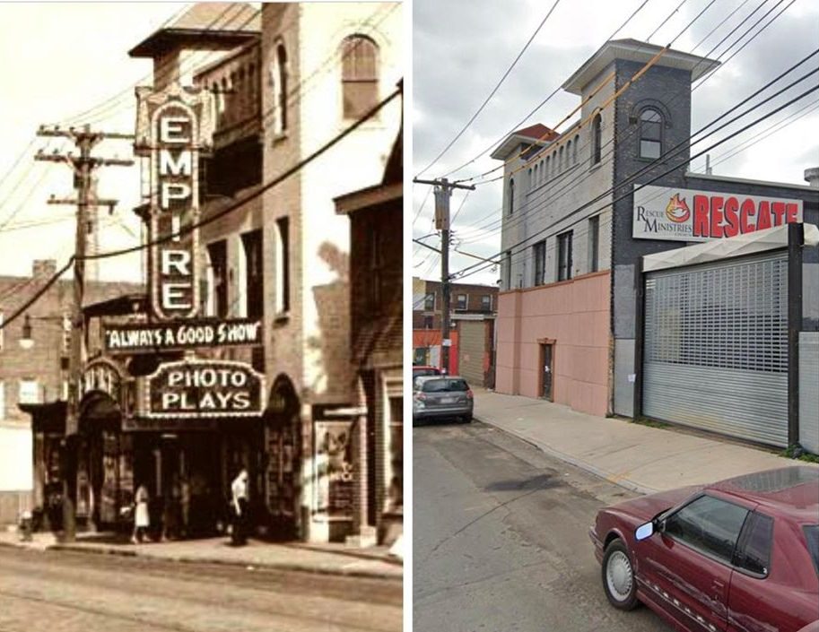
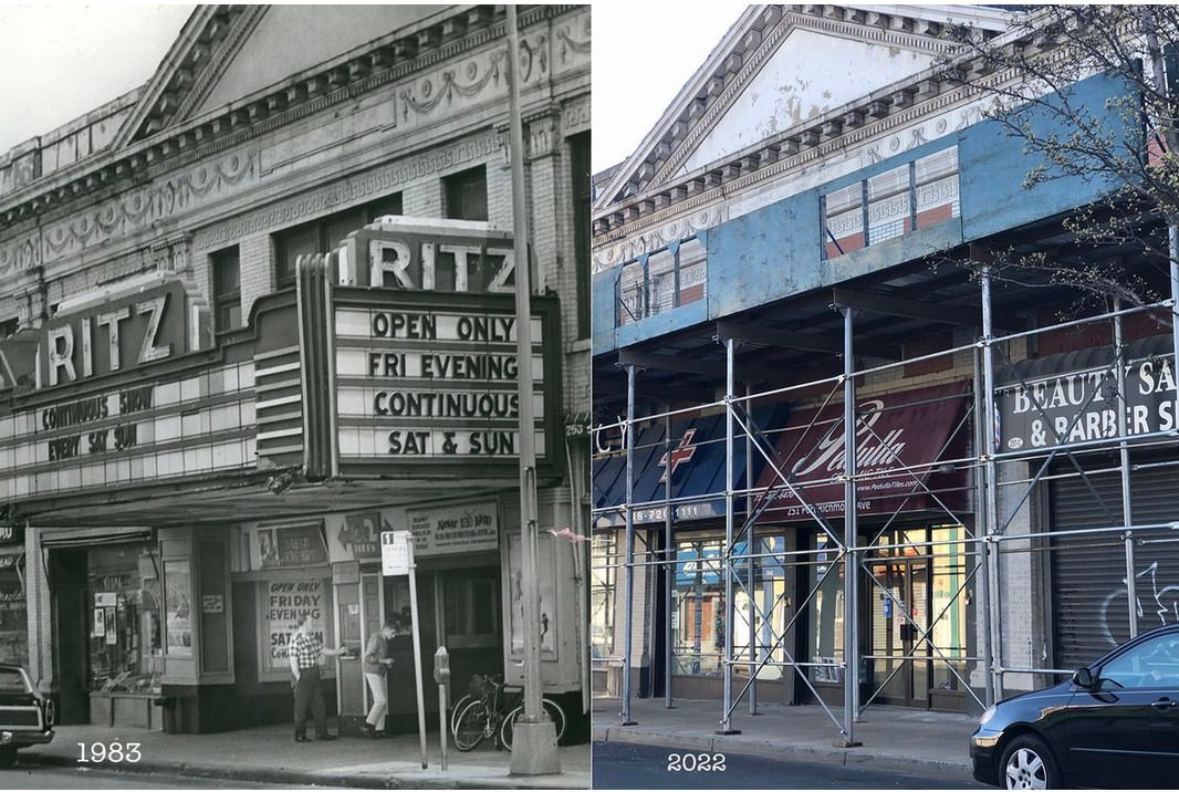
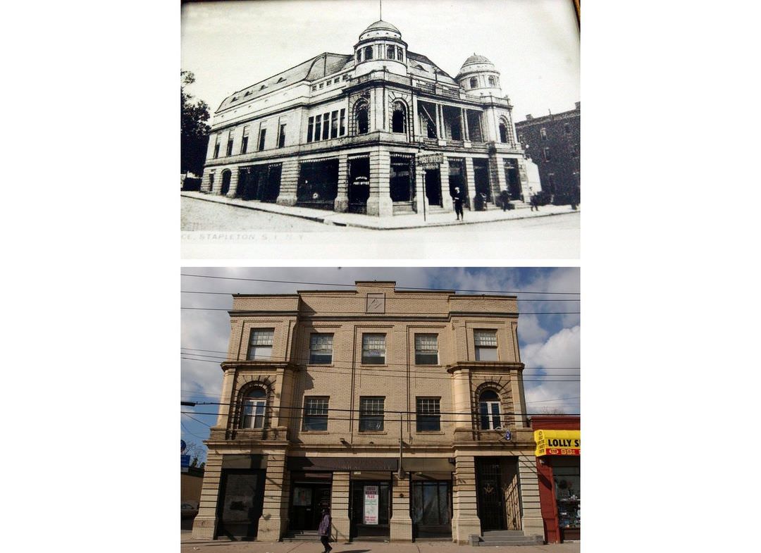
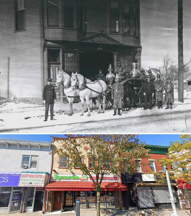
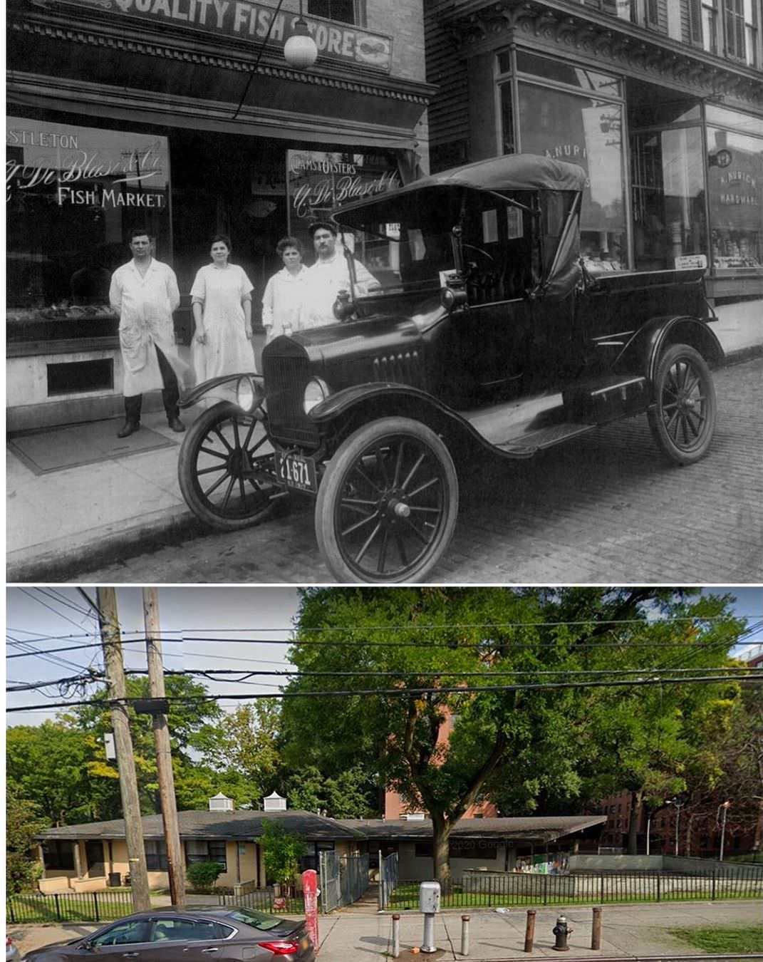
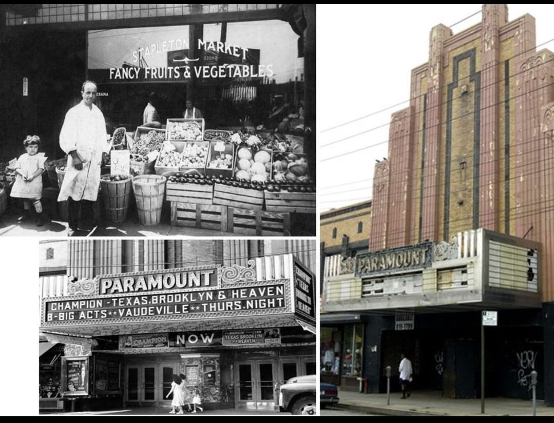
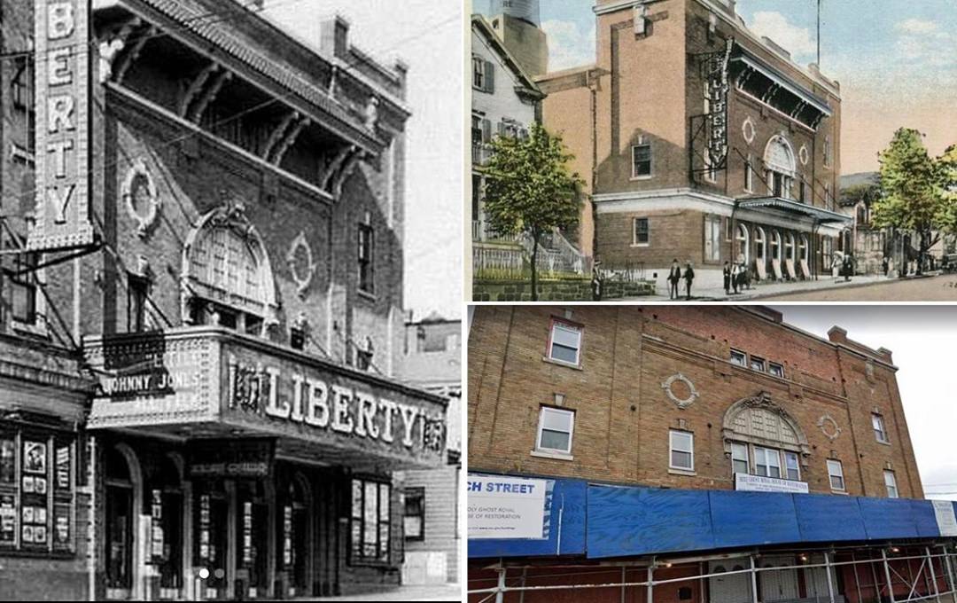
#4 70 Beach Street in Stapleton was originally the Liberty Theatre in 1918. Now houses various businesses.
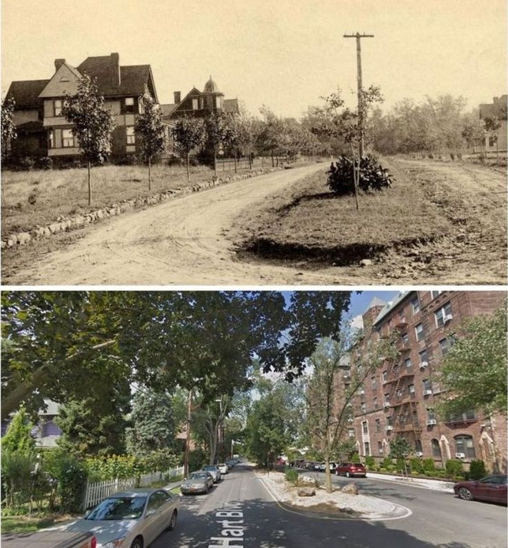
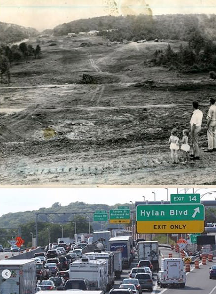
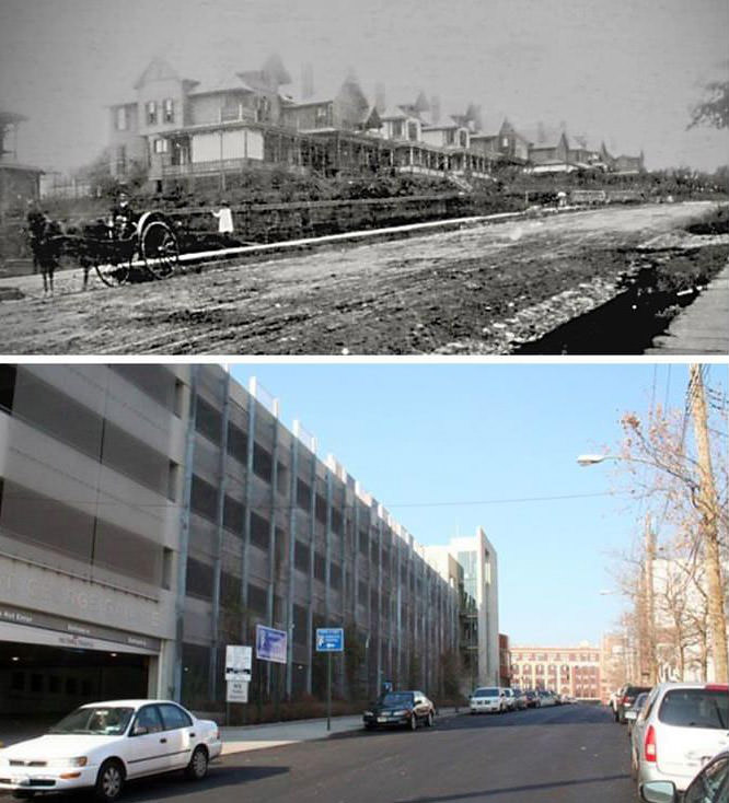
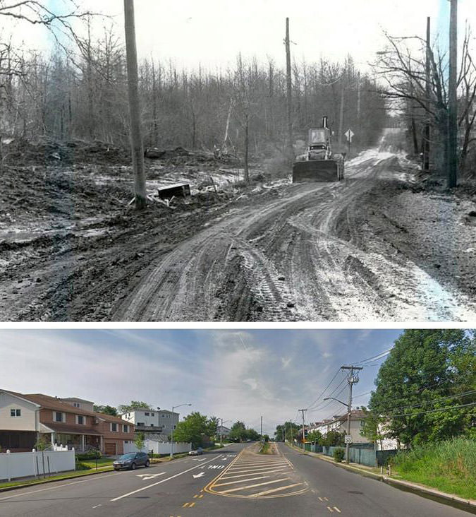
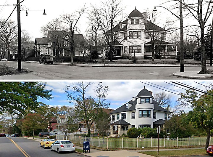
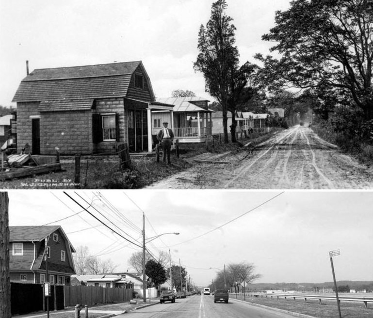
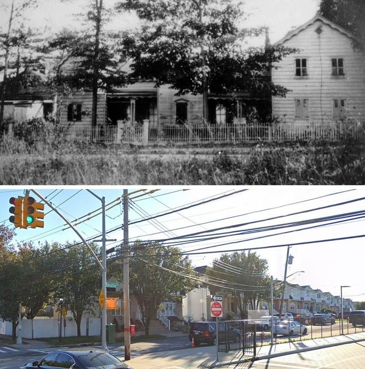
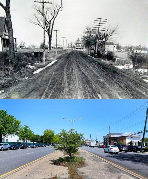
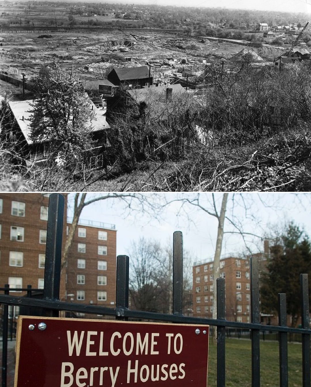
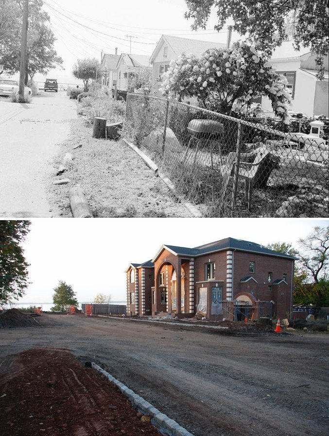
#5 Hart Boulevard transformed from wooded land into a developed area; 1900s – 2009
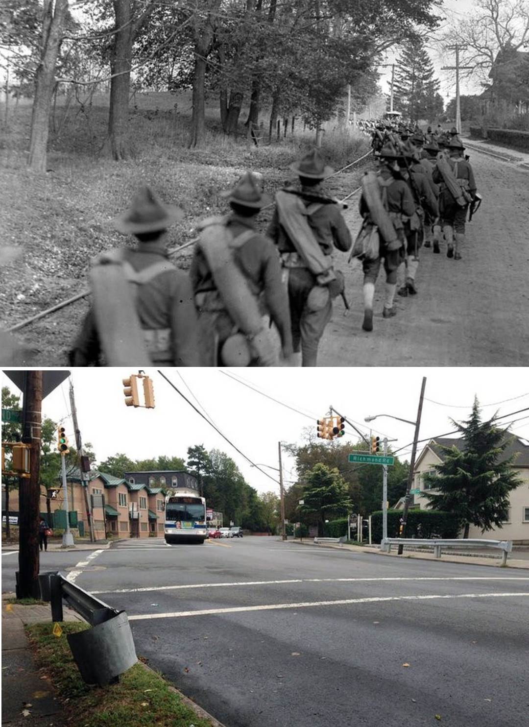
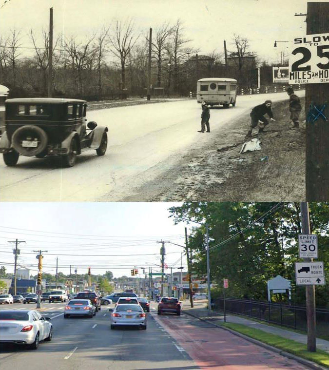
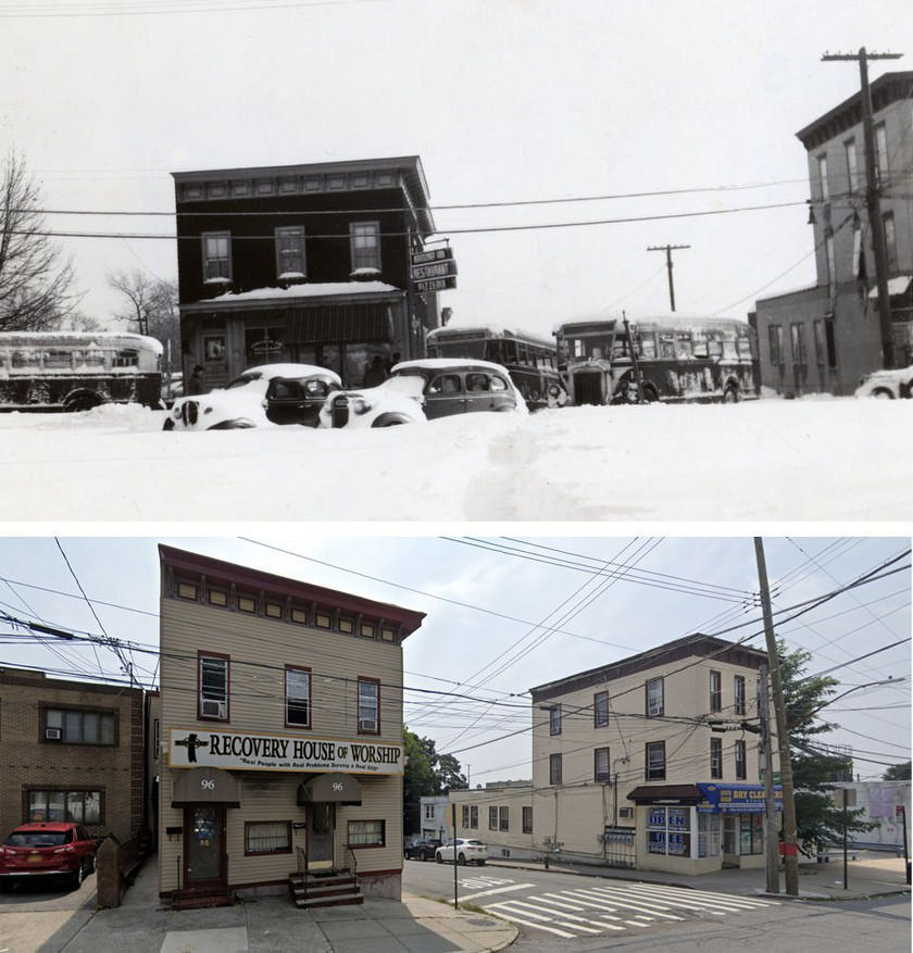
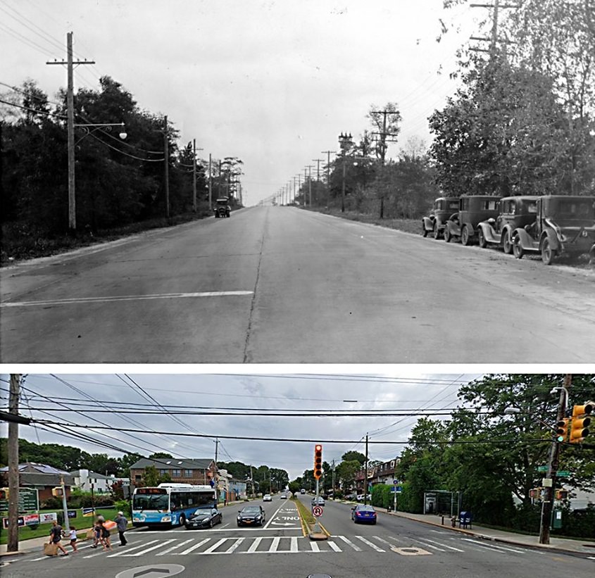
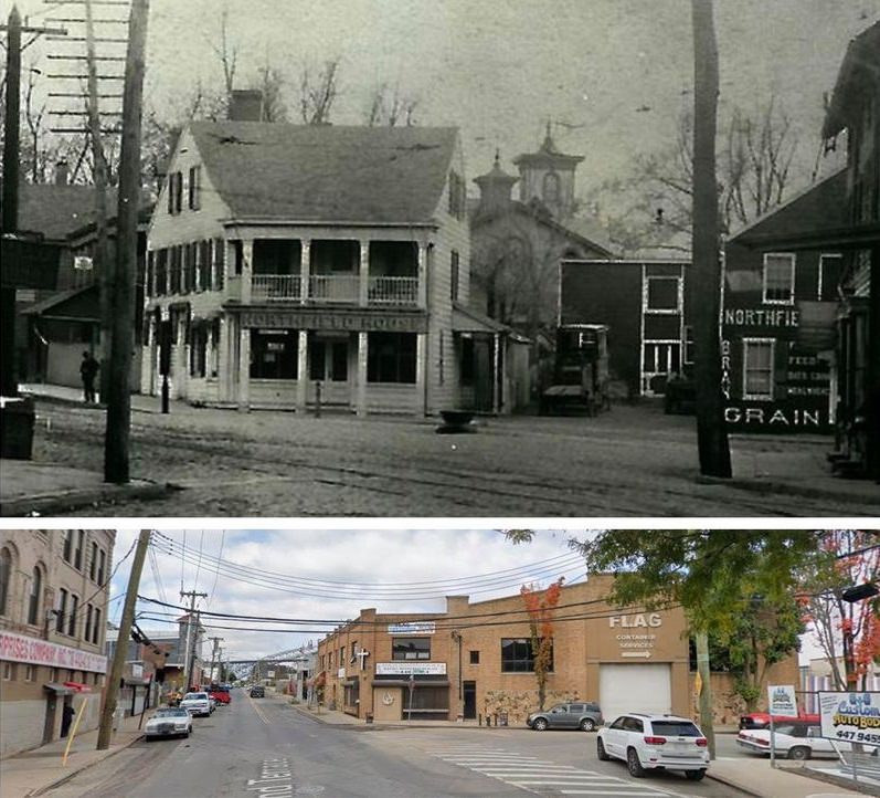
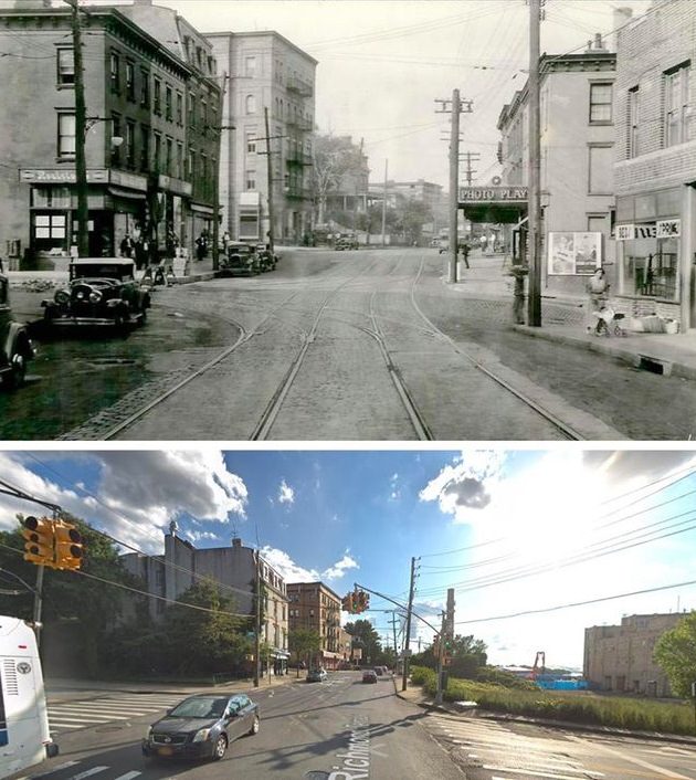
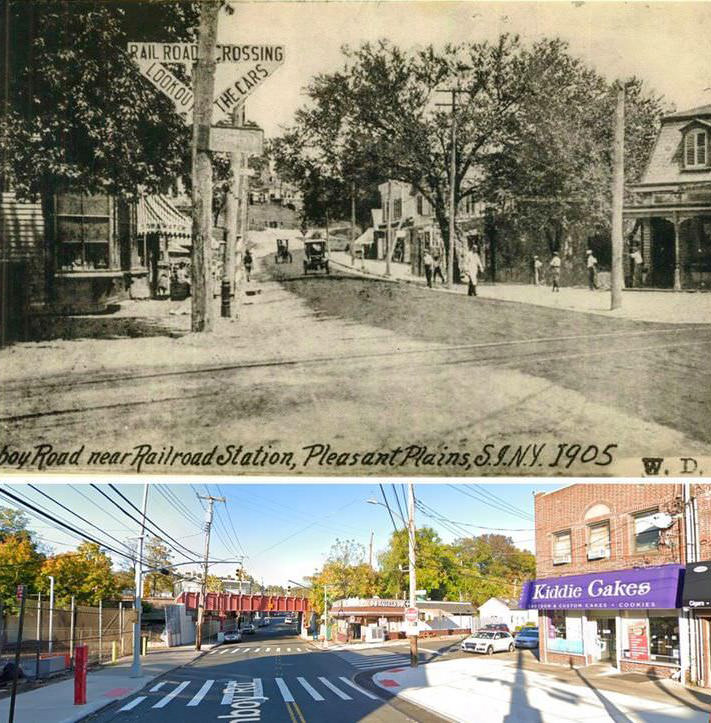
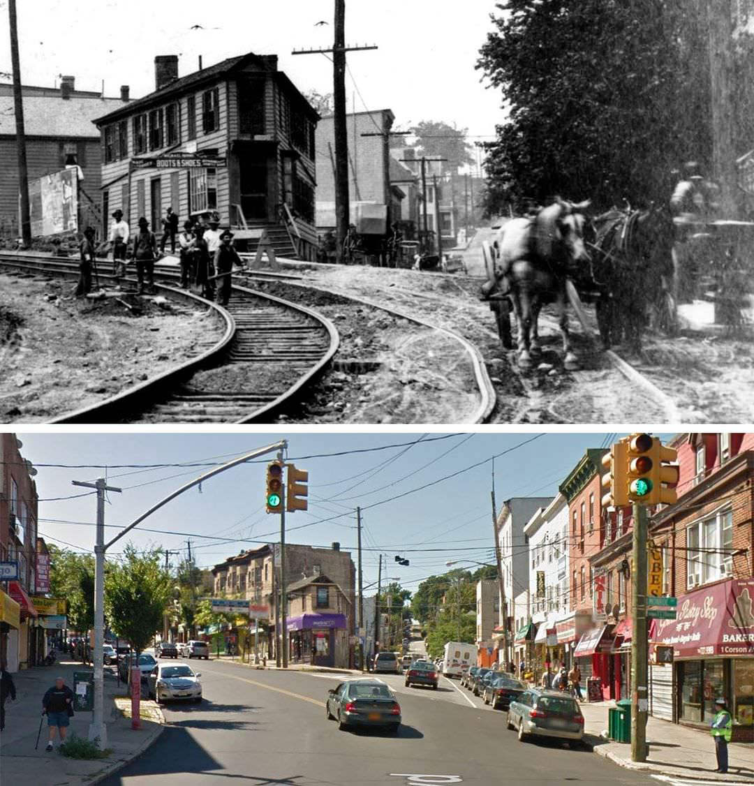
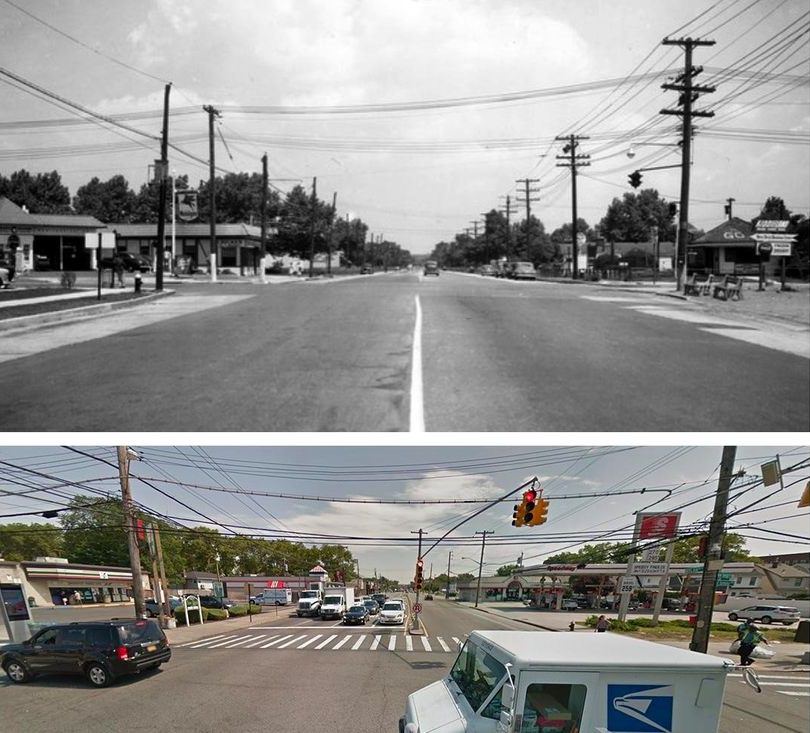
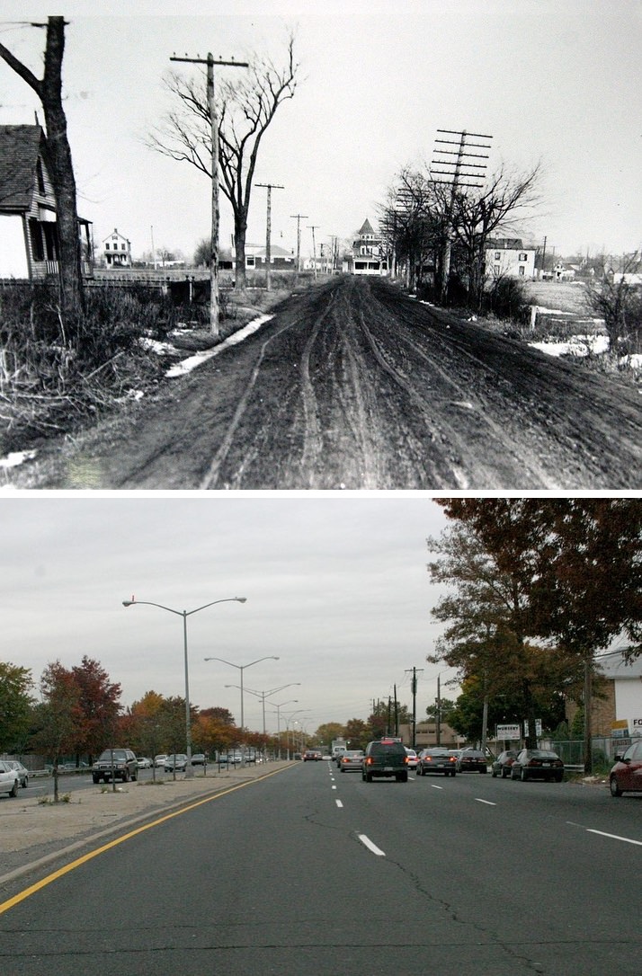
#6 Soldiers march on Amboy Road near Richmond Road in New Dorp, captured on October 26, 1912. Second photo is from 2019
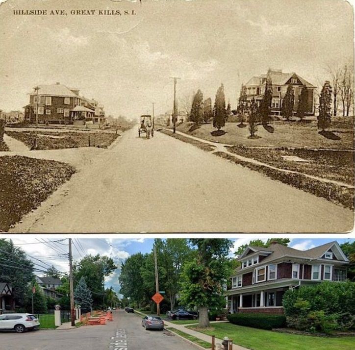
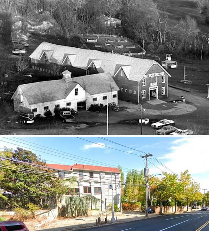
#7 Hillside Terrace in Great Kills offers a glimpse into its undeclared history.
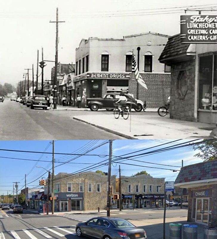
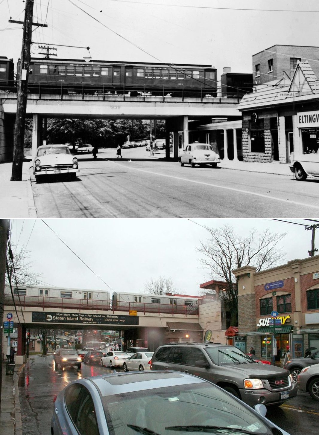
#8 Buffalo Street, Bay Terrace, looking east, circa 1939 and the street east of the SIR today.
#9 The Boulevard: A 1899 view showing University Temple, now part of the Westerleigh community.
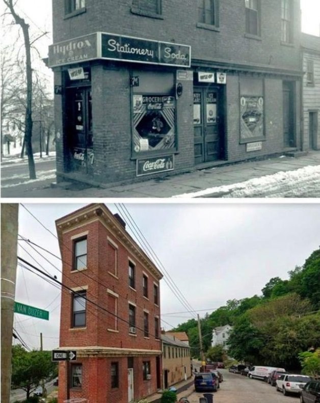
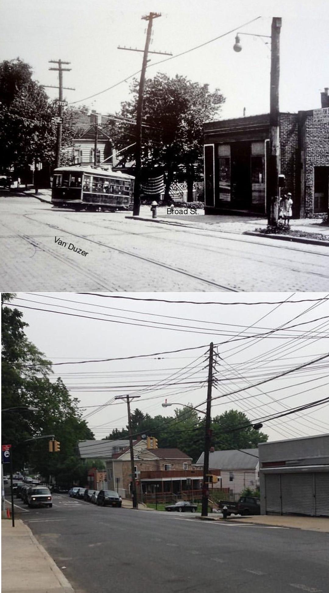
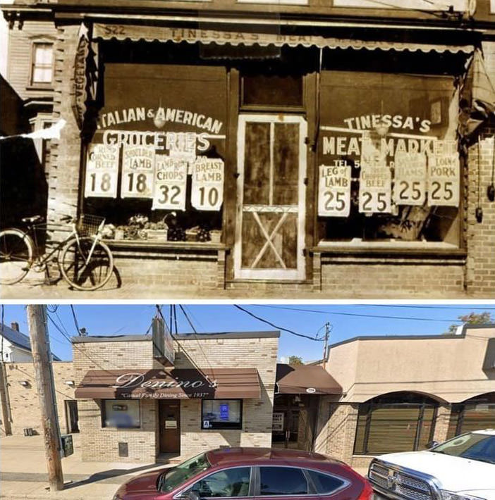
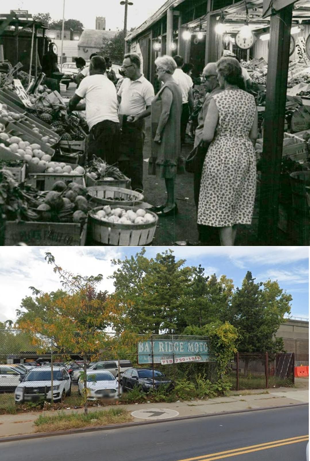
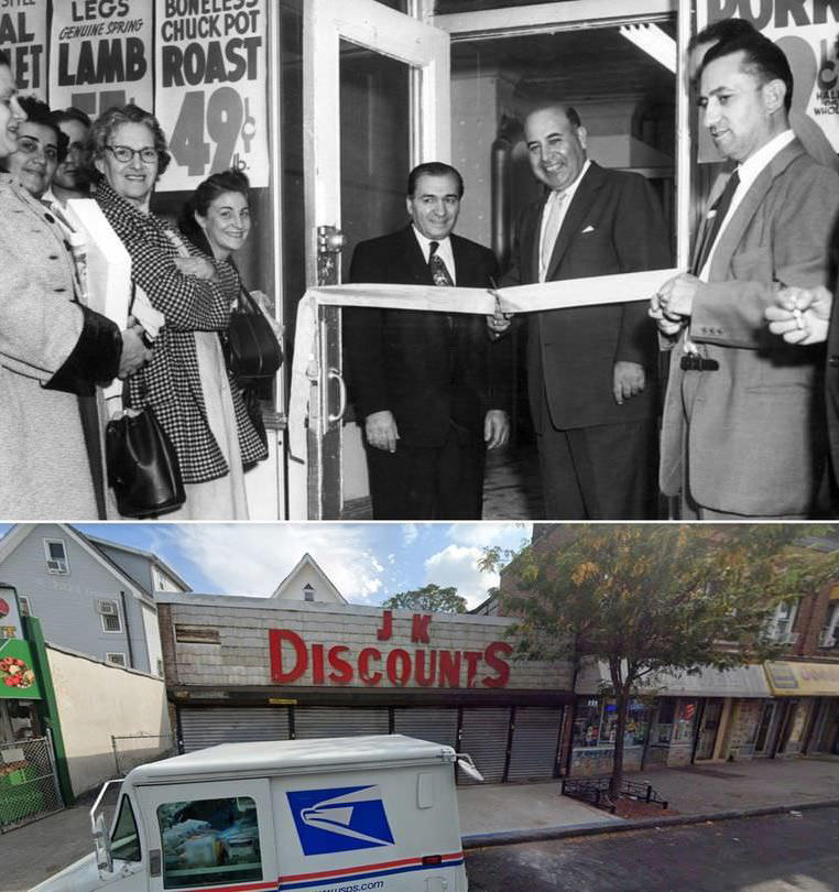
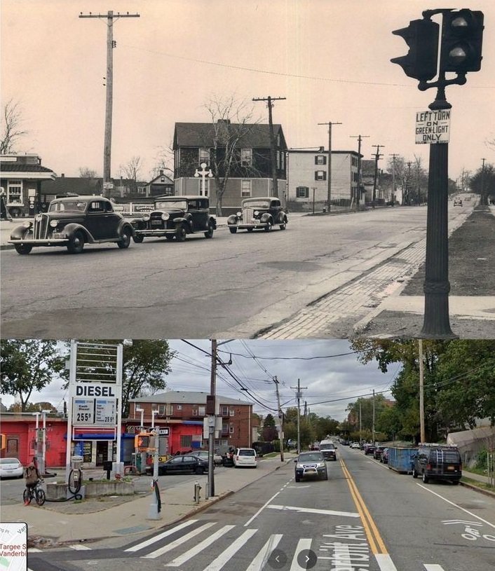
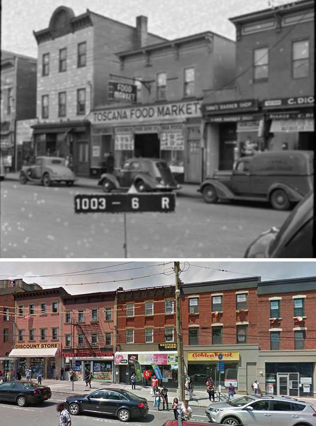
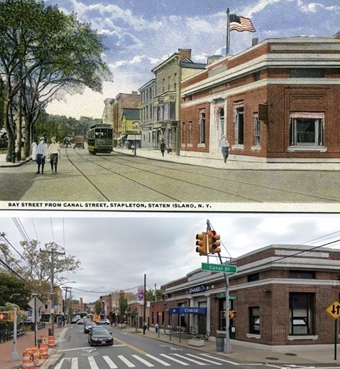
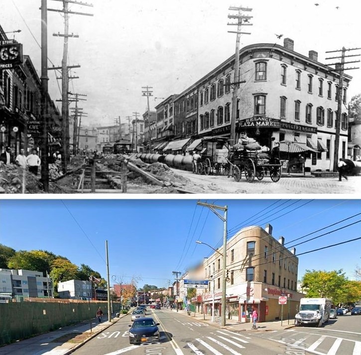
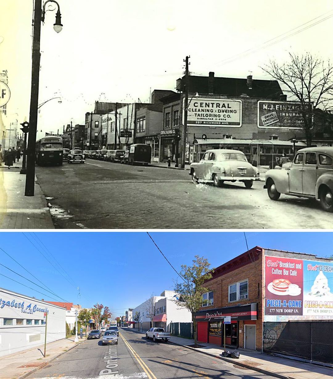
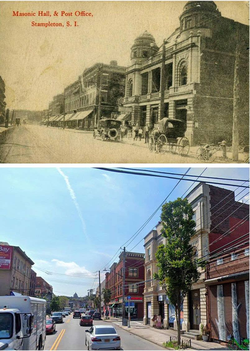
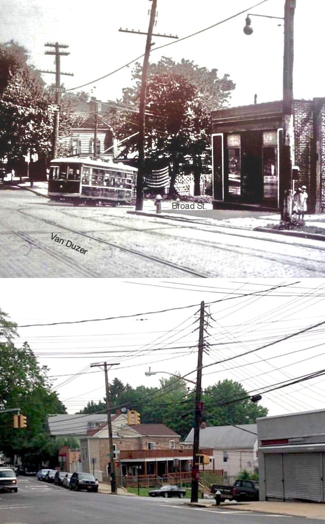
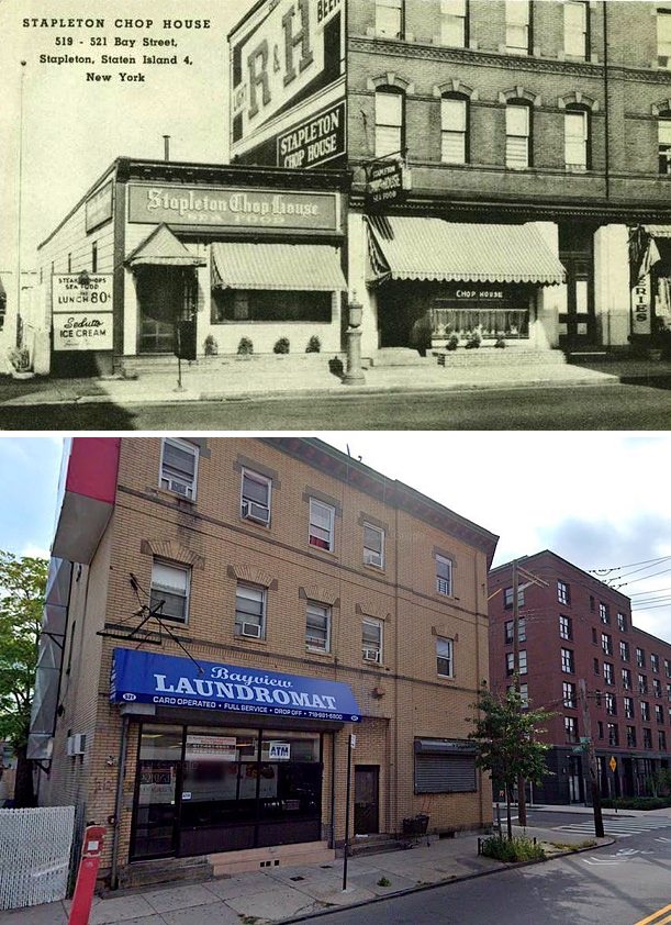
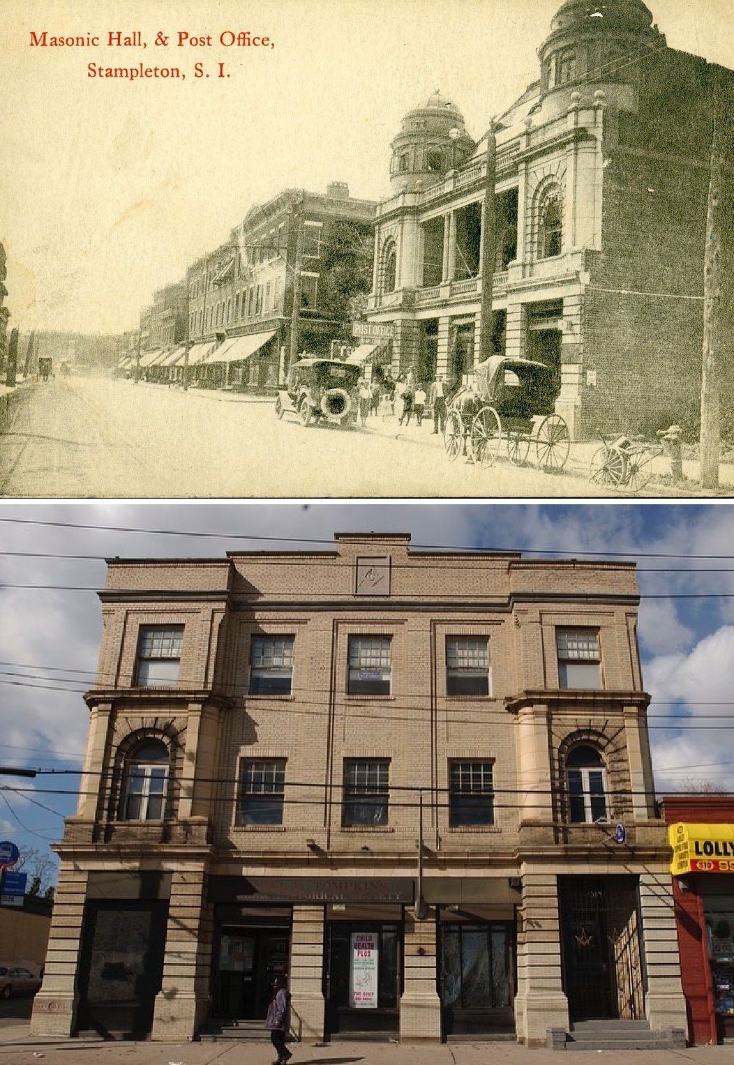
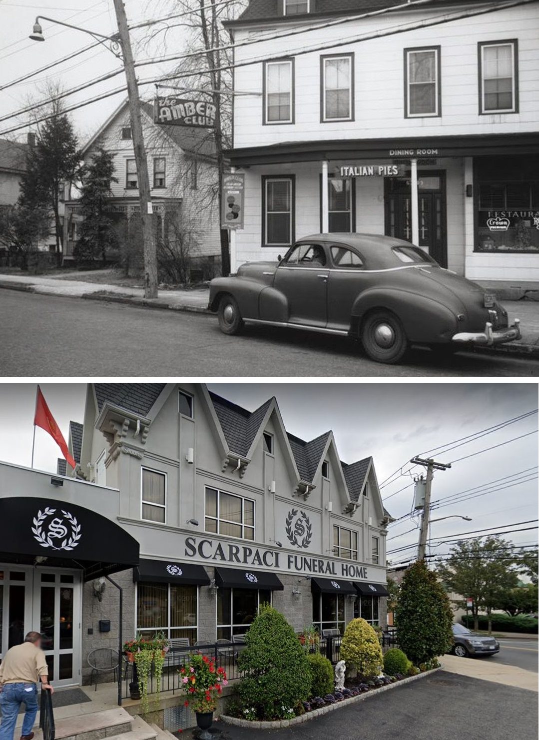
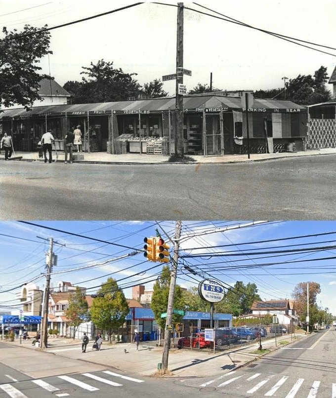
#10 Market at Targee and Van Duzer Streets, Stapleton, photographed on January 4, 1949. Second photo is from 2020
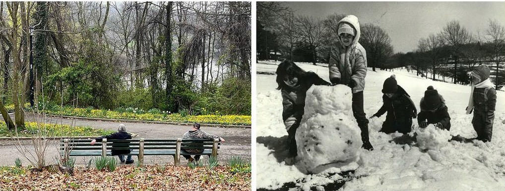
#11 Silver Lake Park in Two Different April Scenes, 1982 and 2019
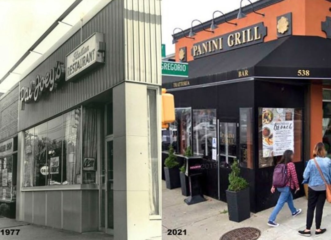
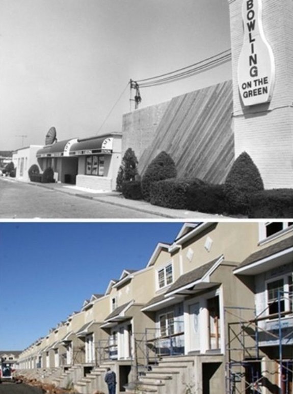
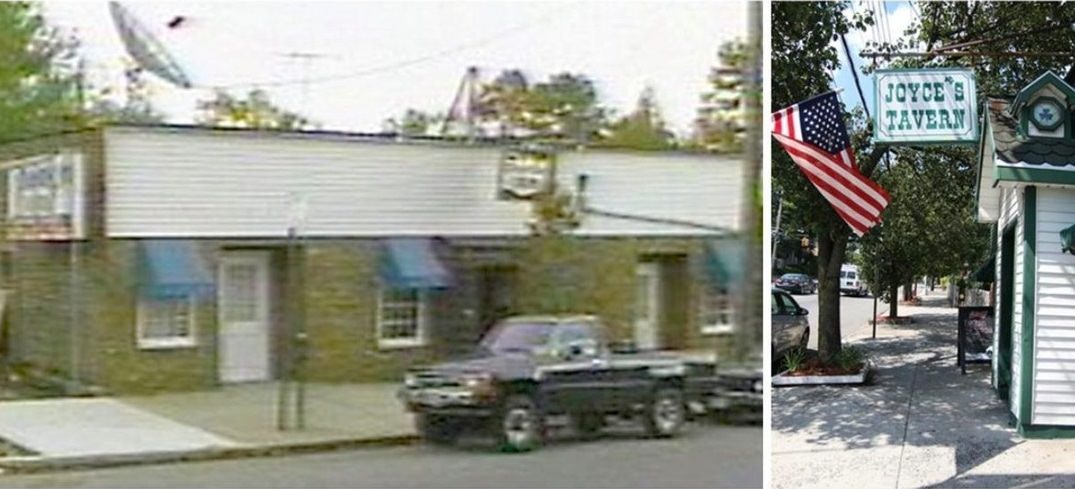
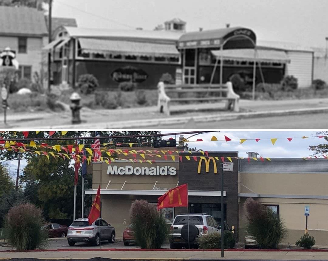
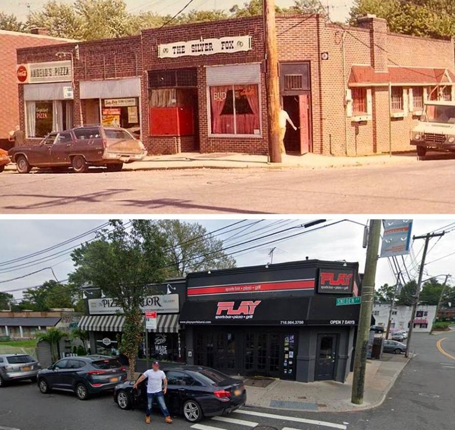
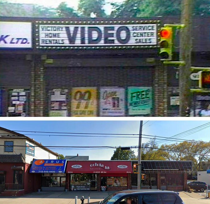
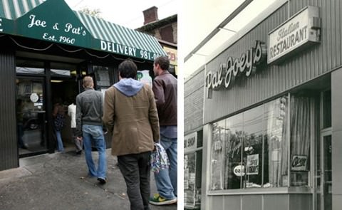
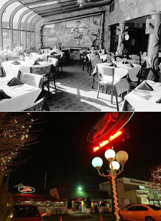
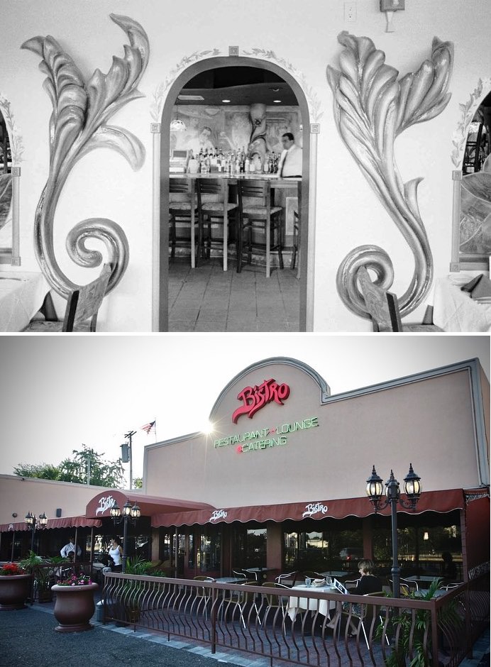
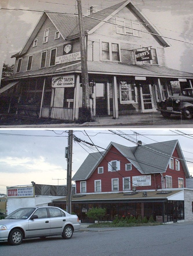
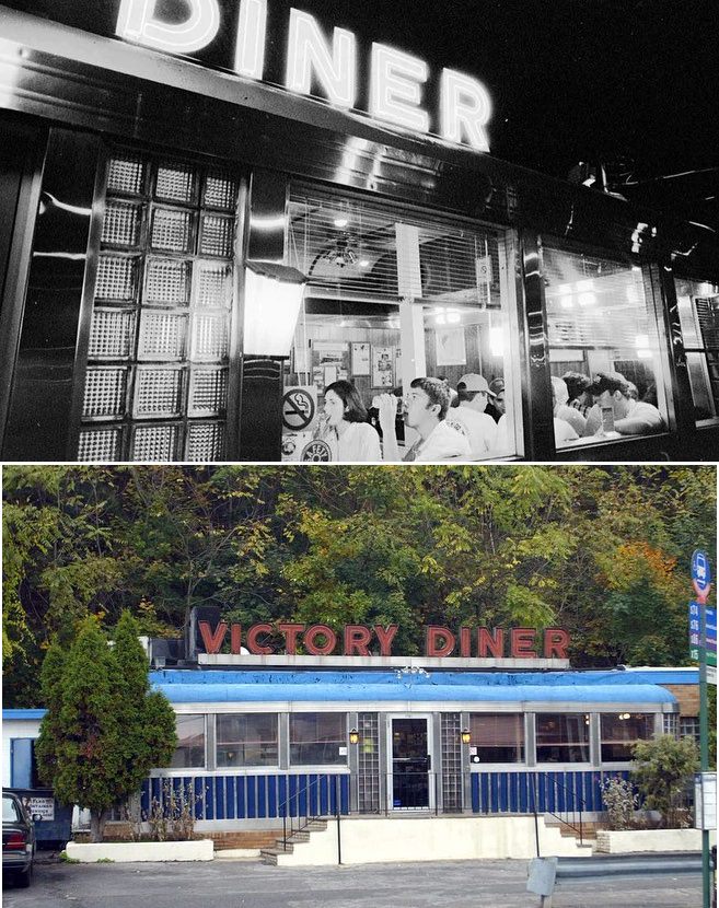
#12 Corner of Forest and Davis avenues, a popular eatery since 1977.
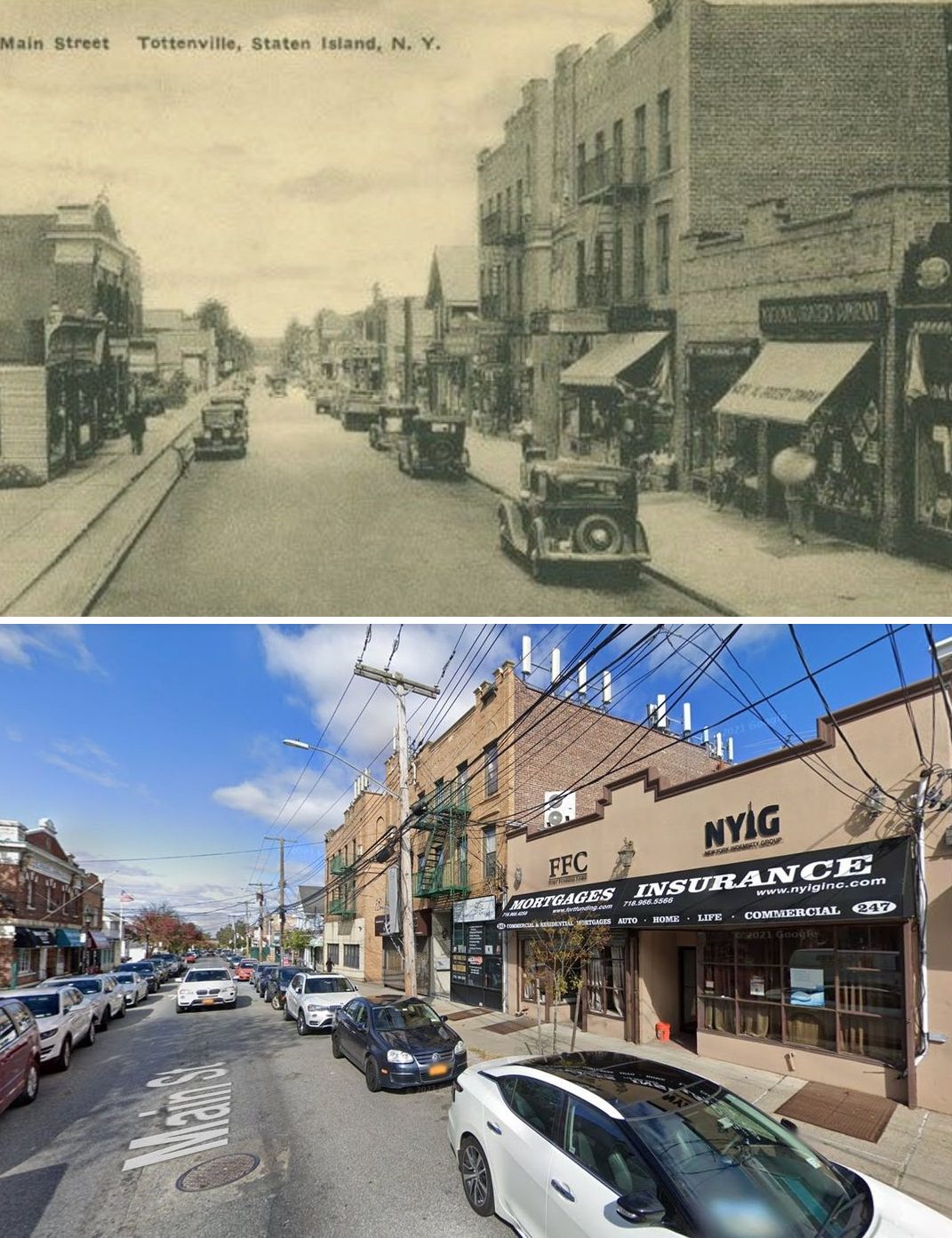
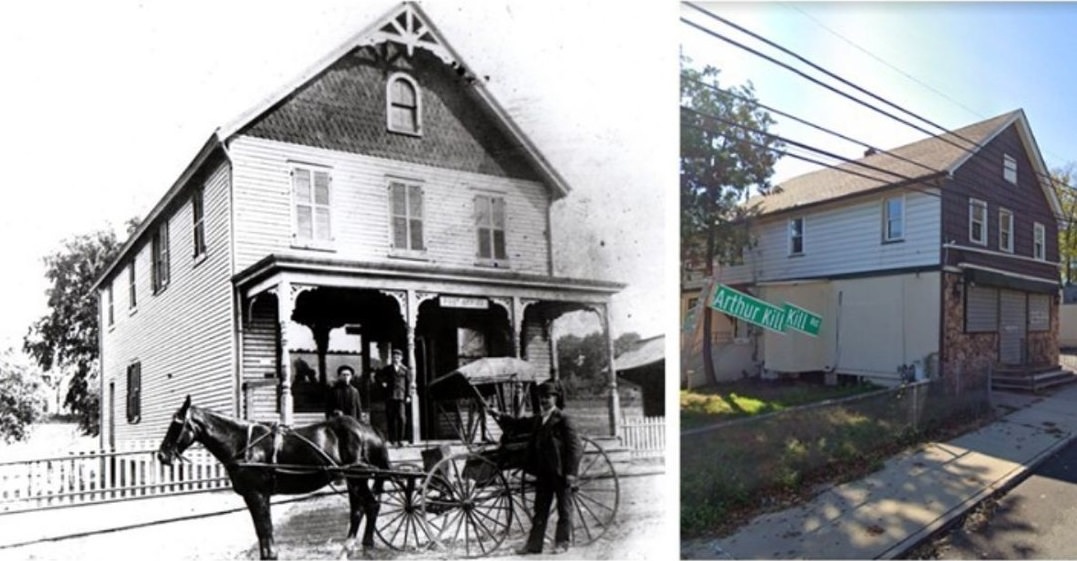
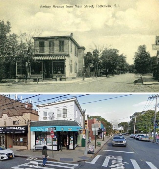
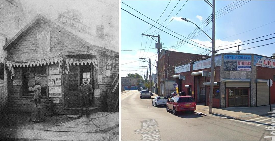
#13 Main Street, Tottenville: A view of the street, date unknown.
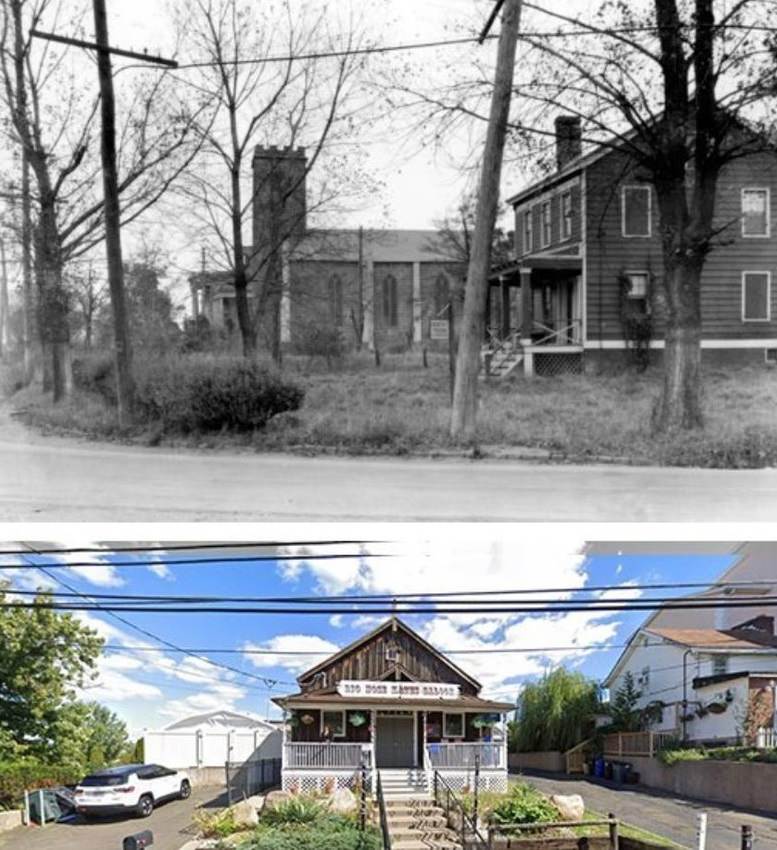
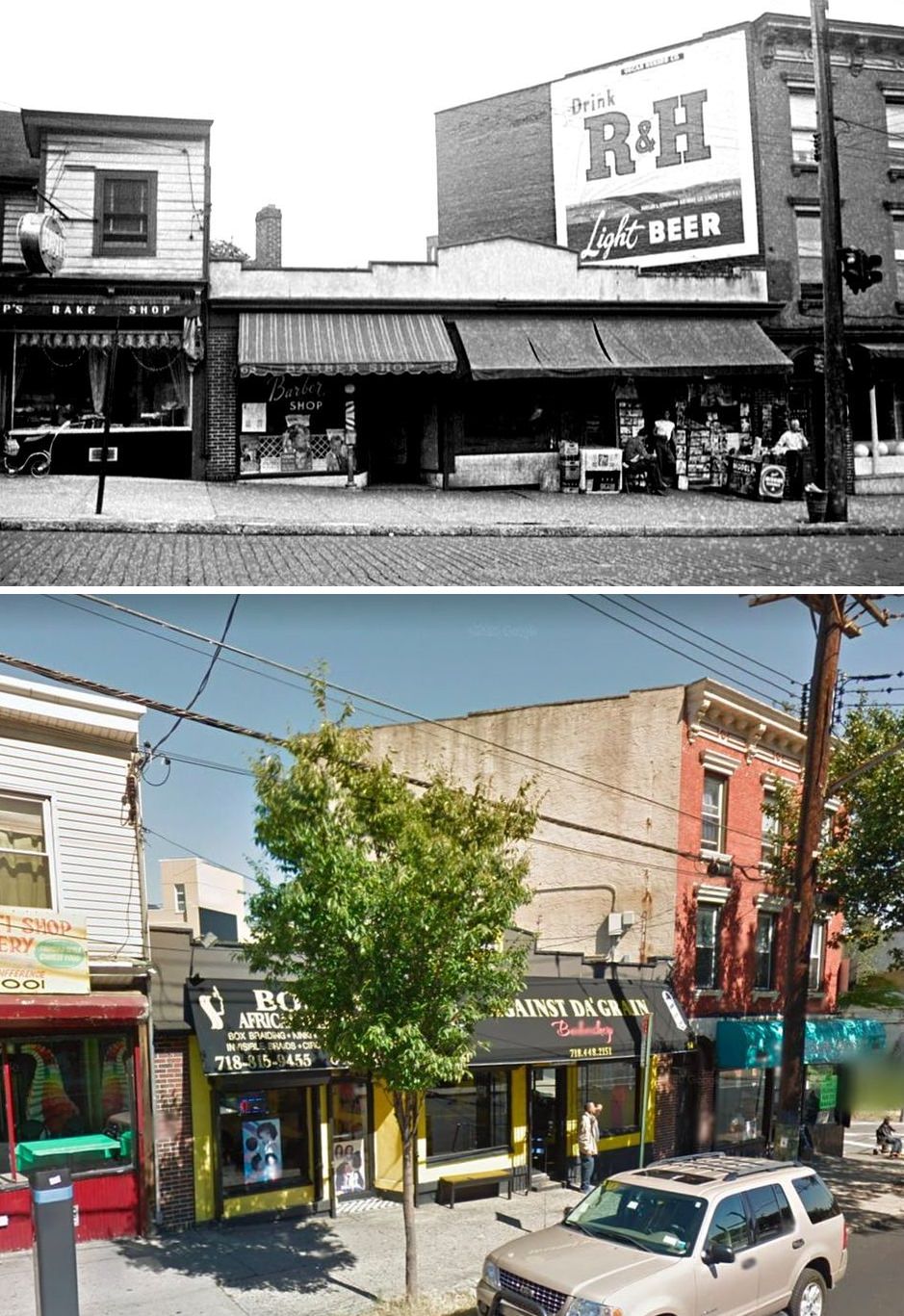
#14 St. Luke’s Church, circa 1930, now operates as Big Nose Kates.
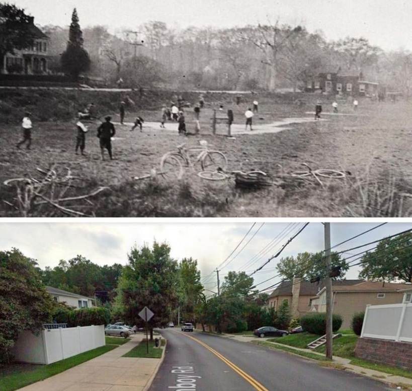
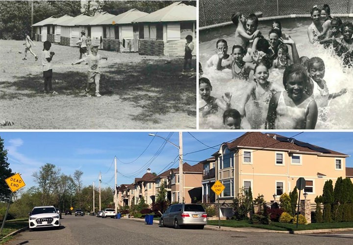
#15 Amboy Road, Annadale, where children are seen playing in a lot between Barclay and Arden Avenues around 1924.
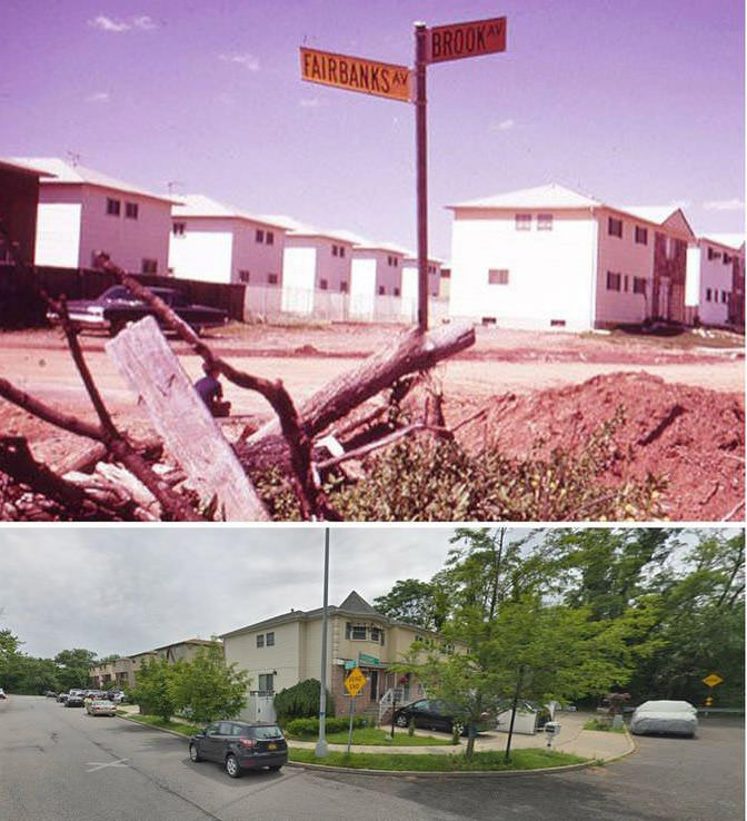
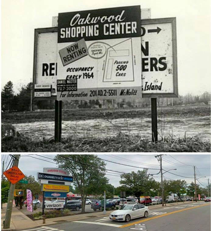
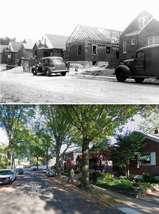
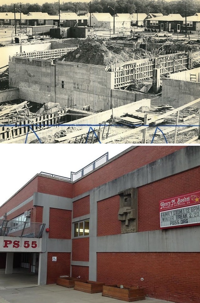
#16 Residential Construction in Oakwood, Yellow Street Signs, 1973.
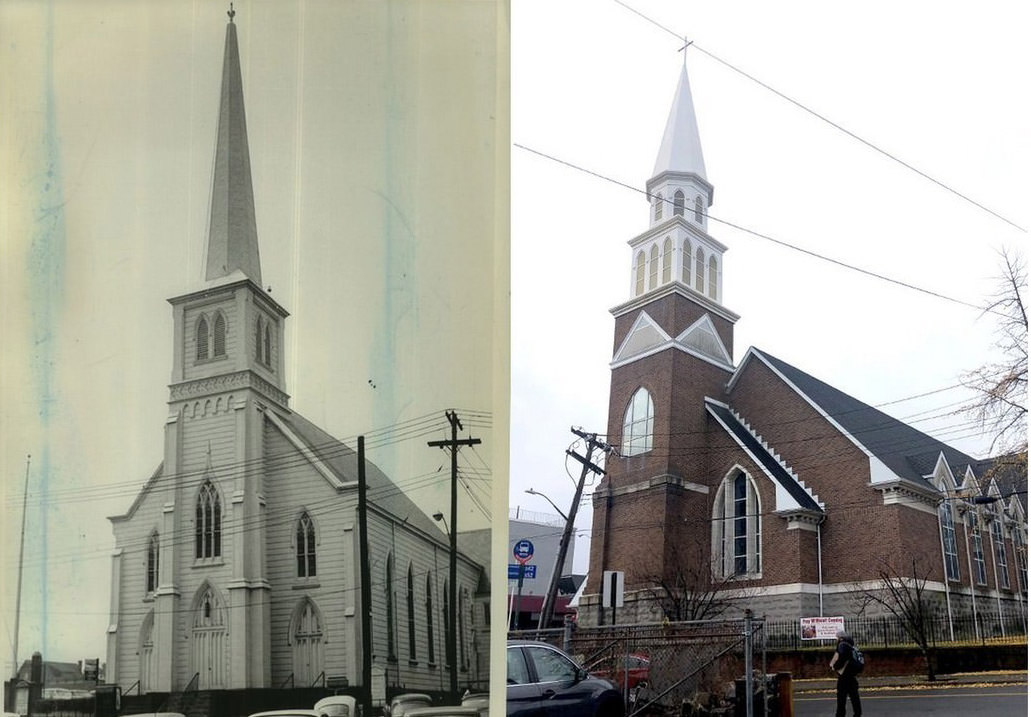
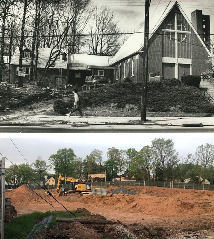
#17 Brighton Heights Reformed Church, St. George, rebuilt after accidental fire destroyed the original building, 1996.
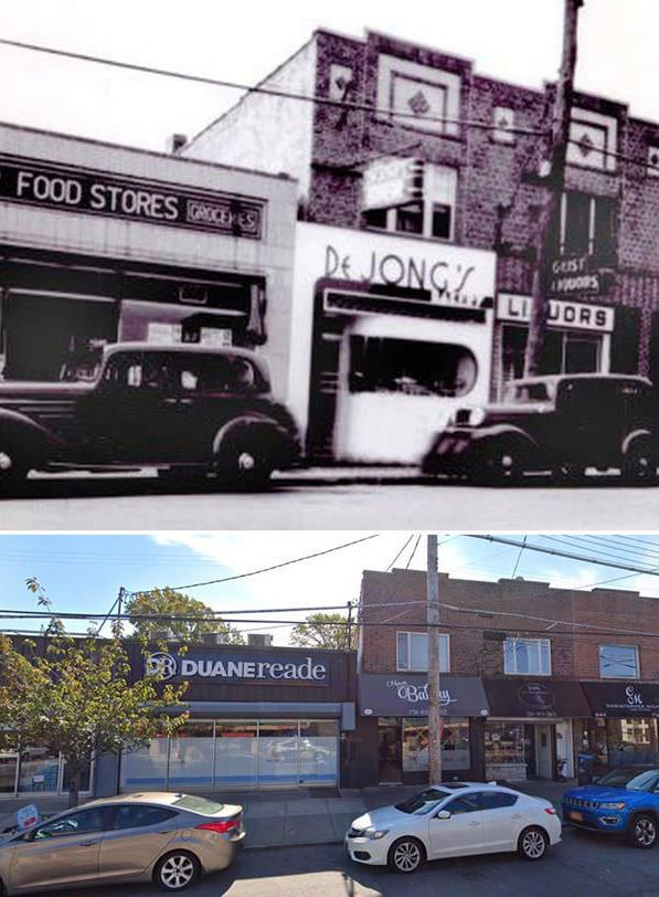
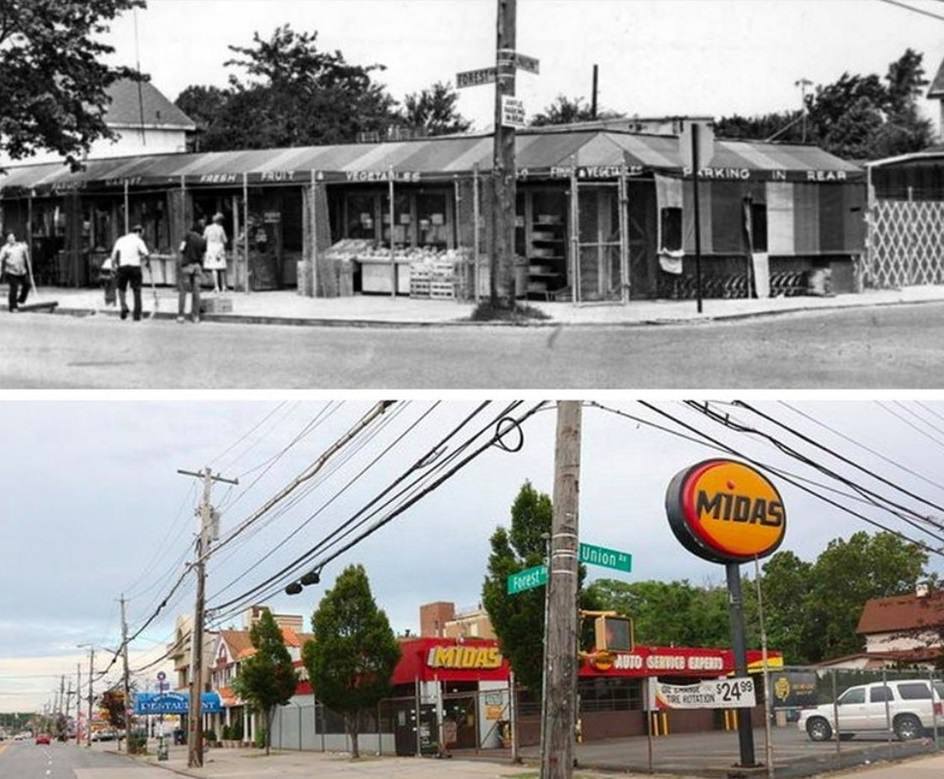
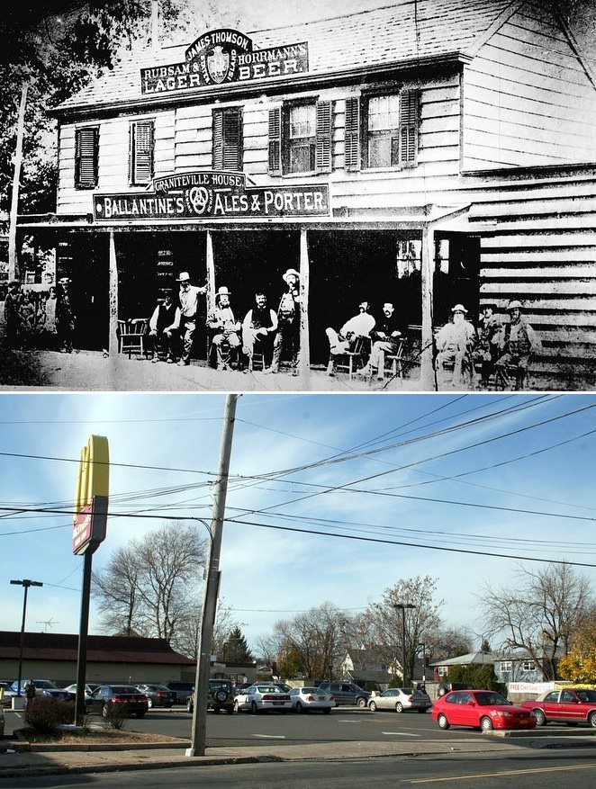
#18 Forest Avenue Featuring A&P Grocery Store, DeJong’s Bakery, and Joe Geist’s Liquors, Circa 1940.
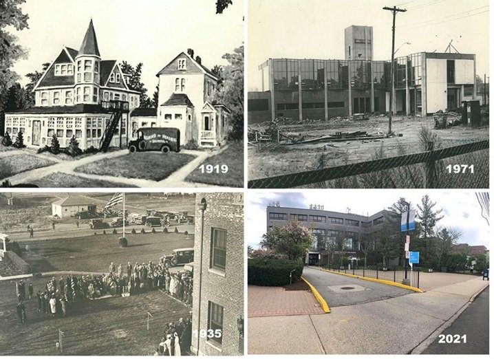
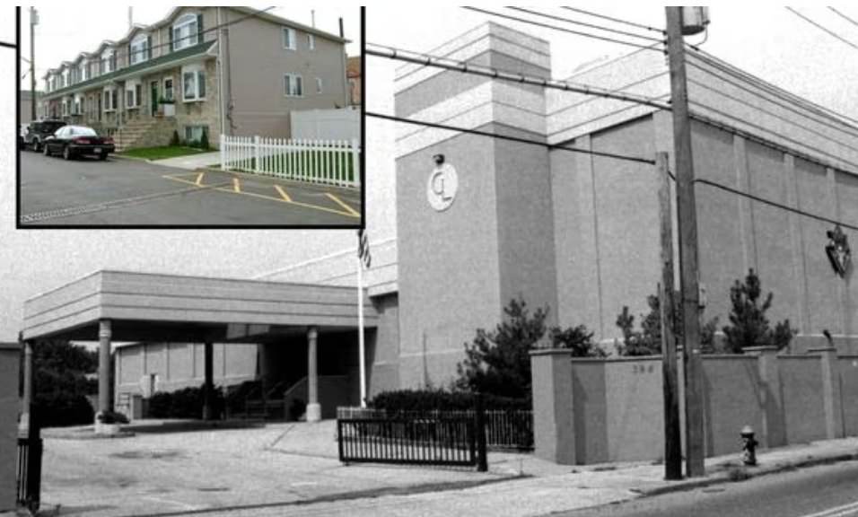
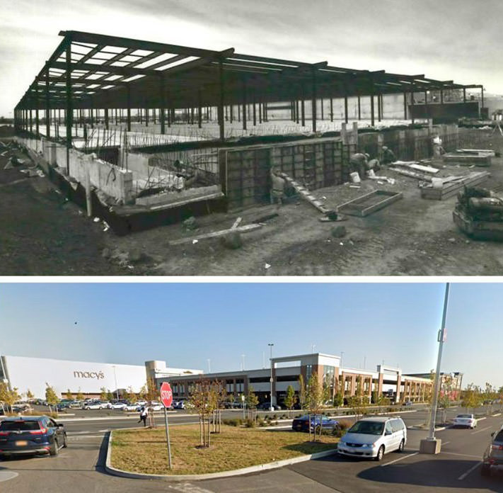
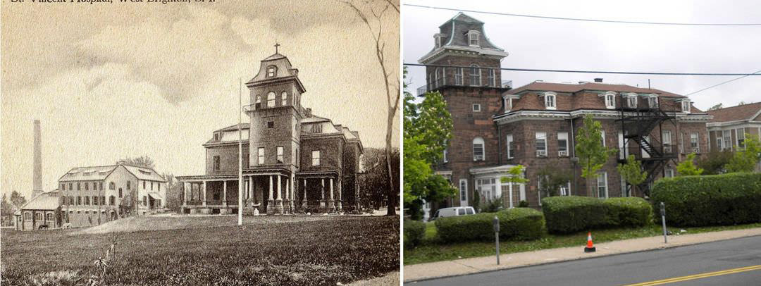
#19 Staten Island University Hospital/ Northwell Health, south campus.Then and Now
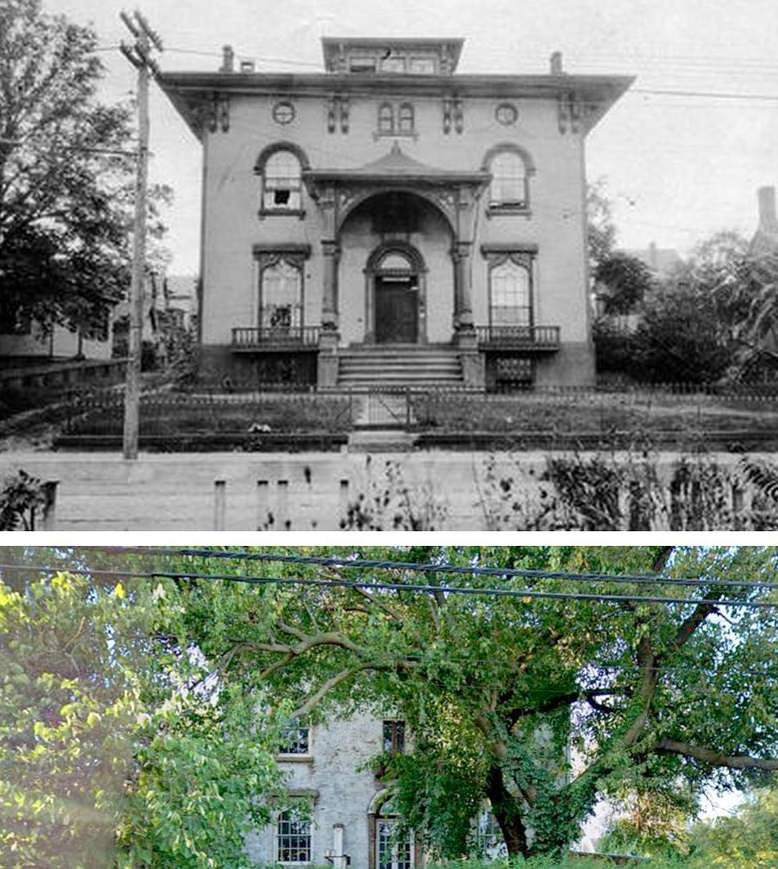
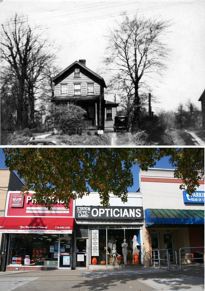
#20 This home at 3525 Victory Blvd.
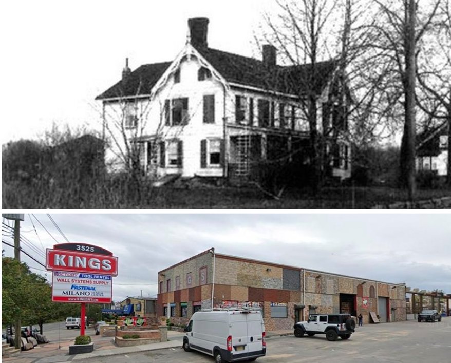
It was where Ichabod Crane a career military officer for 48 years and the probable namesake of the protagonist in Washington Irving's "The Legend of Sleepy Hollow" lived. Crane died on Staten Island in 1857. His family lived here from 1854 to the late 1800s in a house located on Richmond Turnpike, now known as Victory Boulevard. The house at 3525 Victory Blvd. was demolished in March 1989 when preservationists were unable to raise the money to move it to the Historic Richmond Town. Commercial buildings now occupy the site
![Hunter'S Tavern, 1297 Huguenot Avenue, Huguenot Park, Staten Island, N.y. [Dining Area With Hearth And Dance Floor], Now Is A Residential Home.](https://seeoldnyc.com/wp-content/uploads/2023/09/Staten_Island_2657.jpg)
GIPHY App Key not set. Please check settings