in

The Lost World of Staten Island in the 1970s: A Cautionary Tale of Pollution and Progress

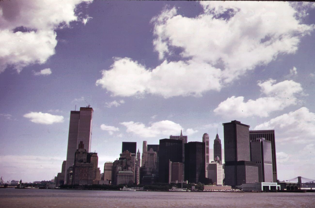
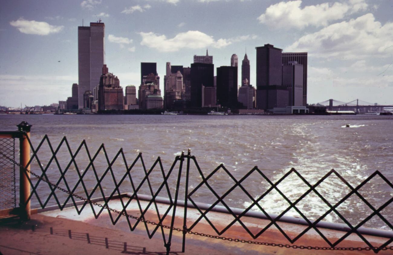
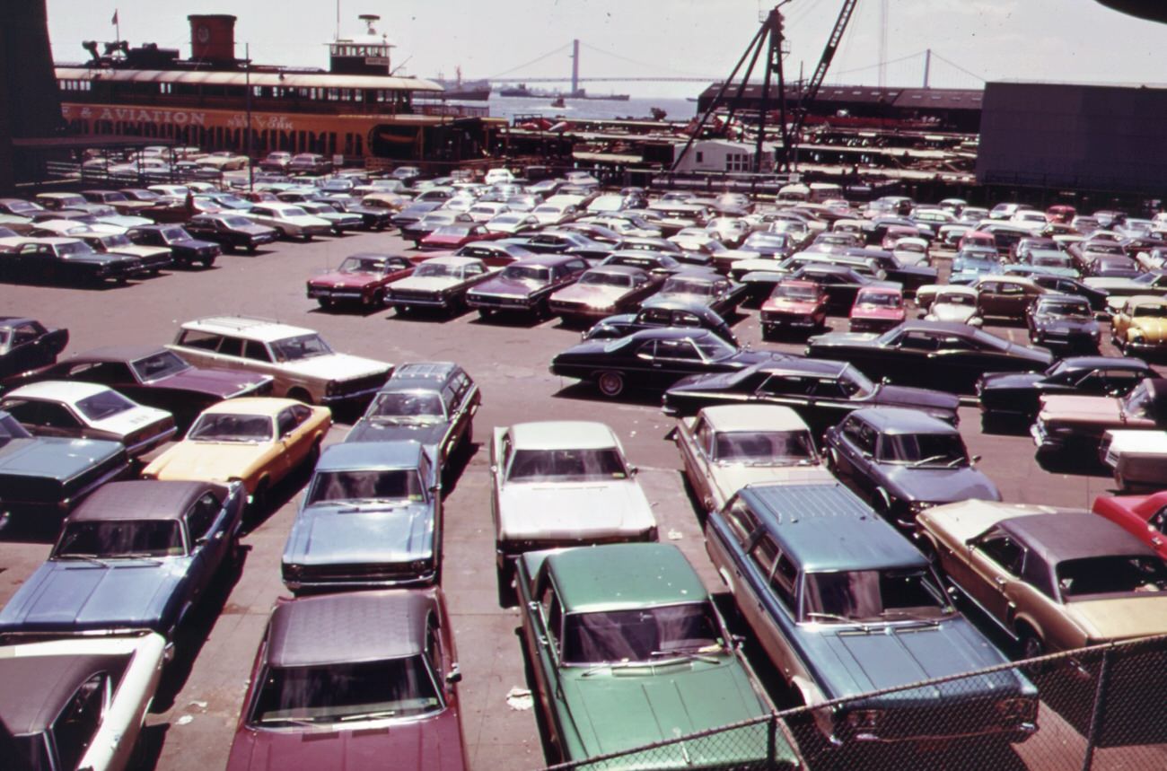
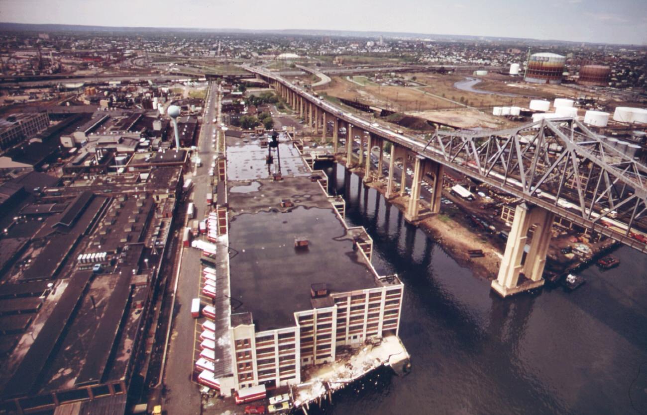
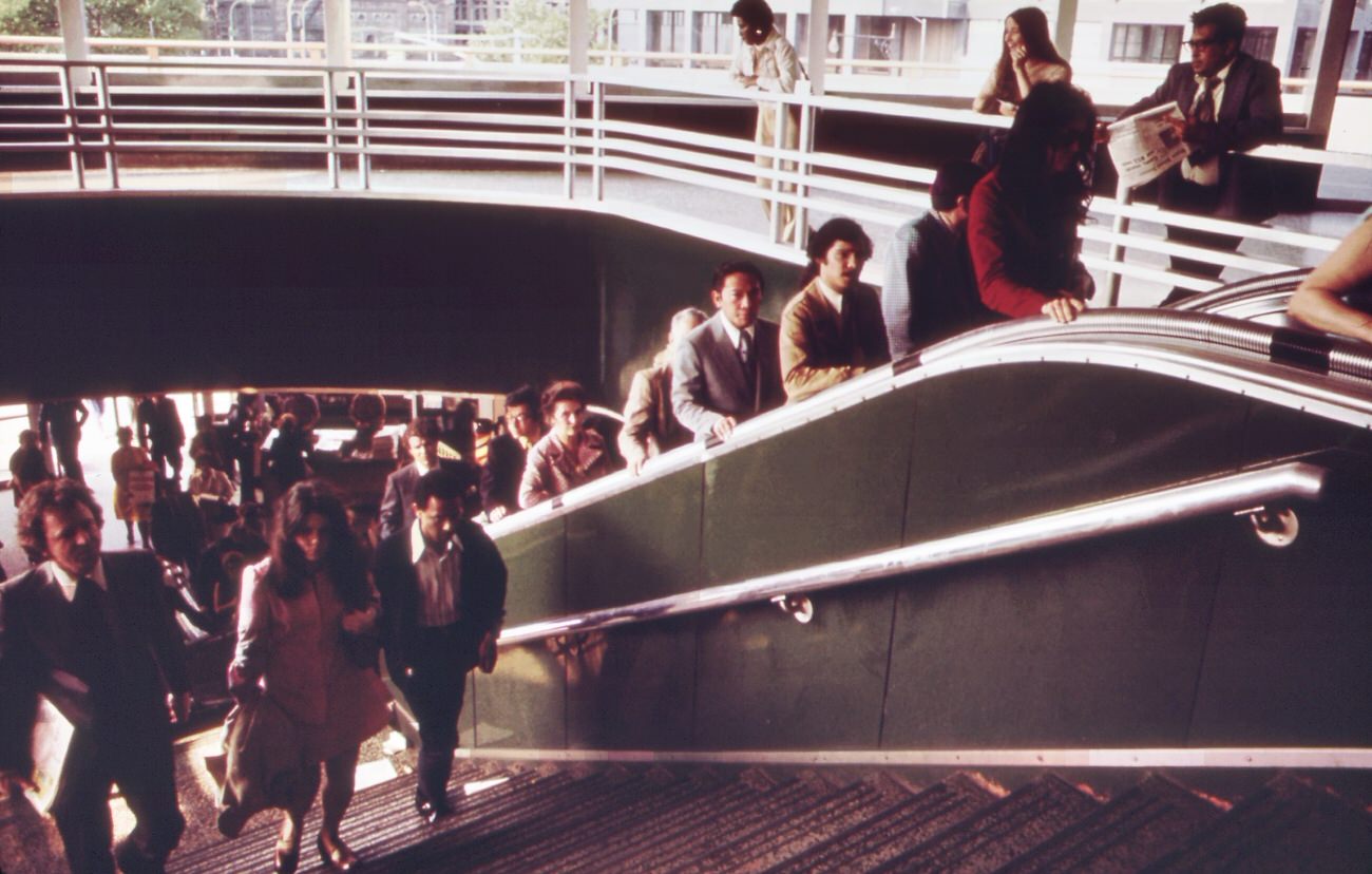
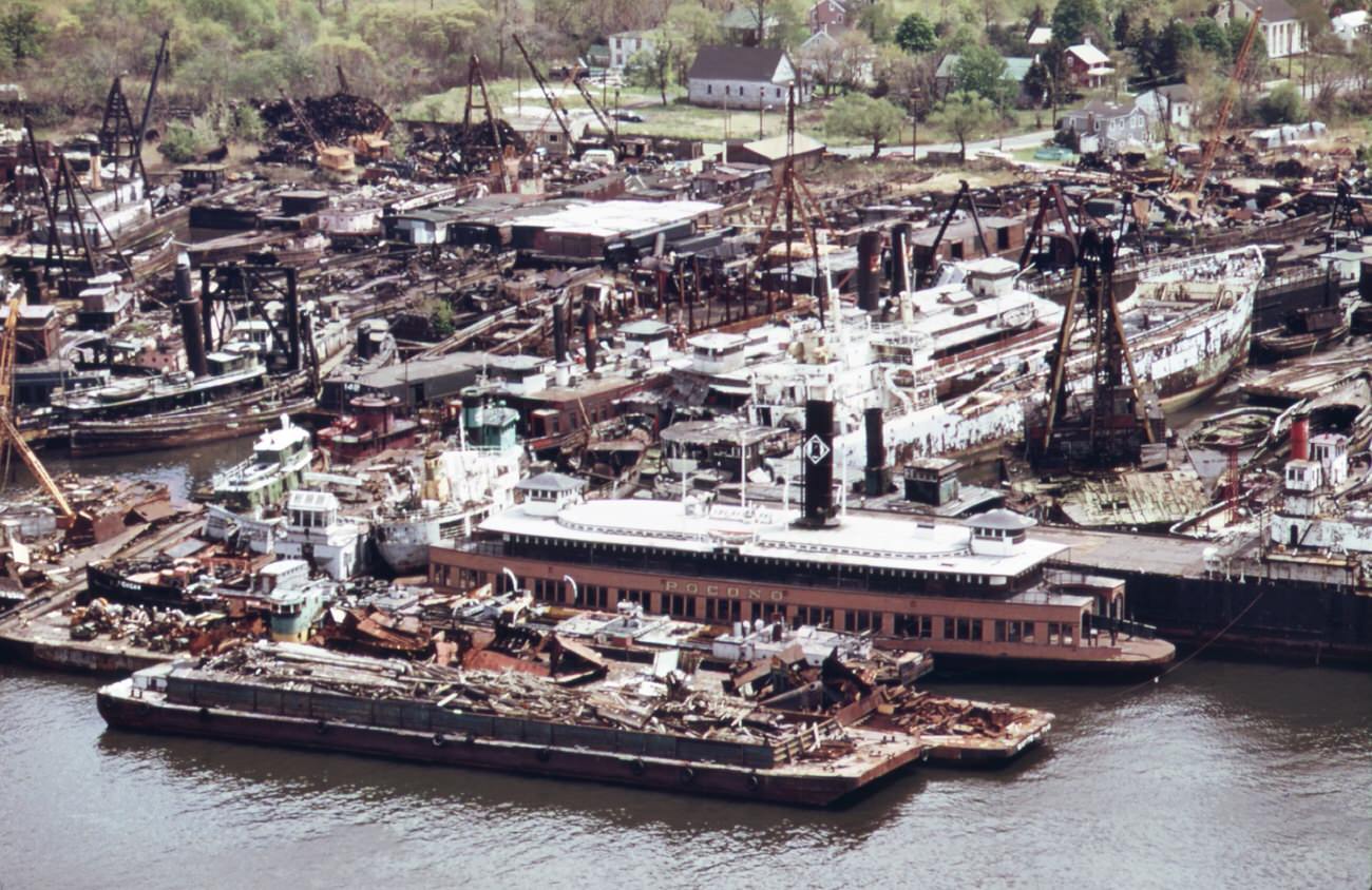
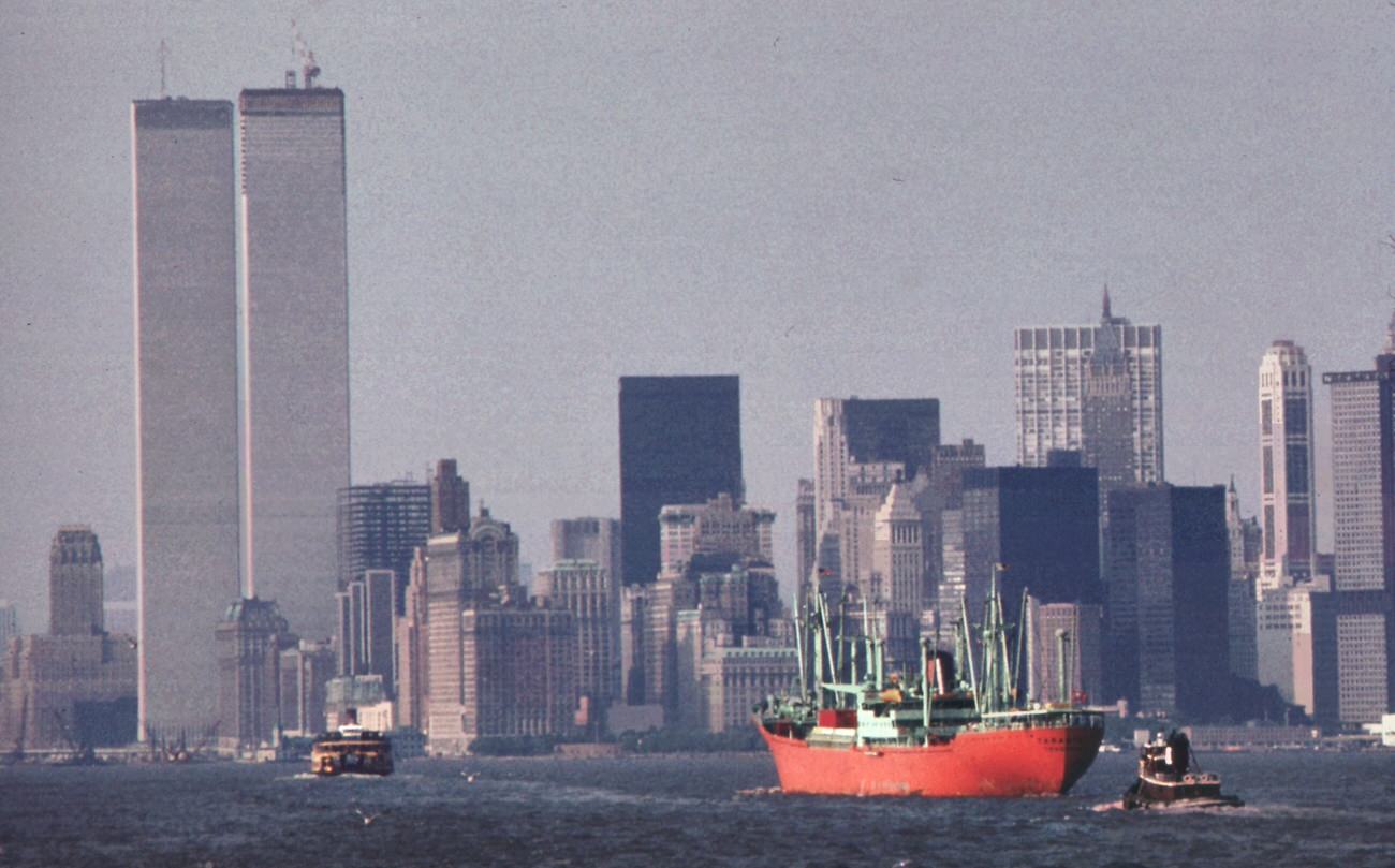
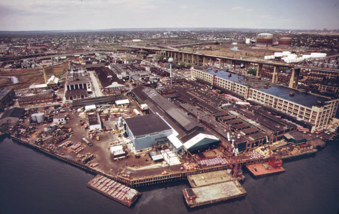
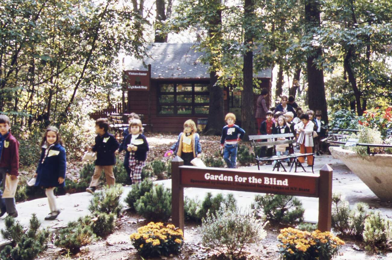
In the 1970s, Staten Island was a bustling New York City borough, home to a growing population and numerous industrial facilities. But with this growth came significant environmental challenges documented by the DOCUMERICA project during this time.

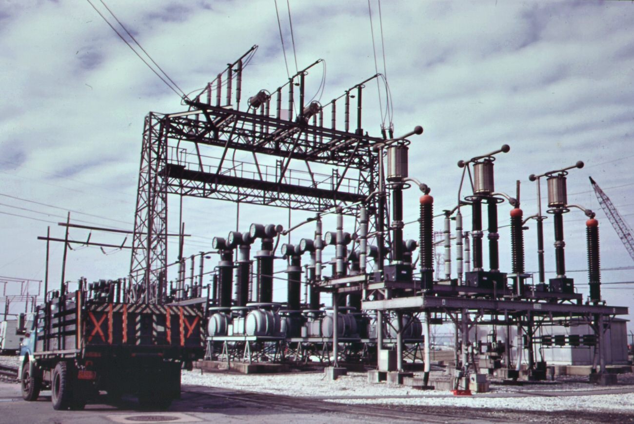
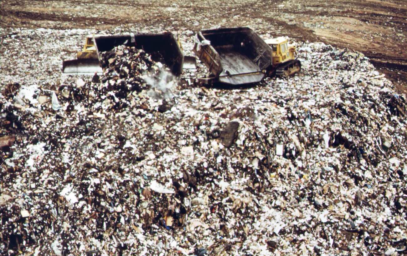
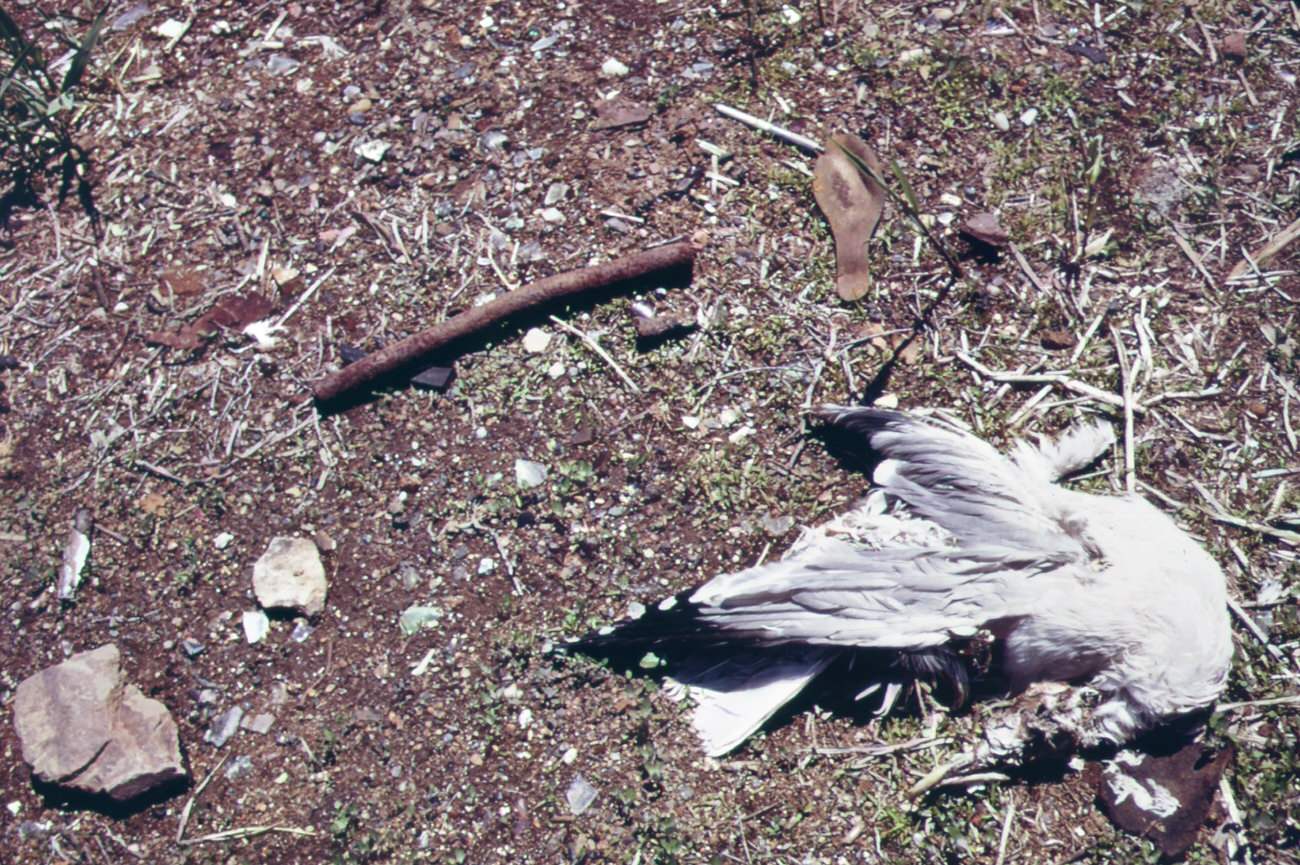
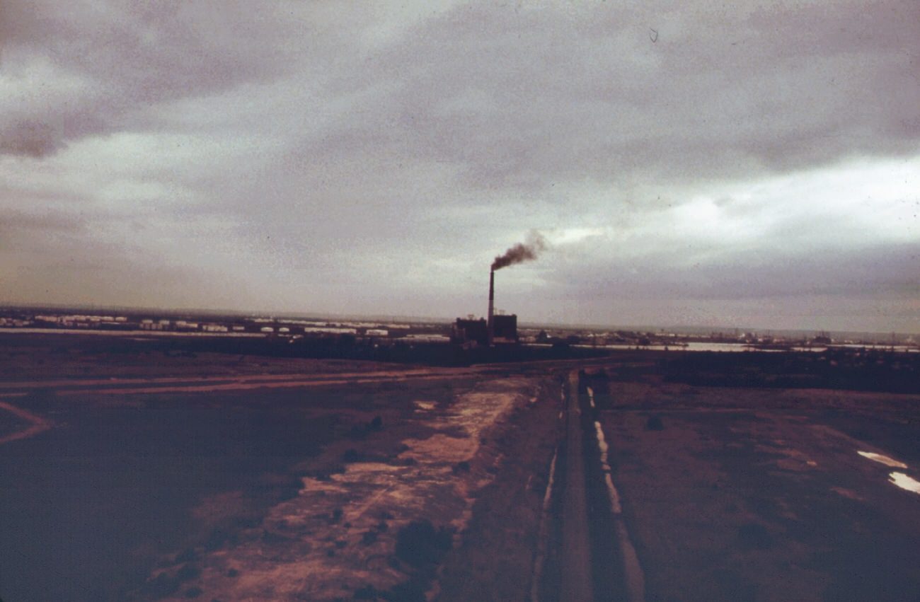
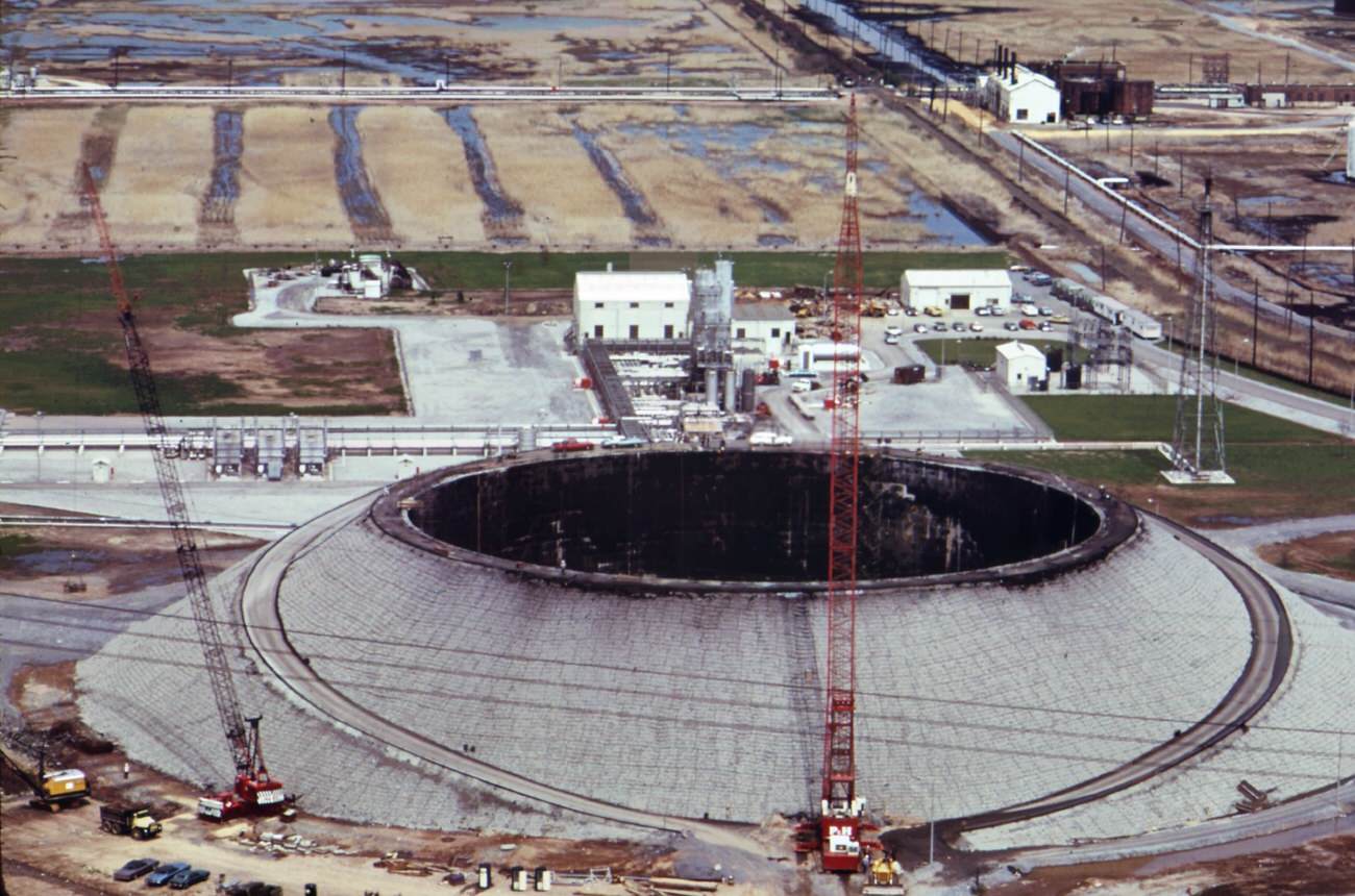
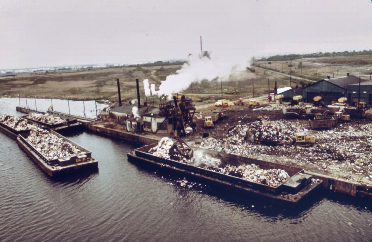
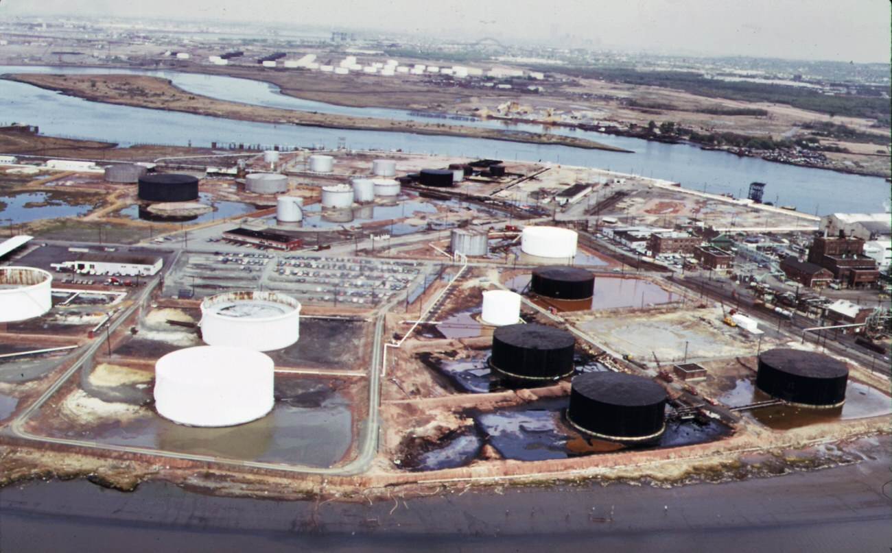
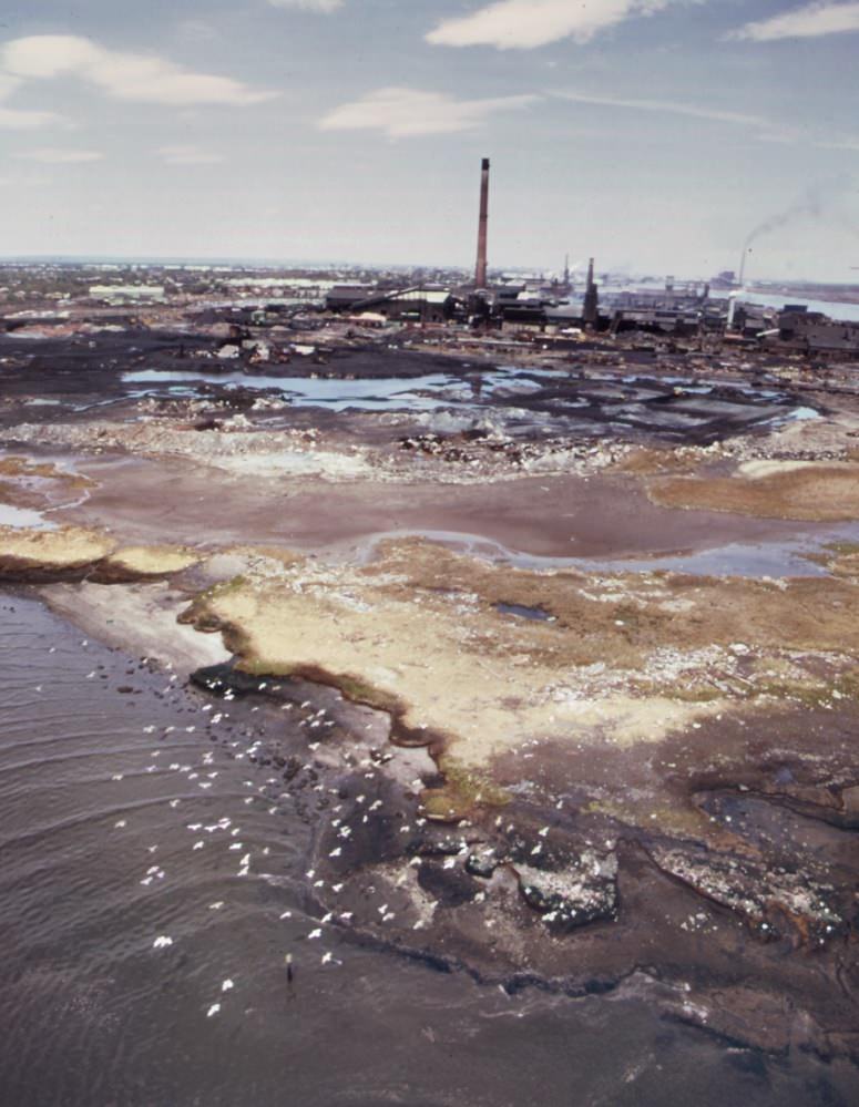
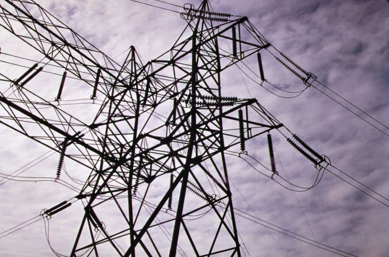
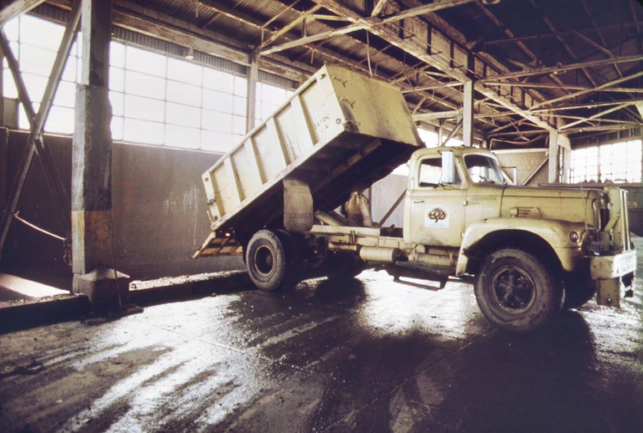
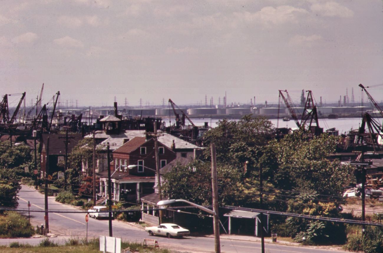
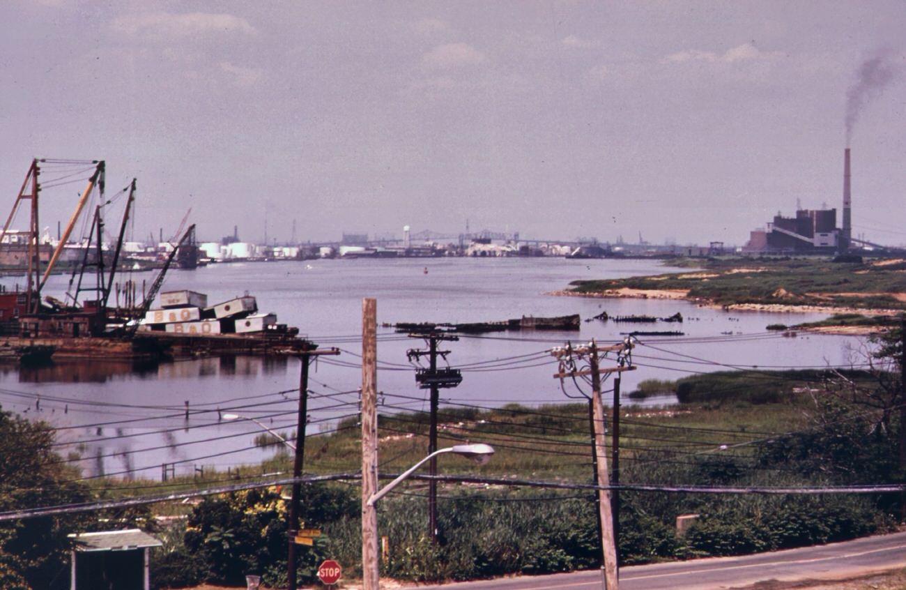
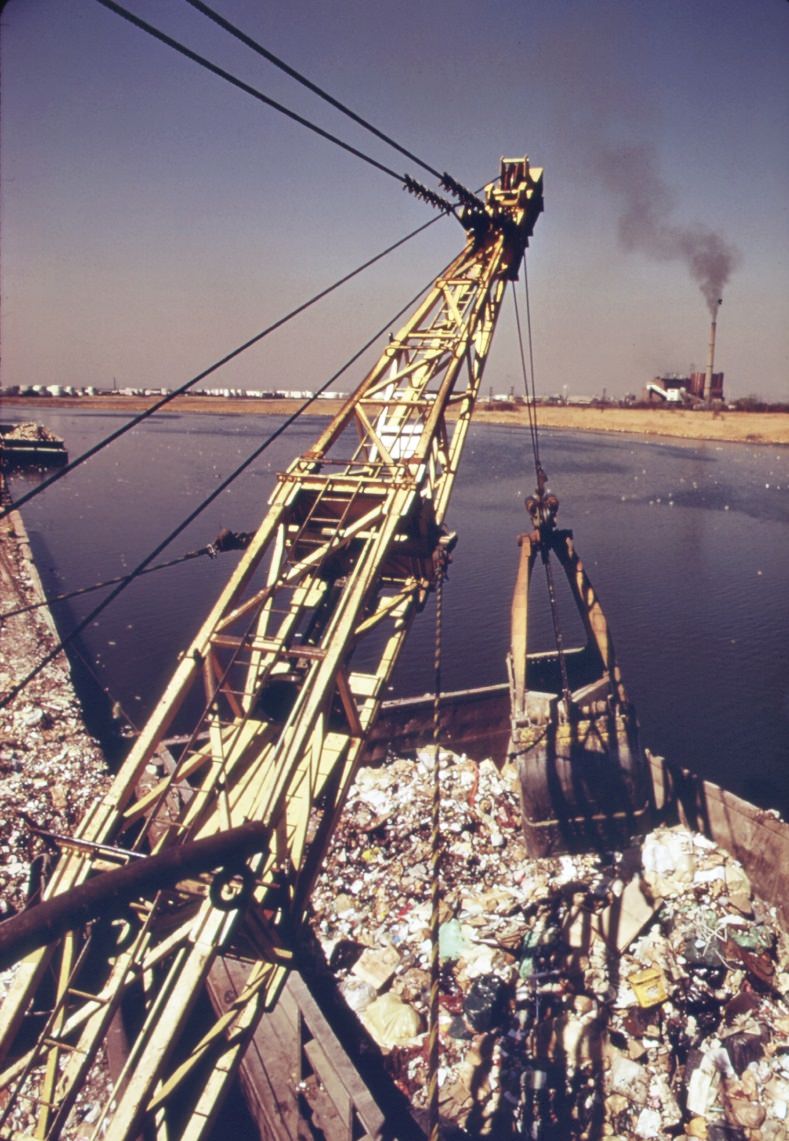
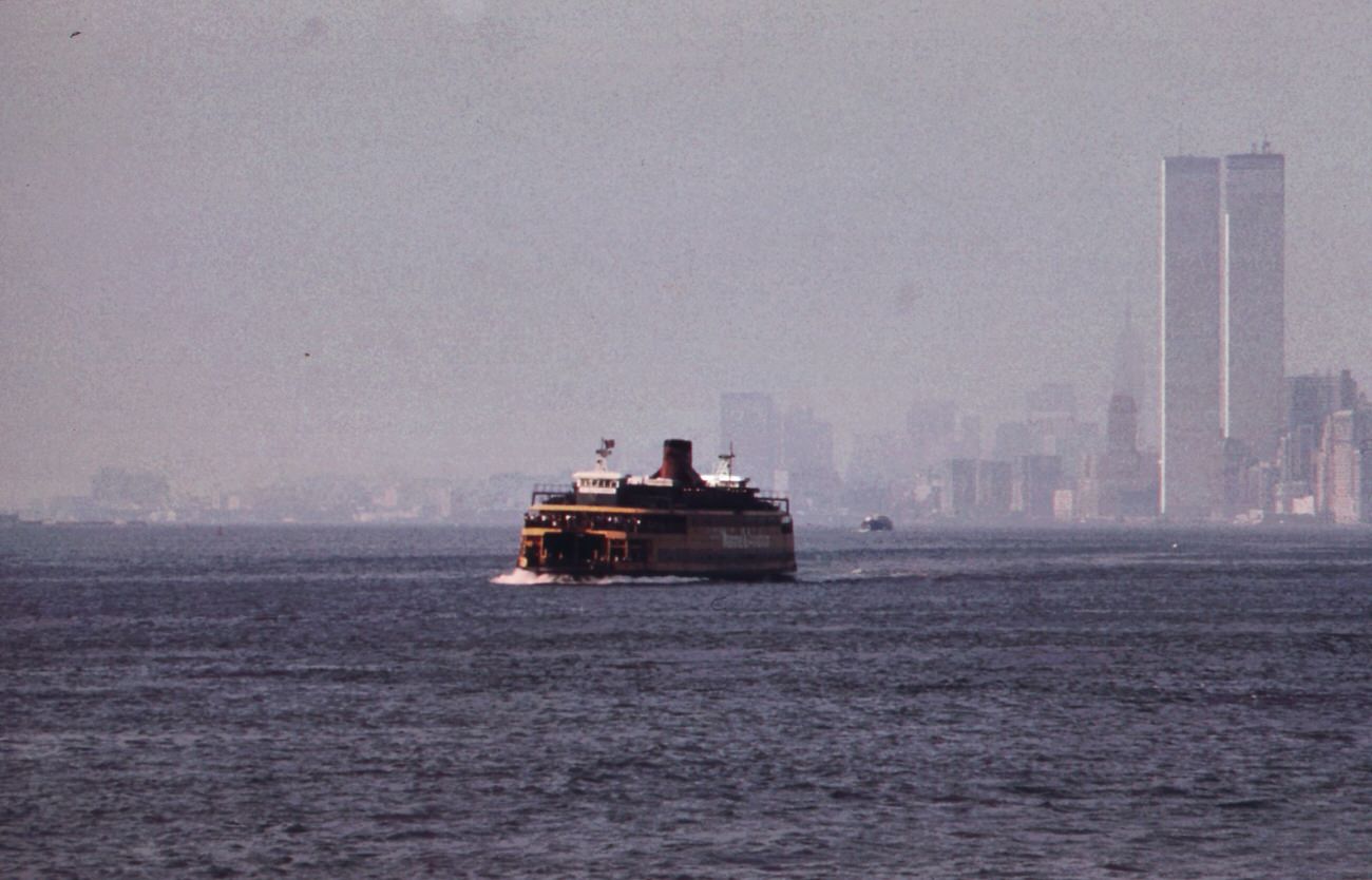
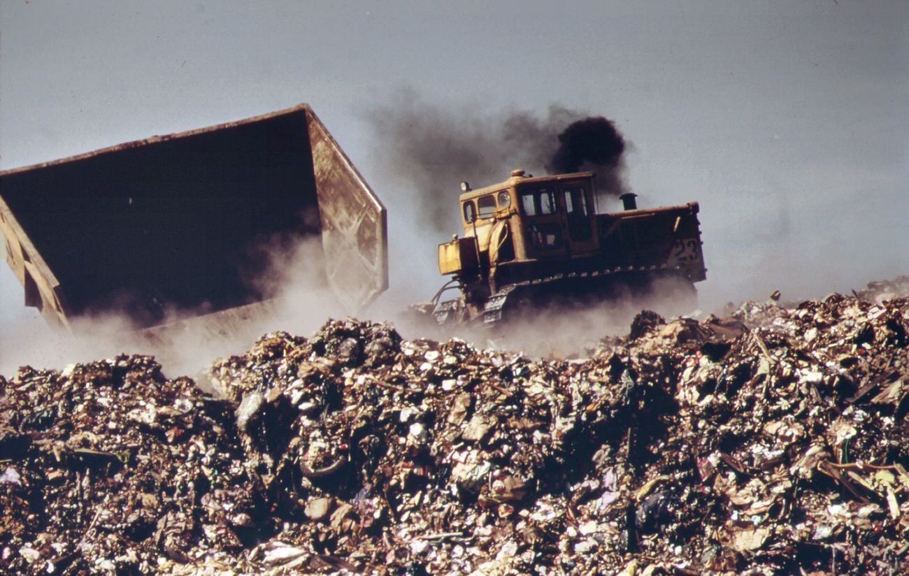
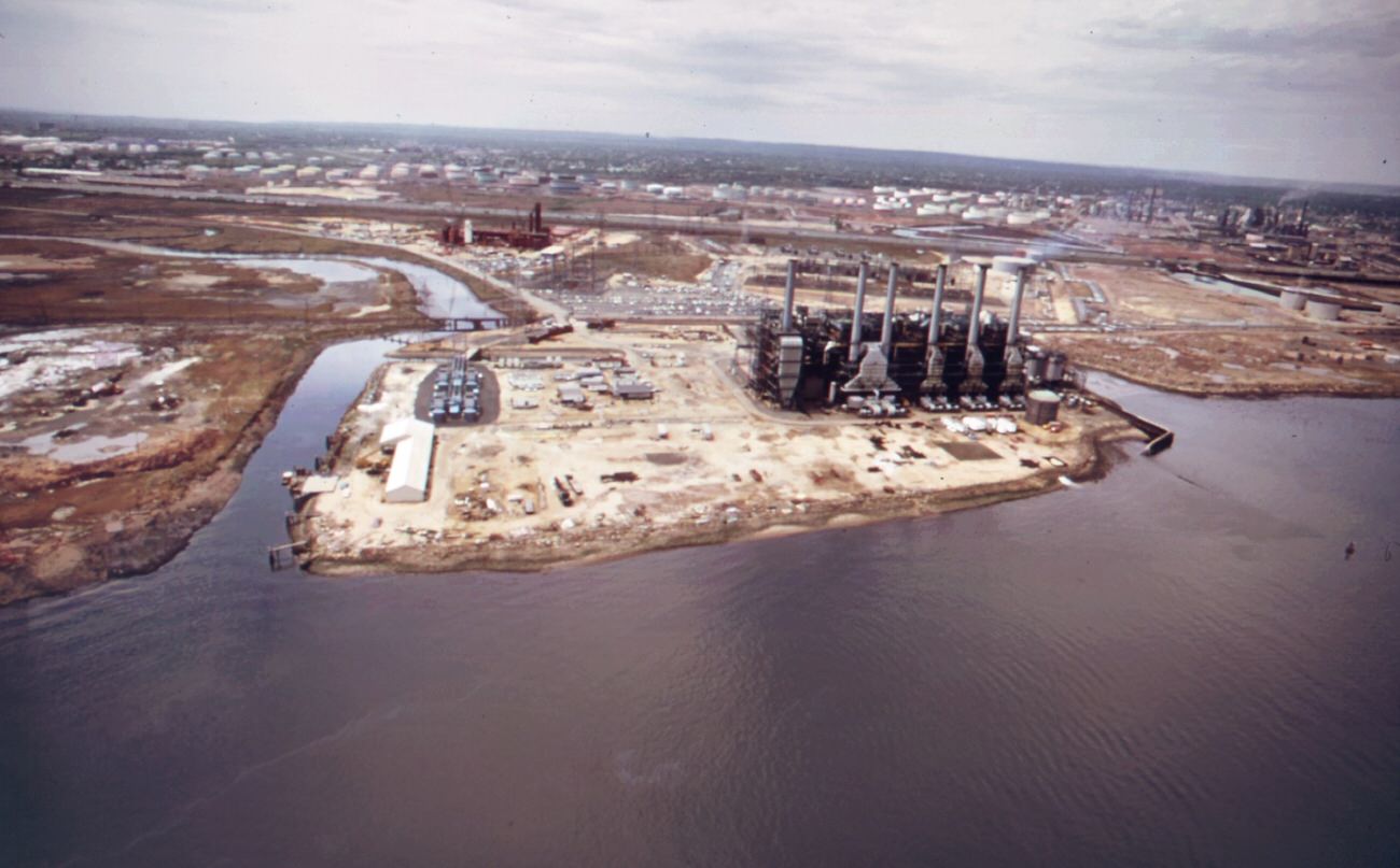
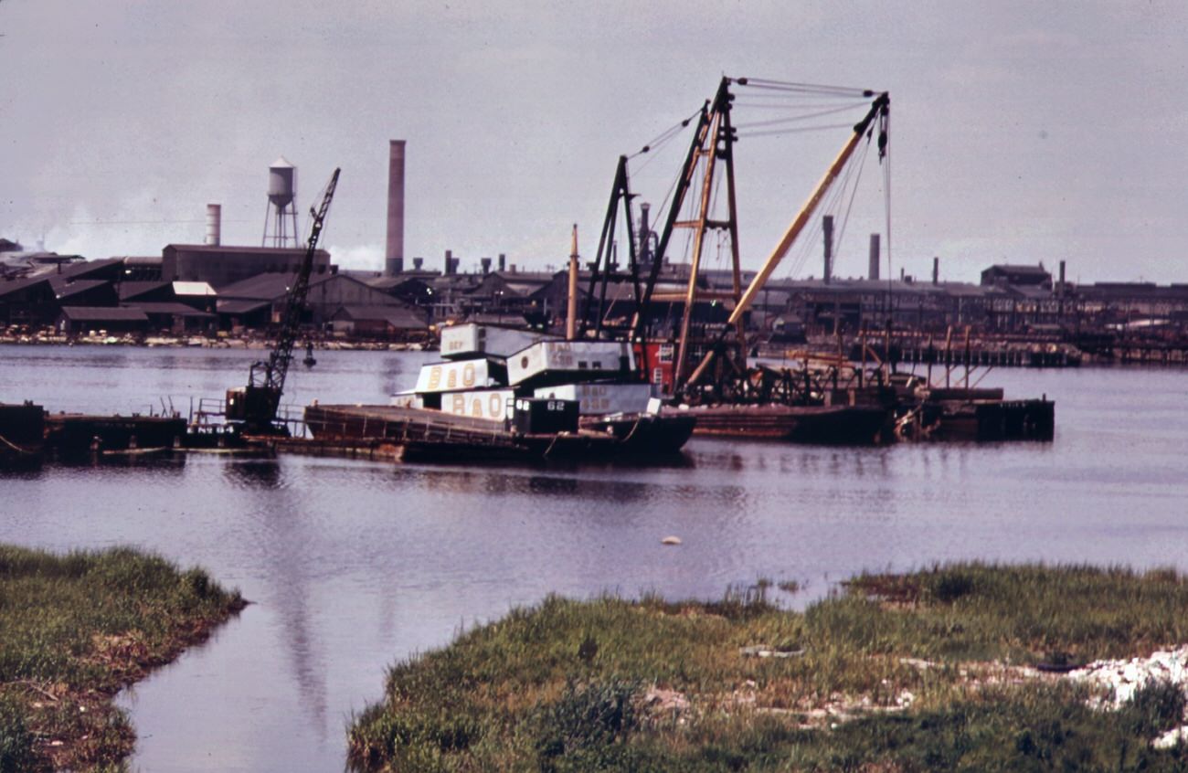
One of the most pressing concerns was air pollution. The borough was home to a large number of manufacturing plants and power stations, which emitted high levels of particulate matter and other pollutants into the air. As a result, the air quality in Staten Island was often poor, with smog and haze frequently visible in the sky. This pollution not only affected the health of local residents but also contributed to the degradation of natural ecosystems and wildlife habitats in the area.

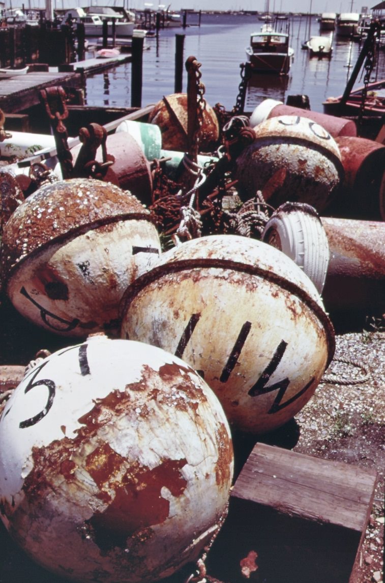
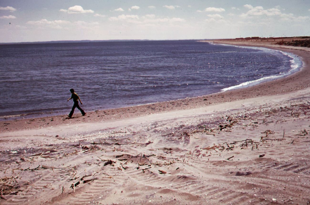
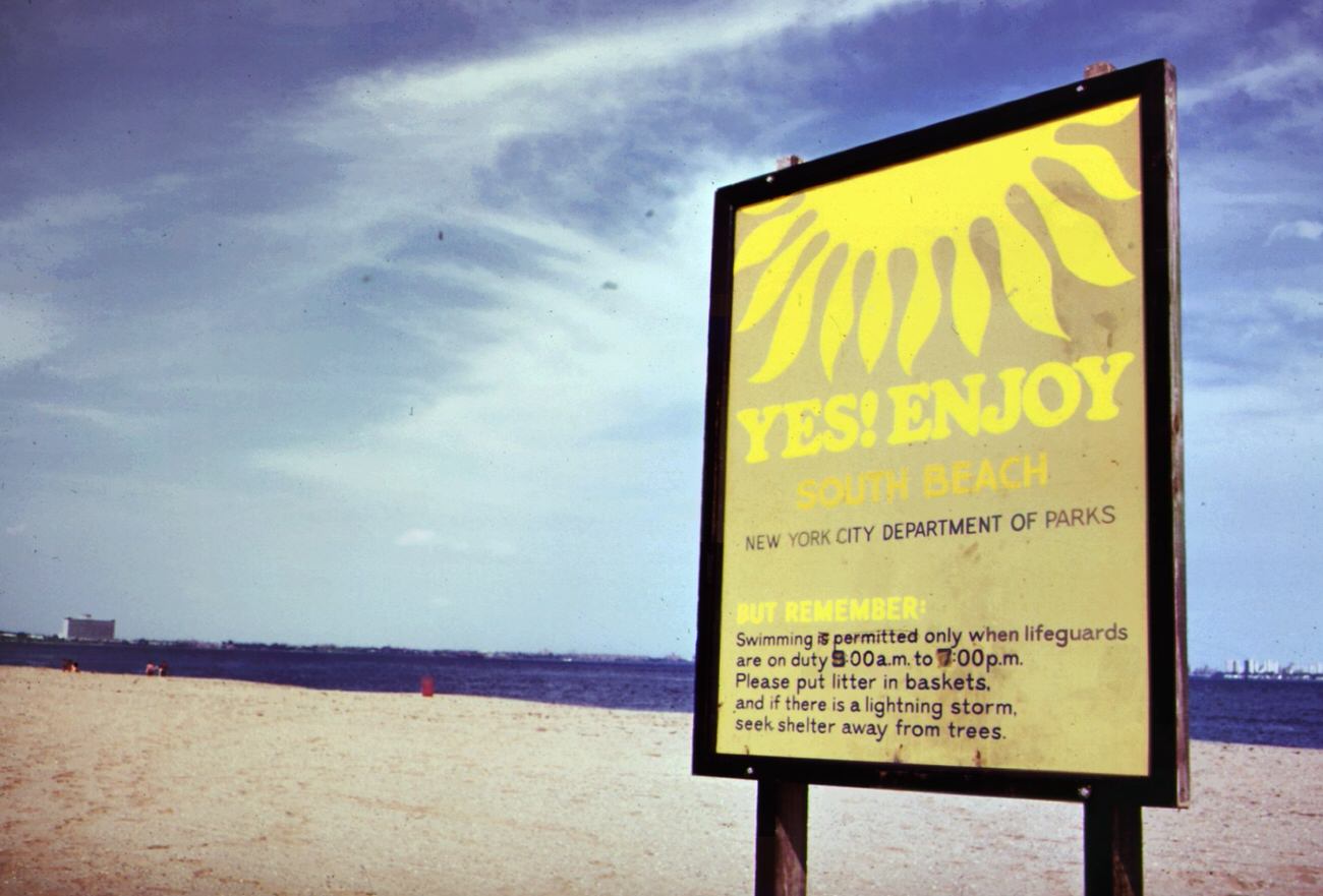
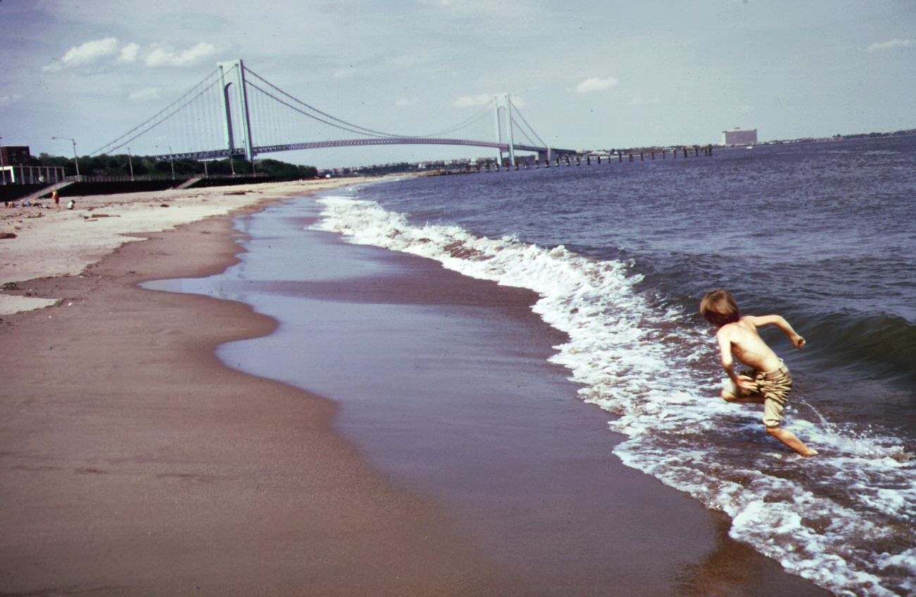
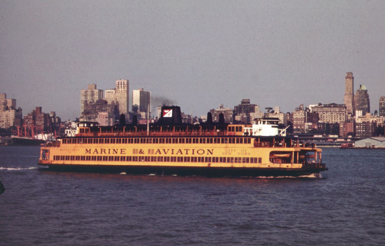
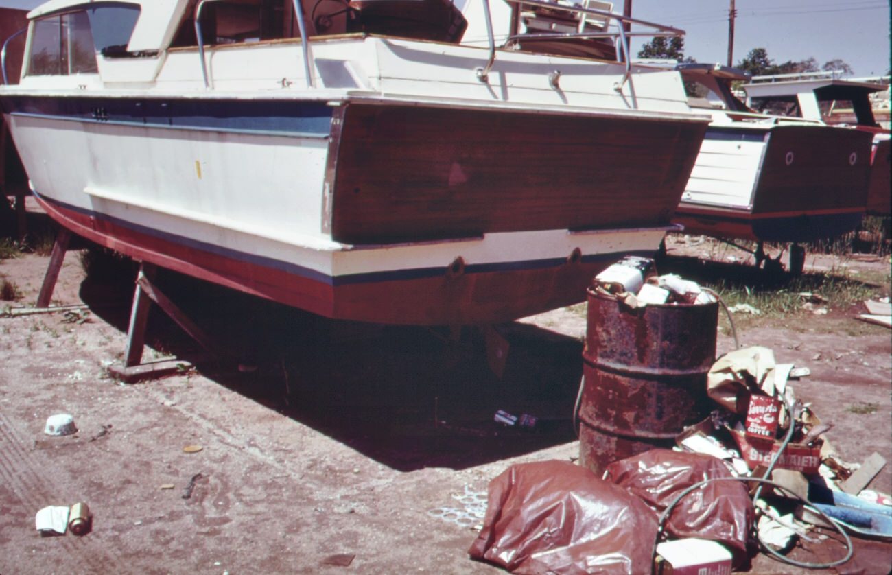
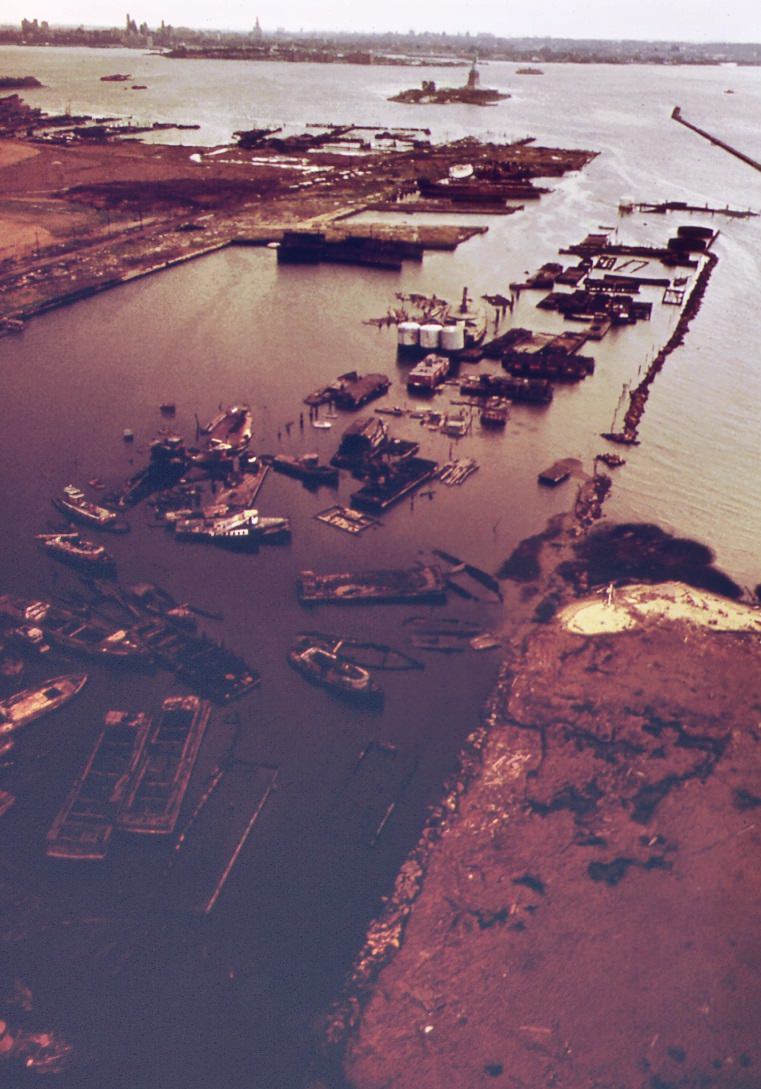
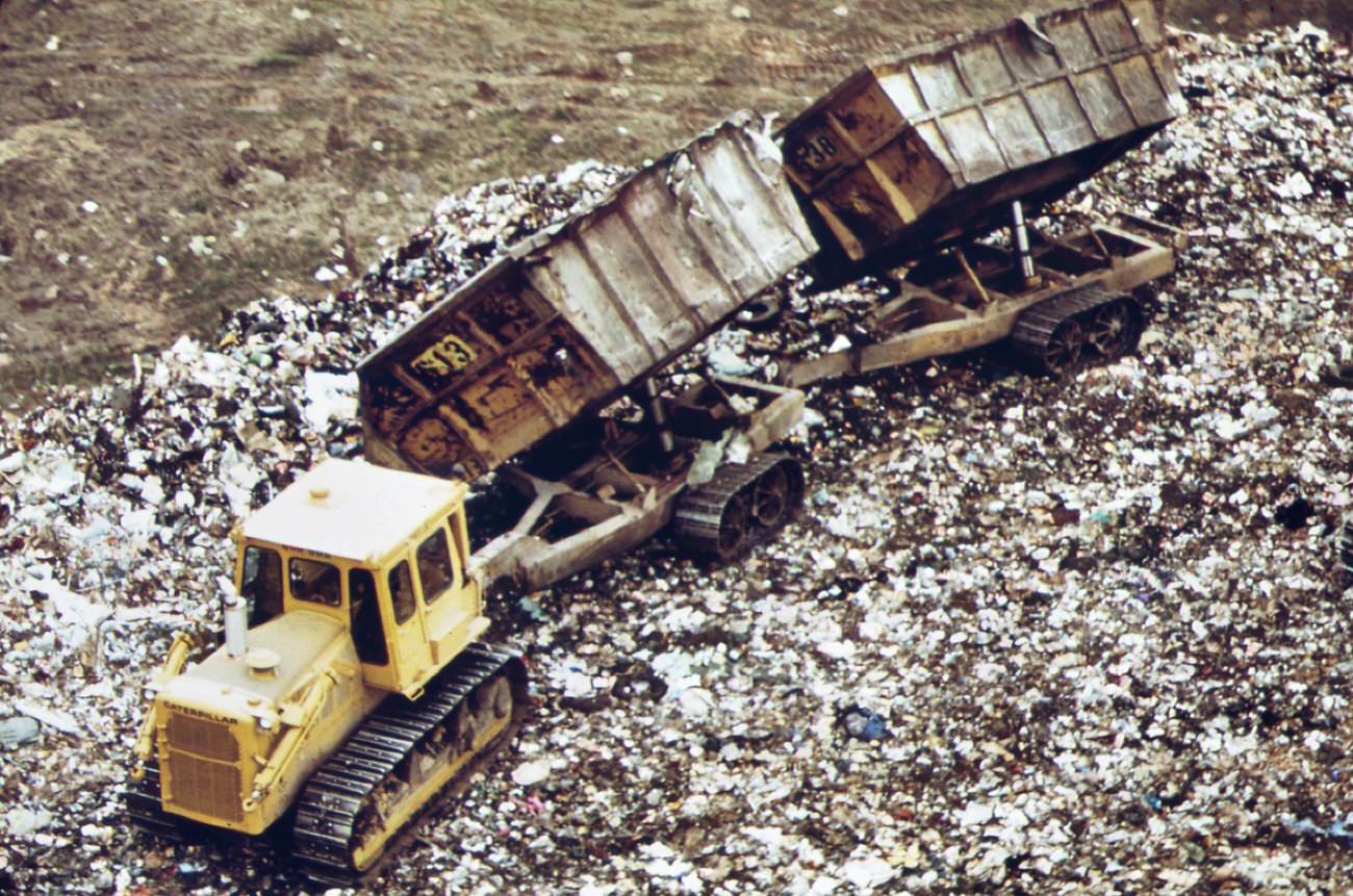
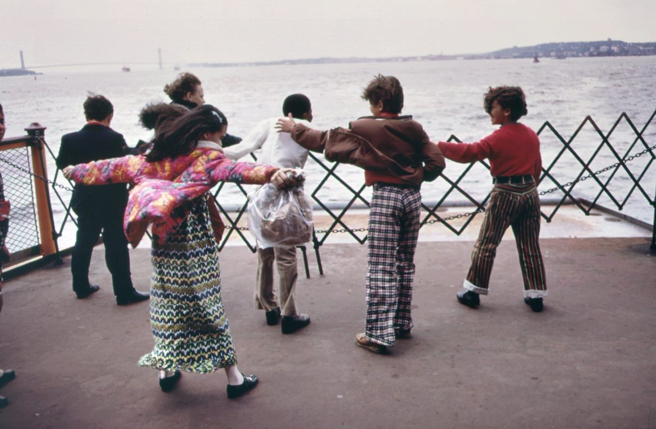
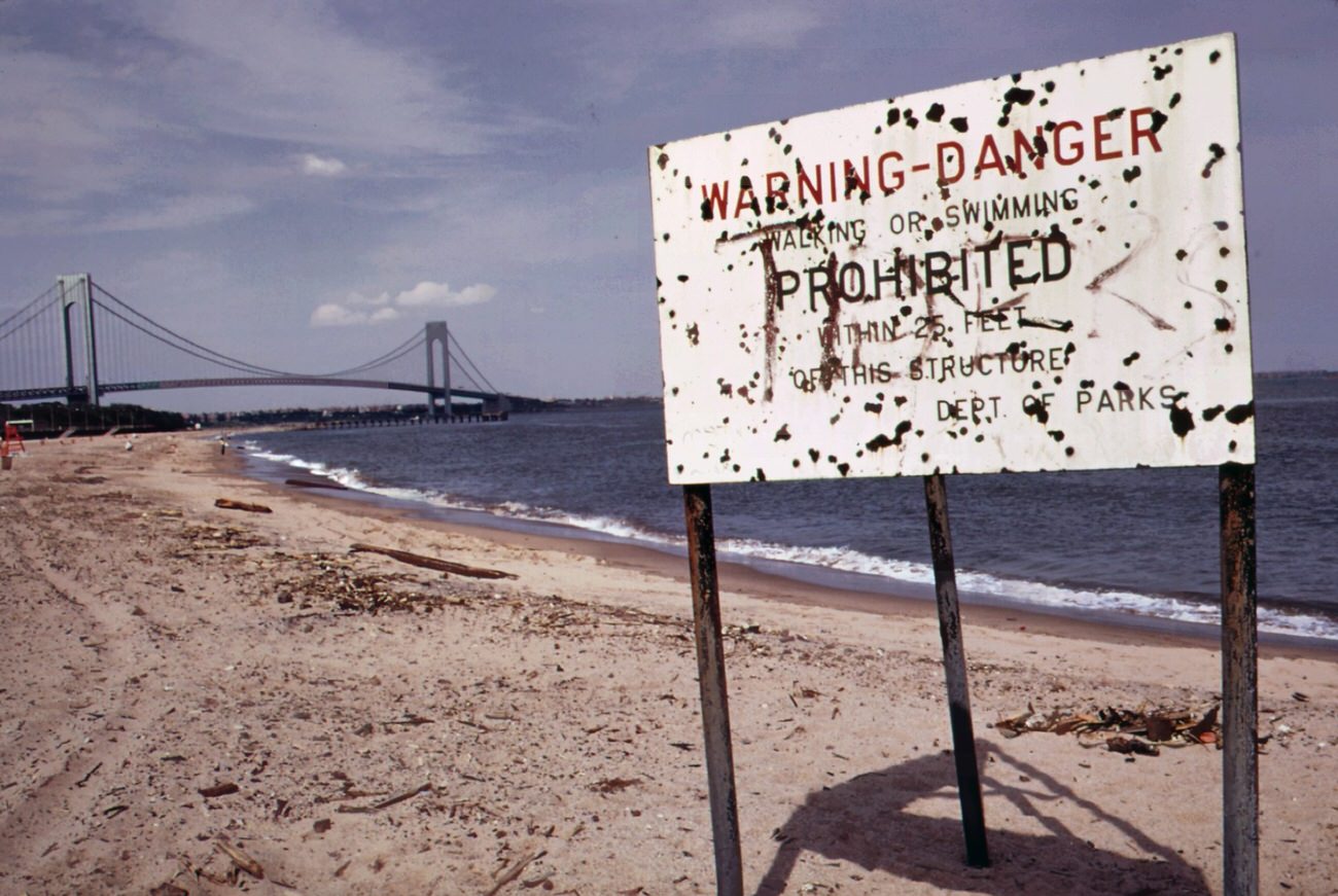
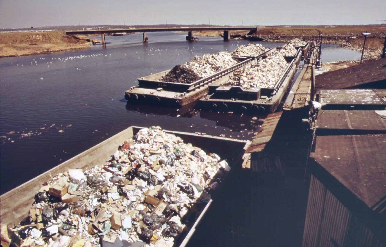
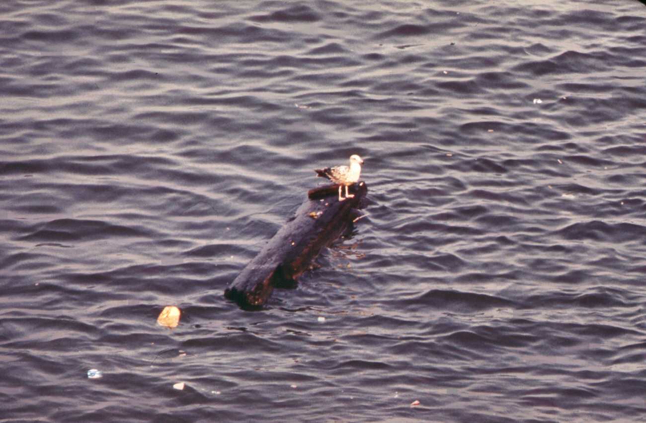
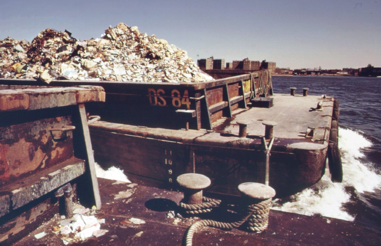
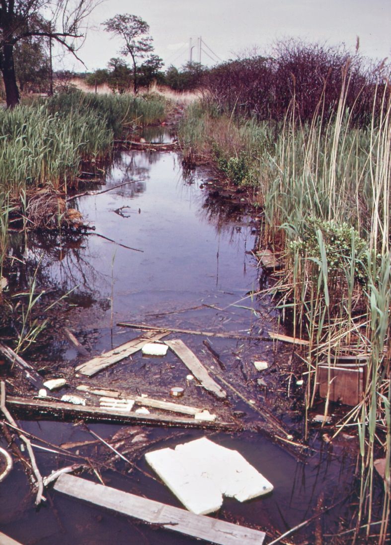
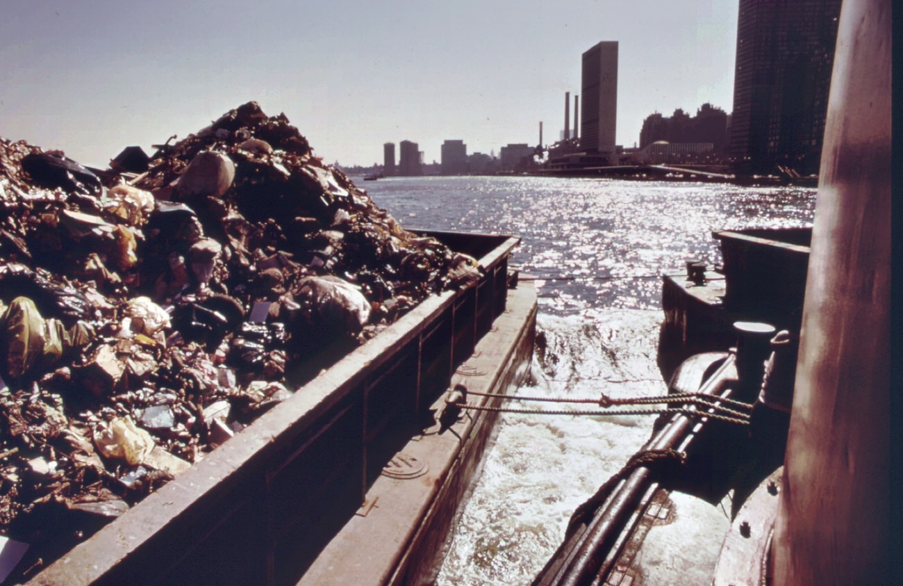
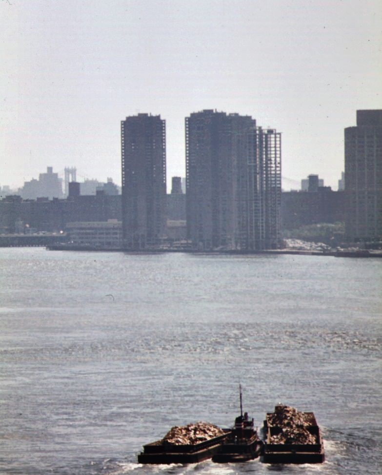
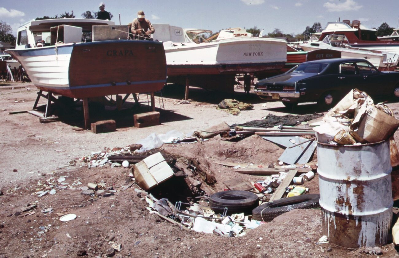
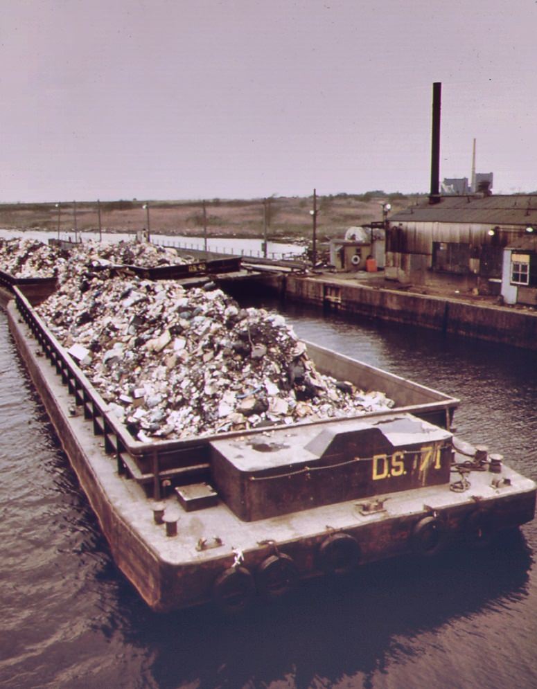
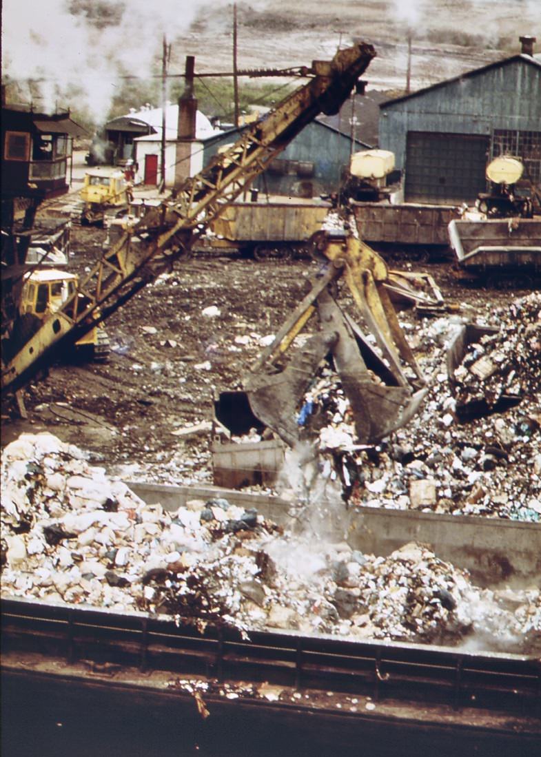
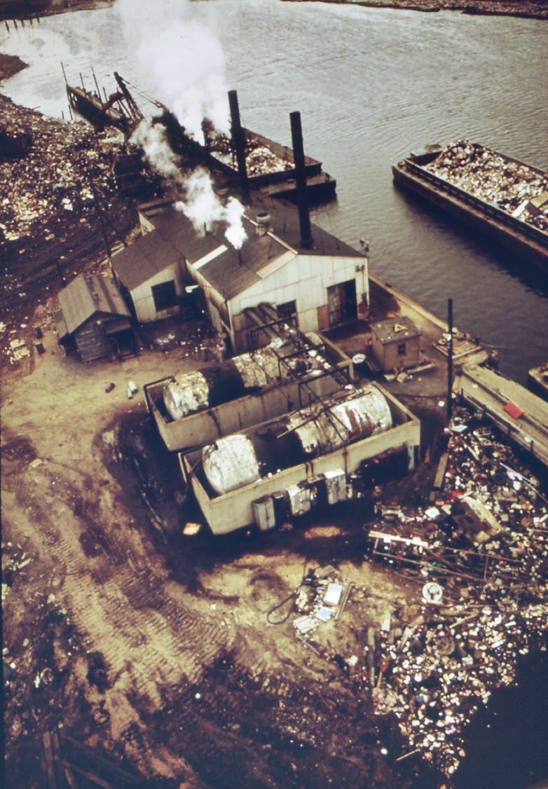
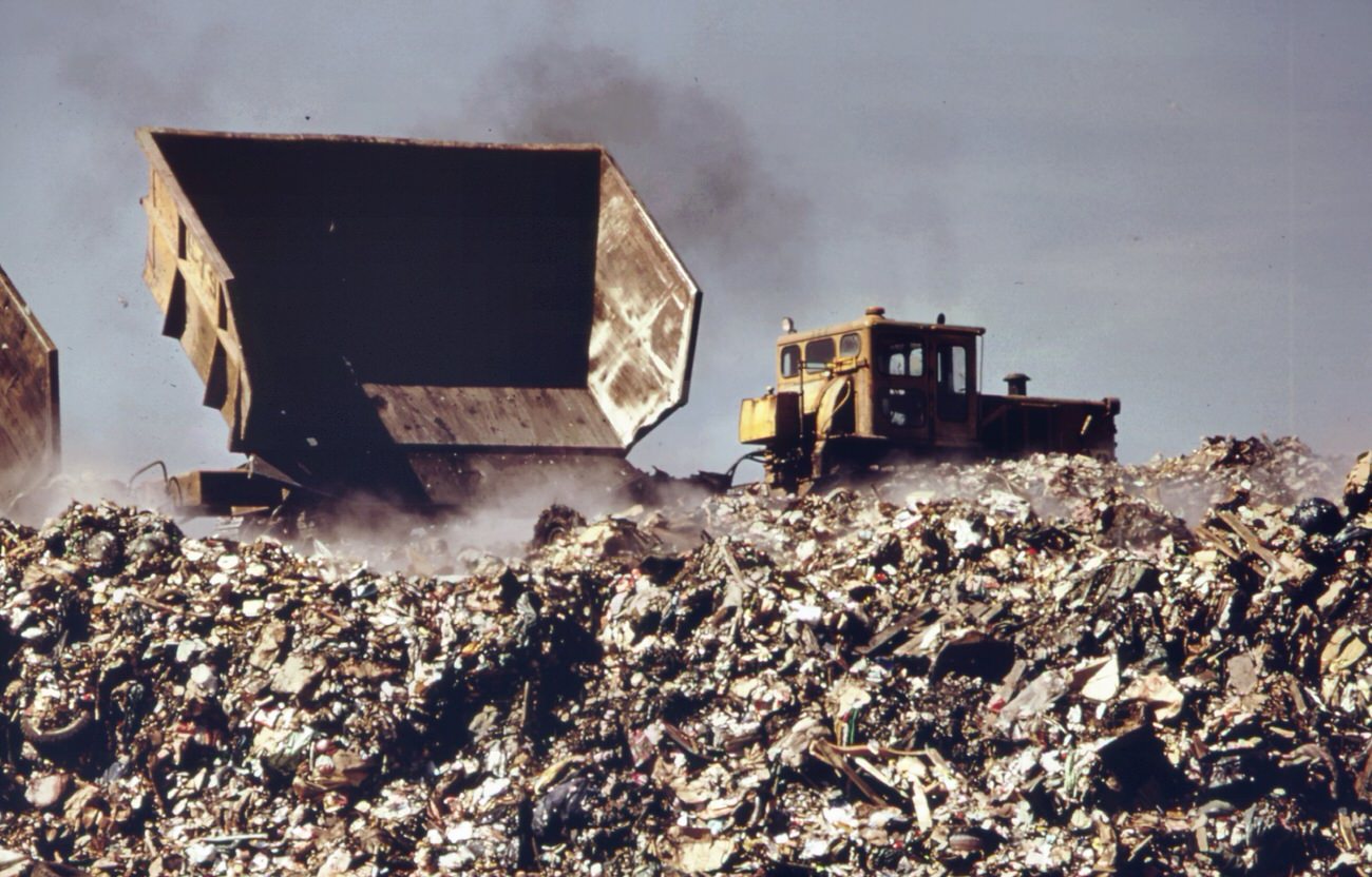
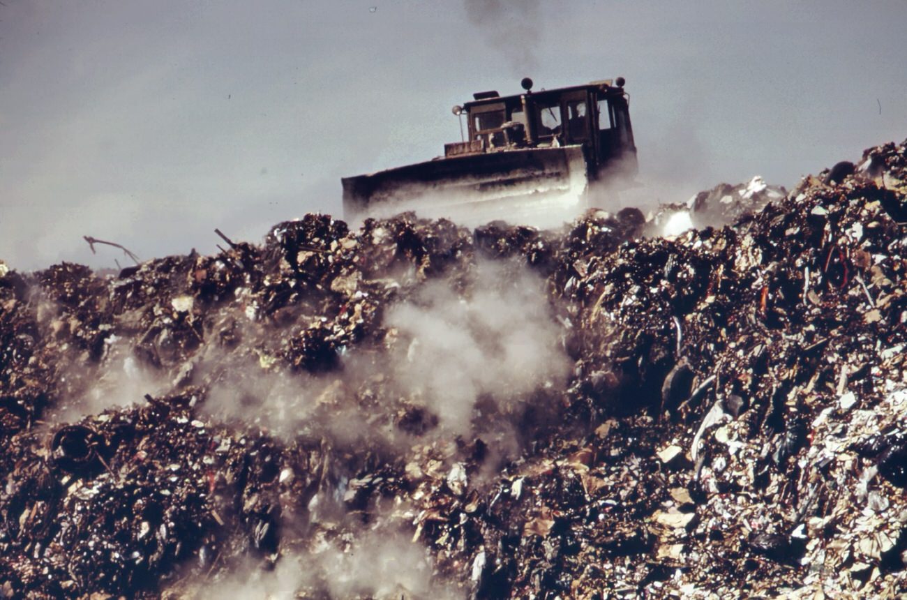
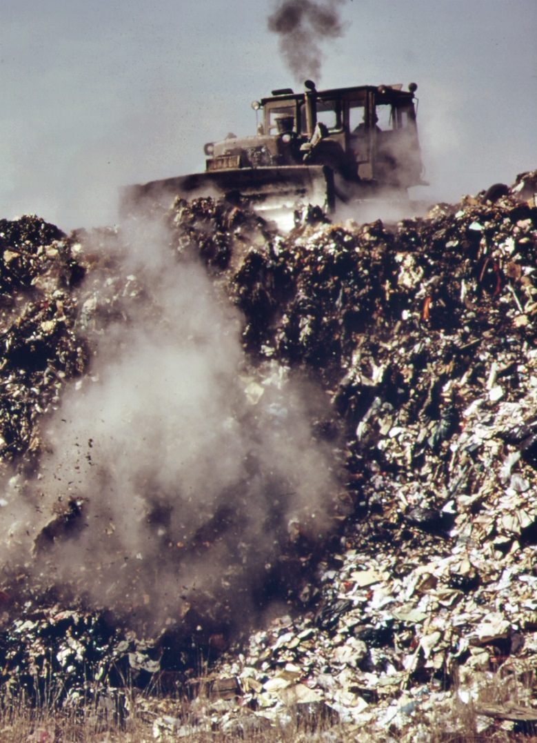
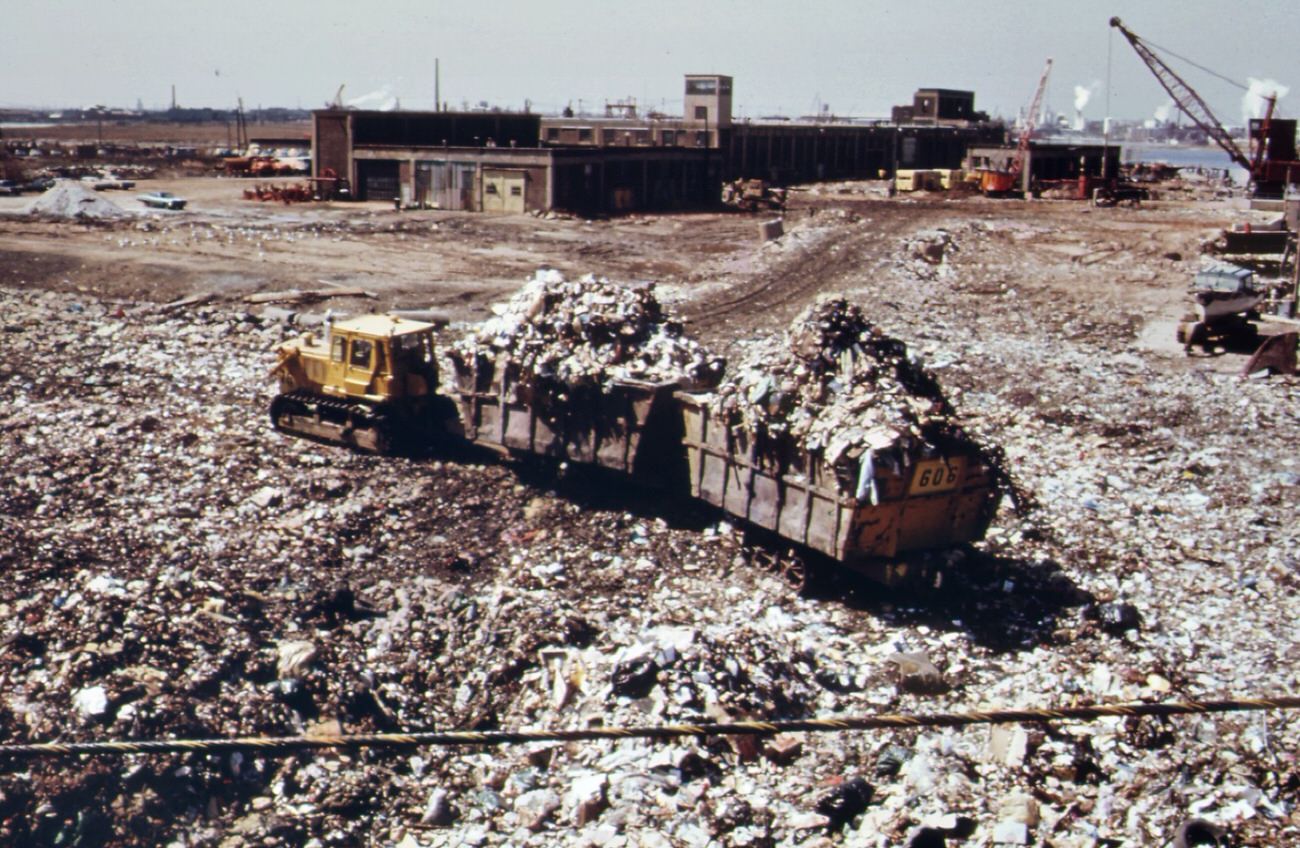
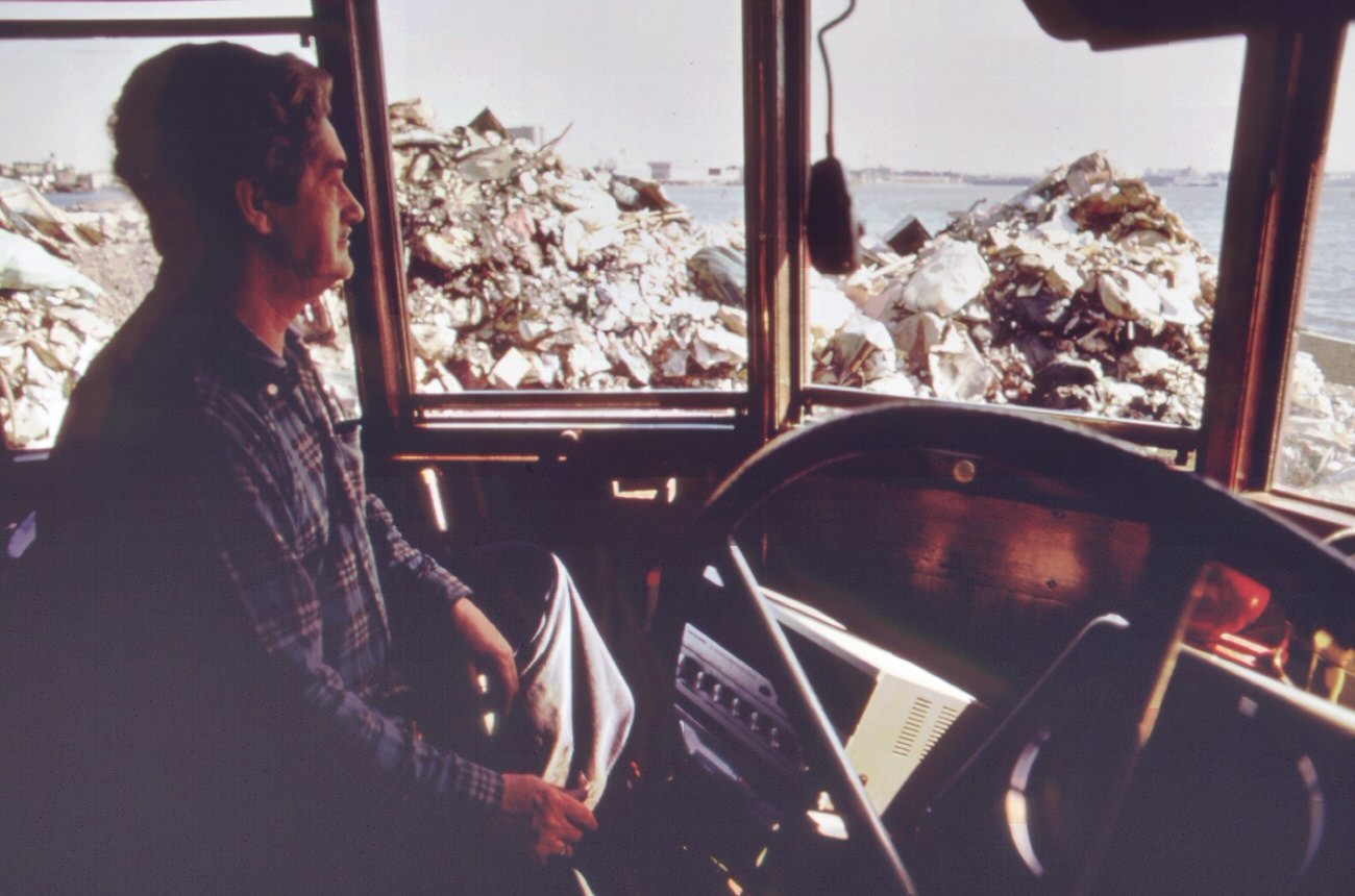
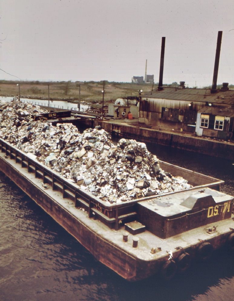
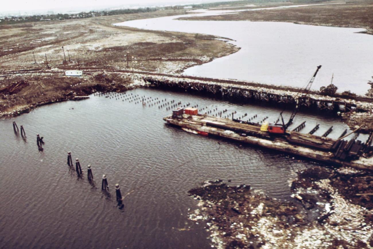
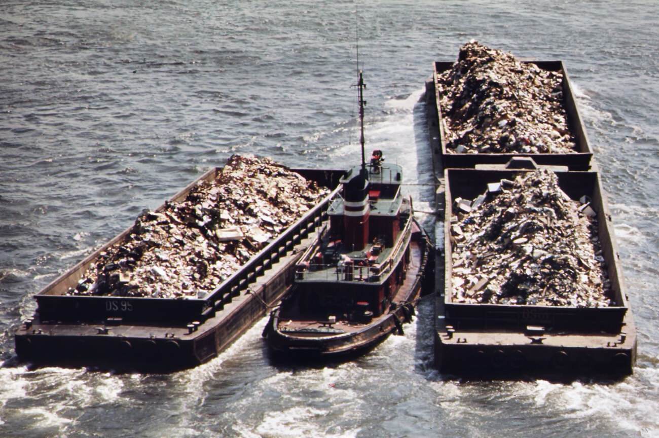
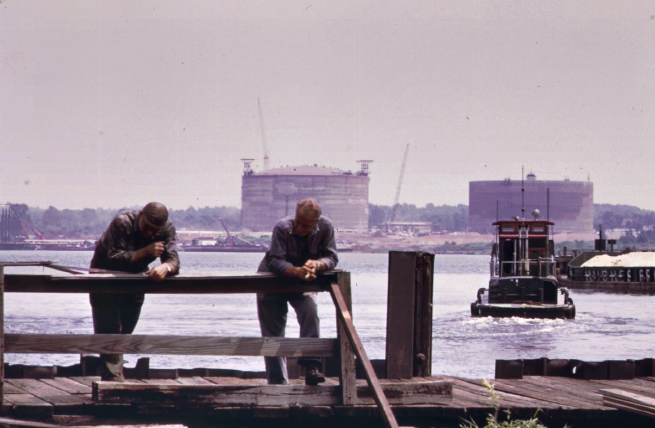
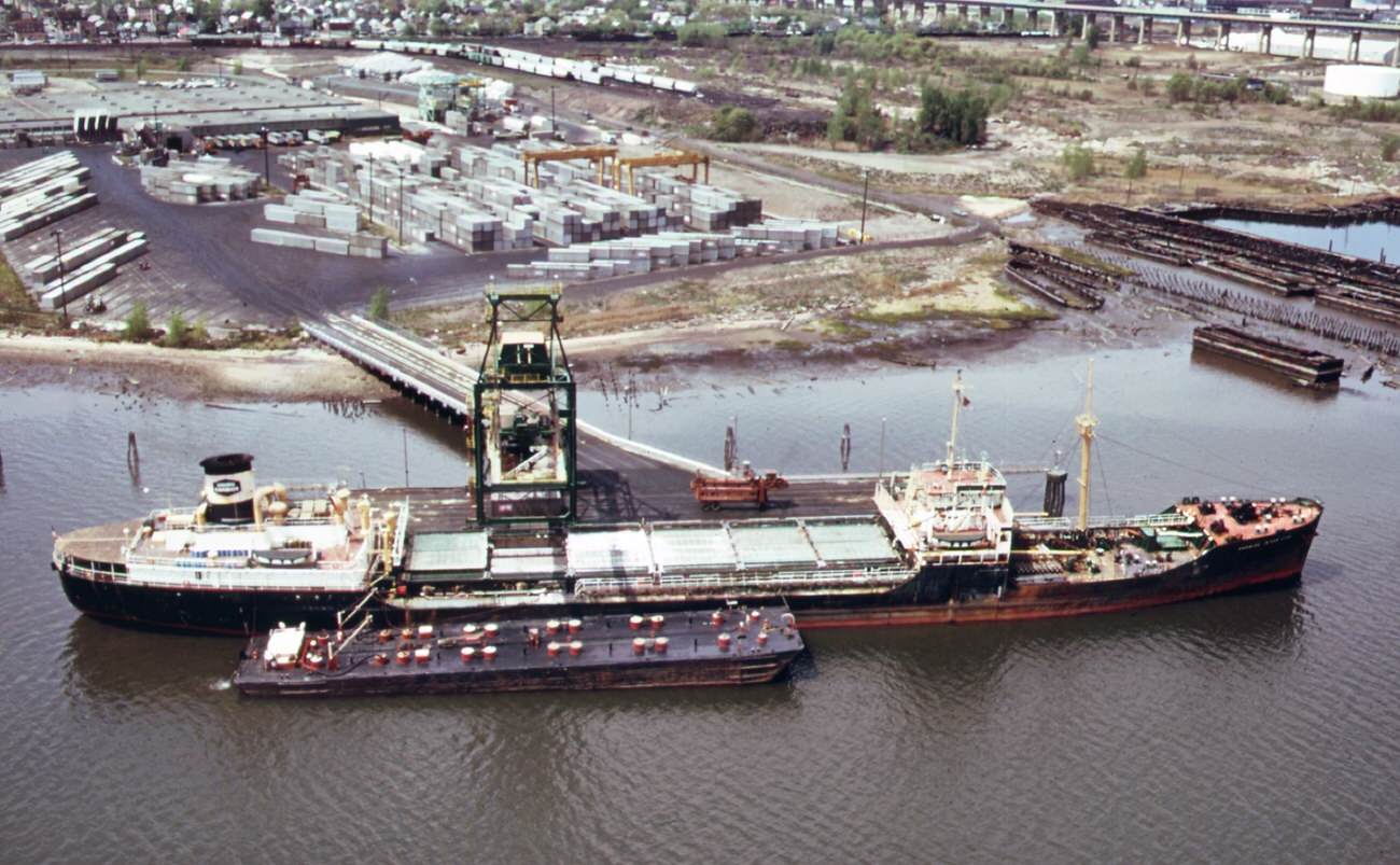
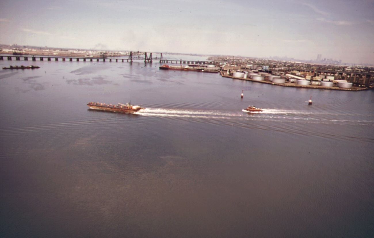
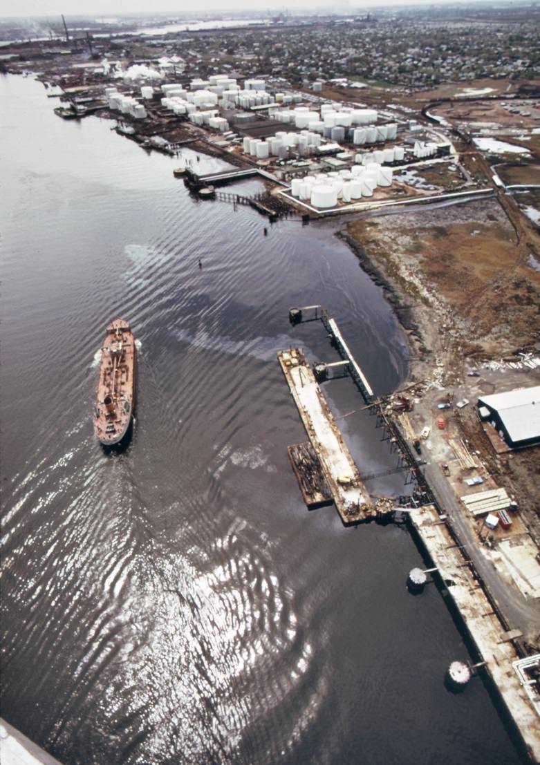
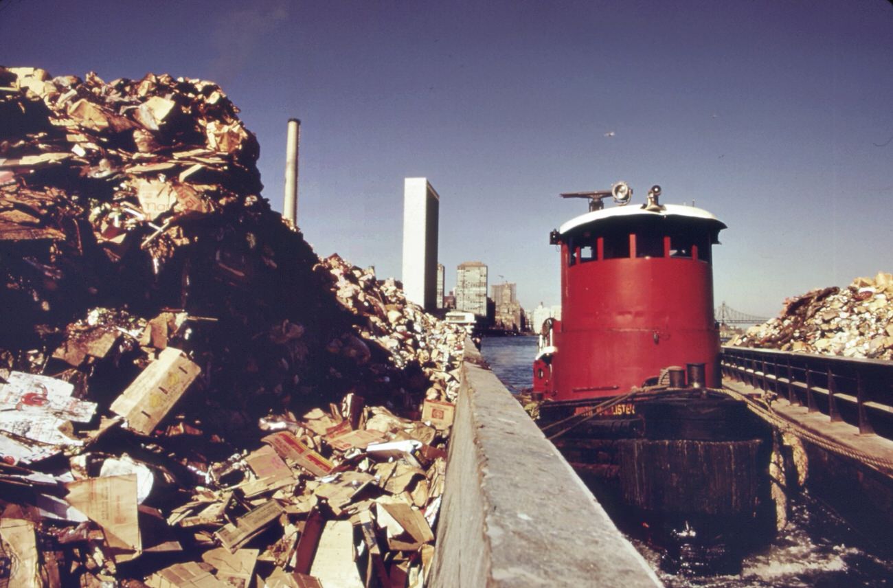
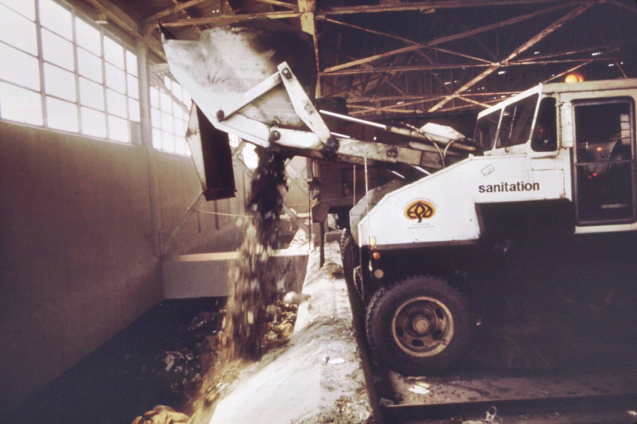
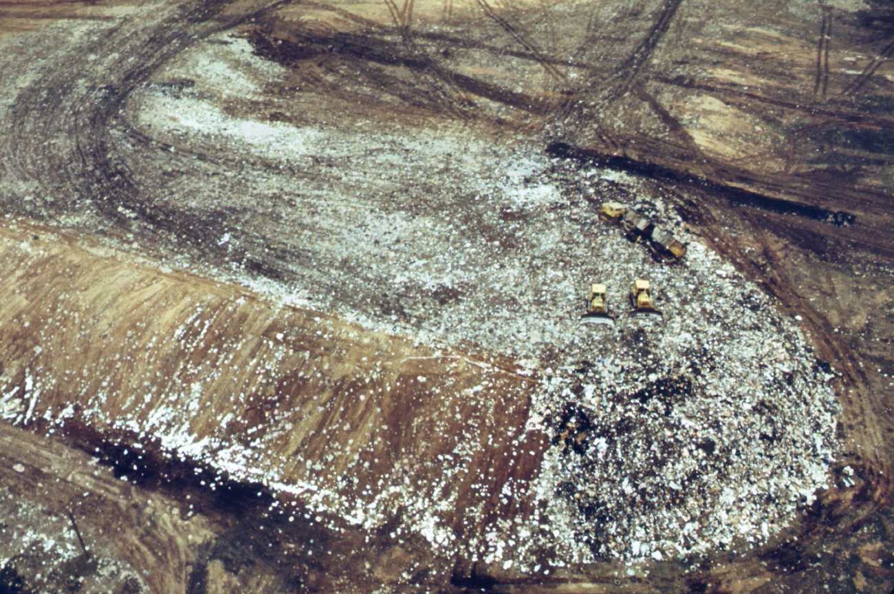
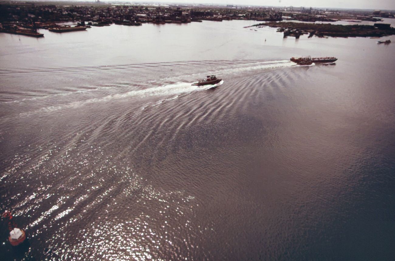
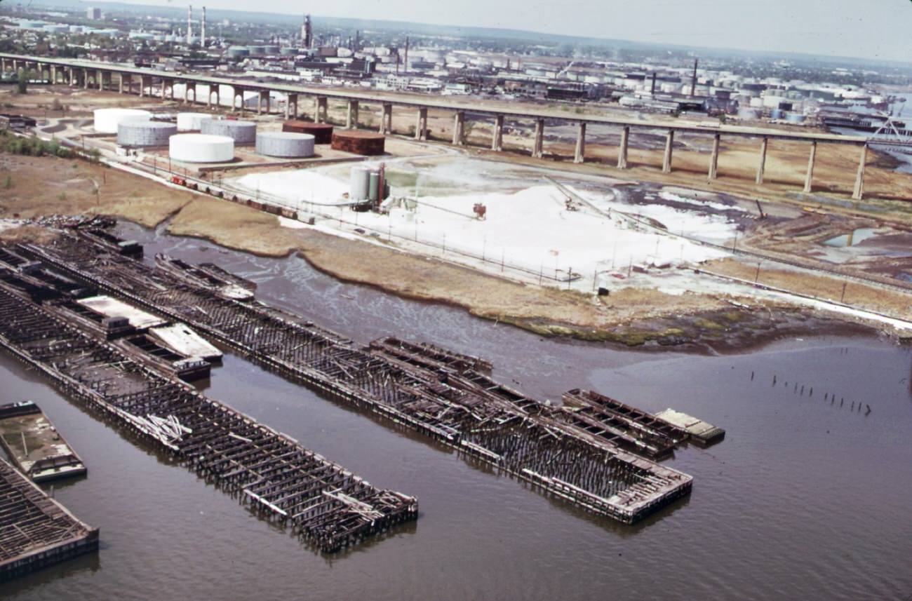
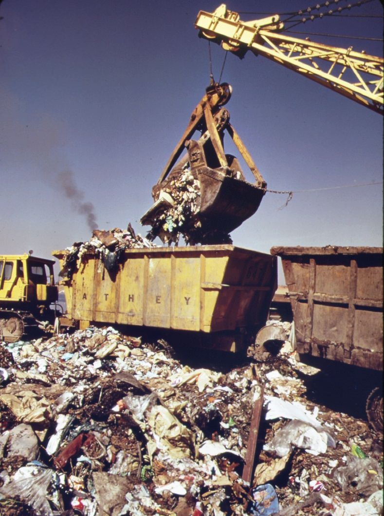
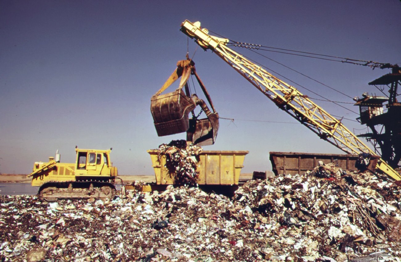
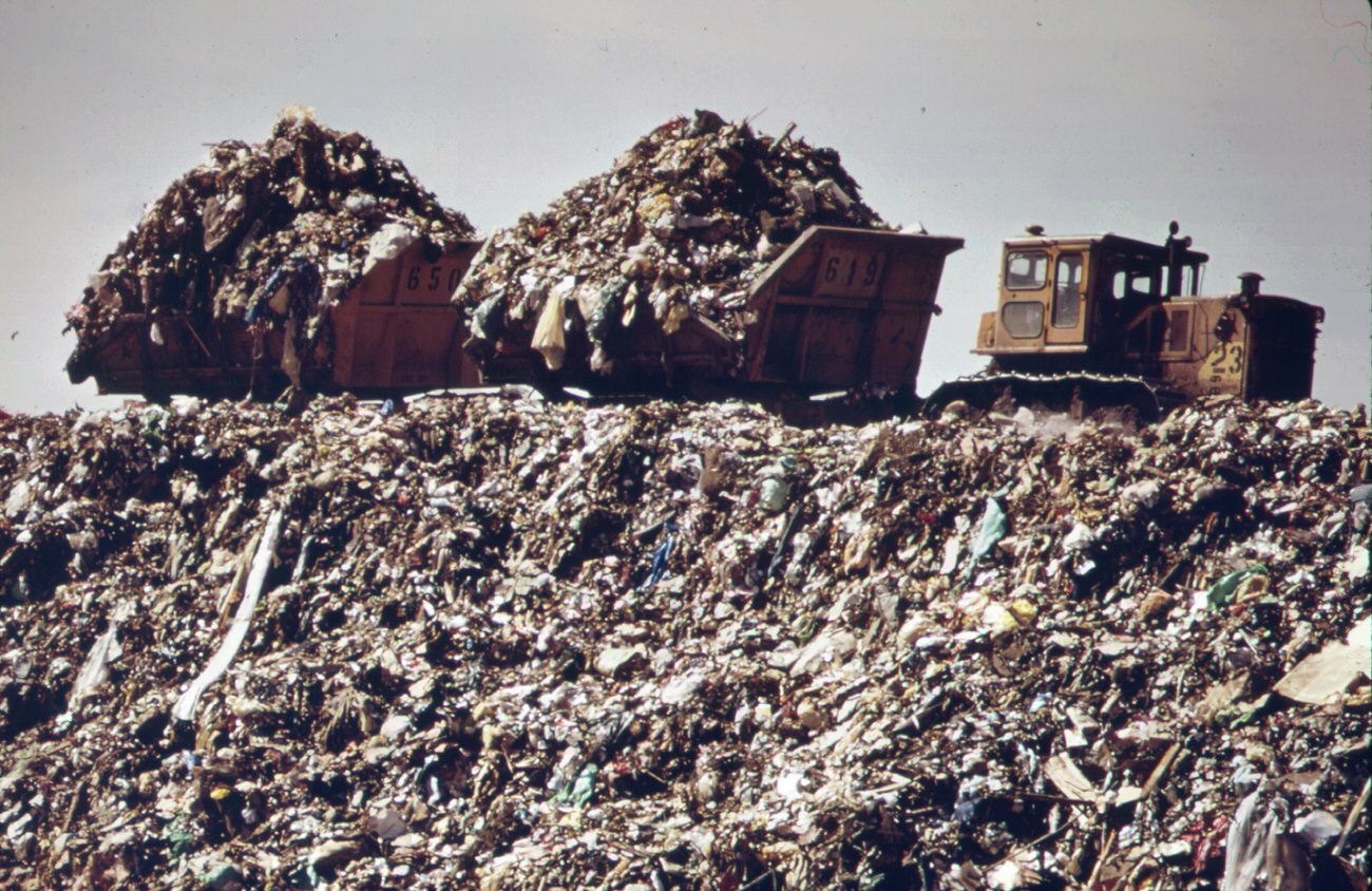
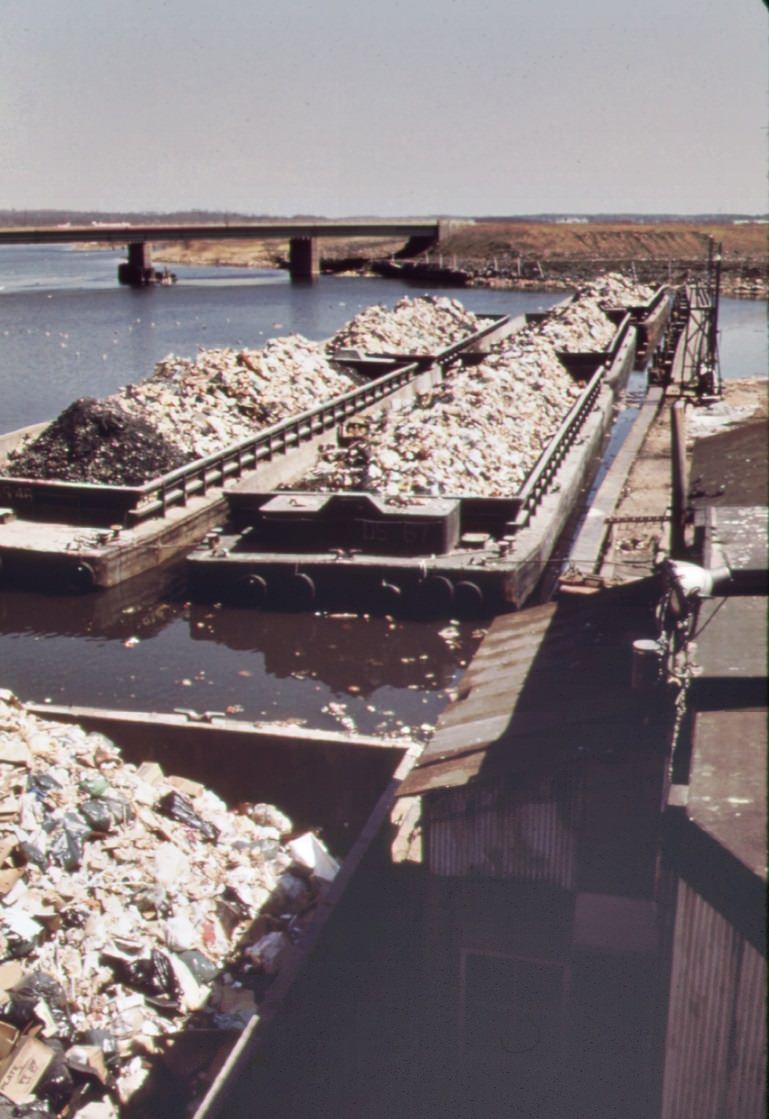
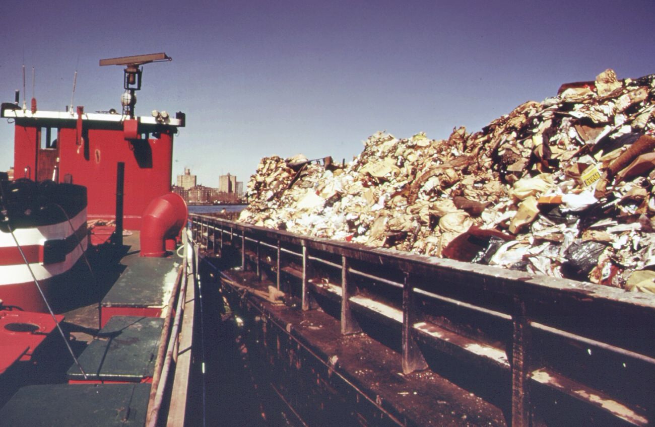
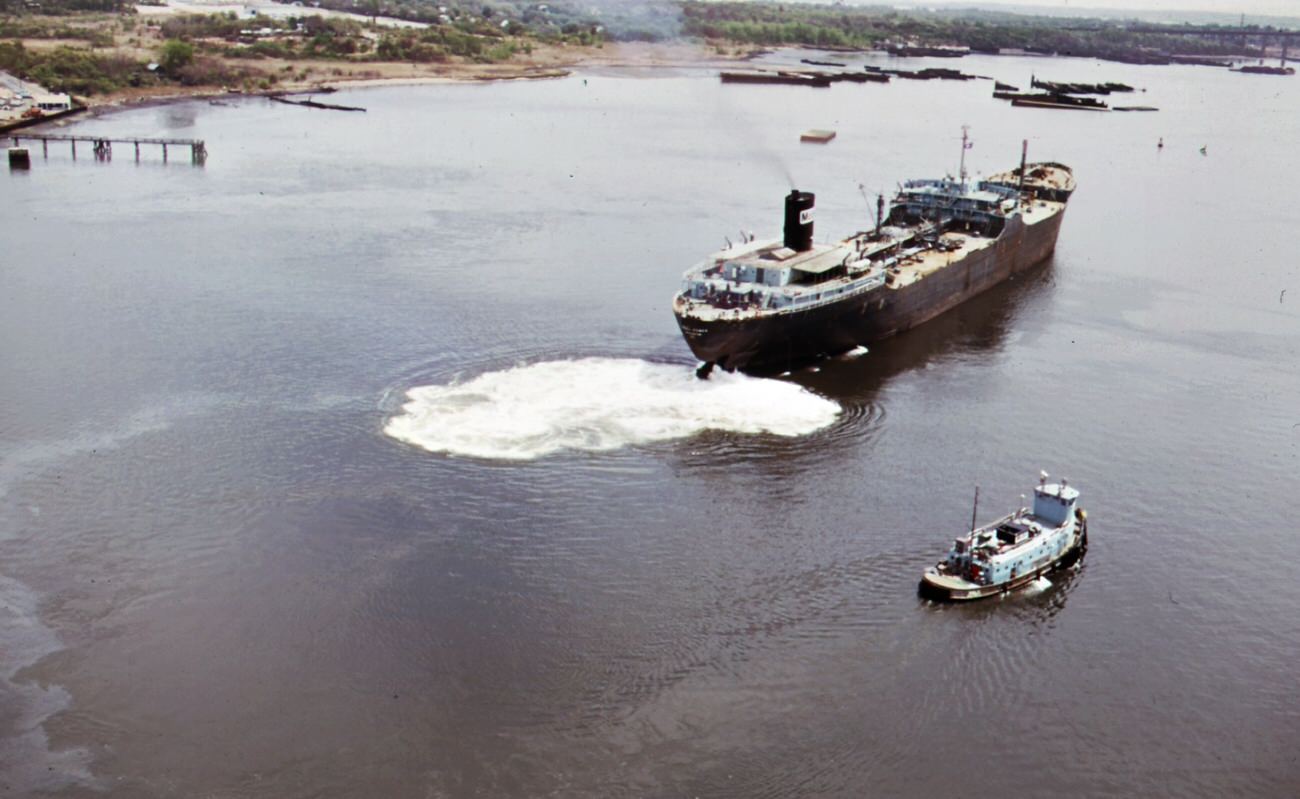
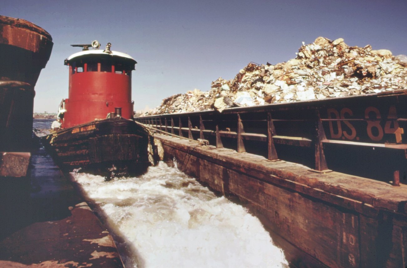
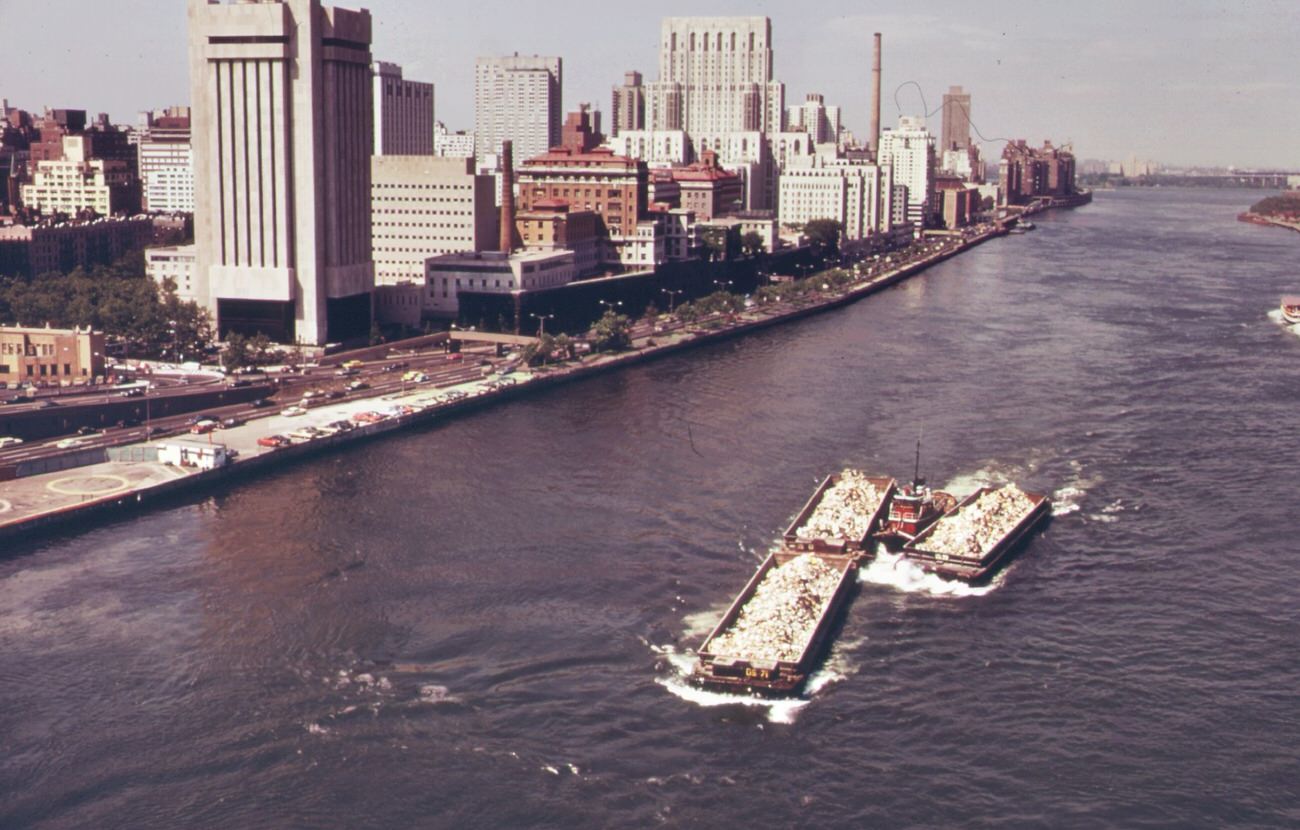
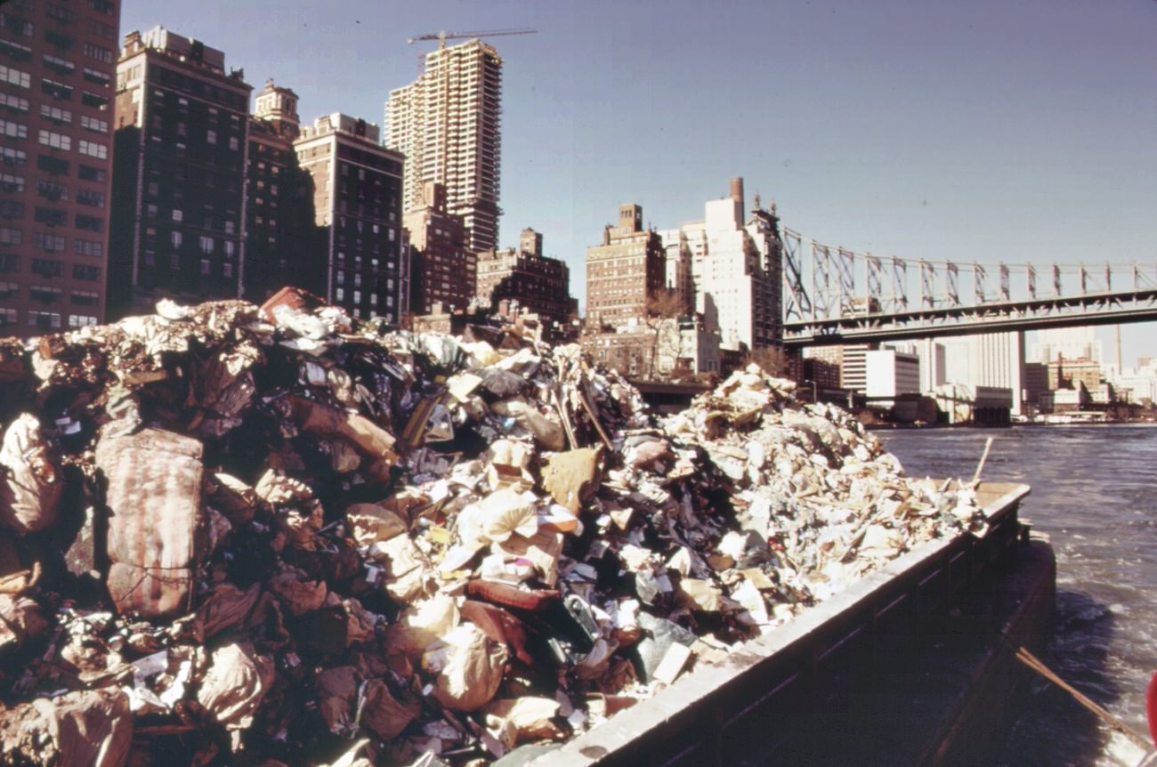
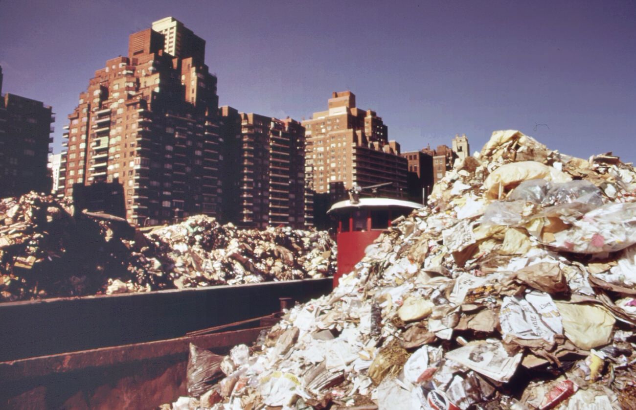
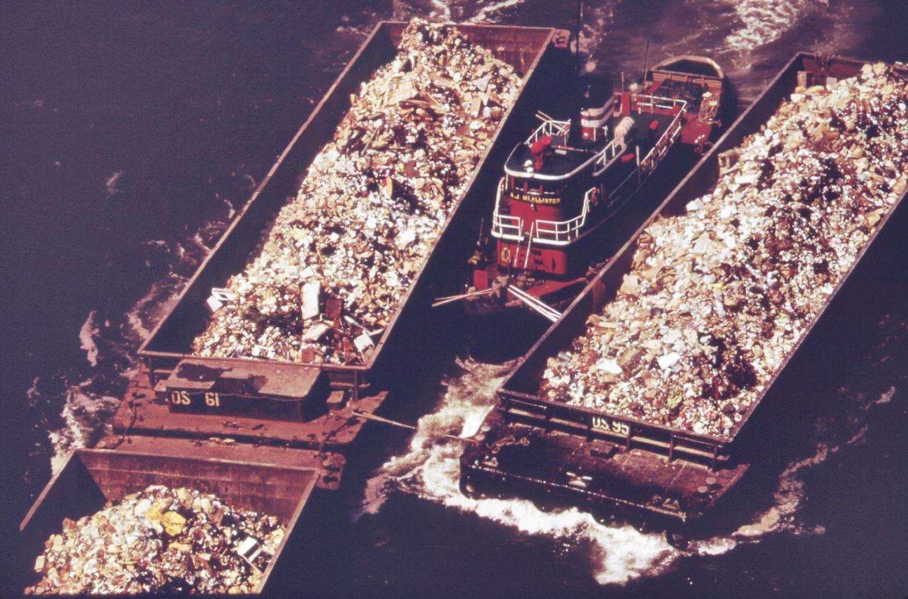
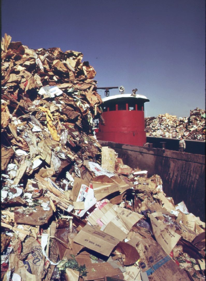
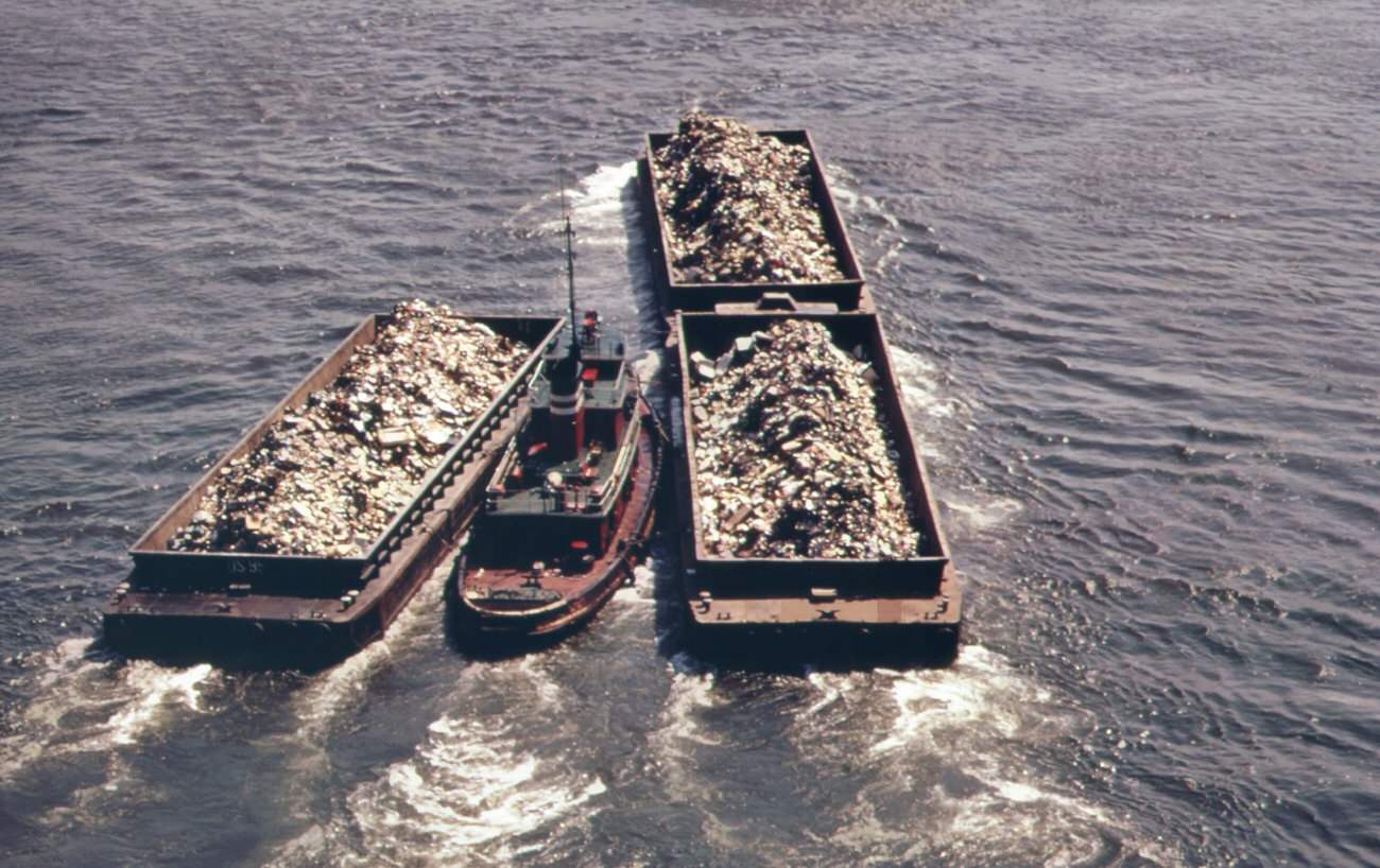
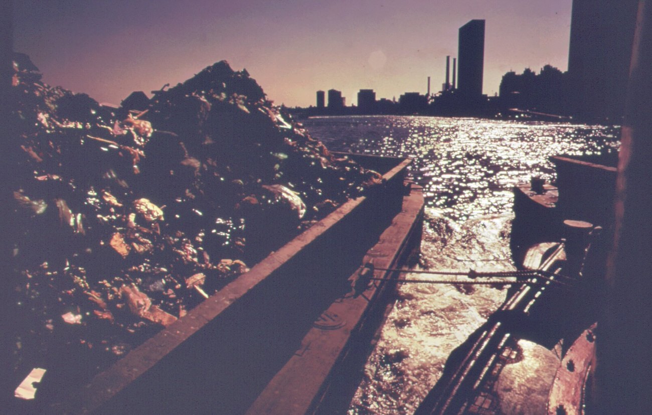
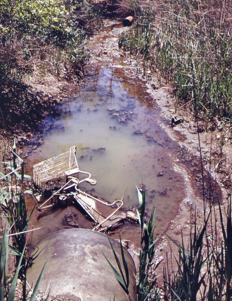
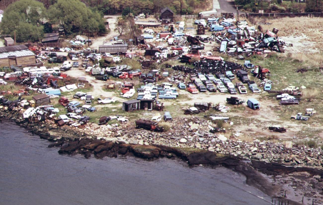
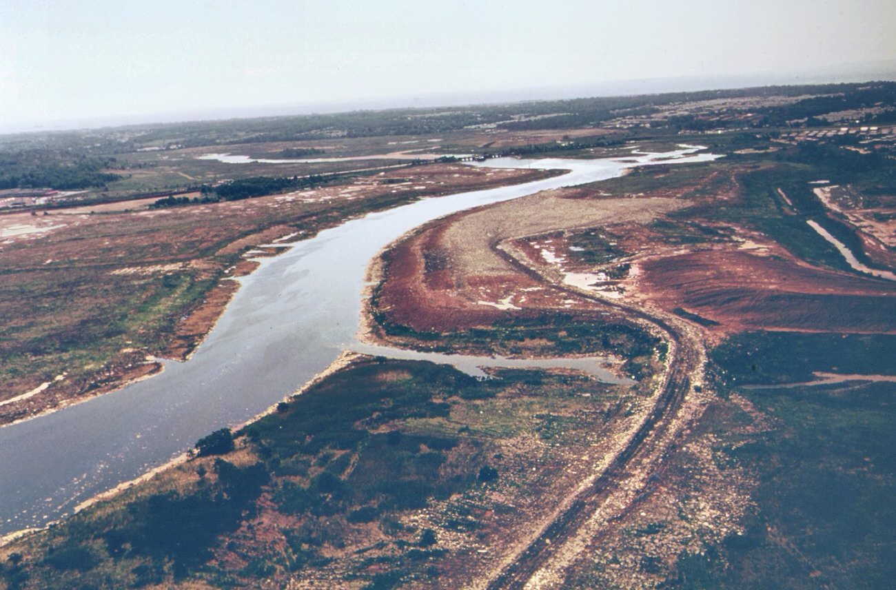
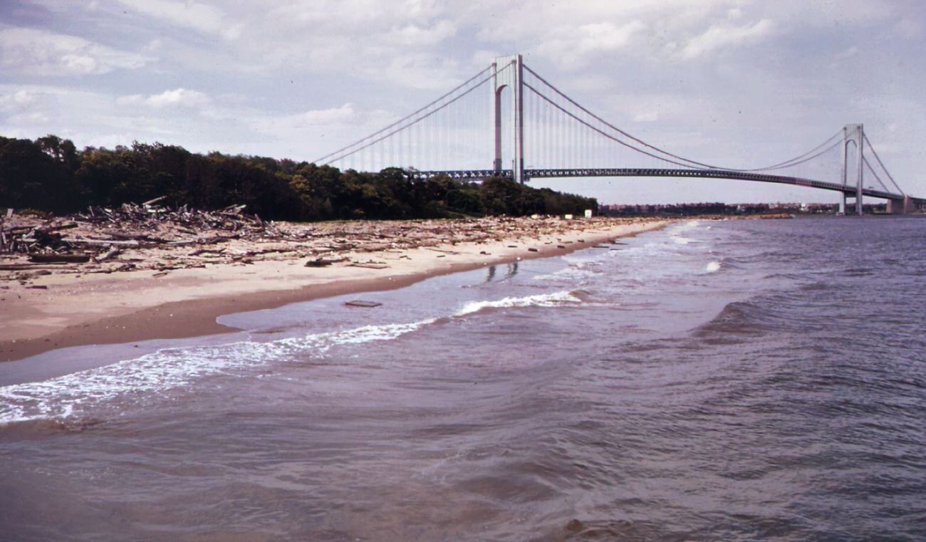
Water quality was another primary environmental concern. Industrial waste and sewage were often dumped into the waterways around Staten Island, leading to contamination and pollution of local water sources. This significantly impacted the recreational opportunities available to residents, with many beaches and waterways being considered unsafe for swimming or fishing.

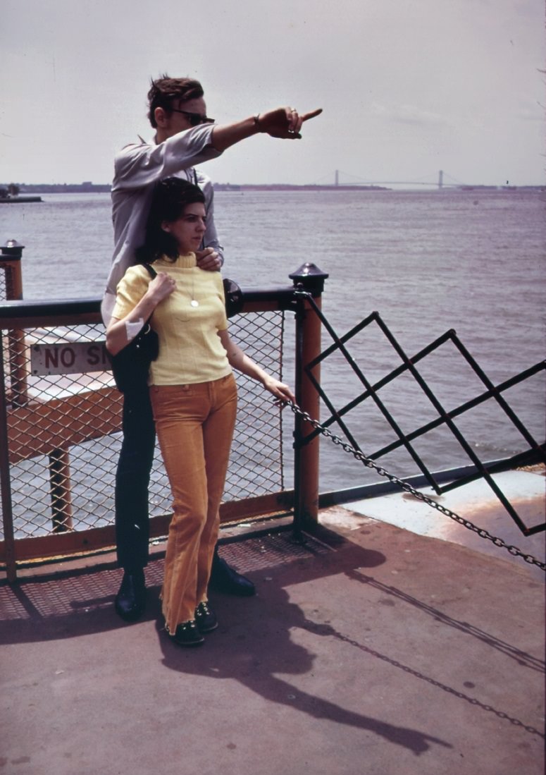
The weather in Staten Island during the 1970s was generally mild, with warm and humid summers and cold winters. Heavy snowfall was not uncommon during the winter months, and the borough was also susceptible to flooding during heavy rainstorms. The hilly topography of the area and its proximity to the ocean contributed to the flooding risk, which was a constant concern for many residents.

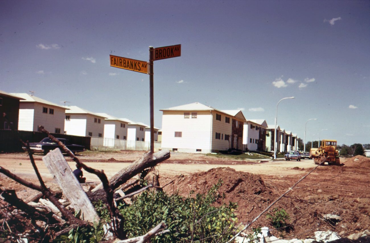
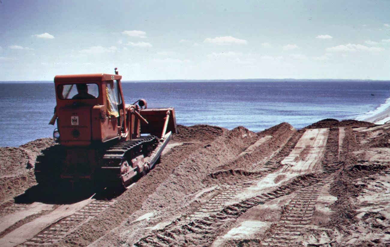
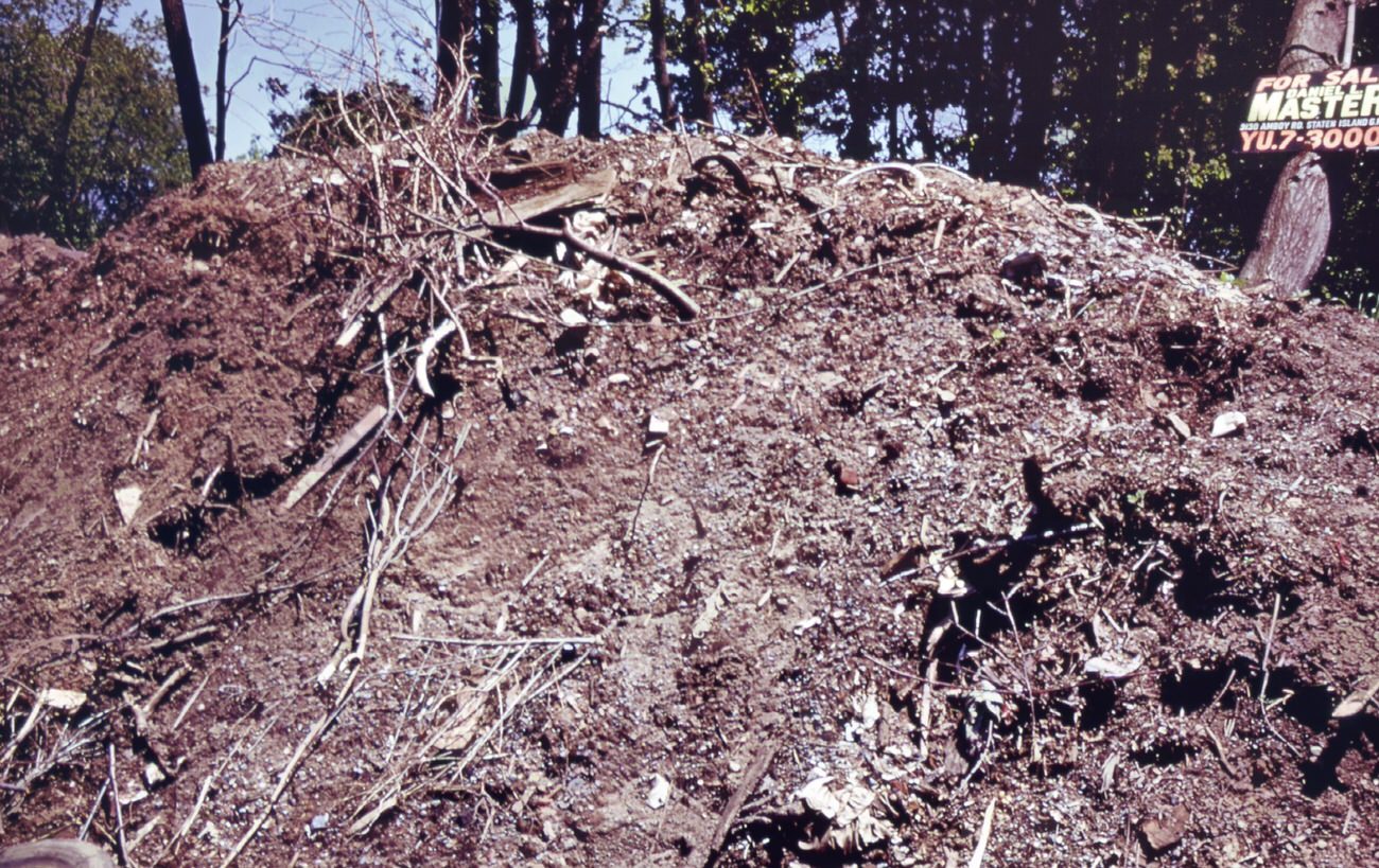
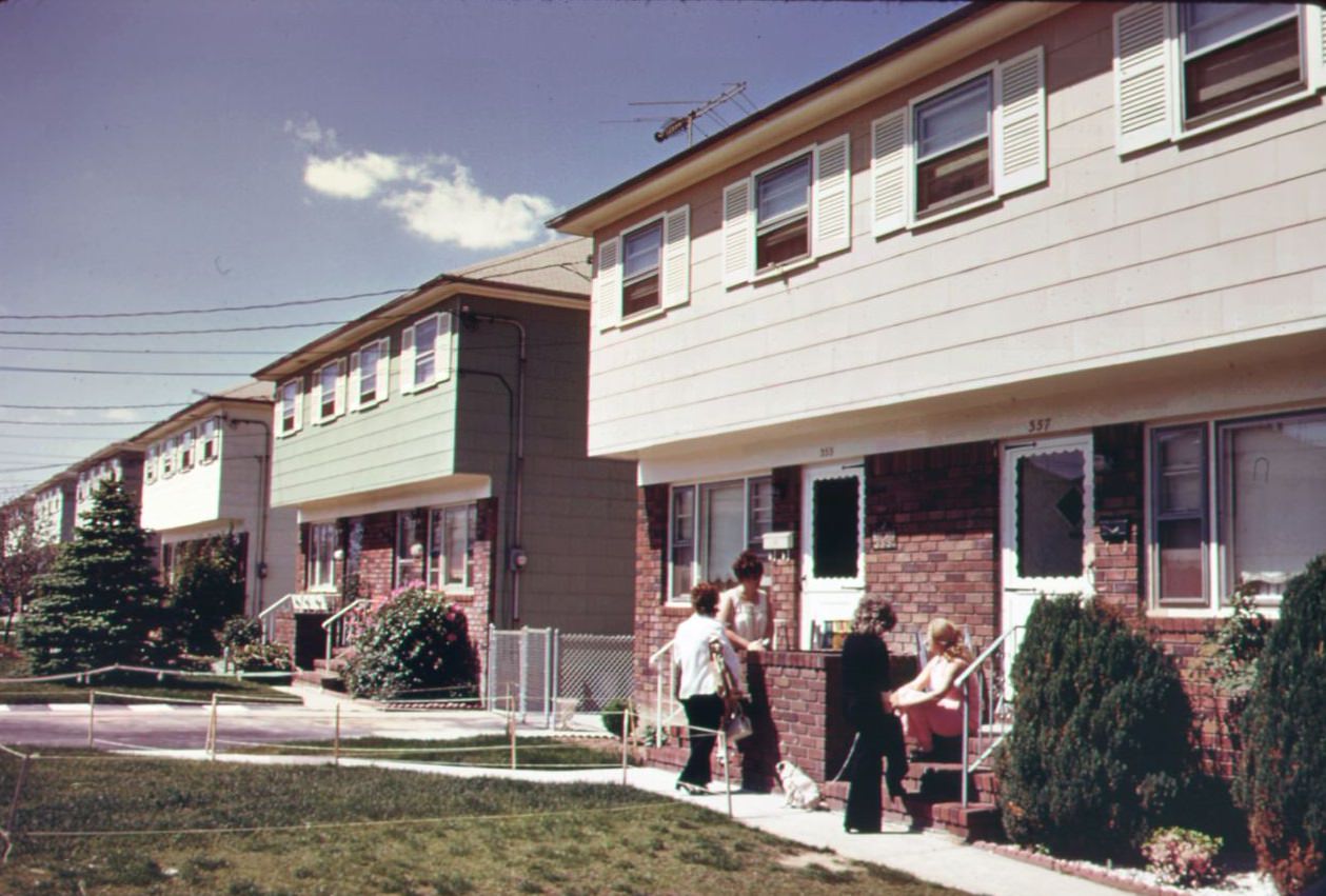
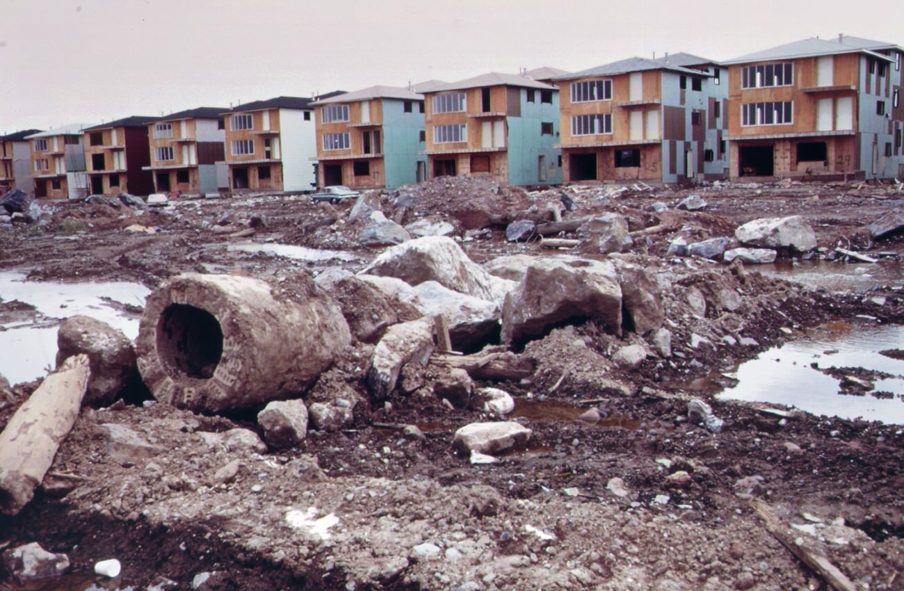
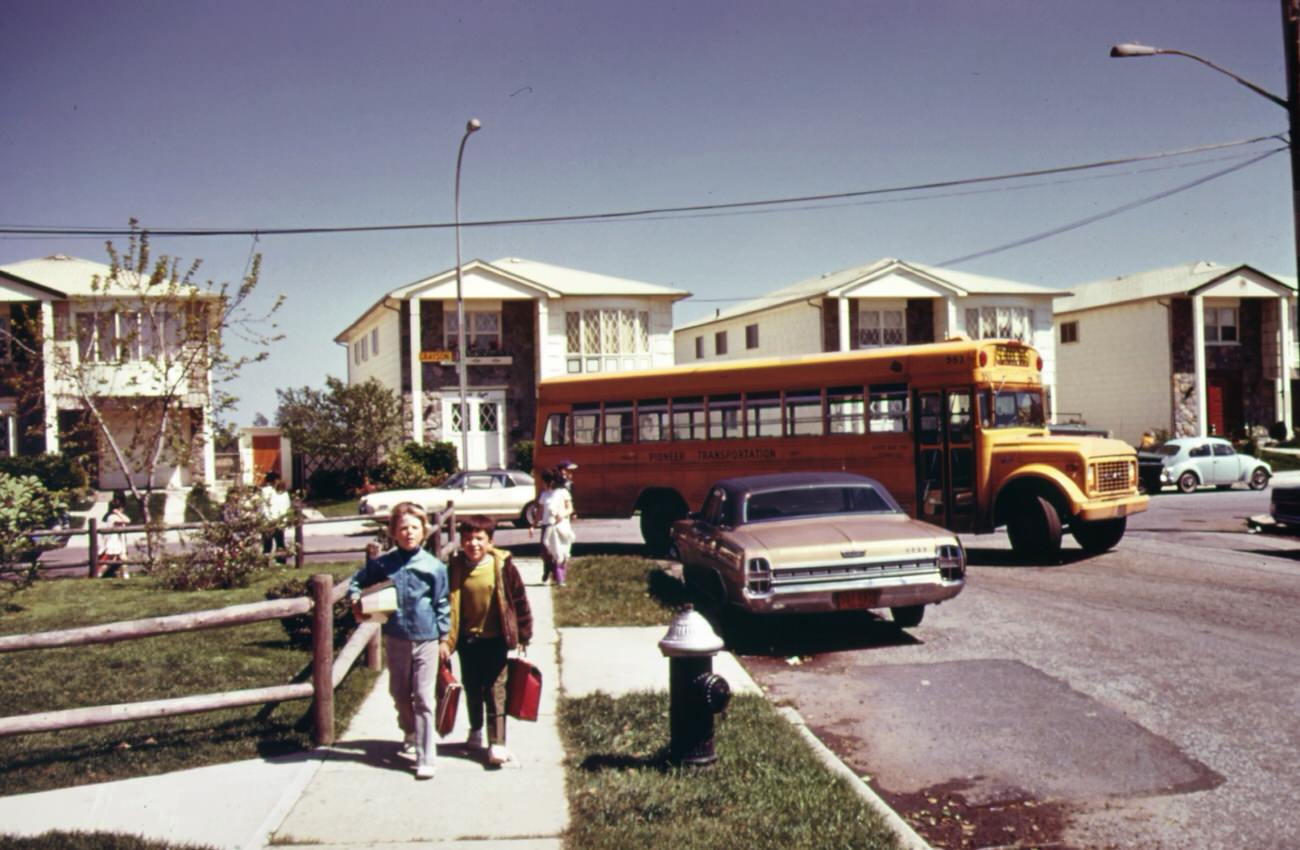
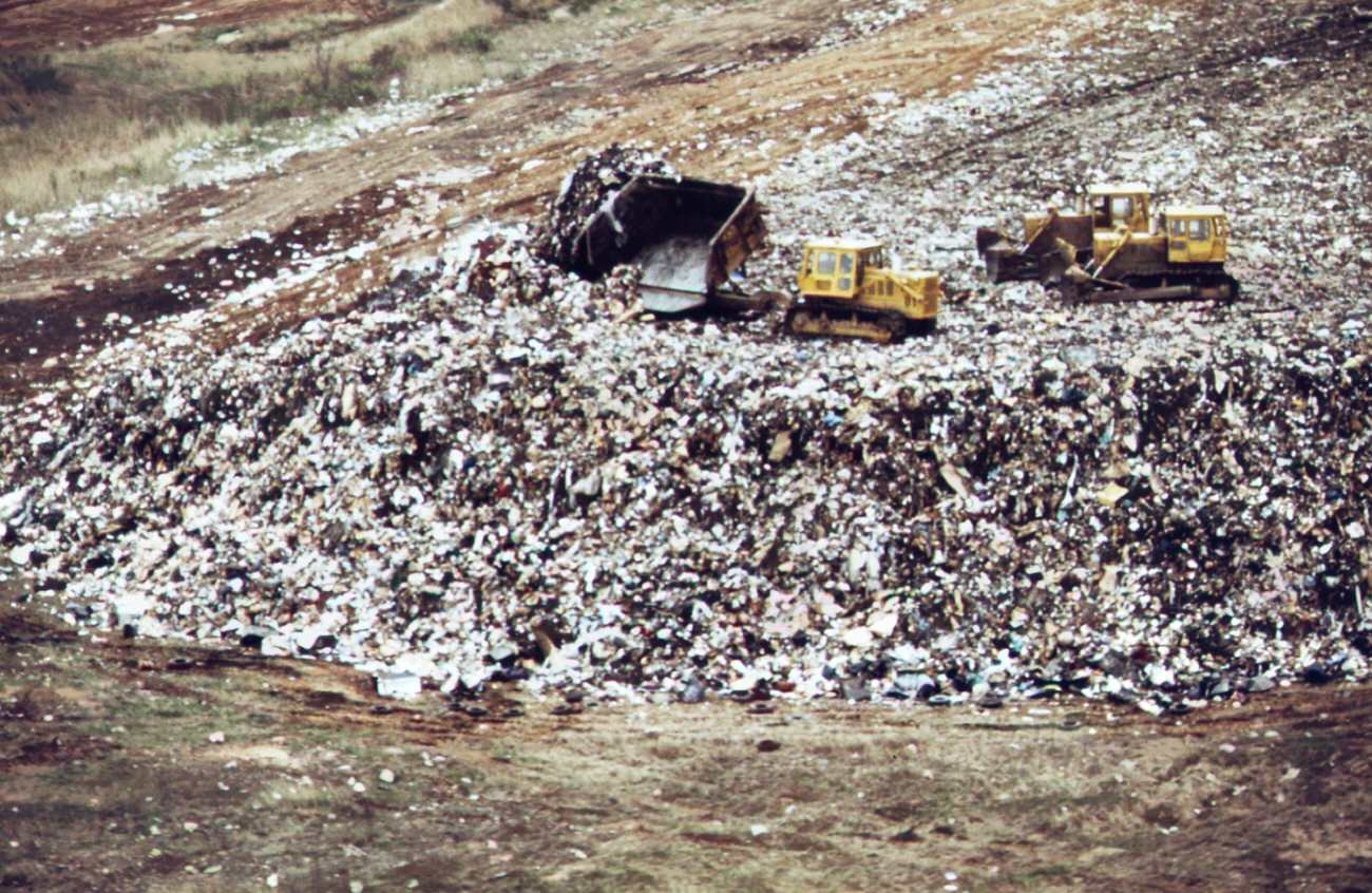
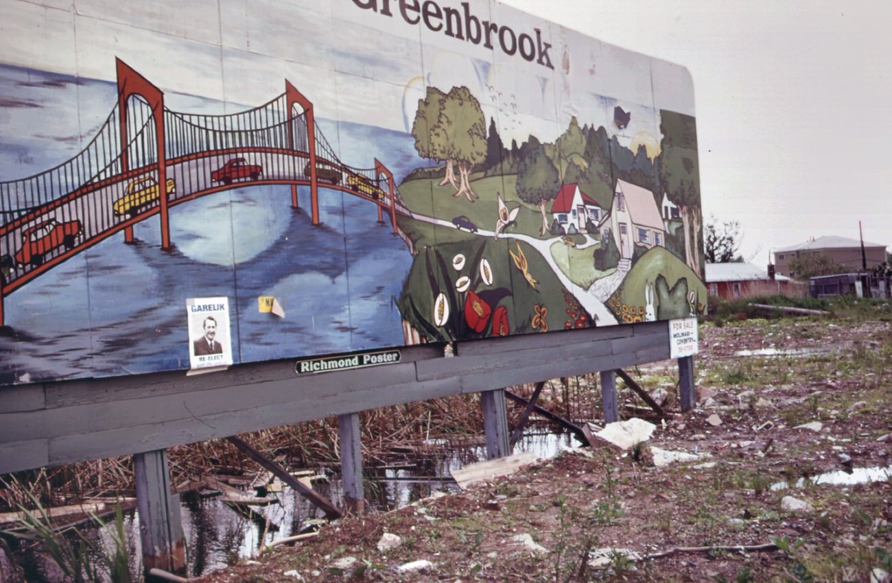
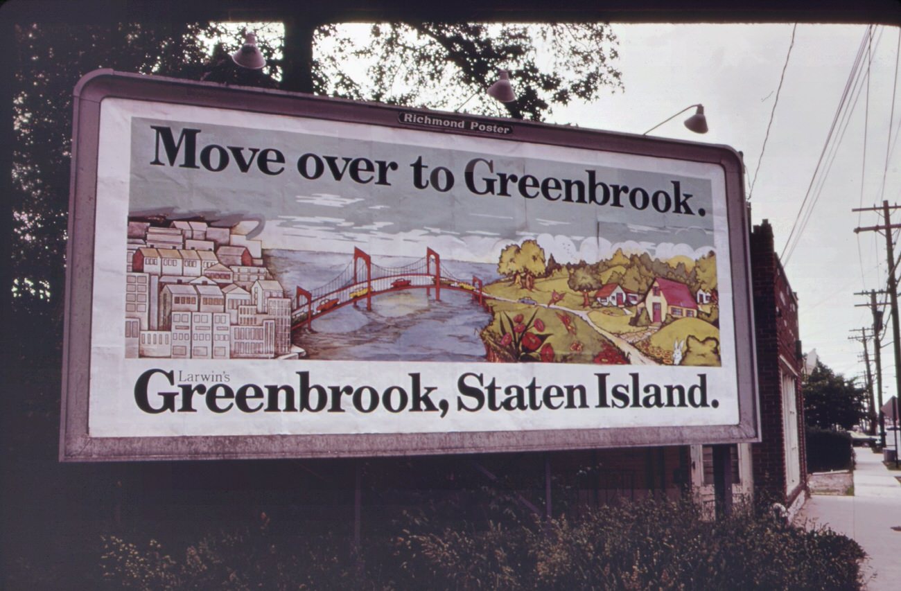
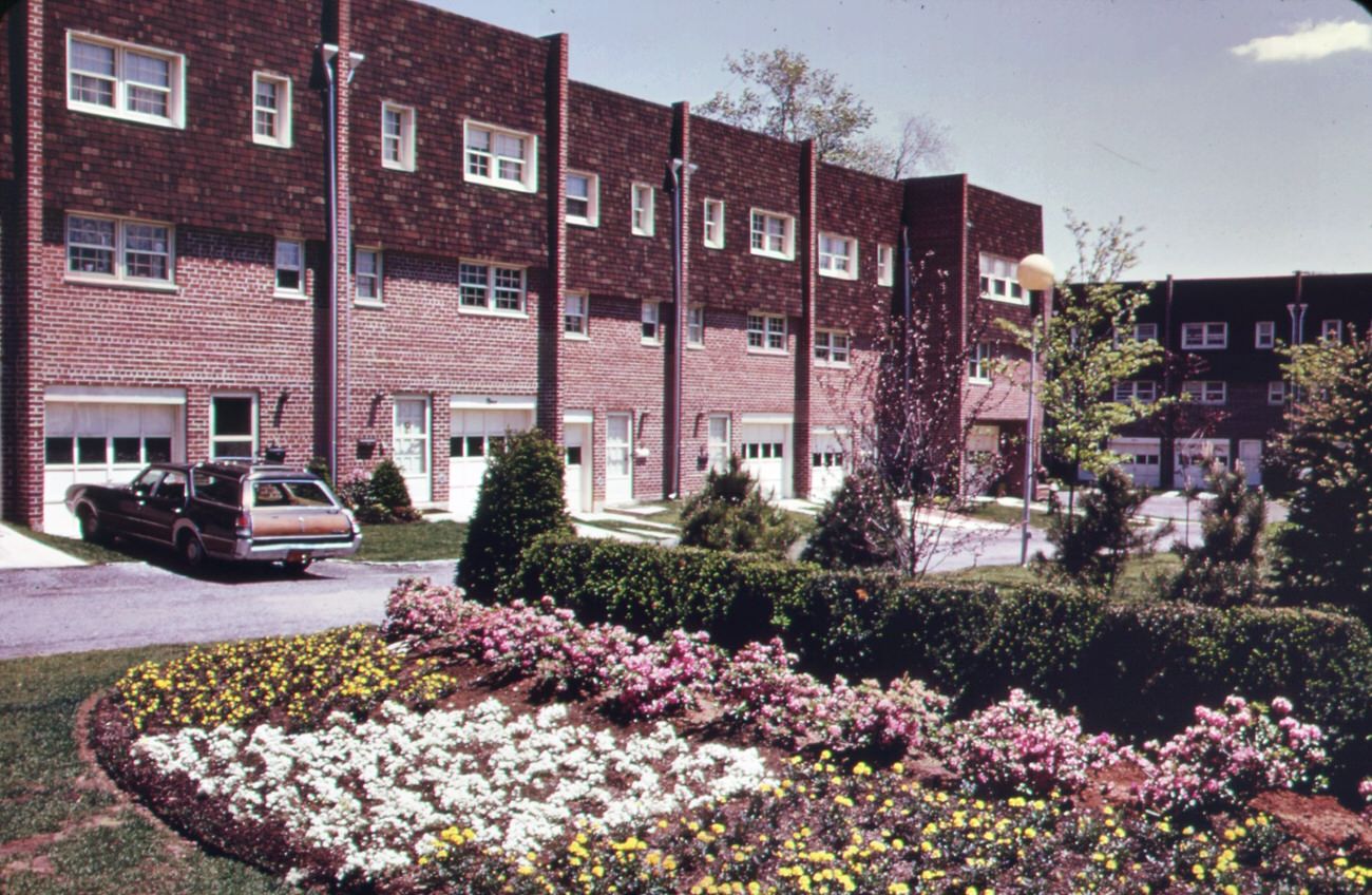
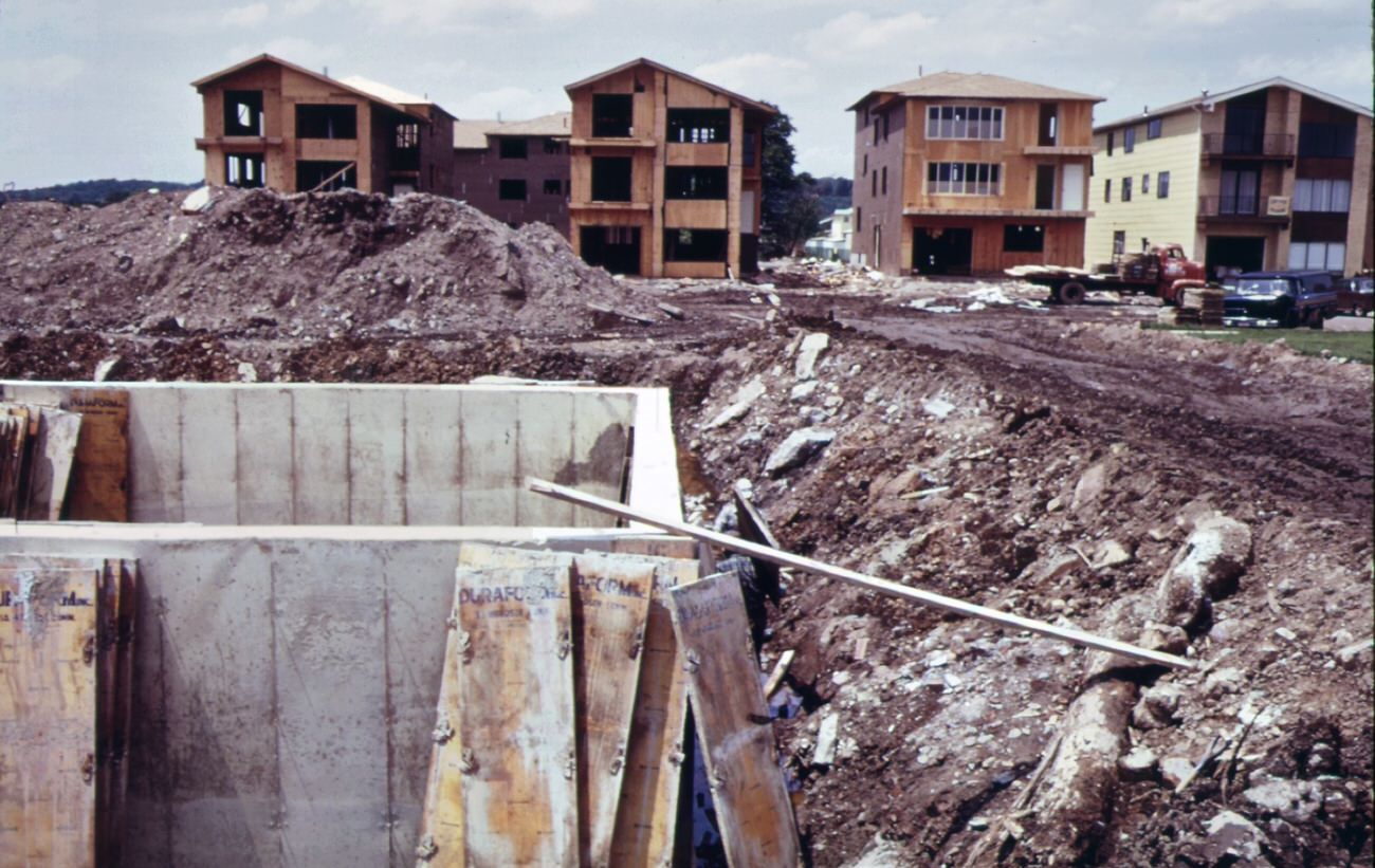
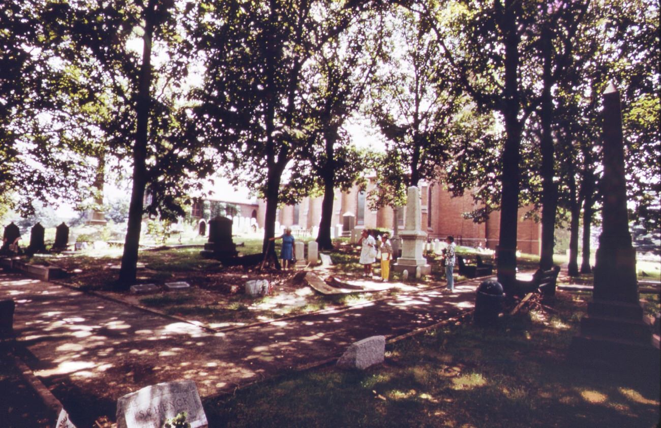
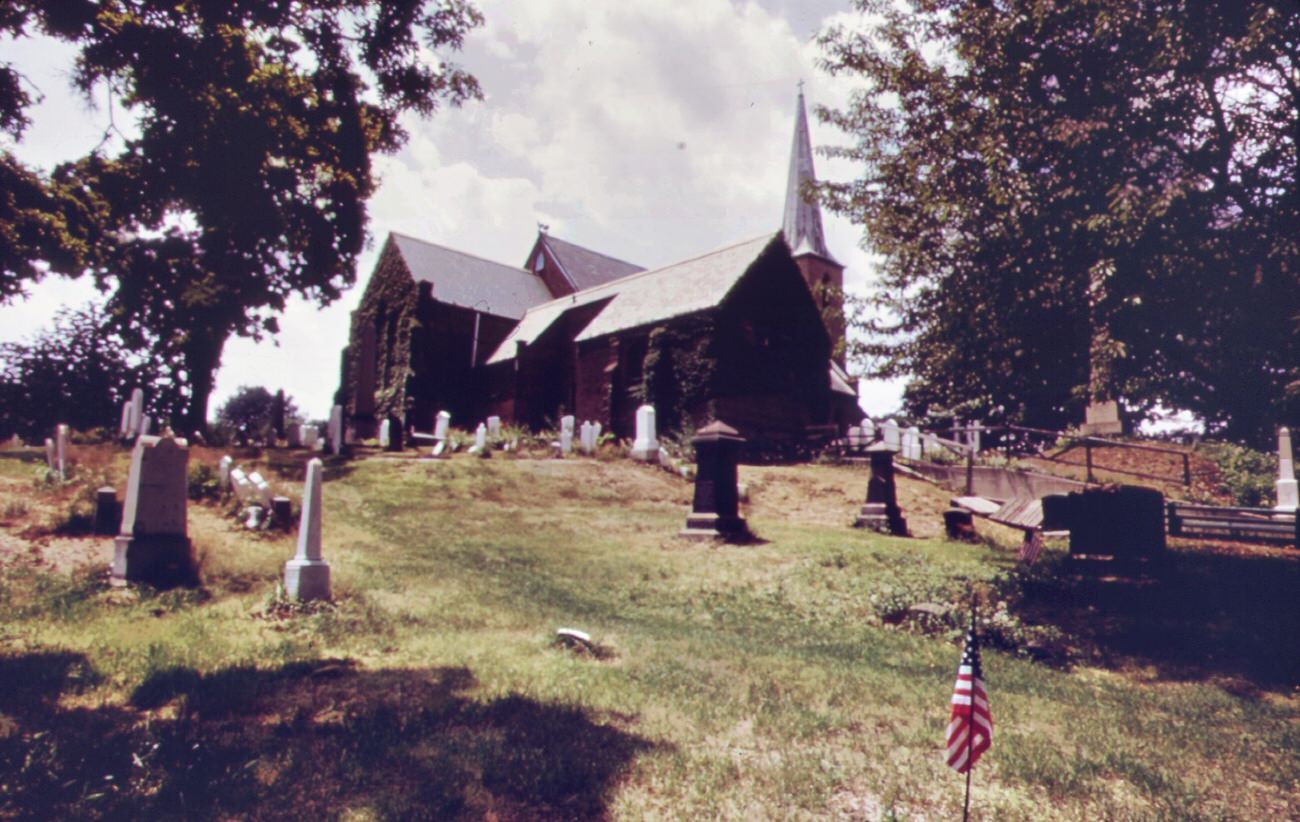
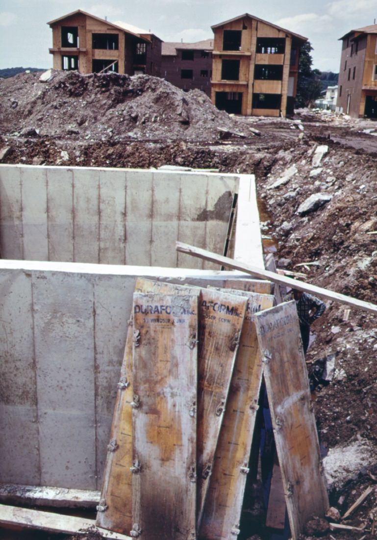
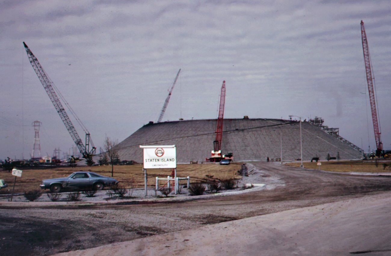
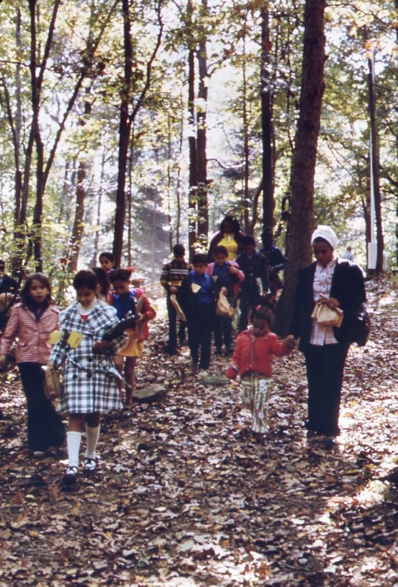
Staten Island continued to grow and develop despite the environmental challenges during the 1970s. New housing developments and commercial areas were built to accommodate the growing population, but this development also created additional ecological concerns. Natural habitats and green spaces were often destroyed to make way for new construction, further exacerbating the pollution and degradation of the local environment.

 Staten Island continues to face environmental challenges today but has made significant progress in addressing many of the documented issues in the DOCUMERICA project. Local initiatives and programs have helped improve air and water quality, and efforts are ongoing to preserve and protect the area’s natural beauty for future generations.

#1 Manhattan skyline from the staten island ferry, 1970s

#5 South beach, staten island, is safe for swimming, 1970s

#7 Flower sellers at the staten island ferry terminal, 1970s

#8 Electric power station, built on marshland on staten island, 1970s

#9 Housing development in great kills area on staten island, 1970s

#10 Commuters entering the terminal of the staten island ferry, 1970s

#11 Public warehouse beneath the goethals bridge to staten island, 1970s

#12 South beach, staten island. Verrazano-narrows bridge in background, 1970s

#13 Garden accessories for sale on hylan boulevard in staten island, 1970s

#14 The staten island ferry in new york harbor’s upper bay, 1970s

#15 Landfill at fresh kills, staten island (just opposite carteret nj.), 1970s

#16 Widening the beach at great kills park on staten island, 1970s

#17 Site of real estate development on hylan boulevard, staten island, 1970s

#18 Great kills park marina on staten island creates a garbage problem, 1970s

#19 Approaching the entrance to the terminal of the staten island ferry, 1973

#20 Abandoned small boats and barges rot in fresh kills, staten island, 1970s

#21 Dead gull near entrance to great kills park on staten island, 1970s

#22 View of upper new york bay from the staten island ferry, 1970s

#23 Lifeguard takes a sunbath at great kills park on staten island, 1970s

#24 Recently built homes on border of great kills park on staten island, 1970s

#25 Dumping landfill at fresh kills, on the west shore of staten island, 1970s

#26 School excursion on the staten island ferry, crossing upper new york bay, 1970s

#27 Sewer pipe ready for installation in grant city, staten island. All staten island is experiencing a building boom, a result of the completion of the verrazano-narrows bridge, 1970s

#28 School children on their way home in great kills, on staten island, 1970s

#29 Commuters at the staten island ferry terminal in lower manhattan’s battery park area, 1970s

#30 Fresh kills landfill area on staten island. Solid waste covers all available land, 1970s

#31 Dumping area of new york city’s sanitation department at fresh kills, staten island, 1970s

#32 Commuters at the staten island ferry terminal in lower manhattan’s battery park area, 1970s

#33 Warning of polluted water at staten island beach verrazano-narrows bridge in background, 1970s

#34 Garbage scows from manhattan wait to be unloaded at the staten island landfill, 1970s

#35 Gull floats on driftwood in new york harbor–seen from the staten island ferry, 1970s

#36 The texas eastern gas tank that killed 41 workmen when it imploded in january 1973, is now being rebuilt over the protests of new jersey and staten island residents. Staten island, 1970s

#37 Garbage is towed down the east river to staten island landfill, manhattan in background, 1970s

#38 Swamp area near south beach, staten island. Towers of verrazano-narrows bridge in background, 1970s

#39 The verrazano-narrows bridge crosses new york bay and connects staten island and brooklyn, 1970s

#40 Garbage is towed down the east river to staten island landfill, manhattan in background, 1970s

#41 Tugboat tows garbage scows down the east river destination is the staten island landfill, 1970s

#42 View from carteret, nj, across the arthur kill to staten island scrapyard and ship graveyard, 1970s

#43 World trade center (left) and lower hudson river shipping seen from the staten island ferry, 1970s

#44 Marina at great kills park on staten island has created a waste disposal and littering problem, 1970s

#45 “cross the verrazano-narrows bridge and find good living in staten island”-a theme of the developers, 1970s

#46 Garbage scow at fresh kills on staten island ready for unloading. Waste is used for landfill, 1970s

#47 The phelps dodge copper refining center. Public warehouses on right beneath the goethals bridge to staten island, 1970s

#48 Landfill is loaded on barges for use at fresh kills, on the west shore of staten island, 1970s

#49 Docks at fresh kills on staten island. Scows are laden with solid waste for use as landfill, 1970s

#50 “cross the verrazano-narrows bridge and find good living in staten island”-a theme of the developers, 1970s

#51 Without breaking stride, homeward bound commuter at the staten island ferry terminal reaches for leaflet from street distributor, 1970s

#52 At staten island landfill. Garbage brought by barge from manhattan is dumped at outer edges of landfill area, 1970s

#53 At staten island landfill. Garbage brought by barge from manhattan is dumped at outer edges of landfill area, 1970s

#54 At staten island landfill. Garbage brought by barge from manhattan is dumped at outer edges of landfill area, 1970s

#55 The landfill at staten island exceeds its capacity. Overflow of waste into surrounding land and water is a result, 1970s

#56 Operator of steam-shovel used to unload garbage scows from manhattan sits in his cab at staten island landfill, 1970s

#57 Garbage scow at fresh kills on staten island, just east of carteret, nj. Waste will be used as landfill, 1970s

#58 Fresh kills on staten island, just east of carteret, ny. Solid waste brought in on barges covers all available land, 1970s

#59 Tugboat herds garbage scows down the east river from a transfer point in manhattan. Destination is the staten island landfill, 1970s

#60 Garbage scows bring solid waste, for use as landfill, to fresh kills on staten island, just east of carteret, nj, 1970s

#61 The texas eastern gas tank (in background) on staten island as seen from the opposite side of arthur kill at port reading, 1970s

#62 Yacht club cove on staten island: an “environmental” community of cluster housing around a central open space designed to preserve land values, 1970s

#63 Chemical and containerized shipping of the union carbide company in the arthur kill. In the background is the outerbridge crossing to staten island, 1970s

#64 American cyanimid and bp storage tanks on the new jersey side of arthur kill, with gulf oil tanks on staten island in background, 1970s

#65 Kill van kull with bayonne in the background. Kill van kull is the body of water bounding staten island to the north, 1970s

#66 Kill van kull with bayonne in the background. Kill van kull is the body of water bounding staten island to the north, 1970s

#67 Oil tankers provide storage for a large variety of chemicals on arthur kill, the waterway which separates new jersey and staten island, 1970s

#68 Transmission lines of electrical power station built on staten island marshland. Opening of verrazano bridge brought huge increase in construction to area, 1970s

#69 Tugboat herds two laden garbage scows down the east river from transfer point at 91st street. Destination is the staten island landfill, 1970s

#70 Garbage trucks at 91st street marine transfer station. From this point, barges carry wastes down the east river to the staten island landfill, 1970s

#71 Solid waste covers land at fresh kills on staten island heavy tire tracks are left by trucks used in hauling waste from docks, 1970s

#72 The mouth of arthur kill, the waterway which separates new jersey and staten island. It is the site of a huge petrochemical manufacturing complex, 1970s

#73 Petroleum shipping terminal at perth amboy on the arthur kill, showing oil slick from spill. In the background is the outerbridge crossing to staten island, 1970s

#74 Truck at the 91st street marine transfer station empties garbage into barge for trip down the east river to the staten island landfill dumping site, 1970s

#75 At staten island landfill steam shovel loads carts with garbage brought by barge from manhattan. Carts will haul refuse to outer edges of dumping area, 1970s

#76 At staten island landfill steam shovel loads carts with garbage brought by barge from manhattan. Carts will haul refuse to outer edges of dumping area, 1970s

#77 At staten island landfill. Carts heaped with garbage brought by barge from manhattan are about to dump their loads at outer edges of landfill area, 1970s

#78 Arthur kill road in staten island, looking south. Private houses are almost engulfed by encroaching industries. In background is the arthur kill and the new jersey shore, 1970s

#79 Arthur kill road on staten island, looking north. This is an area of high density petrochemical shipping and industry, with an attendant high level of pollution, 1970s

#80 Solid waste is towed down the east river in barges. At staten island, it is transferred to carts, and then dumped at the already overflowing landfill, 1970s

#81 Tugboat tows heaped-up garbage scow from the 91st street marine transfer station down the east river. Garbage will be dumped at the staten island landfill, 1970s

#82 Building boom on staten island was touched off by completion of the verrazano-narrows bridge which makes the area readily accessible to brooklyn and lower manhattan, 1970s

#83 Unloading garbage scows at staten island. Carts haul the waste material to the edges of the vast landfill area. There the refuse is dumped and burned, 1970s

#84 St. Peter’s episcopal church and graveyard in perth amboy during the revolutionary war this historic church, originally built in 1702, was bombarded by the british from staten island, 1970s

#85 Staten island ferry with smog-obscured skyline of lower manhattan in background. On the right are the twin towers of the world trade center overlooking the hudson river, 1970s

#86 Mobile oil tanker and tug boat on arthur kill–the waterway between new jersey and staten island which is the site of a huge petrochemical manufacturing complex, 1970s

#87 Commuters head for home at rush hour near the docks of the staten island ferries in battery park, lower manhattan. Some pause at a flower-sellers’ stand, 1970s

#88 On the staten island ferry, looking back toward the skyline of lower manhattan. To the left of the cluster of buldings are the towers of the world trade center, 1970s

#89 Garbage truck at the 91st street marine transfer station (mts). From the mts, waste is carried by barge down the east river to the landfill dump on staten island, 1970s

#90 St. Peter’s episcopal church and graveyard in perth amboy during the revolutionary war this historic church, originally built in 1702, was bombarded by the british from staten island, 1970s

#91 Garbage truck at the 91st street marine transfer station (mts). From the mts, garbage is carried by barge down the east river to the landfill dump on staten island, 1970s

#92 New homes under construction on staten island. Building boom here was touched off by completion of the verrazano-narrows bridge, making area easily accessible to brooklyn and lower manhattan, 1970s

#93 Part of the 26,000 tons of solid waste that new york city produces each day. Tugs tow heavily-laden barges down the east river to the overflowing staten island landfill, 1970s

#94 Part of the 26,000 tons of solid waste that new york city produces each day. Tugs tow heavily-laden barges down the east river to the overflowing staten island landfill, 1970s

#95 Part of the 26,000 tons of solid waste that new york city produces each day. Tugs tow heavily-laden barges down the east river to the overflowing staten island landfill, 1970s

#96 Staten island is the site of the world’s largest liquefied gas storage tank. The tank, a property of the texas eastern transmission corporation blew up in february of 1973 killing 43 workers, 1970s

#97 Part of the 26,000 tons of solid waste that new york city produces each day. Tugs tow heavily-laden barges down the east river to the overflowing staten island landfill, 1970s

#98 Part of the 26,000 tons of solid waste that new york city produces each day. Tugs tow heavily-laden barges down the east river to the overflowing staten island landfill, 1970s

#99 Part of the 26,000 tons of solid waste that new york city produces each day. Tugs tow heavily-laden barges down the east river to the overflowing staten island landfill, 1970s

#100 Part of the 26,000 tons of solid waste that new york city produces each day. Tugs tow heavily-laden barges down the east river to the overflowing staten island landfill, 1970s

#101 Part of the 26,000 tons of solid waste that new york city produces each day. Tugs tow heavily-laden barges down the east river to the overflowing staten island landfill, 1970s

#102 Clogged stream at entrance to great kills park on staten island. Area has been placed under jurisdiction of the gateway national park. It will be developed for camping and environmental education, 1970s

#103 In last stage of city waste disposal process, garbage brought by barge from manhattan is dumped from carts at outer edges of staten island landfill. Previously deposited refuse is already smoldering, 1970s

#104 High rock park, in staten island, has nature trails, wildlife preserves, and a garden for the blind. School children are frequent visitors. The group shown here is from ps 163, new york city, 1970s

#105 High rock park, on staten island, has nature trails, wildlife preserves, and a garden for the blind. School children are frequent visitors. The group shown here is from ps 163, new york city, 1970s

#106 Industrial plant owned by agrico, overlooking the arthur kill, which flows between the new jersey shore and staten island behind the plant is the avenel housing community, and further back the colonial tank farm, 1970s

#107 At high rock park on staten island, a member of a group from a new york city public school takes a close look at a bed of flowers. School children are frequent visitors to the park, 1970s

#108 Auto wreckers and auto junk-yard on meridith avenue unwanted automobile bodies and parts are dumped into arthur kill, 1970s

#109 Destruction of wetlands at staten island, new york. Lands adjacent to the bight, rivers flowing into it, and bays and estuaries edging it have direct impact upon the environment of the coastal waters.

Destruction Of Wetlands At Staten Island, New York. Lands Adjacent To The Bight, Rivers Flowing Into It, And Bays And Estuaries Edging It Have Direct Impact Upon The Environment Of The Coastal Waters.

Stress factors affecting the bight include air and water pollution, destruction of wetlands which are nurseries for marine life, and ocean dumping of municipal and industrial wastes,1974

#110 Arthur kill road on, looking north. This is an area of high density petrochemical shipping and industry, with an attendant high level of pollution, 1970s

Written by Wendy Robert

Brand journalist, Ghostwriter and Proud New Yorker. New York is not a city – it’s a world.

Leave a Reply

Comment using name and email. Or Register an account

GIPHY App Key not set. Please check settings

One Comment