

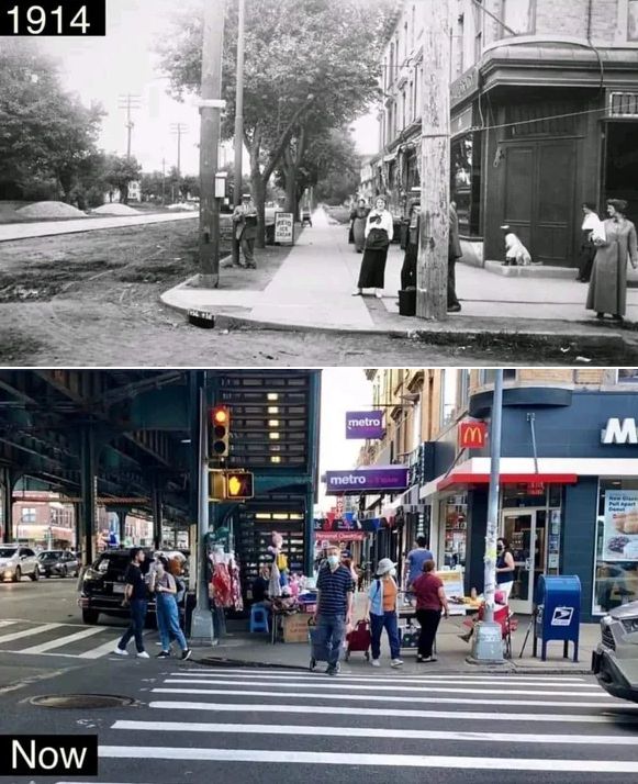
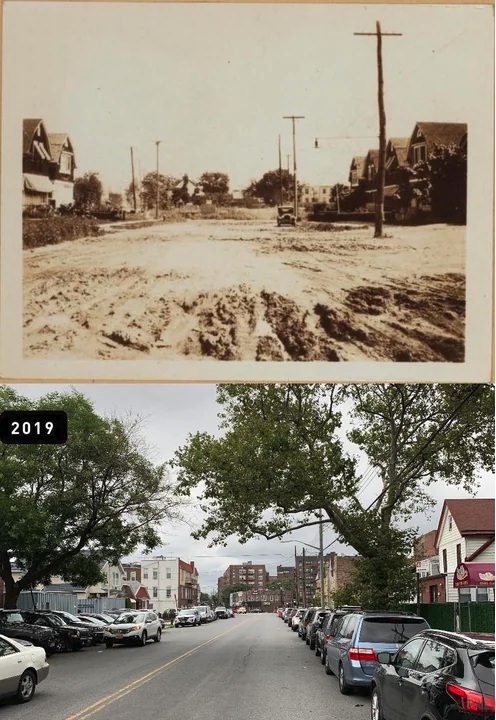
Brooklyn began as an independent city before becoming part of New York City in 1898. At that time, it already had busy docks, rowhouse neighborhoods, and strong immigrant communities. Its streets held horse carts, streetcars, and factory workers moving between jobs and home.
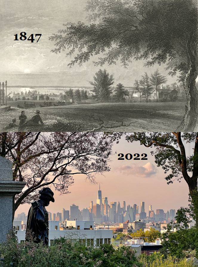
Today, Brooklyn holds more than 2.7 million residents. Glass towers stand near brick warehouses. Old brownstones sit beside modern apartment buildings. The borough shows layers of change instead of one single transformation.
Early Brooklyn streets and buildings
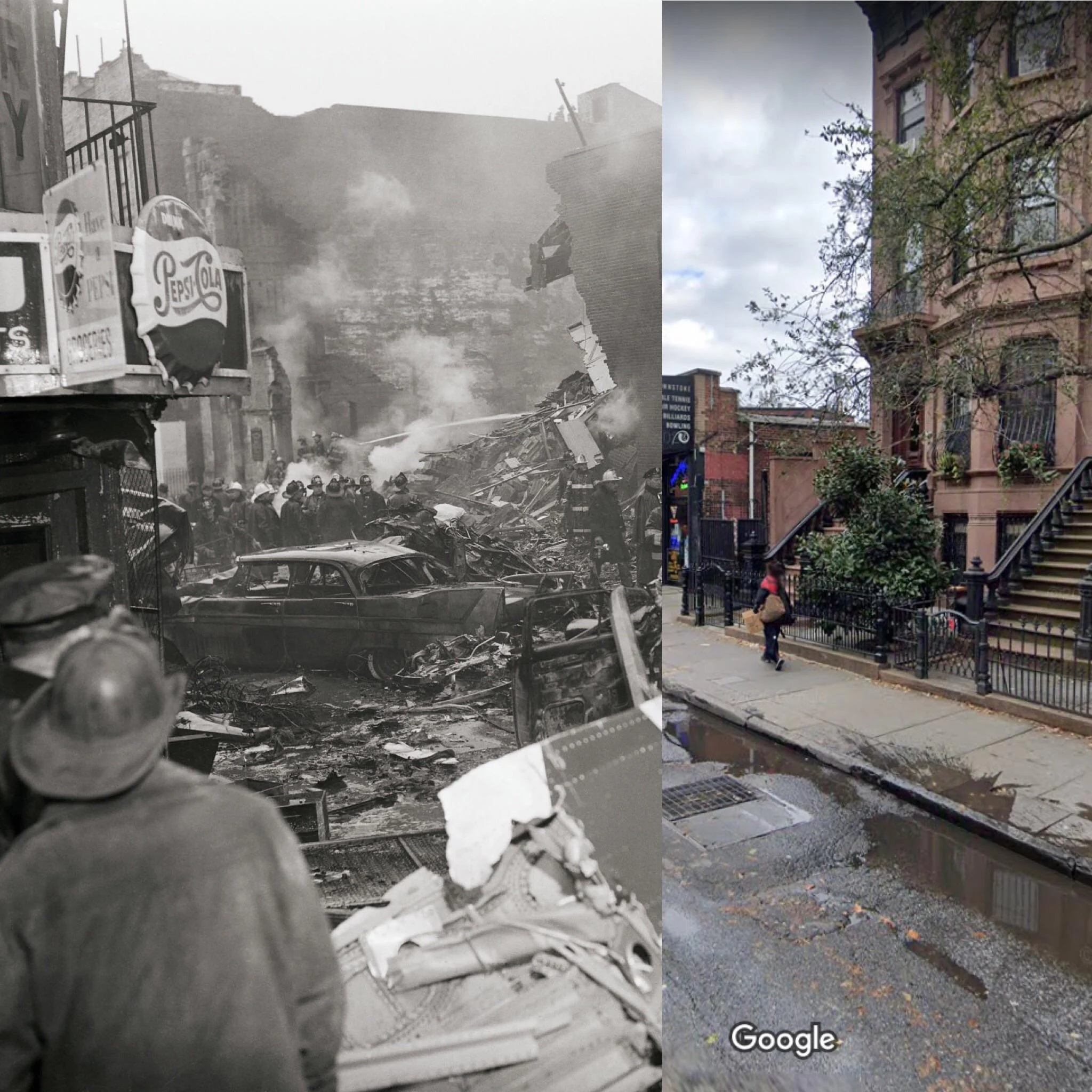
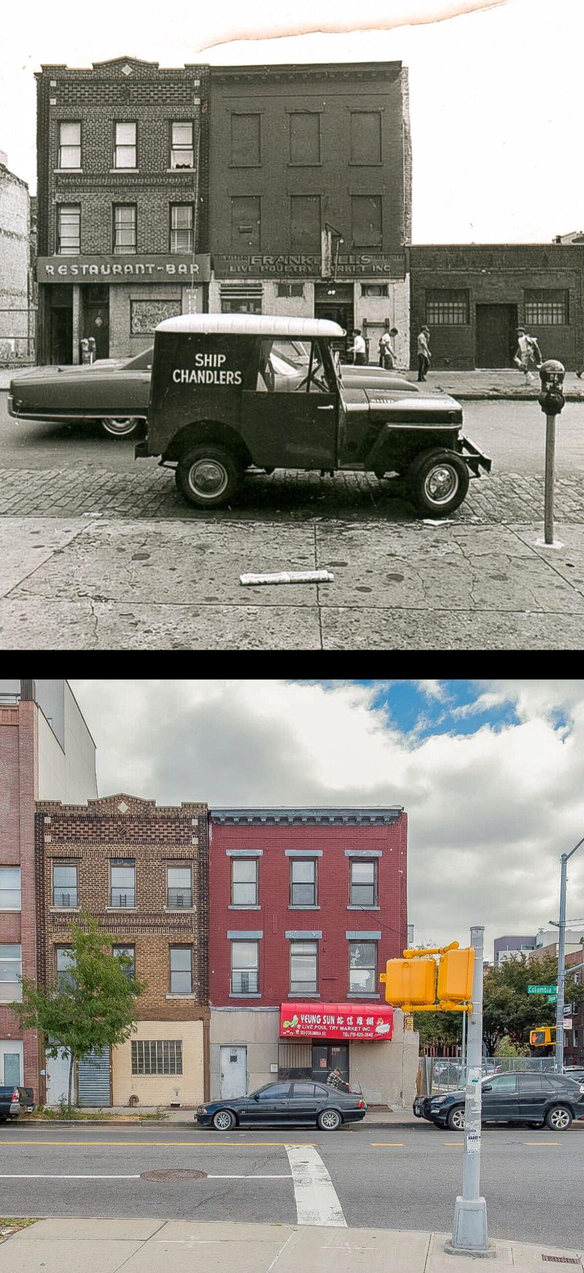
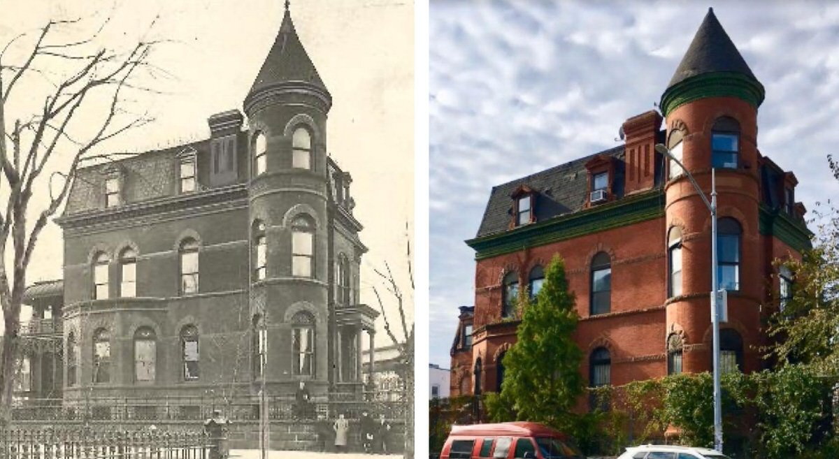
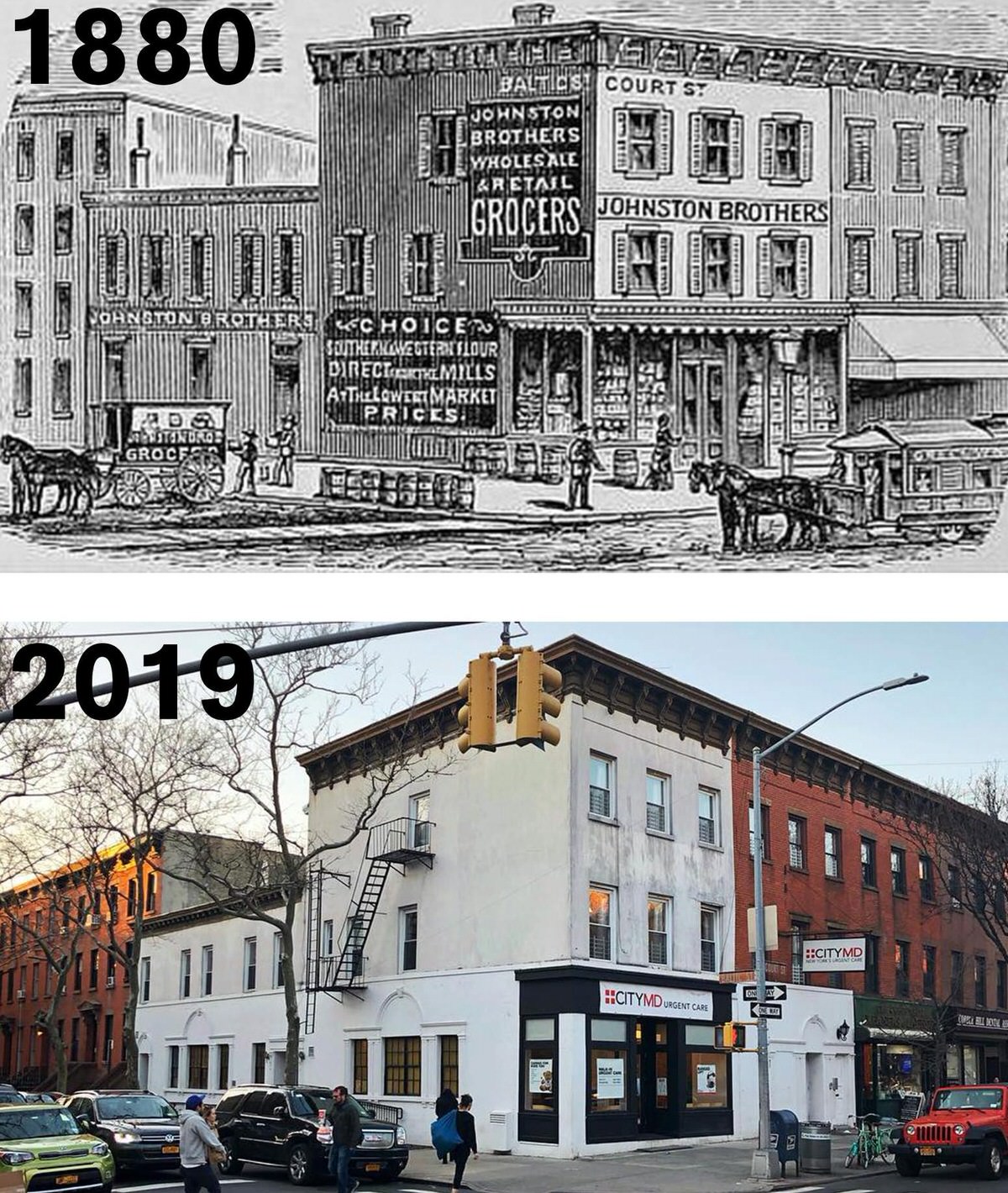
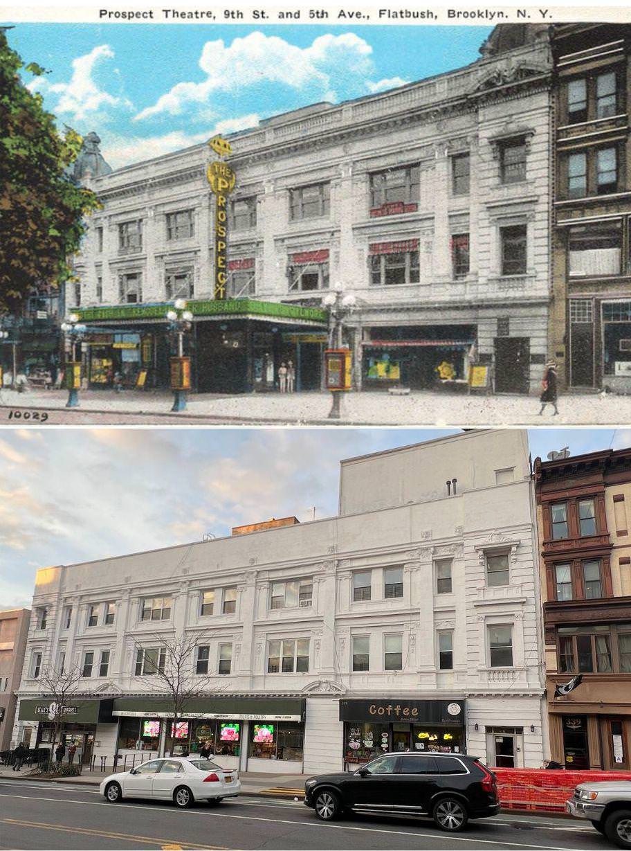
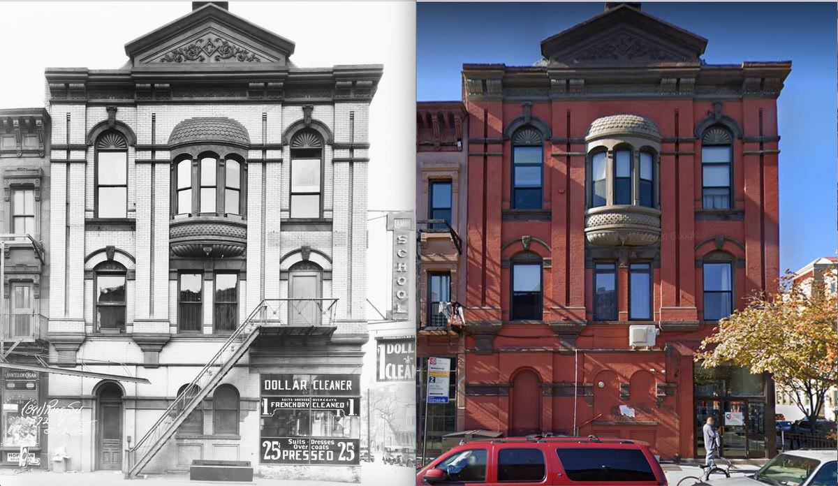
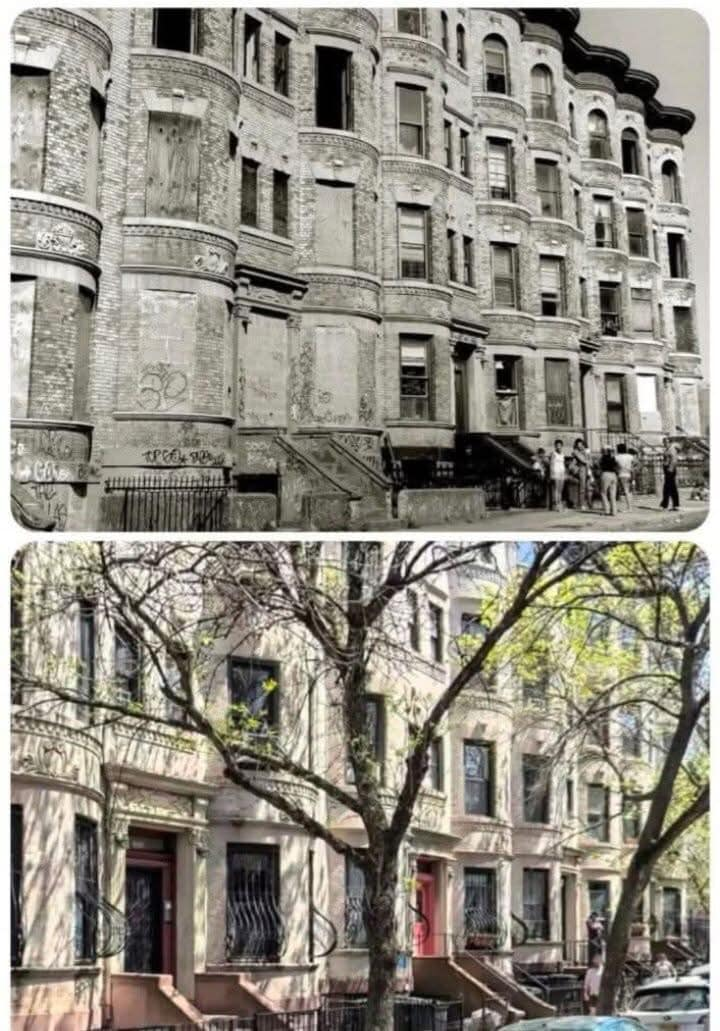
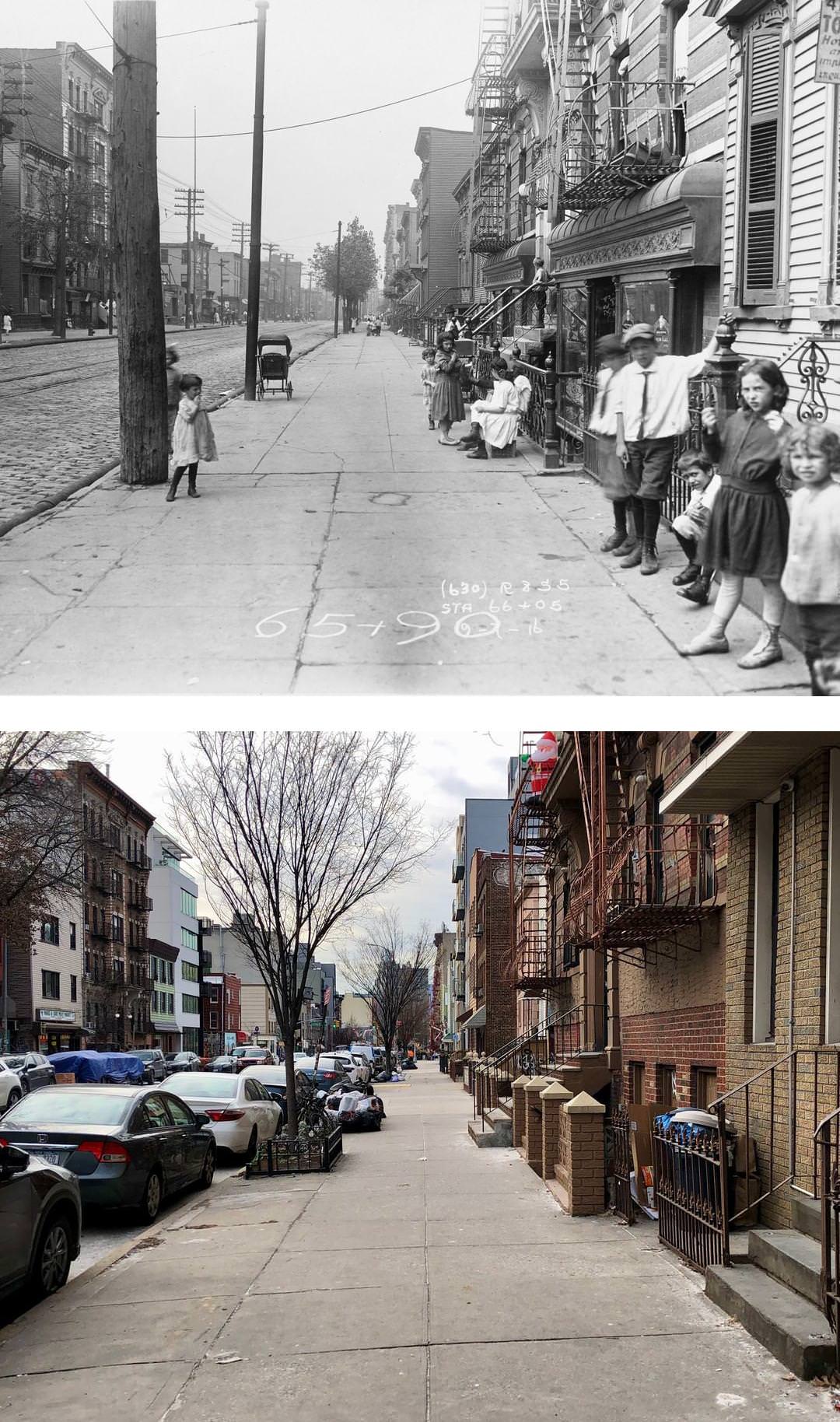
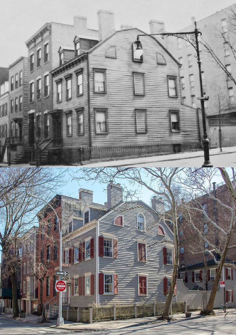
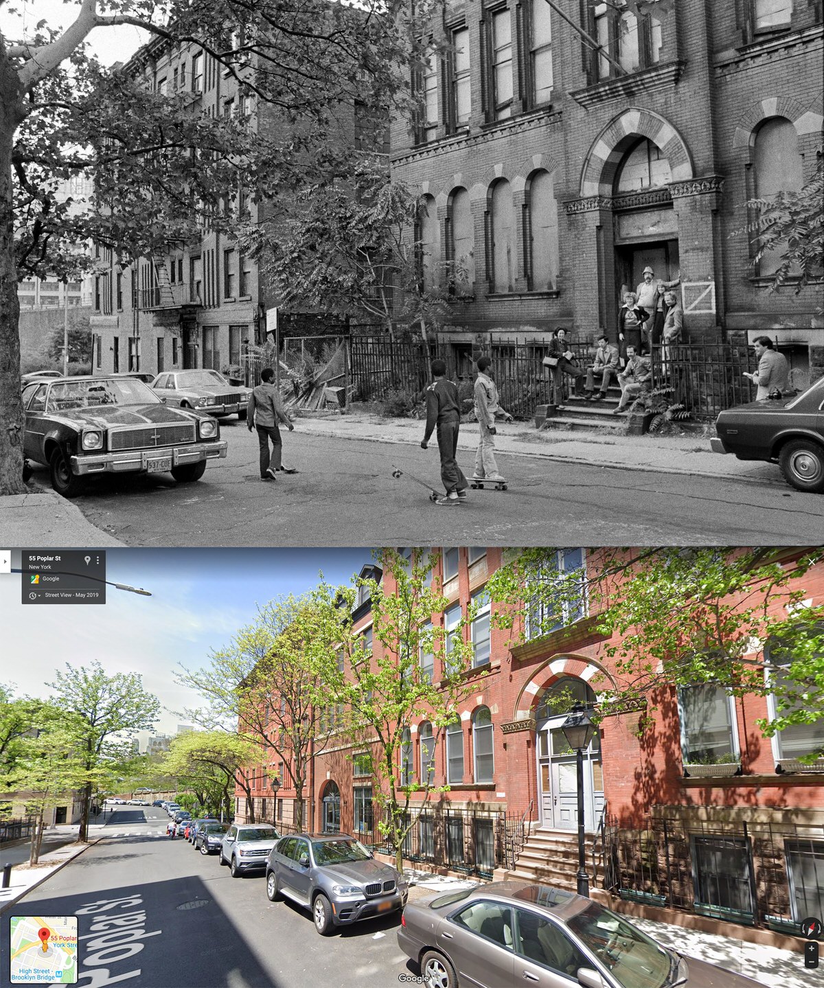
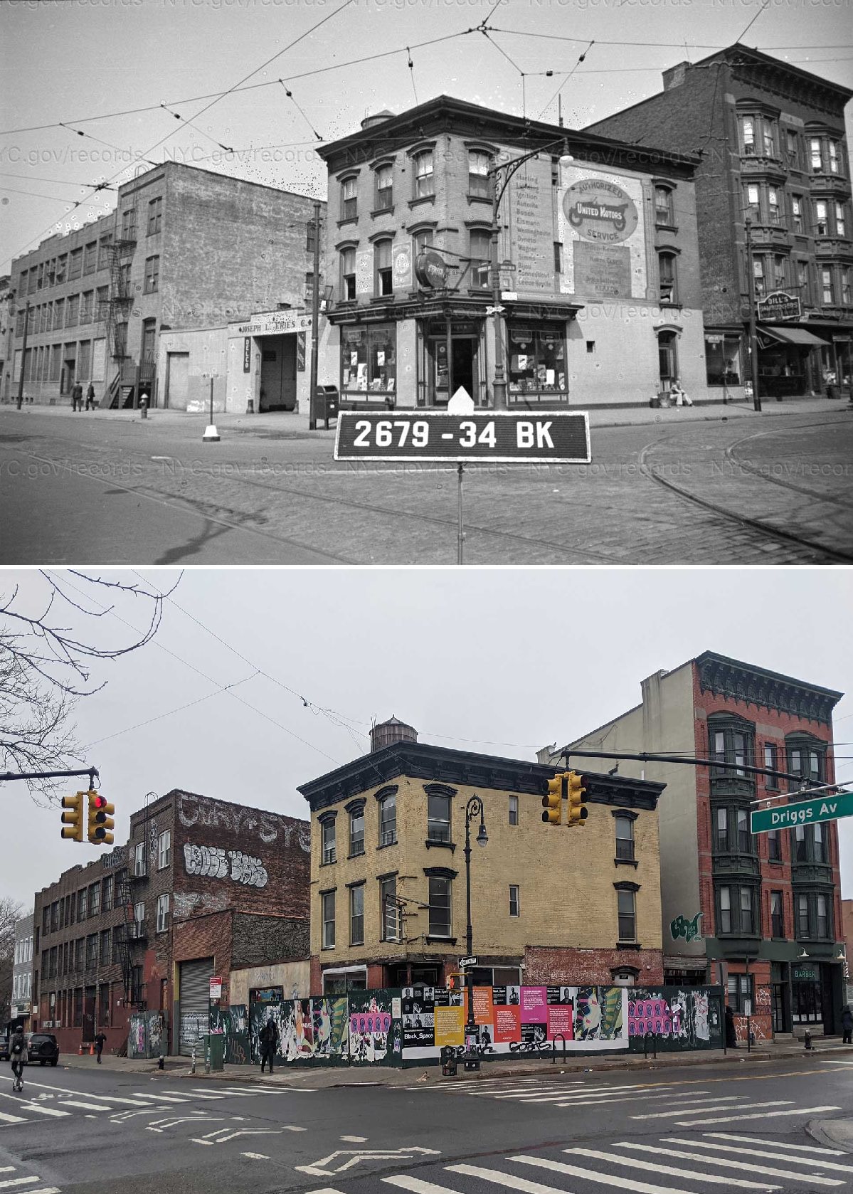
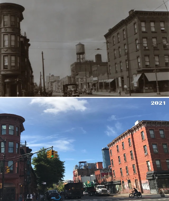
In the late 1800s and early 1900s, much of Brooklyn grew through rowhouse construction. Developers built long blocks of brick and brownstone homes. These houses featured stoops, bay windows, and detailed stone carvings.
Neighborhoods like Brooklyn Heights and Park Slope became known for these homes. Tree-lined streets gave these areas a stable residential feel. Many of these buildings still stand with their original façades.
Read more
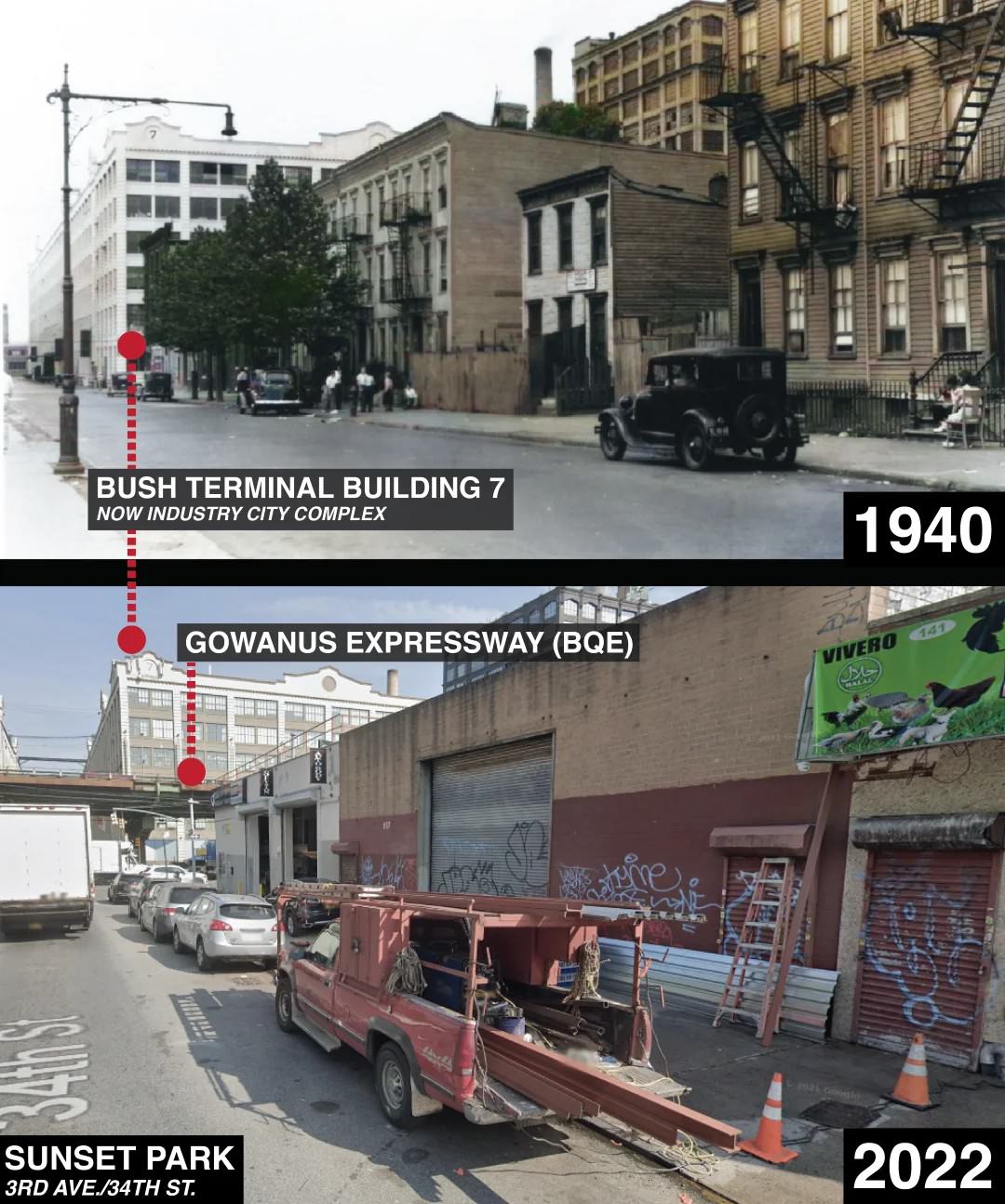
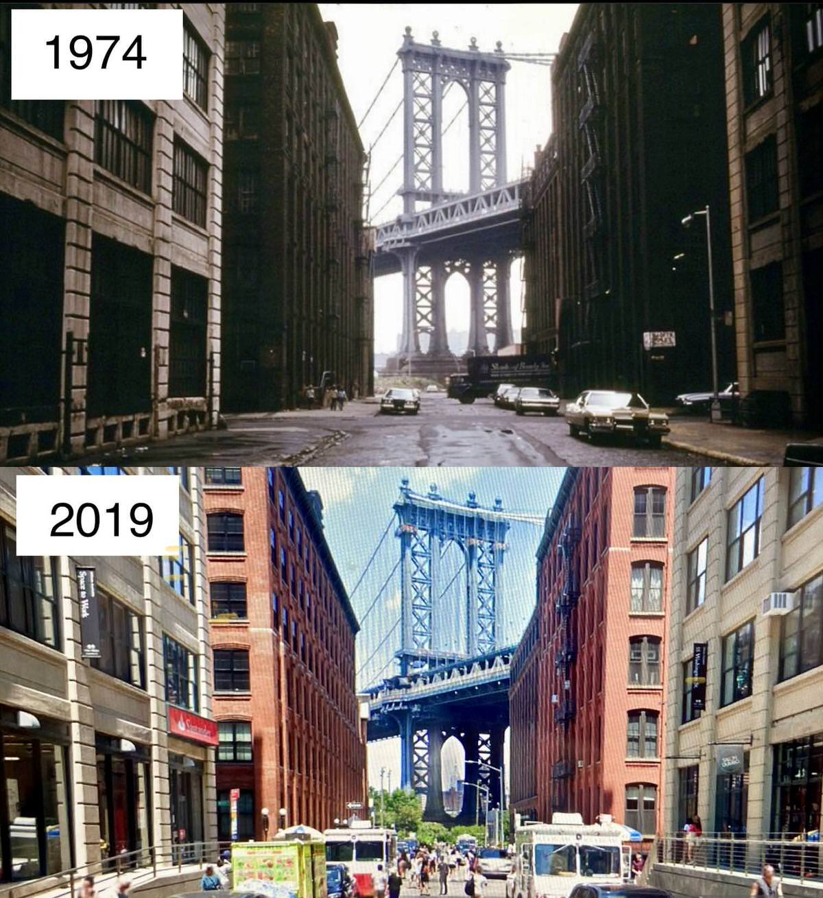
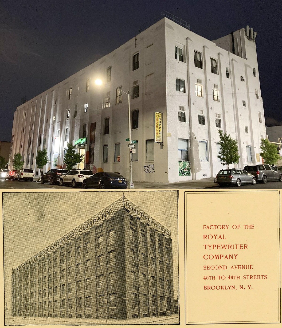
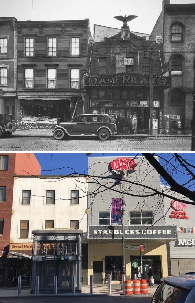
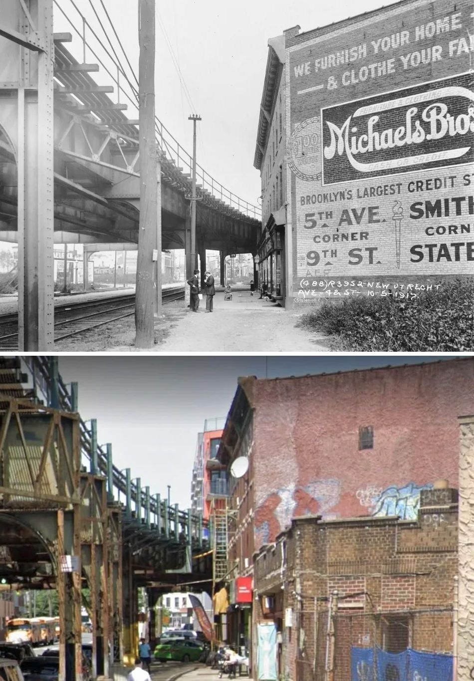
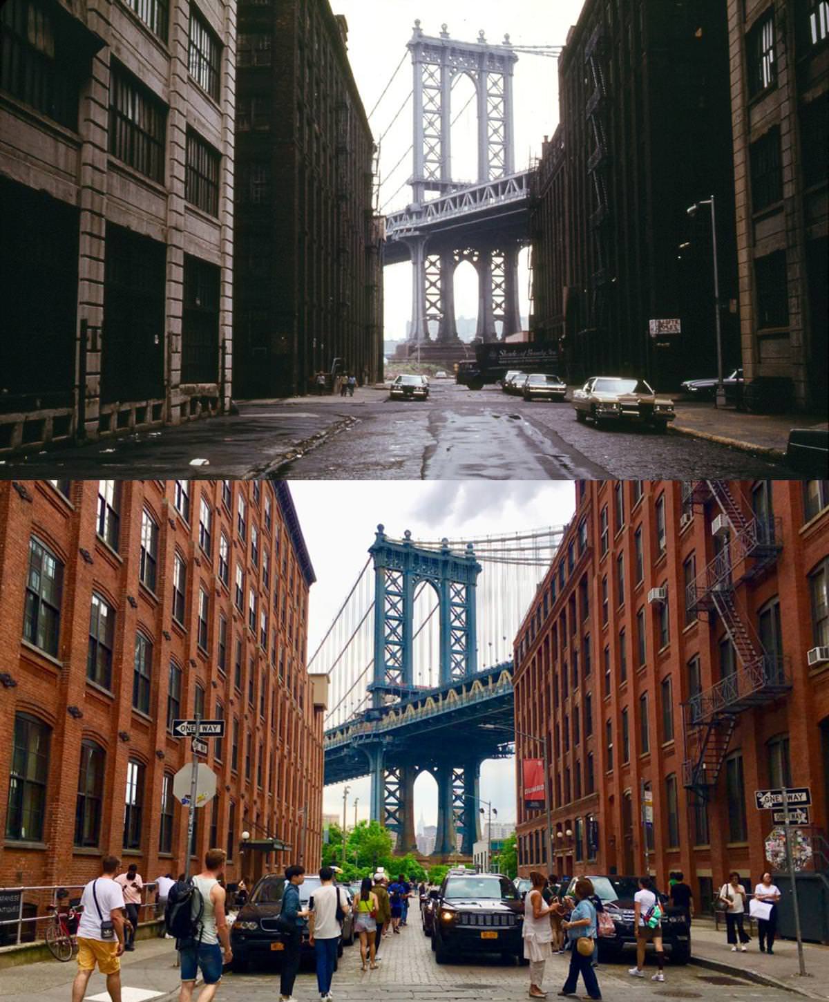
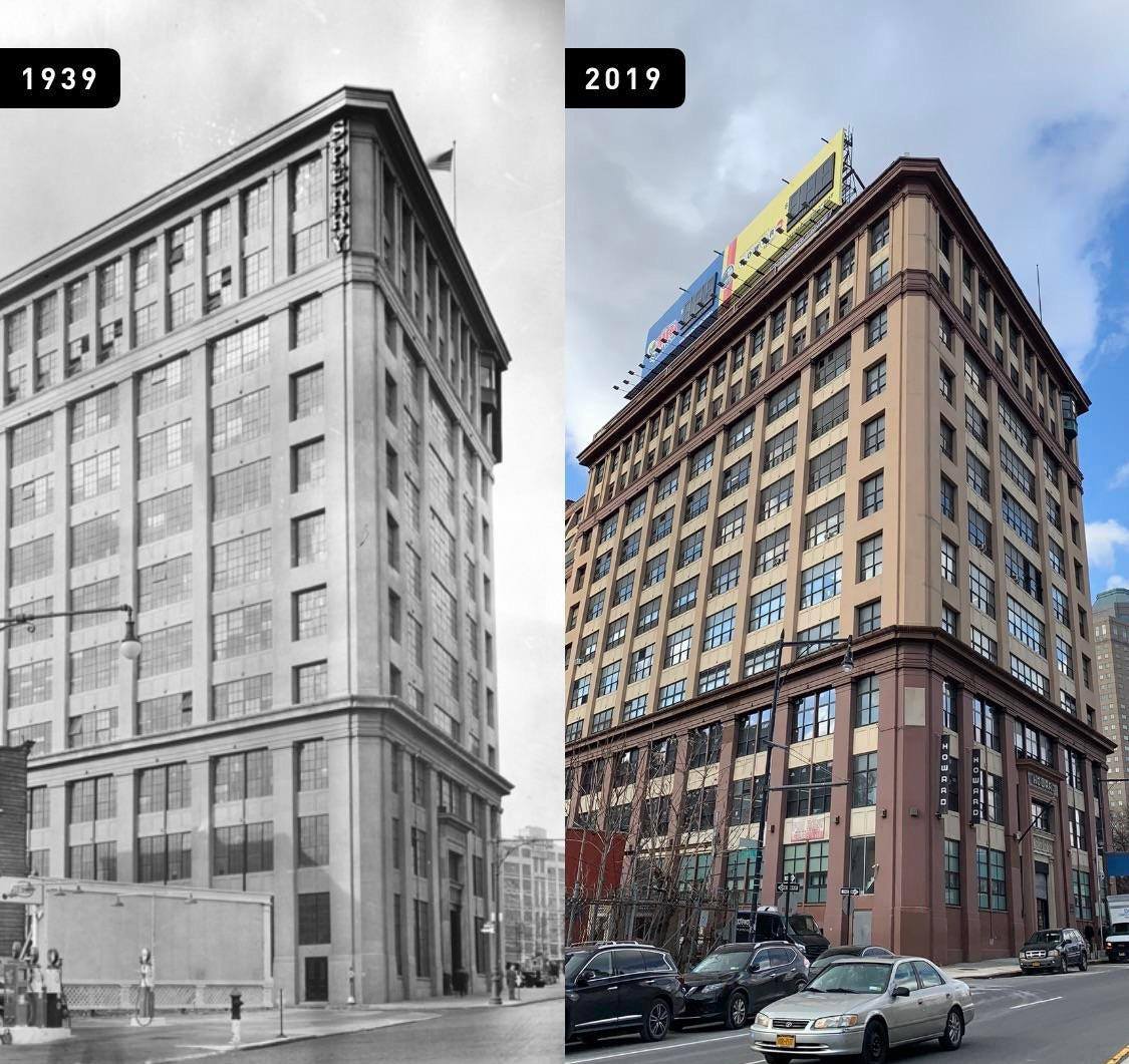
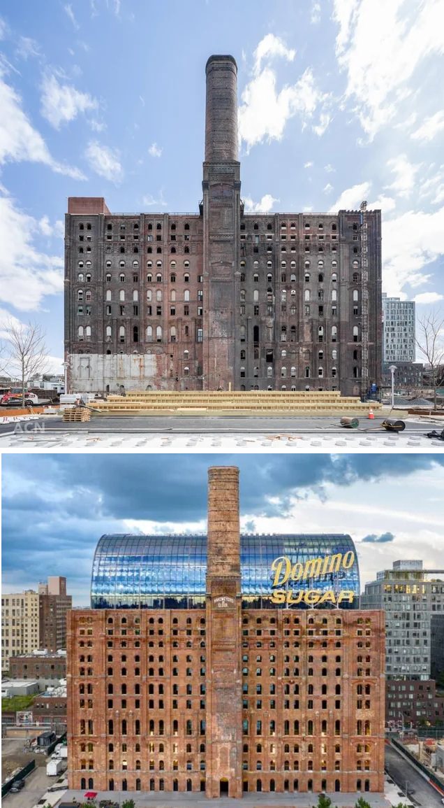
Industrial Brooklyn looked different. Areas such as DUMBO and Williamsburg held factories, storage buildings, and shipping piers. Brick loft buildings rose near the waterfront. Their large windows allowed light onto factory floors.
Most of these industrial buildings followed simple designs. Builders focused on strength and function. Decoration stayed limited to brick patterns and basic stone trim.
Bridges and major landmarks
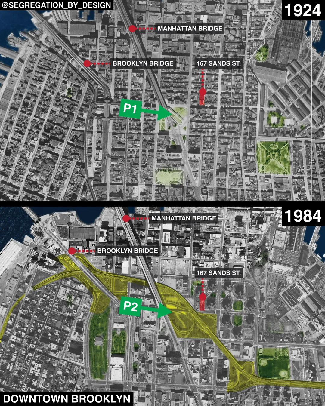
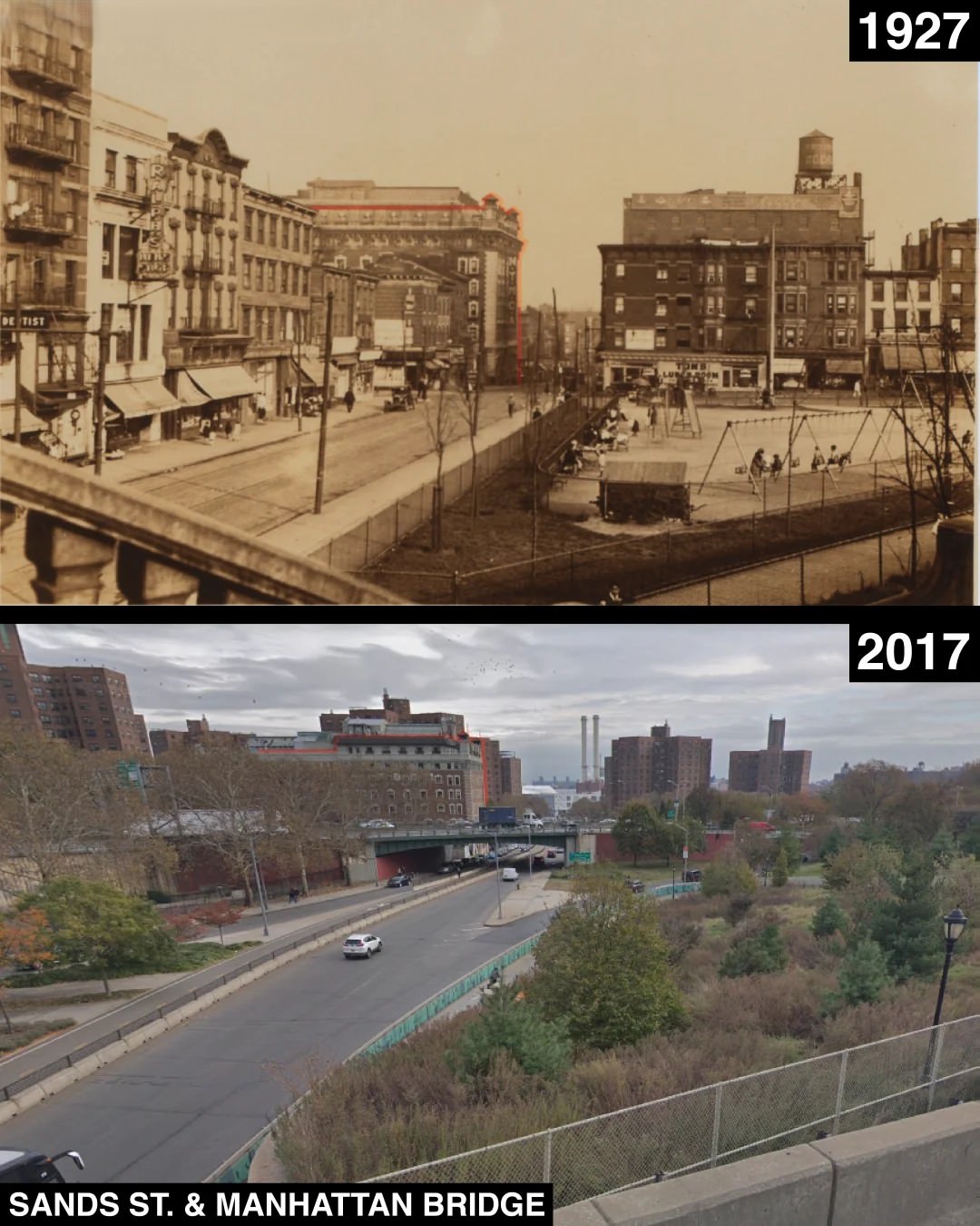
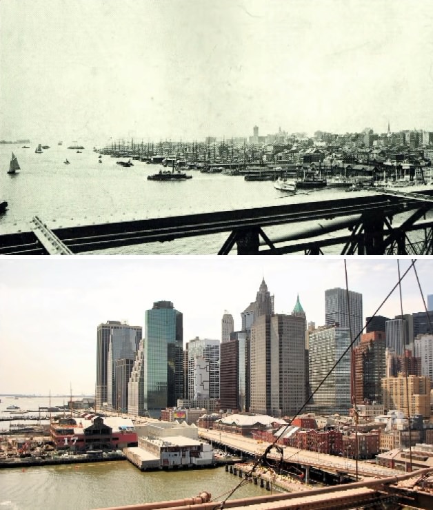
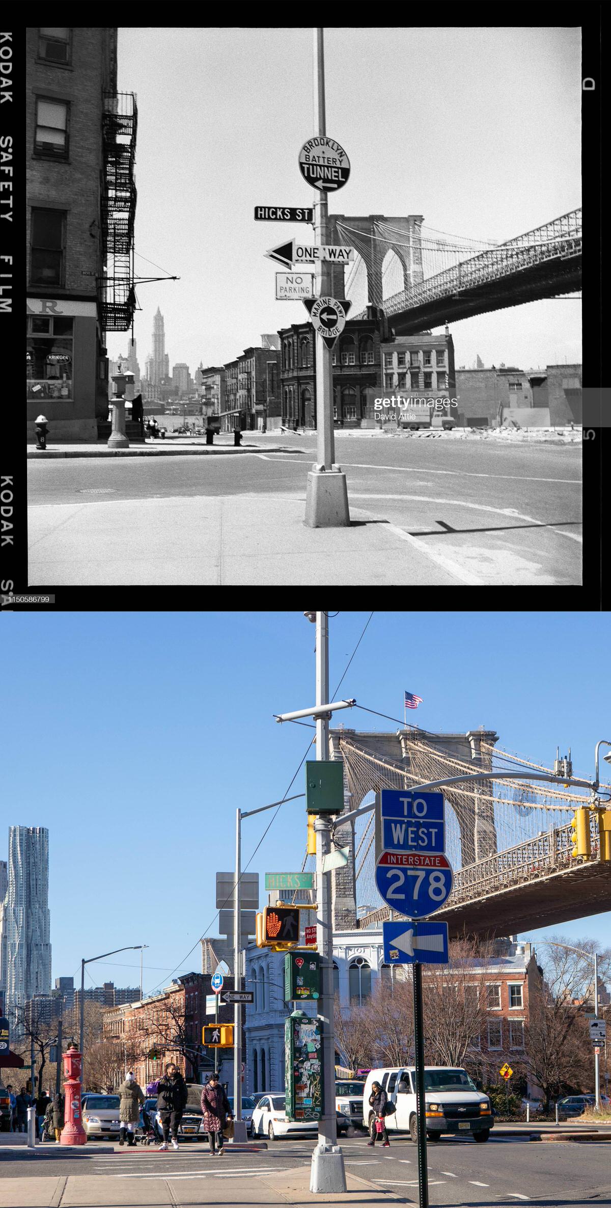
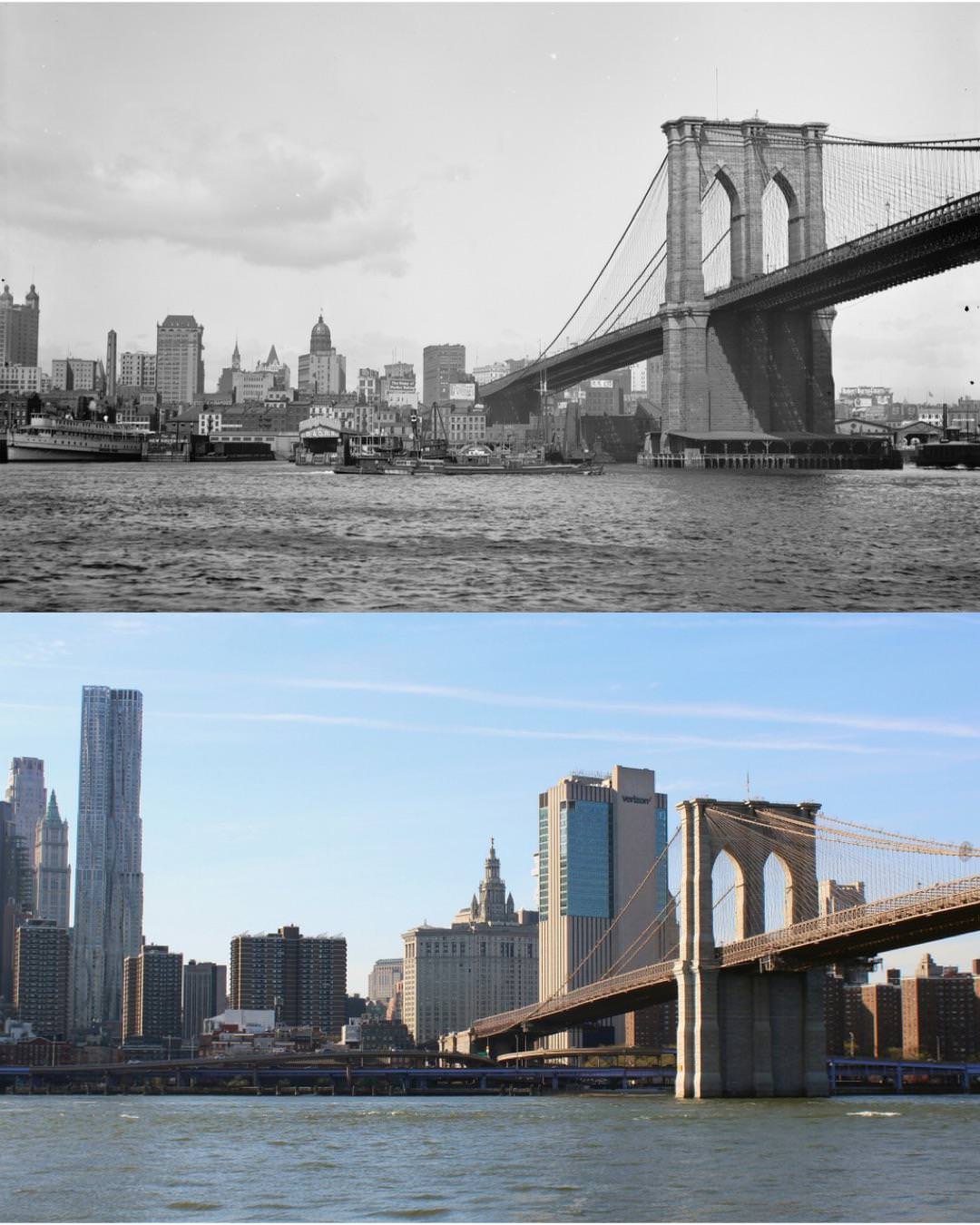
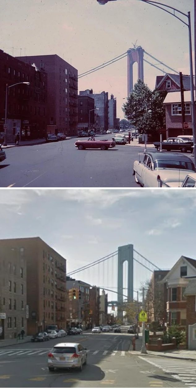
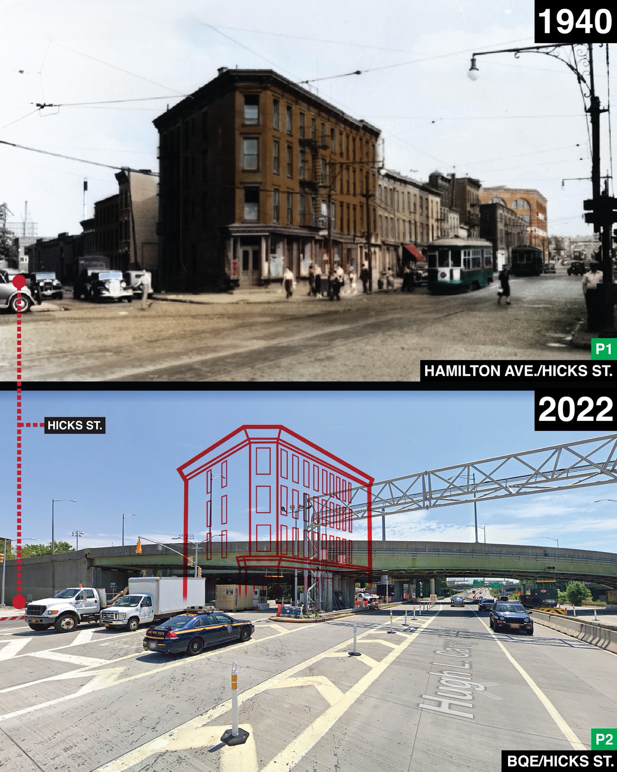
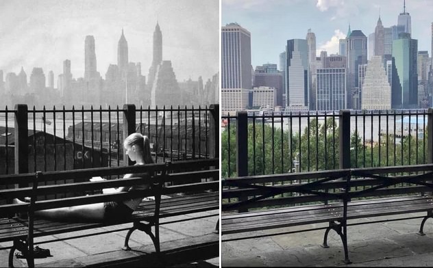
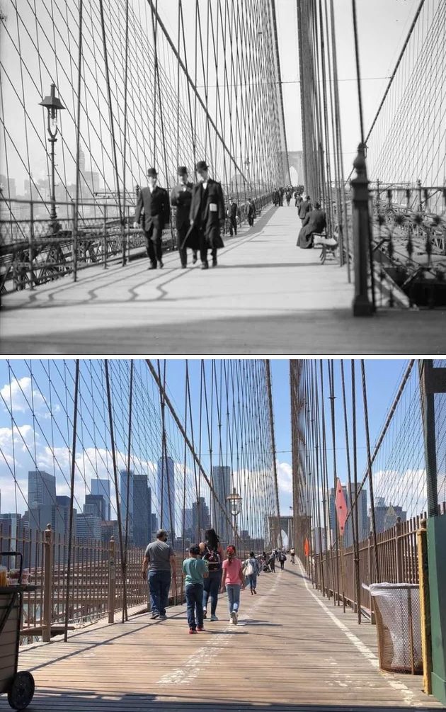
The opening of the Brooklyn Bridge in 1883 changed Brooklyn’s future. The bridge allowed faster travel between Brooklyn and Manhattan. Workers could live in Brooklyn while holding jobs across the East River.
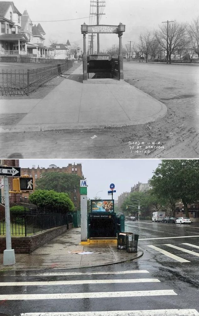
The bridge also pushed development outward. New housing blocks grew around trolley lines and elevated trains.
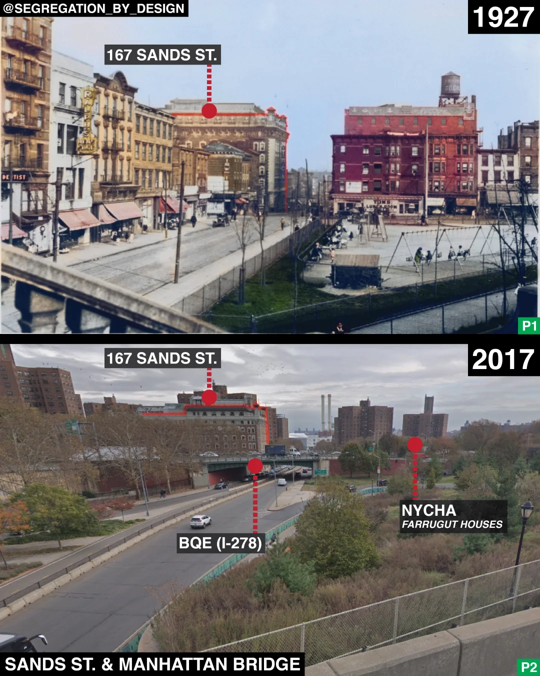
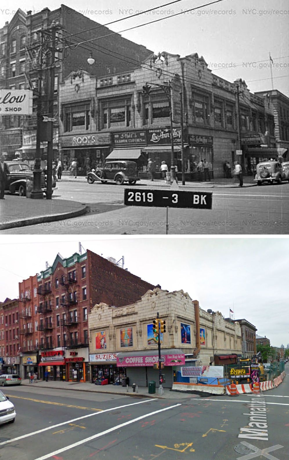
Another major structure, Williamsburg Bridge, opened in 1903. This crossing brought large waves of immigrants into nearby neighborhoods. Tenement buildings filled with families from Eastern Europe and other regions.
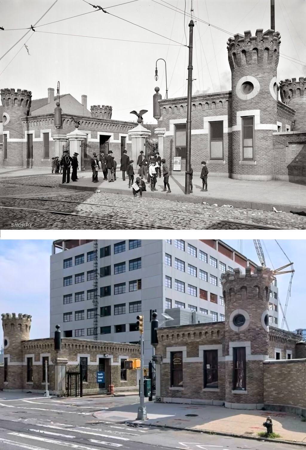
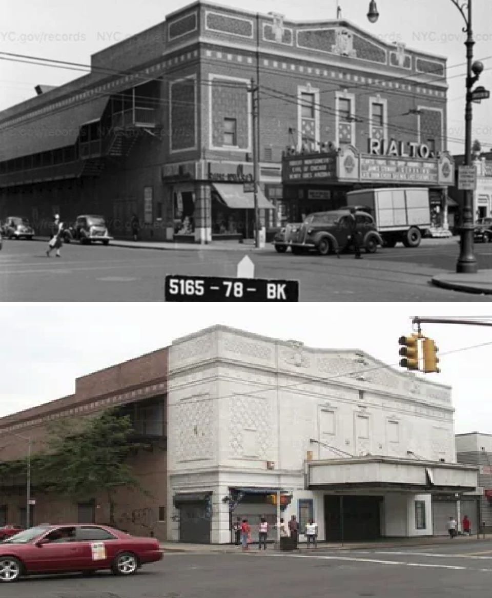
Public buildings also shaped the borough’s identity. Brooklyn Borough Hall stood as a symbol of local government. Brooklyn Navy Yard served as a major shipbuilding site, especially during wartime periods.
Changes after World War II
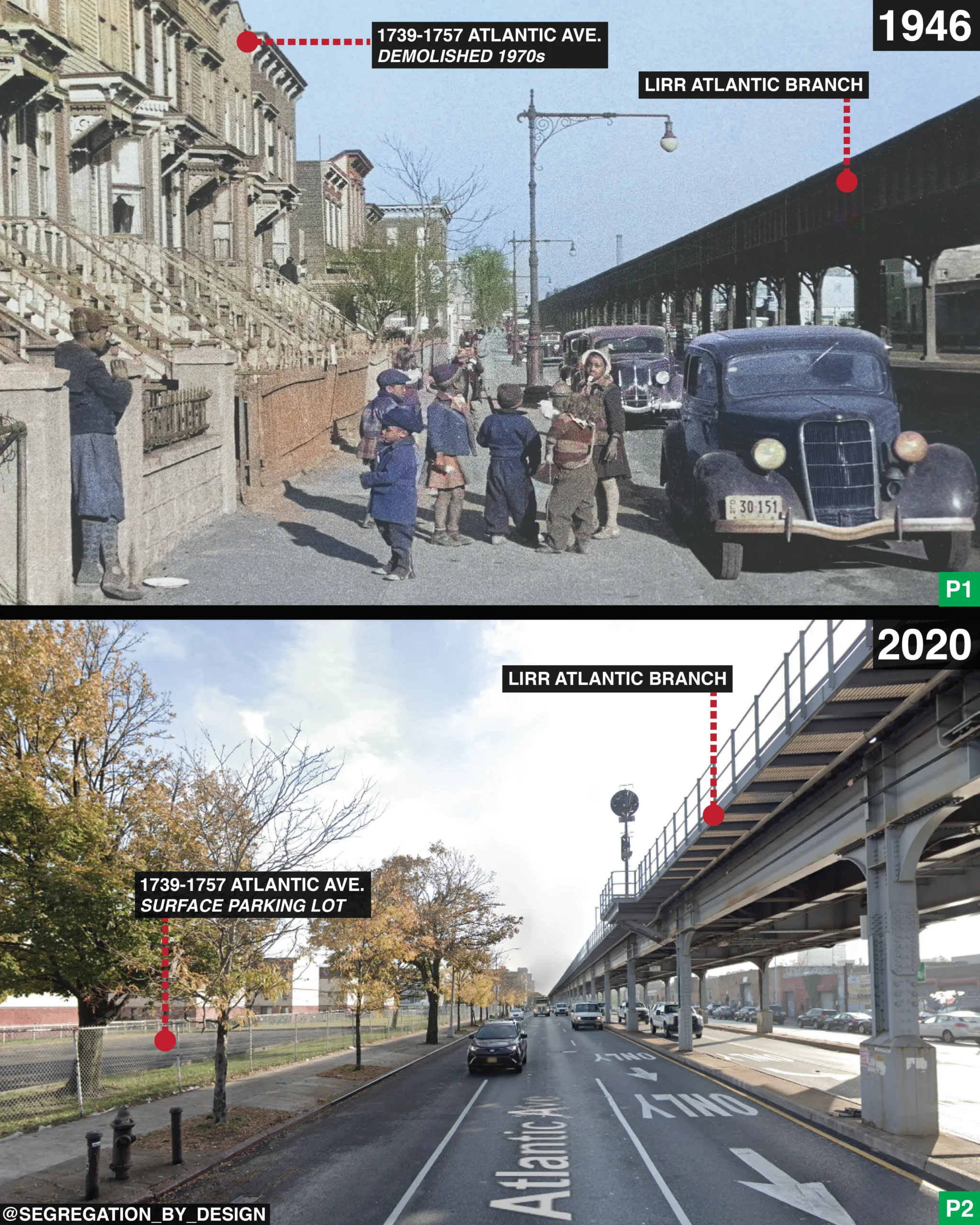
After World War II, Brooklyn entered a period of change. Shipping activity declined as container ports moved to New Jersey. Factories closed or moved away. Many waterfront buildings lost their original purpose.
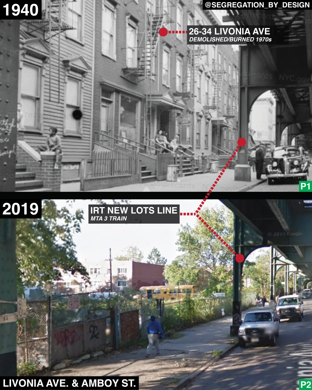
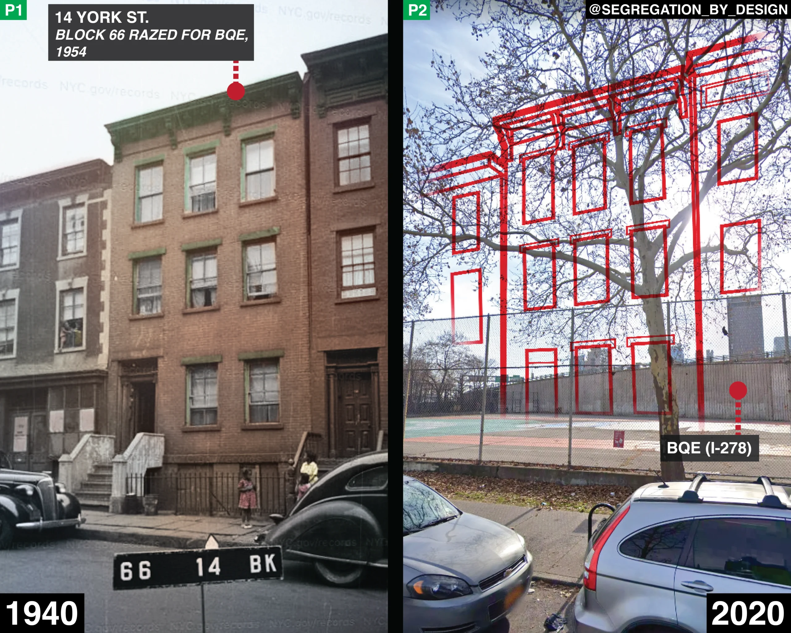
Highway construction reshaped several neighborhoods. Projects led by planner Robert Moses introduced expressways and large housing developments. Some older buildings disappeared to make space for these projects.
During the 1950s through the 1970s, parts of Brooklyn faced population loss. Some middle-class families moved to suburbs. Property owners divided large homes into smaller apartments.
Even during these years, many historic buildings survived. Preservation groups fought to protect brownstone districts. Their work kept entire blocks from demolition.
Industrial buildings become residential spaces
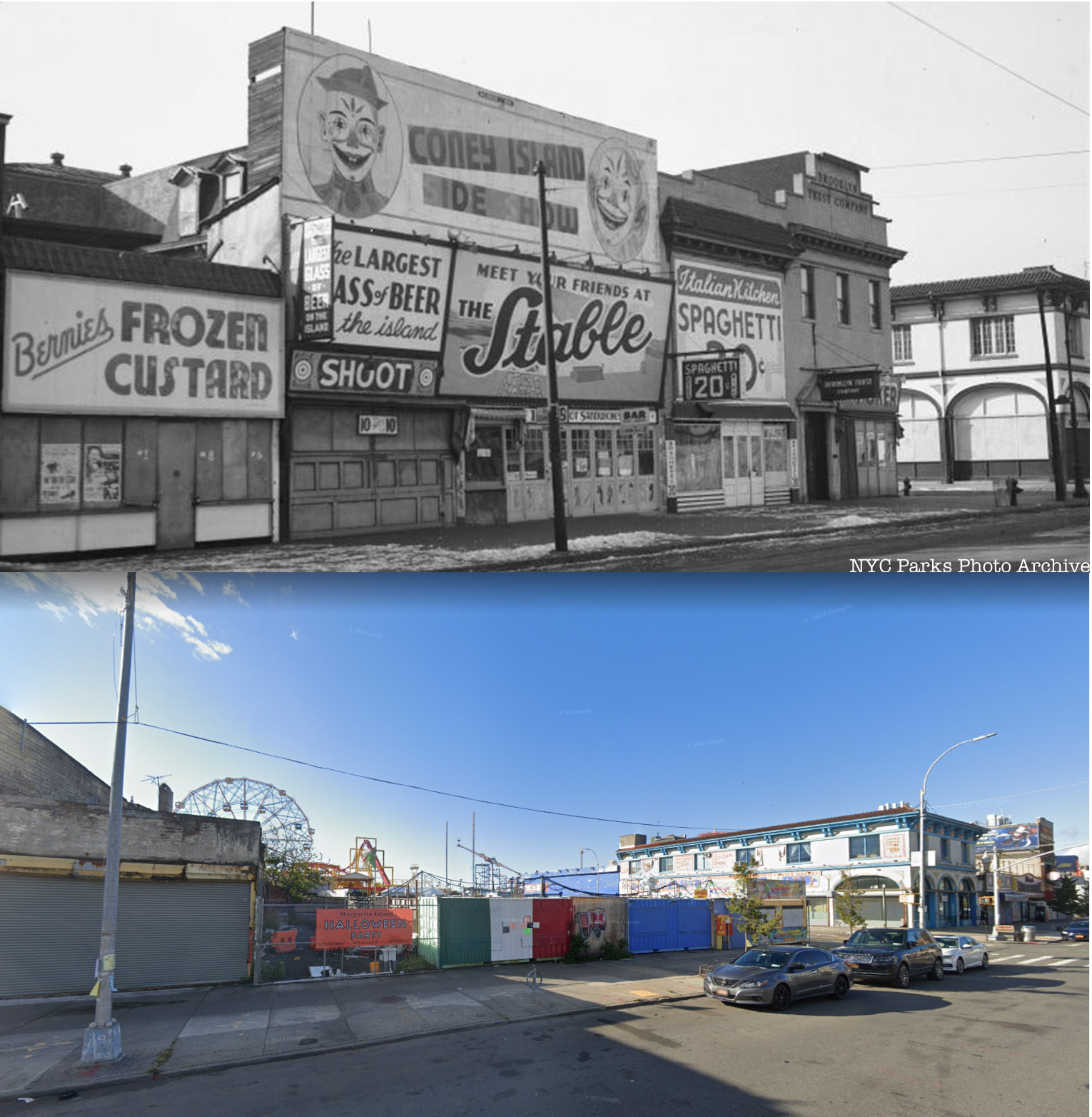
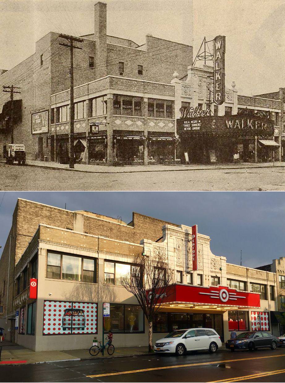
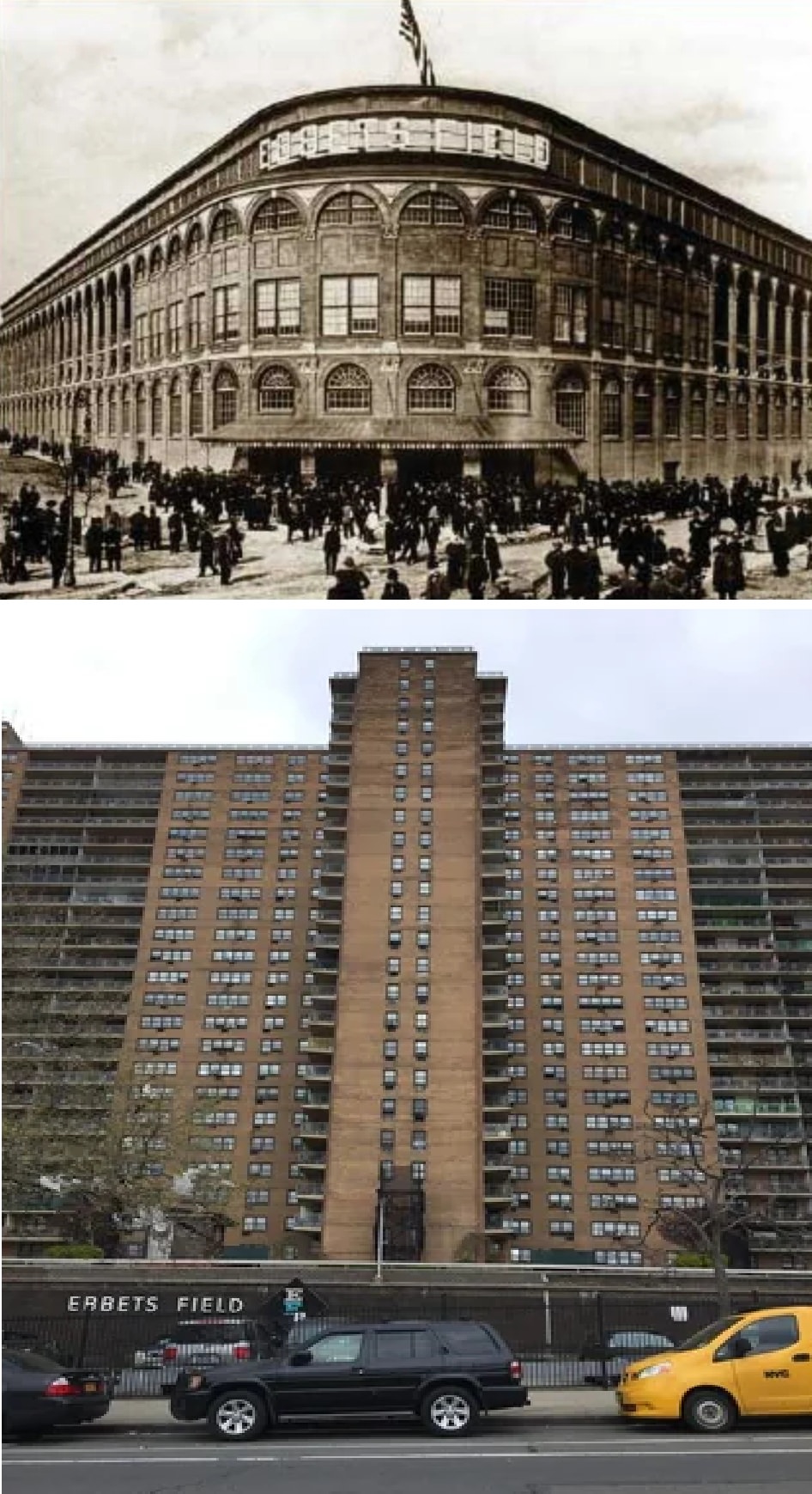
By the 1980s and 1990s, change returned to Brooklyn’s old factory zones. Developers converted empty loft buildings into apartments and studios. Artists moved into large former workspaces because of the open layouts and lower rents.
DUMBO became one of the most visible examples of this shift. Former warehouses turned into offices, tech spaces, and residential lofts. Cobblestone streets remained while interiors changed.
Williamsburg followed a similar path. Old industrial structures became rental buildings, music venues, and restaurants. New towers later joined these older structures, changing the skyline along the East River.
Modern construction and skyline growth
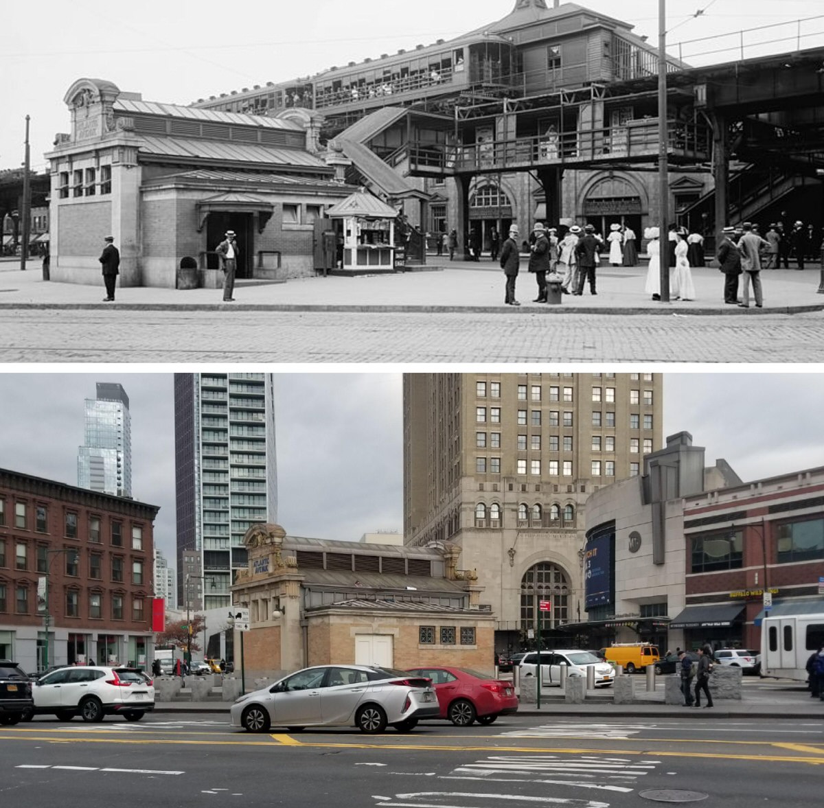
Since 2000, Brooklyn has seen major residential construction. High-rise towers now stand in areas like Downtown Brooklyn. Glass and steel designs contrast with older masonry buildings nearby.
New projects often include retail space on ground floors. Developers design these buildings to serve both housing and business needs. Zoning changes allowed taller structures in certain districts.
At the same time, landmark rules protect many historic areas. Neighborhoods with protected status keep strict building rules. Exterior changes must match historic character.
This balance creates streets where 19th-century homes stand across from modern apartments.
Religious buildings and civic architecture
Brooklyn’s churches and synagogues show another form of continuity. Structures such as Plymouth Church remain active. Gothic Revival and Romanesque designs still define many religious buildings.
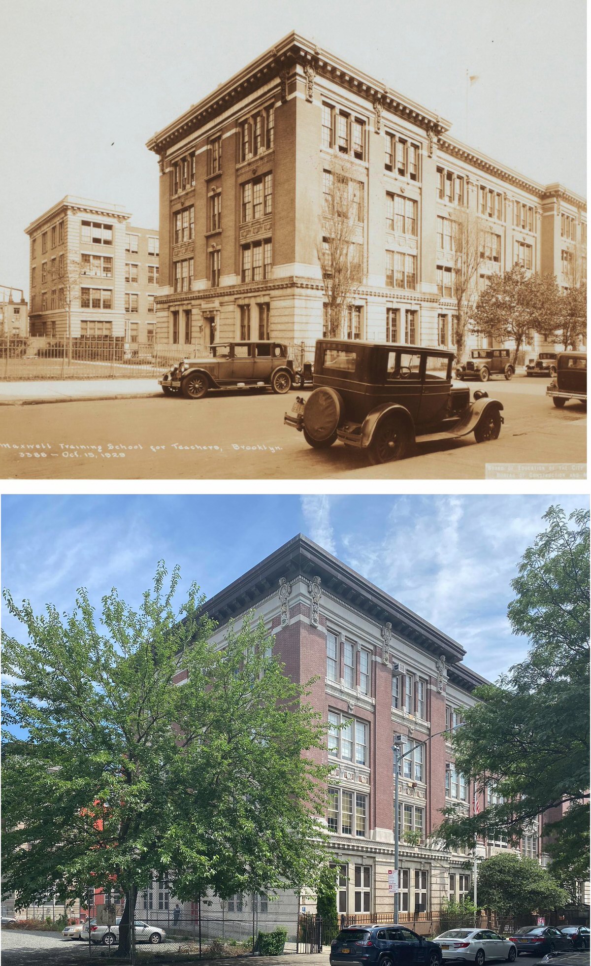
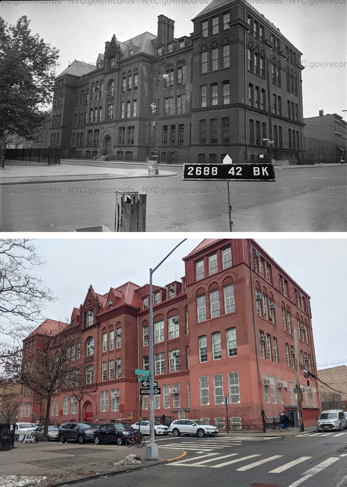
Public schools also reflect architectural change. Early school buildings often used heavy brick and stone. Newer schools use steel framing and large glass panels.
Libraries, firehouses, and courthouses also show design shifts. Older civic buildings used carved stone and classical columns. Modern versions focus on efficiency and accessibility.
Changing housing patterns
Brooklyn housing once centered on multi-family townhouses and small apartment buildings. These allowed extended families to live close together.
Today, housing includes luxury towers, restored brownstones, public housing complexes, and smaller rental buildings. This range reflects shifts in population, income levels, and city planning rules.
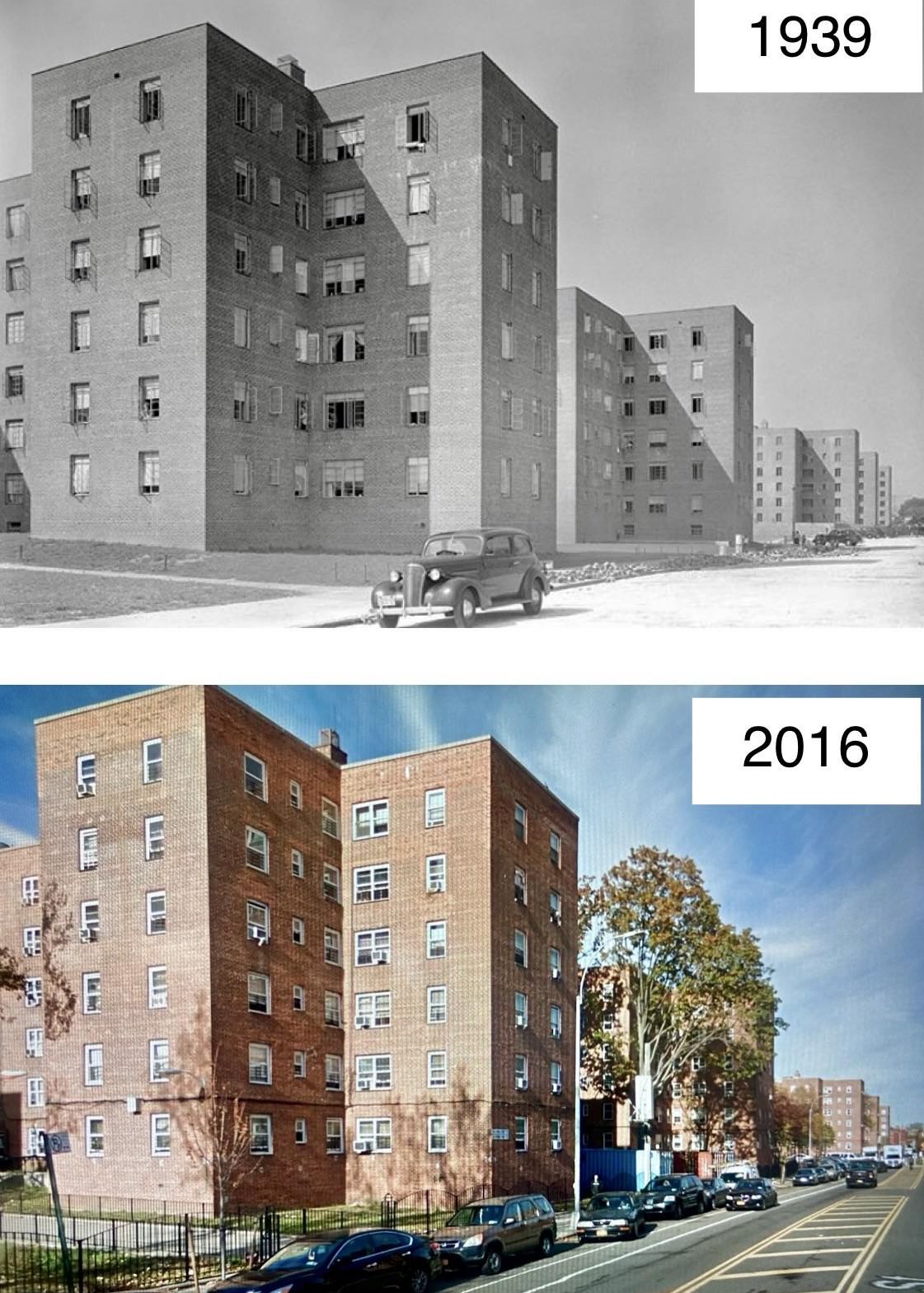
Public housing developments managed by the New York City Housing Authority remain a major part of Brooklyn’s residential landscape. Many of these complexes date from the mid-20th century and follow a superblock layout with open courtyards.


GIPHY App Key not set. Please check settings